Ingleside is a suburb in Northern Sydney, in the state of New South Wales, Australia. Ingleside is located 28 kilometres north of the Sydney central business district, in the local government area of Northern Beaches Council. Ingleside is part of the Forest District region, about 2 kilometres from the coast at Mona Vale. Ingleside Heights and Tumbledown Dick are localities in the west of the suburb.
Elanora Heights is a suburb in northern Sydney, in the state of New South Wales, Australia. Elanora Heights is 27 kilometres north-east of the Sydney central business district, in the local government area of Northern Beaches Council. Elanora Heights is part of the Northern Beaches region.

Silverwater is a suburb in western Sydney, in the state of New South Wales, Australia. Silverwater is located 15 kilometres west of the Sydney central business district on the southern bank of the Parramatta River within the local government area of City of Parramatta.

Rushcutters Bay is a harbourside inner-east suburb of Sydney, in the state of New South Wales, Australia 3 kilometres east of the Sydney central business district, in the local government area of the City of Sydney.

Northwood is a suburb on the Lower North Shore of Sydney, in the state of New South Wales, Australia 8 kilometres north-west of the Sydney central business district, in the local government area of the Municipality of Lane Cove. Northwood is on the northern side of the Lane Cove River between Woodford Bay and Gore Creek.

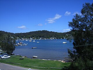
Church Point is a suburb in the Northern Beaches region of Sydney, in the state of New South Wales, Australia. Church Point is 32 kilometres north of the Sydney central business district, in the local government area of Northern Beaches Council.
Pretty Beach is a south-eastern suburb of the Central Coast region of New South Wales, Australia on the Bouddi Peninsula. It is part of the Central Coast Council local government area.

Cedar Brush Creek is a suburb of the Central Coast region of New South Wales, Australia, located 24 kilometres (15 mi) upstream from Wyong along the Wyong River. It is part of the Central Coast Council local government area.

Wyong Creek is a suburb of the Central Coast region of New South Wales, Australia. It is part of the Central Coast Council local government area.
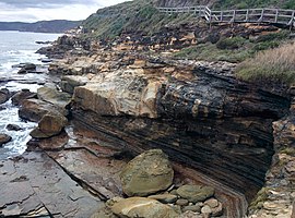
Bouddi is a coastal south-eastern locality on the Central Coast of New South Wales, Australia. It is in the Central Coast Council local government area. Bouddi is the Aboriginal word for the heart.

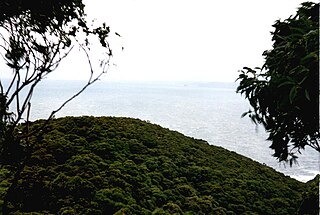
Box Head is a coastal locality in the Central Coast Council local government area located on the Central Coast of New South Wales, Australia. It is within Bouddi National Park which includes the island of Lion Island.
Daleys Point is a south-eastern suburb of the Central Coast region of New South Wales, Australia on the Bouddi Peninsula. It is part of the Central Coast Council local government area. The median house price in January 2010 was A$950,000.

Hardys Bay is a south-eastern suburb of the Central Coast region of New South Wales, Australia on the Bouddi Peninsula. It is part of the Central Coast Council local government area.
Killcare is a south-eastern suburb and village located on the Bouddi Peninsula on the Central Coast of the state of New South Wales, Australia. It is part of the Central Coast Council local government area.

Kincumber South is a south-eastern suburb of the Central Coast region of New South Wales, Australia. It is part of the Central Coast Council local government area.

MacMasters Beach is a south-eastern suburb of the Central Coast region of New South Wales, Australia on the Bouddi Peninsula. It is part of the Central Coast Council local government area

St Huberts Island is a canal estate and suburb of the Central Coast region of New South Wales, Australia connected to the mainland at Daleys Point. It is part of the Central Coast Council local government area.

Huntleys Cove is a suburb on the Lower North Shore of Sydney, in the state of New South Wales, Australia. Huntleys Cove is located 9 kilometres north-west of the Sydney central business district, in the local government area of the Municipality of Hunter's Hill. Huntleys Cove sits on the peninsula between Tarban Creek and the Parramatta River.
Moonee is a coastal suburb of the Central Coast region of New South Wales, Australia. It is part of the Central Coast Council local government area.
Wilsonton Heights is a residential locality of Toowoomba in the Toowoomba Region, Queensland, Australia. In the 2021 census, Wilsonton Heights had a population of 2,747 people.