Bateau Bay is a suburb of the Central Coast region of New South Wales, Australia. It is part of the Central Coast Council local government area. Bateau Bay lies in the area known as Darkinjung to Indigenous Australians. "Bateau" is French for "boat." The suburb was previously known as Boat Harbour but it was changed to the French version as a marketing activity in the 1970s.
Vincent Martin Ball is an Australian-born retired actor of film, theatre and radio active in the industry for nearly 55 years firstly in Britain starting in the late 1940s and then his native Australia. Ball, a Royal Air Force military veteran, has also authored a number of books.
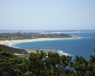
Buff Point is a suburb of the Central Coast region of New South Wales, Australia. It is part of the Central Coast Council local government area.

Canton Beach is a suburb located on the Central Coast of New South Wales, Australia, as part of the Central Coast Council local government area. It is next to Toukley which is a large residential and holiday town.

Charmhaven is a suburb of the Central Coast region of New South Wales, Australia. It is part of the Central Coast Council local government area.

Chittaway Bay is a suburb of the Central Coast region of New South Wales, Australia. It is part of the Central Coast Council local government area.

Rocky Point is a suburb of the Central Coast region of New South Wales, Australia. It is part of the Central Coast Council local government area. It has a covering an area of 0.127 square kilometres. Rocky Point has a recorded population of 262 (2021) residents and is within the Australian Eastern Daylight Time zone Australia. Rocky Point marks the northern flank of Minnie Water's stretch of beach
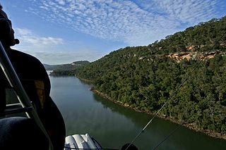
Bar Point is a suburb of the Central Coast region of New South Wales, Australia, located on the north bank of the Hawkesbury River 53 kilometres (33 mi) north of Sydney. It is part of the Central Coast Council local government area.
Cheero Point is a waterfront locality and suburb of the Central Coast region of New South Wales, Australia. Cheero Point is located on the west bank of the Mooney Mooney Creek in the Brisbane Water National Park. It is situated 53 kilometres (33 mi) north of Sydney. It is part of the Central Coast Council local government area.
Daleys Point is a south-eastern suburb of the Central Coast region of New South Wales, Australia on the Bouddi Peninsula. It is part of the Central Coast Council local government area. The median house price in January 2010 was A$950,000.
Green Point is a south-eastern suburb of the Central Coast region of New South Wales, Australia between Erina and Kincumber accessed by a main road, Avoca Drive. It is part of the Central Coast Council local government area.
Little Wobby is a suburb of the Central Coast region of New South Wales, Australia, located on the north bank of the Hawkesbury River. It is part of the Central Coast Council local government area.
Point Clare is a suburb of the Central Coast region of New South Wales, Australia located approximately 75 kilometres (47 mi) north of Sydney and 4 kilometres (2 mi) south-west of Gosford's central business district on the western shore of Brisbane Water. It is part of the Central Coast Council local government area.

Point Frederick is a suburb of the Central Coast region of New South Wales, Australia on a peninsula protruding into Brisbane Water 2 kilometres (1 mi) south-southeast of Gosford's central business district. It is part of the Central Coast Council local government area.

St Huberts Island is a canal estate and suburb of the Central Coast region of New South Wales, Australia connected to the mainland at Daleys Point. It is part of the Central Coast Council local government area.

Wagstaffe is a south-eastern suburb of the Central Coast region of New South Wales, Australia on the Bouddi Peninsula. It is part of the Central Coast Council local government area. It was named after Captain Wagstaffe, one of the first settlers in the area. It has a general store, which is also the local post office. It is a thin slither of around 200 houses between the bay and the bush. Historically it was also known as Wagstaffe Point. In aboriginal dialect the point is called Kourang Gourang. A ferry service operates between Wagstaffe and Palm Beach. Travel time is 30 minutes.

Pelican Point is a northeastern suburb of Bunbury, Western Australia, that is six kilometres from the centre of Bunbury and adjoins the suburb of Eaton. It is within the City of Bunbury local government area.
The Central Coast's 107.7 Triple M is a commercial radio station based in Gosford, New South Wales, Australia. The broadcast area is the NSW Central Coast, a region that extends from southern Lake Macquarie to the Hawkesbury River. Originally called 2GO, it was the Central Coast's first radio station starting on the AM band with 1310, moving to 1323, and the final location on the AM band was 801. It later moved to its current frequency of FM 107.7. Ownership of the station has changed a number of times. For some period it was a part of Wesgo, being a two-station company comprising 2GO in Gosford and 2WS in Sydney. Currently owned by Southern Cross Austereo, in November 2019 it was rebranded to Triple M.

Nick Yallouris is an Australian track cyclist. He represented Australia in the 2016 Rio Paralympics as a sighted pilot for Australian cycling Paralympian, Matthew Formston.

