The Rocks, Sydney

Last updated

The Rocks
Sydney,  New South Wales

Street through The Rocks.jpg

The Rocks, Sydney
Population 774 (2016 census) [1]
 • Density 3,900/km2 (10,000/sq mi)
Postcode(s) 2000
Area 0.2 km2 (0.1 sq mi)
Location 1 km (1 mi) from Sydney CBD
LGA(s) City of Sydney
Parish St. Philip
State electorate(s) Sydney [2]
Federal Division(s) Sydney [3]
Suburbs around The Rocks:
Millers Point Dawes Point Port Jackson
Barangaroo The Rocks Sydney Cove
Sydney CBD Sydney CBD Sydney CBD
Campbell's Cove Sydney The Rocks.jpg
Campbell's Cove

The Rocks is an urban locality, tourist precinct and historic area of Sydney's city centre, in the state of New South Wales, Australia. It is located on the southern shore of Sydney Harbour, immediately north-west of the Sydney central business district.

New South Wales State of Australia

New South Wales is a state on the east coast of Australia. It borders Queensland to the north, Victoria to the south, and South Australia to the west. Its coast borders the Tasman Sea to the east. The Australian Capital Territory is an enclave within the state. New South Wales' state capital is Sydney, which is also Australia's most populous city. In March 2018, the population of New South Wales was over 7.9 million, making it Australia's most populous state. Just under two-thirds of the state's population, 5.1 million, live in the Greater Sydney area. Inhabitants of New South Wales are referred to as New South Welshmen.

Port Jackson Part of Sydney Harbour, Australia

Port Jackson, consisting of the waters of Sydney Harbour, Middle Harbour, North Harbour and the Lane Cove and Parramatta Rivers, is the ria or natural harbour of Sydney, New South Wales, Australia. The harbour is an inlet of the Tasman Sea. It is the location of the Sydney Opera House and Sydney Harbour Bridge. The location of the first European settlement and colony on the Australian mainland, Port Jackson has continued to play a key role in the history and development of Sydney.

Sydney central business district Suburb of Sydney, New South Wales, Australia

The Sydney central business district is the main commercial centre of Sydney, the state capital of New South Wales and the most populous city in Australia. It extends southwards for about 3 km (2 mi) from Sydney Cove, the point of first European settlement in which the Sydney region was initially established. Due to its pivotal role in Australia's early history, it is one of the oldest established areas in the country.

Contents

History

The Rocks became established shortly after the colony's formation in 1788. It was known as Tallawoladah by the Cadigal people. [4] The original buildings were first traditional vernacular houses, of wattle and daub, with thatched roofs, and later of local sandstone, from which the area derives its name. [4] From the earliest history of the settlement, the area had a reputation as a slum and the arriving convicts' side of town, often frequented by visiting sailors and prostitutes. [4] After November 1790, many of the inhabitants were also aboriginals. In 1823, the district had a population of about 1,200. During the late nineteenth century, the area was dominated by a gang known as the Rocks Push. It maintained this rough reputation until approximately the 1870s. [5] [6]

The Cadigal, also spelled as Gadigal and Caddiegal, are a group of indigenous Australians whose traditional lands are located in Sydney, New South Wales, Australia. The Cadigal originally inhabited the area that they called "Cadi" that lies south of Port Jackson covering today's Sydney central business district and stretches from South Head to Petersham with part of the southern boundary lying on the Cooks River.

Vernacular architecture category of architecture based on local needs, construction materials and reflecting local traditions

Vernacular architecture encompasses the vast majority of the world's built environment, and thus resists a simple definition. It is perhaps best understood not by what it is, but what it can reveal about the culture of a people or place at any given time. The sheer range of global building types and developments--from Mongolian yurts to Japanese minka to American roadside commercial strips--suggests that vernacular architecture is everywhere, but tends to be disregarded or overlooked in traditional histories of architecture and design. As geographer Amos Rapoport has famously written, vernacular architecture constitutes 95 percent of the world's built environment: that which is not designed by professional architects and engineers. While such an understanding has its limitations, it nonetheless indicates the vastness of the subject and helps us recognize that all aspects of the built environment can impart something about the society and culture of a people or place. If nothing else, vernacular architecture cannot be distilled into a series of easy-to-digest patterns, materials, or elements. Vernacular architecture is not a style.

Wattle and daub

Wattle and daub is a composite building material used for making walls, in which a woven lattice of wooden strips called wattle is daubed with a sticky material usually made of some combination of wet soil, clay, sand, animal dung and straw. Wattle and daub has been used for at least 6,000 years and is still an important construction material in many parts of the world. Many historic buildings include wattle and daub construction, and the technique is becoming popular again in more developed areas as a low-impact sustainable building technique.

By the early 20th century, many of the area's historic buildings were in serious decay. In 1900, bubonic plague broke out, and the state government resumed areas around The Rocks and Darling Harbour, with the intention of demolishing them and rebuilding them. [4] More than 3,800 houses, buildings and wharves were inspected and hundreds demolished, but the continuation of these plans were brought to a halt due to the outbreak of World War I. [7] During the 1920s, several hundred buildings were demolished during the construction of the Sydney Harbour Bridge.

Bubonic plague Human and animal disease

Bubonic plague is one of three types of plague caused by bacterium Yersinia pestis. One to seven days after exposure to the bacteria, flu-like symptoms develop. These symptoms include fever, headaches, and vomiting. Swollen and painful lymph nodes occur in the area closest to where the bacteria entered the skin. Occasionally, the swollen lymph nodes may break open.

Darling Harbour recreational and pedestrian precinct on the western edge of the Sydney central business district

Darling Harbour is a harbour adjacent to the city centre of Sydney, New South Wales, Australia. It is also a large recreational and pedestrian precinct that is situated on western outskirts of the Sydney central business district. Originally named Long Cove, the locality extends northwards from Chinatown, along both sides of Cockle Bay to King Street Wharf 3 on the east, and to the suburb of Pyrmont on the west. Cockle Bay is just one of the waterways that makes up Darling Harbour, which opens north into the much larger Port Jackson.

World War I 1914–1918 global war originating in Europe

World War I, also known as the First World War or the Great War, was a global war originating in Europe that lasted from 28 July 1914 to 11 November 1918. Contemporaneously described as "the war to end all wars", it led to the mobilisation of more than 70 million military personnel, including 60 million Europeans, making it one of the largest wars in history. It is also one of the deadliest conflicts in history, with an estimated nine million combatants and seven million civilian deaths as a direct result of the war, while resulting genocides and the 1918 influenza pandemic caused another 50 to 100 million deaths worldwide.

A.S.N. Warehouses, Hickson Road The rocks new south wales...jpg
A.S.N. Warehouses, Hickson Road

In 1968, the state government gave control of The Rocks to the Sydney Cove Redevelopment Authority, with the intention of demolishing all the original buildings, re-developing them as high-density residential dwellings. In February 1971, a group of local residents formed the Rocks Residents Group to oppose the plans. [4] They felt that the new dwellings would result in increased rents, which would force out the traditional residents of the area. The residents' group requested a green ban from the Builder's Labourers Federation, who had become increasingly active in preventing controversial developments over the previous four years.

A green ban is a form of strike action, usually taken by a trade union or other organised labour group, which is conducted for environmentalist or conservationist purposes.

SIRIUS apartments, a residential public housing development Sirius apartments, Sydney.jpg
SIRIUS apartments, a residential public housing development

By 1973, the union had imposed the ban, and after discussions with the Sydney Cove Redevelopment Authority, a 'People's Plan' was developed. By October 1973, it appeared that the redevelopment would proceed as originally planned, using non-union labour.[ citation needed ] For two weeks, demonstrations by local residents and unionists followed, with numerous arrests being made.[ citation needed ] Liberal Premier Robert Askin was in the midst of an election campaign, and used the protests as a means of conveying his law and order message to voters.[ citation needed ] However, the green ban stayed in place until 1975, when the state union leadership was overthrown, and was ultimately successful, as can be seen in the buildings that survive today. Instead of demolishing The Rocks, renovations transformed the area into a commercial and tourist precinct. [4]

Liberal Party of Australia Australian political party

The Liberal Party of Australia is a major centre-right political party in Australia, one of the two major parties in Australian politics, along with the centre-left Australian Labor Party (ALP). It was founded in 1944 as the successor to the United Australia Party (UAP).

Robert Askin Australian politician and Premier of New South Wales

Sir Robert William Askin, GCMG, was an Australian politician and the 32nd Premier of New South Wales from 1965 to 1975, the first representing the Liberal Party. He was born in 1907 as Robin William Askin, but always disliked his first name and changed it by deed poll in 1971. Before being knighted in 1972, however, he was generally known as Bob Askin. Born in Sydney in 1907, Askin was educated at Sydney Technical High School. After serving as a bank officer and as a Sergeant in the Second World War, Askin joined the Liberal Party and was elected to the seat of Collaroy at the 1950 election.

Today the Rocks is a partly gentrified area, but still contains a significant proportion of Housing Commission properties, and there is still a significant problem of urban poverty and street crime in this district.[ citation needed ] As housing stock becomes dilapidated, government policy is to sell the now extremely valuable public housing units to private owners, in the expectation that they will restore the properties. The Sirius building and the associated "Save Our Sirius" protest group was formed to protest relocation of its residents. [8]

Gentrification urban socioeconomic process

Gentrification is a process of renovating deteriorated urban neighborhoods by means of the influx of more affluent residents. This is a common and controversial topic in politics and in urban planning. Gentrification can improve the material quality of a neighborhood, while also potentially forcing relocation of current, established residents and businesses, causing them to move from a gentrified area, seeking lower cost housing and stores.

Housing NSW is an agency of the Department of Family and Community Services that is responsible for the provision and management of public housing services with the aim to prevent homelessness in the state of New South Wales, Australia.

Sirius building

The Sirius building is an apartment complex in The Rocks district of Sydney, New South Wales, Australia. Designed for the Housing Commission of New South Wales in 1978–1979 by commission architect Tao Gofers, the building is a prominent example of Brutalist architecture in Australia. It also has striking repetitive geometries in reaction to the Japanese metabolist architecture movement. Notable for being the only high rise development in The Rocks, Sirius houses 79 apartments with one, two, three or four bedrooms, generally with single storey apartments to two and three storey walk ups.

Population

In the 2016 Census, there were 774 people in The Rocks. 39.8% of people were born in Australia and 51.1% of people only spoke English at home. [1]

Culture

Rocks Market Sydney Rocks market.jpg
Rocks Market
Susannah Place Museum The-Rocks.jpg
Susannah Place Museum

The close proximity to Circular Quay and the views of the iconic Harbour Bridge, as well as the historic nature of many of the buildings, makes the Rocks very popular with tourists. It features a variety of souvenir and craft shops, as well as many themed and historic pubs. The Rocks Market operates each weekend, with around 100 stalls. During the week, shopping options include galleries exhibiting Australian artists, such as Ken Done and Ken Duncan, as well as Australian clothing and Australian opal shops. There are numerous historic walks through the area, visiting historical buildings such as Cadmans Cottage and Sydney Observatory, and the Dawes Point Battery, which was the first fortified position in New South Wales. [9]

Two separate pubs in The Rocks claim to be Sydney's oldest surviving pubs: the Fortune of War and the Lord Nelson. Others in the area include the Observer, the Orient, the Mercantile, the Palisade and the Hero of Waterloo.[ citation needed ]

A passenger boat terminal and the Museum of Contemporary Art, Sydney is also situated beside the Rocks area. The precinct can also be accessed by rail, as it is within walking distance of Circular Quay station.

Water Polo by the Sea is held there every year by Australian Water Polo with the Australia men's national water polo team take on the International All Stars. [10]

Susannah Place Museum is a historic house museum situated in The Rocks. It is a block of four terrace houses that was built in 1844 and had domestic occupants until 1990. It is a documentation of the urban working class community in The Rocks. The terraces in various states of modernity show the evolution of occupation over 150 years

Literature

Related Research Articles

Millers Point, New South Wales Suburb of Sydney, New South Wales, Australia

Millers Point is an inner-city suburb of Sydney, in the state of New South Wales, Australia. It is on the north-western edge of the Sydney central business district, adjacent to The Rocks and is part of the local government area of the City of Sydney.

Australian Hotel

The Australian Hotel is a heritage-listed hotel at 100-104 Cumberland Street, The Rocks, City of Sydney, New South Wales, Australia. It was built from 1914 to 1915. The property is owned by Property NSW. It was added to the New South Wales State Heritage Register on 10 May 2002.

Glenmore Hotel

The Glenmore Hotel is a heritage-listed pub located at 96-98 Cumberland Street, in the inner city Sydney suburb of The Rocks in the City of Sydney local government area of New South Wales, Australia. It was designed by the Tooth and Co. resident architects and built in 1921 by D. M. Mitchell. The property is owned by Property NSW, an agency of the Government of New South Wales. It was added to the New South Wales State Heritage Register on 10 May 2002.

British Seamens Hotel

The British Seamen's Hotel is a heritage-listed bar and former hotel, boarding house, office building located at 39-43 Argyle Street, in the inner city Sydney suburb of The Rocks in the City of Sydney local government area of New South Wales, Australia. The property was built in 1886 for John Gill. It is owned by Property NSW, an agency of the Government of New South Wales. It was added to the New South Wales State Heritage Register on 10 May 2002.

Argyle Cut

The Argyle Cut is a heritage-listed roadway and road cutting located at Argyle Street in the inner city Sydney suburb of The Rocks in the City of Sydney local government area of New South Wales, Australia. It was built from 1843 to 1868 with convict and paid labour. The property is owned by the Sydney Harbour Foreshore Authority, an agency of the Government of New South Wales. It was added to the New South Wales State Heritage Register on 10 May 2002.

Argyle Bridge

The Argyle Bridge is a heritage-listed road bridge located on Cumberland Street in the inner city Sydney suburb of The Rocks in the City of Sydney local government area of New South Wales, Australia. It was built from 1911 to 1912. It is also known to include the Argyle Stairs. The property is owned by the Sydney Harbour Foreshore Authority, an agency of the Government of New South Wales. It was added to the New South Wales State Heritage Register on 10 May 2002.

Argyle Terrace

The Argyle Terrace - Caminetto's Restaurant is a heritage-listed former residence and now restaurant located at 13-15 Playfair Street in the inner city Sydney suburb of The Rocks in the City of Sydney local government area of New South Wales, Australia. It was designed by built for Thomas Playfair from 1883 to 1884. It is also known as Former Harry's Bar and Sorrentos. The property is owned by Property NSW, an agency of the Government of New South Wales. It was added to the New South Wales State Heritage Register on 10 May 2002.

Playfairs Terrace

Playfair's Terrace are heritage-listed terrace houses located at 1-7 Atherden Street in the inner city Sydney suburb of The Rocks in the City of Sydney local government area of New South Wales, Australia. It was built during 1880. It is also known as Playfairs. The property is owned by Property NSW, an agency of the Government of New South Wales. It was added to the New South Wales State Heritage Register on 10 May 2002.

32 Harrington Street, The Rocks

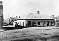
32 Harrington Street is a heritage-listed retail building and former residence located at 32 Harrington Street in the inner city Sydney suburb of The Rocks in the City of Sydney local government area of New South Wales, Australia. It was built for William Reynolds, a blacksmith, in 1834. The property is owned by Property NSW, an agency of the Government of New South Wales. It was added to the New South Wales State Heritage Register on 10 May 2002.

Butchery Building

The Butchery Building is a heritage-listed restaurant and former terraced houses and butcher's shop located at 178-180 Cumberland Street, in the inner city Sydney suburb of The Rocks in the City of Sydney local government area of New South Wales, Australia. It was built from 1890 to 1899. It is also known as The Butchery Buildings. The property is owned by Property NSW, an agency of the Government of New South Wales. It was added to the New South Wales State Heritage Register on 10 May 2002.

Cumberland Place and Steps

The Cumberland Place and Steps are heritage-listed steps and a laneway located at Cumberland Place, in the inner city Sydney suburb of The Rocks in the City of Sydney local government area of New South Wales, Australia. It was built from 1807. It is also known as Suffolk Lane; Stubbs Lane; Gloucester Lane; and Cribb's Lane. The property is owned by Property NSW, an agency of the Government of New South Wales. It was added to the New South Wales State Heritage Register on 10 May 2002.

182 Cumberland Street, The Rocks

182 Cumberland Street, The Rocks is a heritage-listed retail building and residence located at 182 Cumberland Street, in the inner city Sydney suburb of The Rocks in the City of Sydney local government area of New South Wales, Australia. It was designed by Walter Liberty Vernon with the assistance of E. L. Drew and built from 1911 to 1912. The property is owned by Property NSW, an agency of the Government of New South Wales. It was added to the New South Wales State Heritage Register on 10 May 2002.

Longs Lane Precinct precinct of historic terrace houses in Sydney, Australia

The Long's Lane Precinct, also Longs Lane Precinct, comprise a series of heritage-listed terrace houses located at 130 Cumberland Street, 132-134 Cumberland Street, 136-138 Cumberland Street, and 140-142 Cumberland Street, in the inner city Sydney suburb of The Rocks in the City of Sydney local government area of New South Wales, Australia. The terraces houses were built from 1888 to 1914. They are also known as 130 Cumberland Street; 132-134 Cumberland Street; 136-138 Cumberland Street; Watson's Butchery; and 140-142 Cumberland Street. The properties are owned by Property NSW, an agency of the Government of New South Wales. The precinct and the terrace houses were added to the New South Wales State Heritage Register on 10 May 2002.

117-117a Gloucester Street, The Rocks

117-117a Gloucester Street, The Rocks is a heritage-listed terrace houses located in the Long's Lane Precinct at 117-117a Gloucester Street, in the inner city Sydney suburb of The Rocks in the City of Sydney local government area of New South Wales, Australia. It was designed by W. Foggitt and built from 1912 to 1915. It is also known as Longs Lane Terraces/Precinct (Long's). The property is owned by Property NSW, an agency of the Government of New South Wales. It was added to the New South Wales State Heritage Register on 10 May 2002.

Bakers Terrace terrace of houses in Sydney, Australia

Baker's Terrace are heritage-listed commercial office buildings and former terrace houses located at 66-68 and 70-72 Gloucester Street, in the inner city Sydney suburb of The Rocks in the City of Sydney local government area of New South Wales, Australia. It was built during 1875 for William Andrews and Edward Baker. It is also known as Bakers Terrace. The property is owned by Property NSW, an agency of the Government of New South Wales. It was added to the New South Wales State Heritage Register on 10 May 2002.

71 Harrington Street, The Rocks

71 Harrington Street, The Rocks are heritage-listed serviced apartments and former terrace houses and shops located at 71 Harrington Street, in the inner city Sydney suburb of The Rocks in the City of Sydney local government area of New South Wales, Australia. It was built from 1860. It is also known as Sailors Return Hotel; Stafford Apts. and 75 Harrington Street; Clocktower Development. The property is owned by Property NSW, an agency of the Government of New South Wales. It was added to the New South Wales State Heritage Register on 10 May 2002.

67 Harrington Street, The Rocks

67 Harrington Street, The Rocks is a heritage-listed serviced apartments complex and former terrace house located at 67 Harrington Street, in the inner city Sydney suburb of The Rocks in the City of Sydney local government area of New South Wales, Australia. It was built from 1885. It is also known as Stafford Apartments and 75 Harrington Street; Clocktower Development. The property is owned by Property NSW, an agency of the Government of New South Wales. It was added to the New South Wales State Heritage Register on 10 May 2002.

61-65 Harrington Street, The Rocks

61-65 Harrington Street, The Rocks is a heritage-listed serviced apartments and former terrace house located at 61-65 Harrington Street, in the inner city Sydney suburb of The Rocks in the City of Sydney local government area of New South Wales, Australia. It was built from 1870 to. It is also known as Stafford Apartments and 75 Harrington Street; Clocktower Development. The property is owned by Property NSW, an agency of the Government of New South Wales. It was added to the New South Wales State Heritage Register on 10 May 2002.

View Terrace facades

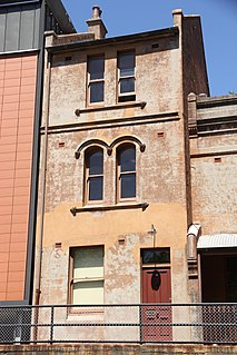
The View Terrace facades are heritage-listed offices and a former residence and terrace houses located at 26-30 Gloucester Street, in the inner city Sydney suburb of The Rocks in the City of Sydney local government area of New South Wales, Australia. It was built from 1893 to 1893. It is also known as Formerly 22-30 Gloucester Street and part of 40 Gloucester Street development. The property is owned by Property NSW, an agency of the Government of New South Wales. It was added to the New South Wales State Heritage Register on 10 May 2002.

References

  1. 1 2 Australian Bureau of Statistics (27 June 2017). "The Rocks (State Suburb)". 2016 Census QuickStats. Retrieved 2 July 2017. Blue pencil.svg
  2. "Sydney". Electoral Commission of NSW.
  3. "Sydney". Australian Electoral Commission.
  4. 1 2 3 4 5 6 Karskens, Grace (2009). "The Rocks". Sydney Journal. 2 (1) via UTS ePress.
  5. "Heritage & History". The Rocks. Retrieved 22 December 2012.
  6. Grace, Karskens (2008). "The Rocks". Dictionary of Sydney . Dictionary of Sydney Trust. Retrieved 11 July 2013.
  7. How plague almost demolished historic Sydney, Australian Geographic, 16 August 2010.
  8. "save our community". save-our-community. Retrieved 6 November 2014.
  9. "The Rocks". NSW Government. Retrieved 22 December 2012.
  10. http://www.waterpolobythesea.com/

Dictionary of Sydney entries

Coordinates: 33°51′35″S151°12′32″E / 33.85985°S 151.20901°E / -33.85985; 151.20901