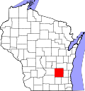
Theresa, Wisconsin | |
---|---|
Coordinates: 43°30′21″N88°27′33″W / 43.50583°N 88.45917°W | |
Country | United States |
State | Wisconsin |
County | Dodge |
Area | |
• Total | 0.82 sq mi (2.13 km2) |
• Land | 0.81 sq mi (2.08 km2) |
• Water | 0.02 sq mi (0.04 km2) |
Elevation | 965 ft (294 m) |
Population | |
• Total | 1,262 |
• Estimate (2019) [4] | 1,205 |
• Density | 1,496.89/sq mi (578.11/km2) |
Time zone | UTC-6 (Central (CST)) |
• Summer (DST) | UTC-5 (CDT) |
Zip Code | 53091 |
Area code | 920 |
FIPS code | 55-79425 [5] |
GNIS feature ID | 1575345 [2] |
State Highways | |
Website | villageoftheresa |
Theresa is a village in Dodge County, Wisconsin, United States. The population was 1,262 at the 2010 census. The village is within the Town of Theresa.
Theresa was founded by Solomon Juneau along with his Metis wife, Josette Vieau Juneau, and children in the 1850s. It was named for Solomon's mother, (Marie-)Thérèse Galarneau Juneau.
During World War I more than 600 people from over a dozen surrounding communities prevented former mayor of Milwaukee and Socialist party member Emil Seidel from holding a "pro-German" meeting in Theresa. [6]
Theresa is located at 43°31′0″N88°27′10″W / 43.51667°N 88.45278°W (43.51667, -88.453001). [7]
According to the United States Census Bureau, the village has a total area of 0.82 square miles (2.12 km2), of which, 0.80 square miles (2.07 km2) of it is land and 0.02 square miles (0.05 km2) is water. [8]
Census | Pop. | Note | %± |
---|---|---|---|
1880 | 277 | — | |
1900 | 355 | — | |
1910 | 345 | −2.8% | |
1920 | 381 | 10.4% | |
1930 | 427 | 12.1% | |
1940 | 418 | −2.1% | |
1950 | 461 | 10.3% | |
1960 | 576 | 24.9% | |
1970 | 611 | 6.1% | |
1980 | 766 | 25.4% | |
1990 | 771 | 0.7% | |
2000 | 1,252 | 62.4% | |
2010 | 1,262 | 0.8% | |
2019 (est.) | 1,205 | [4] | −4.5% |
U.S. Decennial Census [9] |
As of the 2010 census, [3] there were 1,262 people, 539 households, and 365 families living in the village. The population density was 1,577.5 inhabitants per square mile (609.1/km2). There were 588 housing units at an average density of 735.0 per square mile (283.8/km2). The racial makeup of the village was 97.5% White, 0.4% African American, 0.6% Native American, 0.2% Asian, 0.6% from other races, and 0.7% from two or more races. Hispanic or Latino of any race were 1.7% of the population.
There were 539 households, of which 26.9% had children under the age of 18 living with them, 54.5% were married couples living together, 7.6% had a female householder with no husband present, 5.6% had a male householder with no wife present, and 32.3% were non-families. 28.4% of all households were made up of individuals, and 11.2% had someone living alone who was 65 years of age or older. The average household size was 2.34 and the average family size was 2.85.
The median age in the village was 42 years. 21.1% of residents were under the age of 18; 6.6% were between the ages of 18 and 24; 27.3% were from 25 to 44; 28.7% were from 45 to 64; and 16.2% were 65 years of age or older. The gender makeup of the village was 51.1% male and 48.9% female.
As of the 2000 census, [5] there were 1,252 people, 495 households, and 365 families living in the village. The population density was 1,672.8 people per square mile (644.5/km2). There were 528 housing units at an average density of 705.5 per square mile (271.8/km2). The racial makeup of the village was 97.92% White, 0.08% Black or African American, 0.32% Native American, 0.08% Asian, 0.88% from other races, and 0.72% from two or more races. 1.92% of the population were Hispanic or Latino of any race.
There were 495 households, out of which 34.1% had children under the age of 18 living with them, 60.6% were married couples living together, 9.3% had a female householder with no husband present, and 26.1% were non-families. 20.6% of all households were made up of individuals, and 8.5% had someone living alone who was 65 years of age or older. The average household size was 2.53 and the average family size was 2.94.
In the village, the population was spread out, with 26.0% under the age of 18, 6.6% from 18 to 24, 33.7% from 25 to 44, 19.3% from 45 to 64, and 14.4% who were 65 years of age or older. The median age was 36 years. For every 100 females, there were 99.4 males. For every 100 females age 18 and over, there were 98.5 males.
The median income for a household in the village was $44,200, and the median income for a family was $50,795. Males had a median income of $37,216 versus $26,023 for females. The per capita income for the village was $17,906. About 1.7% of families and 3.6% of the population were below the poverty line, including 2.2% of those under age 18 and 9.0% of those age 65 or over.
Hilbert is a village in Calumet County in the U.S. state of Wisconsin. The population was 1,248 at the 2020 census.
Mount Sterling is a village in Crawford County, Wisconsin, United States. The population was 211 at the 2010 census.
Juneau is a city in Dodge County, Wisconsin, United States. The population was 2,658 at the 2020 census. It is the county seat of Dodge County.
St. Cloud is a village in Fond du Lac County, Wisconsin, United States, along the Sheboygan River. The population was 477 at the 2010 census. St. Cloud is part of The Holyland region in northeastern Fond du Lac County.
Blue River is a village in Grant County, Wisconsin, United States. The population was 434 at the 2010 census.
Camp Douglas is a village in Juneau County, Wisconsin, United States. The population was 647 at the 2020 census, up from 601 at the 2010 census. Camp Douglas is home to Volk Field Air National Guard Base.
Kingston is a town in Juneau County, Wisconsin, United States. Its population was 58 at the 2000 census. The unincorporated communities of Mather and Meadow Valley are located in the town.
Lyndon Station is a village in Juneau County, Wisconsin, United States. The population was 500 at the 2010 census.
Union Center is a village in Juneau County, Wisconsin, United States, along the Baraboo River. The population was 200 at the 2010 census.
Coleman is a village in Marinette County, Wisconsin, United States. The population was 726 at the 2020 census. It is part of the Marinette, WI–MI Micropolitan Statistical Area.
Bay City is a village on the Mississippi River in Pierce County, Wisconsin, United States. The population was 500 at the 2010 census.
Cecil is a village in Shawano County, Wisconsin, United States. The population was 529 at the 2020 census.
Newburg is a village in Ozaukee and Washington counties in the U.S. state of Wisconsin. The population was 1,254 at the 2010 census. Of this, 1,157 were in Washington County, and only 97 were in Ozaukee County.
Stockbridge is a village in Calumet County, Wisconsin, United States. The population was 678 at the 2020 census. The village lies within the Town of Stockbridge.
Stockbridge is a town in Calumet County, Wisconsin. The population was 1,456 at the time of the 2010 census. The village of Stockbridge, and the unincorporated communities of Kloten, Quinney, and Saint Catherines Bay are located within the town.
Theresa is a town in Dodge County, Wisconsin, United States. As of the census in 2000, the town population was 1,080. The Village of Theresa is located within the town. The unincorporated community of Theresa Station is located in the town. The unincorporated community of Hochheim is also located partially in the town.
Eden is a village in Fond du Lac County, Wisconsin, United States. The population was 875 at the 2010 census. The village is located within the Town of Eden.
Necedah is a village in Juneau County, Wisconsin, United States. The population was 916 at the 2020 census. The village is located within the Town of Necedah.
Wonewoc is a town in Juneau County, Wisconsin, United States. The population was 783 at the 2000 census. The Village of Wonewoc and the village of Union Center are located within the town.
Eagle is a village in Waukesha County, Wisconsin, United States. At the 2020 census, the population was 2,071. The village is located within the Town of Eagle.