Meteorological history | |
---|---|
Formed | November 9,2024 |
Dissipated | November 20,2024 |
Violent typhoon | |
10-minute sustained (JMA) | |
Highest winds | 195 km/h (120 mph) |
Lowest pressure | 920 hPa (mbar);27.17 inHg |
Category 5-equivalent super typhoon | |
1-minute sustained (SSHWS/JTWC) | |
Highest winds | 260 km/h (160 mph) |
Lowest pressure | 923 hPa (mbar);27.26 inHg |
Overall effects | |
Fatalities | 14 |
Injuries | 15 |
Missing | 2 |
Damage | $58.21 - 76.05 million (2024 USD) |
Areas affected | Northern Mariana Islands,Guam,Philippines |
Part of the 2024 Pacific typhoon season |
Typhoon Man-yi, known in the Philippines as Super Typhoon Pepito,was a powerful and long-tracked tropical cyclone that impacted the Philippines in early November 2024. Closely following Tropical Storm Trami and Typhoons Kong-rey,Yinxing,Toraji and Usagi,Man-yi became the sixth consecutive tropical system to affect the country in less than a month. It was also part of the four tropical cyclones to simultaneously exist in the Western Pacific during the month of November,the first occurrence since records began in 1951;the other three were Yinxing,Toraji,and Usagi.
The twenty-fourth named storm,the third violent typhoon of the season,and the sixth super typhoon of the annual typhoon season,Man-yi originated from an area of convection 220 km (140 mi) east of Kwajalein Atoll on November 8. Satellite imagery showed a more organized low-level circulation center and persistent deep convection on the southwestern periphery. As the system moved northwestward,the Japan Meteorological Agency (JMA) upgraded it to a tropical storm,naming it Man-yi,as the system passed Guam on November 13. After spending several days as a tropical storm,the JMA upgraded it to a minimal typhoon on November 15,with the Joint Typhoon Warning Center (JTWC) following shortly thereafter. Early the next day,the JMA reported that the storm reached its peak intensity with ten-minute sustained winds of 195 km/h (120 mph) and a central pressure of 920 hPa (27.17 inHg). It subsequently peaked as a Category 5-equivalent super typhoon on the Saffir-Simpson scale,with one-minute sustained winds of 260 km/h (160 mph). As it moved west-northwestward,Man-yi made its first landfall in Panganiban,Catanduanes,later the same day. After making landfall in Catanduanes,the system slightly degraded in appearance,with the western half becoming less organized as it passed north of the Calaguas Islands. The eye of the typhoon had become more distinct,and its structure seemed to have recovered,with the development of a secondary eyewall,suggesting that the system was undergoing an eyewall replacement cycle,although the cycle could not be completed. The following day,Man-yi made its second landfall in Dipaculao,Aurora,on Luzon Island. The typhoon accelerated northwestward over the South China Sea,with its low-level circulation center partially exposed and fragmented convective bands occurring along the southern and eastern edges of the system. However,the storm rapidly deteriorated as it encountered a low-level northeasterly cold surge across the northern South China Sea and experienced increased vertical wind shear. The JMA continued to monitor it until it was last noted on November 20.
A tropical storm watch was issued for the Mariana Islands,prompting Guam to declare a state of emergency in preparation for the storm's arrival,while a flood watch was also issued for parts of Guam and the Northern Marianas. PAGASA issued Tropical Cyclone Wind Signals for several areas,while PHIVOLCS issued warnings about potential lahar flows from Taal,Pinatubo,and Mayon volcanoes. Mandatory evacuations were ordered in vulnerable areas of Camarines Sur,Catanduanes,Calabarzon and Eastern Samar. Panic-buying occurred in several locations,while multiple events and transportation services were suspended. Overall,Man-yi was responsible for 14 deaths,15 injuries,three missing,and approximately US$58.21–76.05 million in damages,particularly in Catanduanes and Nueva Vizcaya.
Typhoon Man-yi emerged from an area of convection 220 km (140 mi) east of Kwajalein Atoll, with satellite imagery showing a more organized low-level circulation center and a persistent area of deep convection on the southwestern periphery on November 8. [1] By 09:00 UTC, the United States Joint Typhoon Warning Center (JTWC) issued a tropical cyclone formation alert for the disturbance, noting a favorable environment for development due to low to moderate vertical wind shear, good divergence aloft, and warm sea surface temperatures of 29–30 °C (84–86 °F). [2] The Japan Meteorological Agency (JMA) designated the disturbance as a low-pressure area on the same day, [3] and the next day, it was upgraded to a tropical depression. [4] Later that same day, the JTWC assigned the system the designation 25W, noting that it was a consolidating system with formative bands wrapping in from the north and a deepening cold central core that was obscuring the low-level circulation. [5]
As the system moved northwestward along the southern edge of a mid-level subtropical high, the JMA upgraded the system to a tropical storm named Man-yi at 06:00 UTC on the same day, [7] with satellite imagery revealing a very compact system and the low-level circulation center partially exposed on the northwestern edge of a small central dense overcast (CDO). [8] Man-yi wrapped around the northern and eastern quadrants of the circulation center, growing more intense as the vertical structure continued to align. [9] The system became disorganized, with convection displaced to the southeast, but it eventually coalesced, [10] as evidenced by cooling cloud tops in the central cold cover and a tightening wrap of the feeder band around the obscured circulation center, [11] as the system passed Guam on November 13. [12] Early the next day, the JMA upgraded it to a severe tropical storm, citing Dvorak technique—a method of determining a tropical cyclone's intensity based on satellite appearance. [13] It later moved into the Philippine Area of Responsibility, where PAGASA named it as Pepito. [14] The storm displayed cooling cloud tops in its central cold region, with rain bands becoming more defined and tightening around the formation of a developing eye. [15] On November 15, the JMA upgraded the storm to a minimal typhoon, and the JTWC followed suit, [16] with satellite imagery revealing a symmetric eyewall surrounding an oblong eye and spiral banding extending over the eastern semicircle. [17] [18]
Early the next day, the JTWC upgraded the system to super typhoon status, with estimated 1-minute maximum sustained winds of 260 km/h (160 mph), making it a Category 5-equivalent super typhoon. [19] Meanwhile, the JMA upgraded Man-yi to a violent typhoon, estimating its peak intensity with a minimum central pressure of 920 hPa (27.17 inHg) and 10-minute maximum sustained winds of 195 km/h (120 mph). [20] The typhoon was characterized by a nearly symmetrical CDO extending 98–115 miles (157–185 km), with the coldest cloud tops around −72 °C (−98 °F). [19] As it moved west-northwestward, [21] Man-yi made its first landfall in Panganiban, Catanduanes, at around 9:40 PM PHT (13:40 UTC). [22] After making landfall in Catanduanes, the system slightly degraded in appearance, [23] with the western semicircle becoming less organized and the cloud tops warming as it passed north of the Calaguas Islands. [24] Soon after, the typhoon's eye became more defined, with its structure appearing to have recovered. [25] A secondary eyewall also began to develop, indicating that the system was in the process of an eyewall replacement cycle, though the cycle was unable to complete. [26] The following day, Man-yi made its second landfall in Dipaculao, Aurora, on Luzon Island at around 3:20 PM PHT (07:20 UTC) and quickly moved inland, [27] [28] while storm chaser Josh Morgerman, located in Borlongan, Aurora, just inside the eye of the storm, measured a pressure of 951.8 mbar (28.11 inHg) and recorded a pressure gradient of 7.6 mbar (0.2244 inHg) per nautical mile. [29]
Man-yi accelerated northwestward over the South China Sea, with its low-level circulation center partially exposed and fragmented convective bands occurring along the southern and eastern edges of the system. [30] [31] Satellite imagery revealed a rapidly weakening system, with the low-level circulation center partially exposed to the south of intense deep convection, leading the JMA to report that the storm had weakened into a severe tropical storm at 12:00 UTC on November 18. [32] [33] The deep convection associated with Man-yi was able to wrap around, fueled by localized outflow from the convective activity as it moved west-northwestward along the southwestern edge of a mid-level subtropical high. [34] [35] Man-yi rapidly deteriorated as the storm encountered a low-level northeasterly cold surge across the northern South China Sea and experienced increased vertical wind shear. [36] The storm became mostly exposed and embedded in the stratocumulus field associated with the northeasterly cold surge, resulting in the JMA reporting that it weakened into a tropical storm on November 19. [37] [38] The system became fully exposed, with the central convection completely eroded. [39] The JTWC issued its final warning on the same day as the system weakened to a tropical depression, while the JMA continued to monitor it until it was last noted at 06:00 UTC on November 20. [40]
Beginning November 14, PAGASA issued Tropical Cyclone Wind Signal No. 1 for Catanduanes and Northern Samar as well as parts of Camarines Sur, Albay, Sorsogon, Samar and Eastern Samar. [14] Over the succeeding days, this was expanded to include an area stretching from Ilocos Norte in northern Luzon to the Dinagat Islands in northeastern Mindanao. [41] The agency issued Signal No. 5, its highest warning level, for the whole province of Catanduanes, stating that winds of up to 185 km/h or higher were expected in 12 hours. [42] PAGASA issued gale warnings for the eastern and southern seaboards of Luzon and eastern Visayas [43] and also warned of storm surges with a height of up to 46 ft (14 m) [44] affecting Cagayan Valley, Central Luzon, Calabarzon, Mimaropa, the Bicol Region and Eastern Visayas. [45] PHIVOLCS warned of possible lahar flows from the Taal, Pinatubo, and Mayon volcanoes. [46] After Man-yi made landfall in Catanduanes, PAGASA added parts of Polillo Islands and Calaguas Islands to Signal No. 5 as it moved over the eastern section of Southern Luzon. [47] As the storm approached Central Luzon, Signal No. 5 was raised over parts of Aurora, Nueva Vizcaya and Quirino. [48]
President Bongbong Marcos warned officials to prepare for a "worst-case scenario" for the storm. [49] The Land Transportation Franchising and Regulatory Board ordered the suspension of overland commercial passenger and cargo traffic passing through the port of Matnog, which connects Luzon with Visayas and Mindanao. It later extended the suspension to include bus journeys to the Bicol Region and advised against non-essential travel to Bicol, Central Luzon, Metro Manila, and Calabarzon. [50] [51] More than 1.2 million people were evacuated nationwide. [52] Pre-emptive evacuations were announced in Quezon City, [53] while forced evacuations were ordered in vulnerable areas of Nueva Ecija, [54] Northern Samar, Camarines Norte, [55] Camarines Sur [56] Calabarzon, [57] Sorsogon, [58] Eastern Samar [59] and Catanduanes. [60] At least 54 flights were cancelled [61] along with several ferries. [62]
The Philippine Coast Guard closed 55 seaports, stranding 3,912 people. [63] Twenty-eight airports were also closed. [64] The Ambuklao, Binga, San Roque and Magat Dams opened their gates as a precaution. [65] The second day of the Grand Biniverse concert by Bini, which was scheduled on November 17 at the Araneta Coliseum in Quezon City, was instead moved to November 19, [66] while three fun runs scheduled in Metro Manila on November 17 were also postponed [67] along with games of the UAAP Season 87. [68] Panic-buying occurred in Tacloban, [69] Ligao and Nabua, [70] while in Virac, Catanduanes, queues formed around a hardware store giving out free plywood and other materials to barricade against strong winds. [71] A code white alert was raised by the Department of Health, [72] while the Armed Forces of the Philippines placed some of its units on red alert. [73] The Philippine National Police deployed nearly 13,000 personnel to assist in disaster response. [74] A curfew was imposed in Naga, Camarines Sur, [75] while electricity was preemptively turned off in Catanduanes. [76] A red alert status was declared in Malabon [77] and Baguio, while authorities advised against non-essential travel to Baguio and Benguet. [78] Vehicle number coding was suspended in Baguio. [79] The Villa Verde Road connecting Pangasinan with Nueva Vizcaya was closed due to risks of landslides. [80]
A tropical storm watch was in effect for the Mariana Islands on November 12, [81] with the Condition of Readiness at level 3 (COR 3), as Man-yi was located approximately 330 mi (530 km) east of Guam. [82] The Guam Department of Education canceled classes, and government agencies began preparing for the storm as Man-yi approached. [83] A state of emergency was declared as Guam prepared for the arrival of the storm. [84] A flood watch was issued for parts of Guam and the Northern Marianas. [85] Several ferry services were cancelled as Man-yi approached southern China. [86]
According to the National Disaster Risk Reduction and Management Council (NDRRMC), Man-yi killed 14 people and left two others missing; nine died in the Cagayan Valley while five more were killed in the Bicol Region. The typhoon destroyed 16,433 homes and damaging 60,898 others in its path. At least 4,240,764 people were affected, with 163,065 displaced from their homes. Agricultural damage in the Philippines amounted to ₱12.89 million ( US$ 261,775.96), while infrastructure damage reached ₱2.85 billion ( US$ 57.95 million) for a total of ₱2.87 billion ( US$ 58.21 million). However, as reported by the NDRRMC, the agricultural damage of the three successive typhoons (Toraji (Nika), Usagi (Ofel) and Man-yi) stood at ₱784.68 million ( US$ 15.93 million), while infrastructure damage already reached ₱2.96 billion ( US$ 60.11 million), for a total of ₱3.75 billion ( US$ 76.05 million). Additionally, 232 cities experienced power outages. [87] However, in Nueva Vizcaya, officials estimated that agricultural damage in the province reached ₱2 billion ( US$ 40.61 million), [88] while infrastructure damage reached ₱200 million ( US$ 4.06 million). [89]
Man-yi generated 124 mm (4.9 in) of rain in northern Luzon over a 24-hour period, prompting the National Irrigation Administration to open six gates of the Magat Dam after it recorded an water inflow of 8,700 cubic meters per second, which was higher than the 7,100 cms recorded during Typhoon Vamco (Ulysses) in 2020. [90] This, combined with heavy rains, caused extensive flooding in Cagayan Valley [91] that reached 13 ft (4 m). [92] Water levels at the Buntun Bridge reached 38 ft (11.5 m), exceeding its critical level by 1 ft 8 in (0.5 m). [93] Officials in Isabela said that flooding was mitigated by dredging on the Cagayan River in the wake of Vamco. [94] The Office of Civil Defense reported that several areas in the Bicol Region were experiencing storm surges as Man-yi approached, with some buildings being flooded. [95] It also reported "extensive" damage in Catanduanes, [96] with a provincial official adding that six towns in the northern part of the island were "severely damaged". [97] In the provincial capital Virac, the roof of the emergency operations center was damaged. [98] Storm surges also occurred in the Polillo Islands and La Union. [99] [100] Some trees were toppled, and several houses were damaged in San Andres, Catanduanes, as Man-yi passed through the area. [101] A few houses were damaged in coastal areas of Albay. [102] Several houses and boats were destroyed in the Calaguas Islands. [103]
They have not recovered from the previous storms when the [super] typhoon hit. It's been one calamity after another.
A tornado destroyed at least 12 houses and a chapel in Aparri and Pamplona, Cagayan. [105] A flooded house in Santo Tomas, Isabela also caught fire. [106] Heavy rainfall in Albay triggered a landslide in Polangui, blocking several roads. In Tiwi, Albay another landslide rendered the roads impassable to four-wheeled vehicles. [107] Landslides also blocked roads in Mountain Province and Benguet. [99] The Philippine Coast Guard (PCG) stated that 4,784 people were stranded in ports across the country. [108] Parts of Isabela, Aurora and Nueva Ecija were without power due to the onslaught of Man-yi. [109] In Isabela, electric poles that had been restored after being toppled by Typhoon Toraji (Nika) were again toppled by Man-yi. [110] Thirteen roads in Quirino were flooded, while several bridges were damaged. [111] Knee-deep flooding occurred in Nueva Ecija. [112] Heavy rains and strong winds were experienced in Palayan and Cabanatuan due to the storm. Some areas in Quirino also experienced power outages due to Typhoon Man-yi. In Ilagan, Isabela, strong gusts of wind were felt due to the storm. [113] Extensive damage occurred in Nueva Vizcaya after the Magat River overflowed. [114] A total of 77 road sections and 32 bridges were affected in the province. [115] A 130 ft (40 m)-section of a dike burst along the Talavera River in Aliaga, Nueva Ecija, inundating 490 acres (200 ha) of farmland. [116] Power outages in Catanduanes were expected to last for months. [117] One person was reported dead after figuring in a vehicular accident caused by fallen internet wires in Daet and two people were reported injured in separate incidents in Aurora. [118] [119] Seven people were killed in a landslide in Ambaguio, Nueva Vizcaya [120] that injured three others. One person was also reported missing in Nueva Vizcaya. Four people also went missing after their shanty was swept away by strong river currents in Nueva Ecija. [121] [122] Two people were killed in a landslide in Ifugao. [123] A boulder destroyed a house in Dipaculao, burying three people alive. [124] At least 8,000 homes were damaged or destroyed, and more than 100 cities and towns suffered power outages due to toppled electric poles. [125]
The government of Albay has pledged ₱1 million ( US$ 20,304.57) in financial assistance and will provide mental health and psychosocial support to Catanduanes. [126] The governor of Catanduanes said that the Sorsogon provincial government would provide aid to Catanduanes following the destructive landfall of Man-yi. [127] The Philippine Air Force has deployed several units and placed others on standby to provide humanitarian assistance and disaster response in the wake of Man-yi. [128] A state of calamity was declared in the provinces of Aurora, [129] Isabela [130] and Nueva Vizcaya [131] as well as in the city of Tabuk, Kalinga. [132] The Philippine Coast Guard opened a donation drive for those affected by the storm. [133] The Department of Education mandated the immediate implementation of Alternative Delivery Modes in areas affected by Man-yi. [134] The Philippine Navy vessel BRP Apolinario Mabini assisted in delivering essential relief supplies to the communities affected in Catanduanes. [135] Two Lockheed C-130 Hercules aircraft of the Philippine Air Force were also deployed to Catanduanes to carry out relief missions for the typhoon victims. [136]
The Department of Human Settlements and Urban Development allotted ₱15 million ( US$ 304,568.53) for an emergency shelter response fund to support families whose homes were destroyed by the storm. [137] The Department of Social Welfare and Development reported that it has delivered over ₱79 million ( US$ 1.6 million) in humanitarian aid to families impacted by the storm. [138] President Bongbong Marcos subsequently visited affected areas of Catanduanes [139] and delivered ₱50 million ( US$ 1.02 million) in aid to the province. [140] He also urged government offices not to hold lavish Christmas parties in solidarity with victims on Man-yi and previous storms and donate funds allocated for such events to disaster relief instead. [141] Marcos also delivered ₱50 million ( US$ 1.02 million) in aid during his visit to affected areas of Bambang, Nueva Vizcaya. [121] The Taipei Economic and Cultural Office donated disaster relief supplies valued at over ₱5 million ( US$ 101,522.84) to the Philippines, [142] while the United States will allocate an additional US$1 million in funding to support humanitarian efforts in the country. [143]
A study by World Weather Attribution (WWA) in December 2024 examined the impact of six consecutive typhoons that had affected Luzon between late October and November, including Tropical Storm Trami and Typhoons Kong-rey, Yinxing, Toraji and Usagi, Man-yi. The WWA reported, "to assess whether climate change has increased the likelihood of at least three major typhoons making landfall in the Philippines in a single year." Using statistical modeling, the scientists hypothesized that "with a 1.3 °C (34.3 °F) rise in sea surface temperatures, such an event was expected to occur once every 15 years and was projected to happen every 12 years." [144]
The 2013 Pacific typhoon season was a devastating and catastrophic season that was the most active since 2004, and the deadliest since 1975. It featured Typhoon Haiyan, one of the most powerful storms in history, as well as one of the strongest to make landfall on record. It featured 31 named storms, 13 typhoons, and five super typhoons. The season's first named storm, Sonamu, developed on January 4 while the season's last named storm, Podul, dissipated on November 15. Collectively, the storms caused 6,829 fatalities, while total damage amounted to at least $26.41 billion (USD), making it, at the time, the costliest Pacific typhoon season on record, until it was surpassed five years later. As of 2024, it is currently ranked as the fifth-costliest typhoon season.
The 2015 Pacific typhoon season was a slightly above average season that produced twenty-seven tropical storms, eighteen typhoons, and nine super typhoons. The season ran throughout 2015, though most tropical cyclones typically develop between May and November. The season's first named storm, Mekkhala, developed on January 15, while the season's last named storm, Melor, dissipated on December 17. The season saw at least one named tropical system forming in each of every month, the first time since 1965. Similar to the previous season, this season saw a high number of super typhoons. Accumulated cyclone energy (ACE) during 2015 was extremely high, the third highest since 1970, and the 2015 ACE has been attributed in part to anthropogenic warming, and also the 2014-16 El Niño event, that led to similarly high ACE values in the East Pacific.
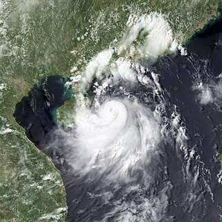
Severe Tropical Storm Rumbia, known in the Philippines as Tropical Storm Gorio, was a tropical cyclone that brought widespread flooding in areas of the Philippines and China late June and early July 2013. The sixth internationally named storm of the season, Rumbia formed from a broad area of low pressure situated in the southern Philippine Sea on June 27. Steadily organizing, the initial tropical depression moved towards the northwest as the result of a nearby subtropical ridge. On June 28, the disturbance strengthened to tropical storm strength, and subsequently made its first landfall on Eastern Samar in the Philippines early the following day. Rumbia spent roughly a day moving across the archipelago before emerging into the South China Sea. Over open waters, Rumbia resumed strengthening, and reached its peak intensity with winds of 95 km/h (50 mph) on July 1, ranking it as a severe tropical storm. The tropical cyclone weakened slightly before moving ashore the Leizhou Peninsula late that day. Due to land interaction, Rumbia quickly weakened into a low pressure area on July 2 and eventually dissipated soon afterwards.
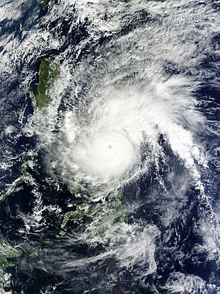
Typhoon Melor, known in the Philippines as Typhoon Nona, was a powerful tropical cyclone that struck the Philippines in December 2015. The twenty-seventh named storm and the eighteenth typhoon of the annual typhoon season, Melor killed 51 people and caused ₱7.04 billion in damage.
Typhoon Haima, known in the Philippines as Super Typhoon Lawin, was the third most intense tropical cyclone worldwide in 2016. It was the twenty-second named storm and the eleventh typhoon of the annual typhoon season. Impacting the Philippines less than 3 days after Typhoon Sarika, Haima formed out of a tropical disturbance southwest of Chuuk on October 14, it developed into a tropical storm the next day. Steady strengthening occurred over the next day or two as it tracked westward towards the Philippines. After forming an eye shortly after it was upgraded to a typhoon, Haima began to rapidly strengthen and eventually became a super typhoon on October 18. It later attained its peak intensity as a Category 5-equivalent tropical cyclone before weakening slightly. Haima later made landfall in Peñablanca, Cagayan late on October 19 as a Category 4-equivalent storm. Rapid weakening occurred as it interacted with the landmasses until it entered the Southern China Sea as a weak typhoon. It formed a large ragged eye once again and remained steady in intensity until making landfall in China on October 21. It weakened below typhoon intensity and became extratropical on October 22. The cyclone drifted northeastwards and later eastwards before emerging over water again, but eventually dissipated by October 26.
Typhoon Vongfong, known in the Philippines as Typhoon Ambo, was a strong tropical cyclone that impacted the Philippines in May 2020. Beginning as a tropical depression on May 10 east of Mindanao, Vongfong was the first storm of the 2020 Pacific typhoon season. It gradually organized as it took a slow northward course, strengthening into a tropical storm on May 12 and curving west thereafter. The next day, Vongfong entered a period of rapid intensification, becoming a typhoon and attaining 10-minute maximum sustained winds of 150 km/h (93 mph). The storm made landfall at this intensity near San Policarpo, Eastern Samar, at 04:15 UTC on May 14. The system tracked across Visayas and Luzon, making a total of seven landfalls. Persistent land interaction weakened Vongfong, leading to its degeneration into a tropical depression over the Luzon Strait on May 17.
Typhoon Goni, known in the Philippines as Super Typhoon Rolly, was an extremely powerful tropical cyclone that made landfall as a Category 5 equivalent super typhoon on Catanduanes in the Philippines, and in Vietnam as a tropical storm. It is the strongest landfalling tropical cyclone on record by 1-minute maximum sustained winds. The name "Goni" means swan in Korean. The nineteenth named storm, ninth typhoon, and second super typhoon of the 2020 Pacific typhoon season, Goni originated as a tropical depression south portion of Guam on October 26. It was then named as Tropical Storm Goni on October 27. On the next day, Goni explosively intensified over the Philippine Sea, becoming a Category 5–equivalent super typhoon on October 30. Goni maintained Category 5 strength for over a day, before making landfall on Catanduanes at peak intensity, with 10-minute sustained winds of 220 km/h (140 mph), and 1-minute sustained winds of 315 km/h (195 mph), with a minimum central pressure of 905 hPa. It was the most intense tropical cyclone observed worldwide in 2020.
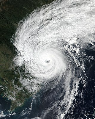
Typhoon Vamco, known in the Philippines as Typhoon Ulysses, was a powerful and very destructive Category 4-equivalent typhoon that struck the Philippines and Vietnam. It also caused the worst flooding in Metro Manila since Typhoon Ketsana in 2009. The twenty-second named storm and tenth typhoon of the 2020 Pacific typhoon season, Vamco originated as a tropical depression northwest of Palau, where it slowly continued its northwest track until it made landfall in Quezon. After entering the South China Sea, Vamco further intensified in the South China Sea until it made its last landfall in Vietnam.
The 2024 Pacific typhoon season is an ongoing event in the annual cycle of tropical cyclone formation in the western Pacific Ocean. It is the fifth-latest starting Pacific typhoon season on record, as well as the deadliest since 2013, and the fifth-costliest Pacific typhoon season on record, mostly due to Yagi. This season also saw the most active November on record, with 4 storms active at the same time. The season runs throughout 2024, though most tropical cyclones typically develop between May and October. The season's first named storm, Ewiniar, developed on May 25, and eventually intensified into the first typhoon of the season.
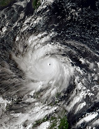
Typhoon Noru, known in the Philippines as Super Typhoon Karding, was an intense and destructive tropical cyclone that affected Vietnam, Thailand, and the Philippines — where it caused widespread agricultural damage. Noru, which means Roe deer in Korean, the sixteenth named storm and eighth typhoon, and third super typhoon of the 2022 Pacific typhoon season, Noru originated from a disturbance over the Philippine Sea, slowly tracking eastward until its development into a tropical depression, where it began to move westward.
Severe Tropical Storm Conson, known in the Philippines as Typhoon Jolina, was a strong tropical cyclone that impacted the central Philippines and Vietnam during the 2021 Pacific typhoon season. Being the thirteenth named storm of the said event, Conson originated as a low-pressure area first monitored approximately 500 km (310 mi) west of Guam. It formed as a tropical depression over the Pacific Ocean on September 5, 2021. As it formed within the Philippine Area of Responsibility, the Philippine Atmospheric, Geophysical, and Astronomical Services Administration (PAGASA) named the storm Jolina. Over the next day, it intensified into a tropical storm and was named Conson by the Japan Meteorological Agency (JMA). As the storm neared Samar Island, it intensified into a severe tropical storm, and later into a typhoon according to the PAGASA prior to its first landfall in Eastern Samar. The storm retained its strength as it crossed Visayas and later Calabarzon before weakening over Manila Bay prior to its final landfall in Bataan. It subsequently emerged into the South China Sea where it struggled to reintensify further. It then weakened into a tropical depression just offshore of Vietnam before moving ashore near Da Nang. It then rapidly weakened before dissipating on September 13.
Typhoon Rai, known in the Philippines as Super Typhoon Odette, was a deadly and extremely destructive super typhoon, which was the second costliest typhoon in Philippine history behind Typhoon Haiyan in 2013. Rai was a powerful rare tropical cyclone that struck the Philippines in December 2021. Rai became the first Category 5-equivalent super typhoon to develop in the month of December since Nock-ten in 2016, and the third of four Category 5 super typhoons recorded in the South China Sea, along with Pamela in 1954, Rammasun in 2014 and Yagi in 2024.
Tropical Storm Megi, known in the Philippines as Tropical Storm Agaton, was a weak but deadly tropical cyclone that impacted the Philippines in April 2022. It was the third tropical depression, and the second tropical storm of the 2022 Pacific typhoon season. Megi originated from an area of convection in the Philippine Sea where it slowly tracked northwestward into Leyte Gulf, where it remained almost stationary, slowly tracking to the east. Megi made two landfalls, one in Calicoan Island in Guiuan, and another in Basey, Samar. It continued to track southwestward and reentered the Philippine Sea before dissipating.
Typhoon Ewiniar, known in the Philippines as Typhoon Aghon, was a fairly strong tropical cyclone that impacted parts of the Philippines, particularly Luzon, in May 2024. The first named storm and typhoon of the annual typhoon season, Ewiniar emerged from an area of atmospheric convection 441 km (274 mi) southeast of Palau. The Japan Meteorological Agency (JMA) labeled the system as a low-pressure area on May 21. It intensified on May 23 and became a tropical depression, giving it the name Aghon by the Philippine Atmospheric, Geophysical, and Astronomical Services Administration after entering the Philippine Area of Responsibility, marking it as the fifth-latest start of a Pacific typhoon season since reliable records began; the depression intensified into a tropical storm, assigning it the name Ewiniar. The cyclone made nine landfalls in the Philippines. Afterward, it began to move over the warm tropical waters of Lamon Bay, where the Joint Typhoon Warning Center and the JMA upgraded Ewiniar into a minimal typhoon. Beginning to weaken for the final time on May 30, the storm passed directly over the island of Minamidaitōjima and began an extratropical transition. It was last noted by the JMA early on June 2, near the International Dateline, and absorbed into another extratropical cyclone just south of Prince William Sound on June 6.
Typhoon Krathon, known in the Philippines as Super Typhoon Julian, was a powerful and erratic tropical cyclone which impacted Taiwan and the Philippines in late September and early October 2024. Krathon, which refers to the santol fruit, was the first storm to make landfall on Taiwan's densely populated western plains since Typhoon Thelma in 1977. It was also the first storm to hit Kaohsiung in October and the first since Tropical Storm Trami in 2001 to weaken into a tropical depression over Taiwan. Additionally, it was the wettest tropical cyclone in Basco, Batanes, bringing more than two months' worth of rainfall for September and surpassing the previous record set by Typhoon Ruth in 1991.
Severe Tropical Storm Trami, known in the Philippines as Severe Tropical Storm Kristine, was a very large, devastating, and deadly tropical cyclone that wreaked havoc across the Philippines and later impacted Vietnam, Thailand, and China in October 2024. It was also the first tropical cyclone in a series to impact the Philippines in late 2024, before Typhoons Kong-rey, Yinxing, Toraji, Usagi, and Man-yi.
Typhoon Kong-rey, known in the Philippines as Super Typhoon Leon, was a powerful tropical cyclone that impacted Taiwan and the Philippines before later affecting East China, South Korea, and Japan in late October and early November 2024. Kong-rey was the first typhoon in Taiwan's history to make landfall after mid-October and the largest storm to strike since Typhoon Herb in 1996. Additionally, it was the second tropical cyclone in a series to impact the Philippines, following Tropical Storm Trami a few days earlier, and preceding Typhoons Yinxing, Toraji, Usagi, and Man-yi which would impact a few days later.
Typhoon Yinxing, known in the Philippines as Typhoon Marce, was a powerful tropical cyclone that impacted the Philippines before later affecting Vietnam in early November 2024. It was the third tropical cyclone in a series to impact the Philippines, following Tropical Storm Trami and Typhoon Kong-rey a few days earlier, and Typhoons Toraji, Usagi, and Man-yi only a few days after. Additionally, it was also part of the four tropical cyclones to simultaneously exist in the Western Pacific during the month of November, the first occurrence since records began in 1951; the other three were Toraji, Usagi and Man-yi.
Typhoon Toraji, known in the Philippines as Typhoon Nika, was a fairly strong tropical cyclone that impacted the Philippines in early November 2024. It was the fourth tropical cyclone in a series to impact the Philippines, following Tropical Storm Trami and Typhoons Kong-rey, Yinxing, Usagi, and Man-yi which had occurred just a few days earlier. Additionally, it was also part of the four tropical cyclones to simultaneously exist in the Western Pacific during the month of November, the first occurrence since records began in 1951; the other three were Yinxing, Usagi and Man-yi.
Typhoon Usagi, known in the Philippines as Super Typhoon Ofel, was a powerful tropical cyclone that impacted the Philippines before later affecting Taiwan in early November 2024. It was the fifth of six consecutive tropical cyclones that impacted the Philippines within a span of four weeks, following Tropical Storm Trami and Typhoons Kong-rey, Yinxing, and Toraji, and preceding the stronger Typhoon Man-yi. Additionally, Usagi was also part of the four tropical cyclones to simultaneously exist in the Western Pacific during the month of November, the first time since records began in 1951; the other three were Yinxing, Toraji and Man-yi.