This article is about a current severe tropical storm where information can change quickly or be unreliable. The latest page updates may not reflect the most up-to-date information. Please refer to your local weather service or media outlets for the latest weather information pertaining to a specific location. |
A request that this article title be changed to Tropical Storm Trami is under discussion . Please do not move this article until the discussion is closed. |
Meteorological history | |
---|---|
Formed | October 19,2024 |
Severe tropical storm | |
10-minute sustained (JMA) | |
Highest winds | 110 km/h (70 mph) |
Lowest pressure | 970 hPa (mbar);28.64 inHg |
Tropical storm | |
1-minute sustained (SSHWS/JTWC) | |
Highest winds | 110 km/h (70 mph) |
Lowest pressure | 978 hPa (mbar);28.88 inHg |
Overall effects | |
Fatalities | 97+ |
Injuries | 70+ |
Missing | 41+ |
Damage | >$7.68 million (2024 USD) |
Areas affected | Philippines,Vietnam |
IBTrACS | |
Part of the 2024 Pacific typhoon season |
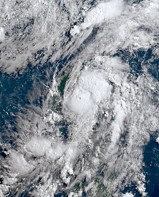
Severe Tropical Storm Trami,known in the Philippines as Severe Tropical Storm Kristine,is currently an active tropical cyclone moving into the South China Sea after having caused deadly impacts in the Philippines in October 2024. The twentieth named storm of the annual typhoon season,Trami developed into a low-pressure area and later into a tropical depression west of Guam on October 19,moving westward along the southern periphery. After entering the Philippine Area of Responsibility,PAGASA named the depression Kristine on October 20. The storm was embedded within a larger trough that extended from the Philippine Islands eastward almost to Guam. Early the next day,satellite imagery showed that the depression was exposed,displaying elongated circulation and convective bands wrapping around its center. The Japan Meteorological Agency (JMA) upgraded the system to a tropical storm,naming it Trami,as spiral bands of deep convection formed around the low-level circulation,while Trami's central dense overcast became sheared and displaced from its central circulation. By October 23,the JMA reported that Trami had intensified into a severe tropical storm as it moved west-northwestward and made landfall in Divilacan,Isabela. The next day,it emerged over the coastal waters of southern Ilocos Sur,with surface observations and radar data revealing that the storm had undergone a lee-side jump,leaving the remnants of its circulation center over Northern Luzon while mid-level rotation shifted into the eastern South China Sea.
PAGASA forecast that the wind flow directed towards the storm will bring strong to gale-force winds to several regions in the Philippines,prompting the issuance of Tropical Cyclone Wind Signals for various areas. A red alert warning has been specifically issued for the Bicol Region,the Cordillera Administrative Region,and the Ilocos Region,while officials from Batanes and Ilocos Norte have expressed concerns about potential further damage to their provinces,as they are still recovering from Typhoon Krathon in 2024. In Daet,Camarines Norte,PAGASA recorded 528.5 mm (20.81 in) of rain from Trami,marking the highest 24-hour rainfall since the 1920s and surpassing the previous record of 507.5 mm (19.98 in) set in December 2000. Overall,Trami was responsible for 97 deaths,with 41 people reported missing and 70 others injured,causing approximately US$7.68 million in damages in the Philippines.
The origins of Severe Tropical Storm Trami can be traced back to October 19, when the Japan Meteorological Agency (JMA) reported a low-pressure area located 633 km (394 mi) west of Guam. [1] The United States Joint Typhoon Warning Center (JTWC) described it as a very weak vortex with light winds wrapping around the circulation, along with deep moisture fields to the southwest beginning to encircle the vortex. [2] The low-pressure area later moved westward slowly before it was designated as a tropical depression by the JMA. [3] At 15:00 UTC that day, the JTWC issued a tropical cyclone formation alert, indicating a consolidating low-level circulation center bounded by formative convective banding wrapping around its northern and southern edges. [4] The depression was moving westward along the southern periphery of a mid-level subtropical high, which made it favorable for tropical cyclogenesis due to low vertical wind shear, warm sea surface temperatures, and high ocean heat content. [5] The following day, the JTWC designated the system as 22W, as low-level banding wrapped into the circulation center, with a tightly curved convective band wrapping along the eastern edge of the circulation. [6] After entering the Philippine Area of Responsibility, the depression was named Kristine by the PAGASA at 05:00 PHT on October 21 (21:00 UTC on October 20) and was embedded within the larger trough that extended from the Philippine Islands eastward almost to Guam. [7] [8]
Early the next day, satellite imagery revealed that the depression was exposed, featuring elongated circulation and convective bands wrapping around the center. [9] At 18:00 UTC that day, the JMA upgraded the system to a tropical storm and named it Trami, [10] with spiral bands of deep convection starting to wrap around the low-level circulation. [11] Trami was moving westward along the southern edge of a mid-level subtropical high, developing spiral bands of deep convection that wrapped around a partly exposed low-level circulation center just east of Luzon Island, [12] while its deep convective banding was displaced over the southwestern quadrant due to northeasterly vertical wind shear. [13] As Trami approached Luzon, its central dense overcast (CDO) became sheared and displaced from its central circulation, [14] featuring moderate upper-level outflow and a partially exposed circulation center located to the northeast of the primary broad central convection. [15] At around 06:00 UTC on October 23, the JMA reported that Trami had intensified into a severe tropical storm as it was moving west-northwestward along the southwestern edge of a mid-level subtropical high, [16] with deep convection developing in the southwestern quadrant of a broad, partially exposed low-level circulation. [17] At 12:30 AM PHT on October 24 (16:30 UTC on October 23), the storm made landfall in Divilacan, Isabela, [18] [19] where it exhibited a circular CDO characterized by fragmented convection as it moved across central Luzon. [20] The following day, Trami emerged over the coastal waters of southern Ilocos Sur, [21] with surface observations and radar data revealing that the storm had undergone a lee-side jump, [22] leaving the remnants of a circulation center over Northern Luzon while mid-level rotation shifted slowly westward into the eastern South China Sea; [23] later, satellite imagery showed a consolidating CDO, indicating a well-defined circulation with most of the deep convection situated to the south. [24] As it moves westward along the southern periphery, [25] satellite imagery indicates an asymmetric system, featuring minimal significant convection in the northern circulation, while the southern circulation displays a convective mass with cloud tops colder than −91 °C (−132 °F). [26] By late on October 26, the storm was encountering strong easterly vertical wind shear, [27] which caused its core convection to become more linear as it approached the coast of Vietnam. [28]
PAGASA stated that the wind flow directed towards the circulation of the storm will bring strong to gale-force winds to several regions in the Philippines. [7] Shortly after upgrading the storm, PAGASA issued Tropical Cyclone Wind Signal No. 1 for various areas, including Biliran, Batanes, Burias Island, Dinagat Islands, Eastern Samar, Leyte, Masbate, Occidental Mindoro, Oriental Mindoro, Romblon, Sorsogon, Samar, Southern Leyte, Siargao, Surigao del Norte (including Bucas Grande Islands), and Ticao Island. [29] After Trami developed into a tropical storm, PAGASA raised Signal No. 2 for Abra, Albay, Apayao, Babuyan Islands, Bataan, Batangas, Bulacan, Camarines Norte, Camarines Sur, Catanduanes, Cavite, Ilocos Norte, Laguna, Metro Manila, Pampanga, Quezon (including Polillo Islands and Lubang Islands), Rizal, the northern portion of Eastern Samar, as well as the northeastern portion of Northern Samar and Sorsogon. [30] On October 23, the agency also added the whole province of Aklan, Antique (including Caluya Islands), Bohol, Capiz, Cebu (including Bantayan Islands and Camotes Islands), Guimaras and Iloilo, as well as the northern portion of Negros Occidental; Negros Oriental; and Palawan (including Calamian Islands, Cuyo Islands, and Kalayaan Islands) to signal no. 1 due to the effects of Trami. [31] After the storm reached the severe tropical storm category, the agency raised Signal No. 3, indicating an expectation of winds of 89–117 km/h (55–73 mph) within the next 18 hours for Benguet, Ifugao, Isabela, Kalinga, La Union, Mountain Province, Nueva Vizcaya, Pangasinan, Quirino, the central portion of Abra, the northern and central portions of Aurora, the northern portion of Nueva Ecija; Tarlac; and Zambales, the southern portion of Cagayan, and the central and southern portions of Ilocos Sur. [32] PAGASA issued storm surge warnings for portions of Albay, Aurora, Cagayan, Camarines Norte, Catanduanes, Isabela, Quezon, and Camarines Sur. [33] According to the NDRRMC, 24,988 people were preemptively evacuated. [34]
A red alert warning has been issued for the Bicol Region, [35] the Cordillera Administrative Region, [36] and the Ilocos Region. [37] Classes in some parts of Bulacan, [38] Bohol, Cavite, Camarines Norte, Camarines Sur, Laguna, Metro Manila, Quezon, Sorsogon, Negros Occidental, Northern Samar, [39] and Oriental Mindoro were suspended due to the storm. [40] Following this, the Regional Disaster Risk Reduction and Management Council activated all response clusters, urging communities to take necessary precautions in preparation for Trami. [41] Orange rainfall warnings were also issued for Eastern Samar, Samar, Biliran, the northern portion of Leyte, and northern Cebu, with PAGASA cautioning that flooding could occur in low-lying areas. [42] The Office of Civil Defense anticipates that the storm will affect approximately 30 million individuals across different regions and has announced that it has initiated the Charlie protocol—its highest level of emergency readiness—in seven areas due to these anticipated effects. [43] [44] The Philippine Institute of Volcanology and Seismology also raised lahar advisories for Mayon Volcano. [45] Officials from Batanes and Ilocos Norte expressed concern about the potential for further damage to their provinces due to the expected impact of the storm, especially since these areas were still recovering from Typhoon Krathon (Julian) in 2024. [46] The Magat, Ipo, San Roque, Ambuklao and Binga Dams opened spillways as a precaution. [47]
The Department of Agriculture urged farmers to harvest their rice in wake of the storm. [48] The Philippine Coast Guard (PCG) banned sea travel in the three provinces of Samar island, with the greatest loss travel going to island communities. [49] Regional offices in Bicol also prepared family food packs in wake of the storm. [50] The PCG stated that 8,786 people were stranded in ports across the country, including 162 people in Southern Tagalog, 2,450 in Bicol, 2,109 in Eastern Visayas, and 490 in Central Visayas. [51] [52] [53] In Sorsogon, the Kasanggayahan Festival was canceled, [54] while the National Collegiate Athletic Association and the University Athletic Association of the Philippines postponed sports competitions scheduled on October 23–25. [55] [56] [57] Several airports across the country received disruption, while at least 51 flight cancelations were reported, [58] stranding more than 1,000 passengers. [59] Schools and non-essential government offices in Luzon were suspended on October 23–25. [60] [61] [62] Multiple trips originating from the Parañaque Integrated Terminal Exchange were cancelled following the storm. [63] The Metropolitan Manila Development Authority suspended number coding in Metro Manila on October 23–25. [64] [65] The Professional Regulation Commission postponed the Certified Public Accountants Licensure Exam due to the storm's impact on both testing centers and examinees. [66]
Trami is expected to be the sixth typhoon to strike Vietnam according to the National Center for Hydro-Meteorological Forecasting. [67] Deputy Prime Minister Trần Hồng Hà has urged relevant government agencies to prepare for Trami's impact. [68] A total of 285,480 soldiers and militia personnel, along with 12,503 military vehicles, were deployed in response to the impending storm. [69] The Civil Aviation Authority of Vietnam reported that four airports in central Vietnam would suspend operations, while authorities in Quảng Bình announced a ban on all coastal activities starting at midnight on October 27. [70] [71]
On October 23, the Central Weather Administration issued heavy rain warnings for the Greater Taipei and Yilan–Hualien areas despite Trami not expecting to directly affect Taiwan. [72] [73] The Hong Kong Observatory issued a signal number 1 warning for the city on October 25 at 1:40am. [74] At 10:40am on October 26, the Hong Kong Observatory issued a signal number 3 warning. [75]
Heavy rains were reported in the Visayas, Mindanao, and parts of Luzon due to the storm's trough. [76] In Bacolod, over 281 residents from two barangays were evacuated due to flash floods triggered by heavy rains from the storm, [77] while 316 families were evacuated in Negros Occidental. [58] Trami also caused flooding in Sorsogon, Catanduanes, and Northern Samar. [78] Heavy rains from Trami have caused flash floods in several regions within the provinces of Maguindanao del Sur, Maguindanao del Norte, and Sultan Kudarat. [79] Nearly all of Naga, Camarines Sur was submerged in floodwaters reaching up to 1.8 m (6 ft), [80] leading to forced evacuations after the Naga River reached critical level. [81] Trami caused heavy rainfall that led to landslides in Bato, Catanduanes, [82] and heavy flooding in Albay, [83] where 413 mm (16.3 in) of rain fell within 17 hours, the highest since Typhoon Durian (Reming) in 2006, [84] and the equivalent of two months of average precipitation. [85] In Daet, Camarines Norte, PAGASA recorded the highest 24-hour rainfall since the 1920s, with Trami dumping 528.5 mm (20.81 in) of rain and surpassing the previous record of 507.5 mm (19.98 in) set in December 2000. [86] Officials in Naga said that around 700 mm (28 in) of rain fell on the city, equivalent to 2.5 months of average precipitation, causing floods from the Bicol River basin that affected 30% of its territory and 70% of its population. [87] Trami brought torrential rainfall over a 24-hour period, leading to what could be considered the worst flooding in the Bicol Region since 1969. [88] A storm surge inundated six barangays in Lingayen, Pangasinan. [89]
A person was reported missing after their banca broke down in the waters near Merida, Leyte, [90] while his two companions were rescued in Pilar, Cebu. [52] Another person died in the sinking of a banca in Obando, Bulacan, while nine others were rescued. [91] A landslide blocked a road in Calanasan, Apayao, while strong winds were experienced in Laoag, Ilocos Norte, and heavy rainfall and flooding were reported in Pili, Camarines Sur. [92] Several power lines in Luzon and the Visayas have been disconnected, as determined by the National Grid Corporation of the Philippines. [93] In Dolores, Eastern Samar, strong winds nearly toppled several trees, and schools in Jipapad were flooded. [94] In Guinobatan, Albay, some roads in the area were impassable due to a lahar flow from Mayon Volcano. [95] At least three villages were partially covered by lahar from Mayon Volcano after heavy rainfall from Trami. [96] Fifty houses were destroyed by strong waves in Sibuco, Zamboanga del Norte, [58] while several cottages were also destroyed along the coast of San Juan, La Union. [97] In Surigao City, ten houses were destroyed along with hundreds of cottages by waves with a height of up to 3.0 m (10 ft). [98] Trami caused Batangas province to experience precipitation equivalent to "two months' worth of rain," totaling 391.3 mm (15.41 in), on October 24–25. [99] At least 6,034 people were evacuated in the province, while the Batangas Provincial Hospital in Lemery halted patient admissions after floodwaters entered its wards and emergency room, [100] and a landslide occurred in Talisay, resulting in 18 fatalities. [101] Two Bicol University campuses sustained major damage to fields, windows, and other important parts, [102] while Naga Cathedral was submerged in floodwaters reaching waist levels. [103] Multiple places across Bicol sustained chest-high flood waters, with multiple calls for help. [104] In Bula, Camarines Sur, trapped residents accused private rescuers of charging fees of up to ₱5,000 ( US$ 101.52) before they can be evacuated by boat. [105] Globe Telecom reported outages affecting 75% to 92% of customers in Catanduanes, Camarines Sur, Albay, and Camarines Norte. [106]
Province/Region | Deaths | Ref. | |||
---|---|---|---|---|---|
Batangas | 54 | [107] | |||
Bicol Region | 36 | [107] | |||
Cavite | 2 | [107] | |||
Cordillera Region | 2 | [108] | |||
Ilocos Region | 1 | [108] | |||
Central Luzon | 1 | [108] | |||
Zamboanga Peninsula | 1 | [109] | |||
Total | 97 | ||||
In Quezon, floods reached a depth of 3.0 m (10 ft). [110] A total of 101,148 people were displaced in Camarines Sur alone, [111] [112] while 17,000 were displaced in Albay [113] and 11,000 in Quezon. [114] Sixty people were evacuated in Palanan, while 316 were evacuated from the coast near Divilacan. [115] More than 3,800 people were evacuated in Cagayan, [116] while 1,438 were evacuated in Ilagan. A landslide partially blocked a section of the Nueva Vizcaya-Benguet road in Kayapa. [117] In Tuguegarao, around 3.230 ha (7.98 acres) of crops were destroyed. [118] Around 1,104 people were evacuated in Rizal. [119] At least seven houses on Apo Island in Dauin, Negros Oriental, were destroyed by strong winds and massive waves. [120] Eight-four houses in Catanduanes, Masbate and Camarines Norte were destroyed while 857 others were damaged. [111] At least four houses in Sagay, Camiguin and three others in Cagayan de Oro were also destroyed. [121] Some areas in Metro Manila were experiencing flooding as a result of the storm, [122] resulting in the evacuation of 588 people in Malabon and five families in Marikina. [123] A second alarm warning was raised in the Marikina River after its water level reached 16.8 m (55 ft). [124] Operations at the LRT Line 1 were partially disrupted by a tree that fell into the tracks. [125] In General Luna, Quezon, the mayor described the floods as the worst to hit the town since Typhoon Angela (Rosing) in 1995. [126] Six bridges in Isabela and one in Quirino were rendered impassible due to increased water levels. [127] [128] Two cargo vessels ran aground in the Port of Batangas, [129] while two others ran aground off Minglanilla, Cebu and San Agustin, Romblon respectively. A dredger ran aground off Binmaley, Pangasinan. [130] [131]
As of October 26,2024 [update] , the National Disaster Risk Reduction and Management Council reported that 5,074,413 people were affected, with 536,415 displaced from their homes. Additionally, 287 cities experienced power outages, and 9,801 houses were damaged. Flooding continued to impact at least 584 areas across the country. The estimated damage to the agricultural sector was ₱127.79 million ( US$ 2.59 million), with even higher losses anticipated for infrastructure, exceeding ₱250.54 million ( US$ 5.09 million). Overall damage was ₱378.34 million ( US$ 7.68 million). Telecommunications outages were reported in 53 municipalities. At least 85 people died, 70 were injured, and 41 others were reported missing. [nb 1] [34] The Department of Agriculture counted losses reaching up to ₱1.69 billion ( US$ 34.31 million) and 37,590 ha (92,900 acres) hectares of agricultural areas affected. [132] The Bicol Region was most affected, accounting for 1,984,433 of the affected individuals, followed by Bangsamoro with 435,135 people and Soccsksargen with 78,069. Ninety-two seaports also suspended operations, while 456 sections of road and 84 bridges were rendered impassable. [34] These figures currently differ from the report by Agence France-Presse, which estimates a death toll of 97. [107]
The local government unit of Naga and former Vice President Leni Robredo urgently appealed for trucks, pump boats, and other resources to assist in rescuing flood victims affected by Trami. [133] Robredo mobilized her Angat Buhay Foundation to support the residents of Naga. [134] President Bongbong Marcos announced that the government would extend all support to Naga and other regions in Camarines Sur impacted by Trami. [135] Marcos announced that sites under the Enhanced Defense Cooperation Agreement across the country would be used for relief and rescue efforts in areas affected by Trami. [136] On October 25, Marcos conducted aerial inspections in Metro Manila, Laguna, Batangas and Cavite. [137] House Speaker Martin Romualdez coordinated the request for the immediate release of ₱390 million ( US$ 7.92 million) in cash aid, which will be distributed to those affected by the storm. [138]
The Office of the Vice President has commenced delivering assistance and relief operations to residents severely impacted by Trami. [139] The Department of Social Welfare and Development (DSWD) reported that it has delivered over ₱55.2 million ( US$ 1.12 million) in humanitarian aid to families impacted by the storm. [140] According to the NDRRMC, a state of calamity has been declared in 83 cities and municipalities due to the severe impact of the storm. [34] A price freeze was issued in areas placed under a state of calamity following the storm, covering important and local goods. [141] The Metropolitan Manila Development Authority deployed clearing and search-and-rescue teams to assist areas in the Bicol Region affected by heavy rains and floods from Trami, [142] while the Philippine Red Cross was preparing to dispatch a water tanker and a food truck to Albay. [143] The Philippine Basketball Association announced that proceeds from the first game of the 2024 PBA Governors' Cup final, scheduled for October 27, would be donated to help victims of Trami. [144] Additionally, the girl and boy band groups Bini and SB19 have launched a donation drive to support those affected. [145] [146] Toyota Motor Philippines has committed ₱5 million ( US$ 101,522.84) to the national government to support relief efforts for Trami victims, [147] while the ACT-CIS Partylist has donated 2,000 sacks of rice and ₱1 million ( US$ 20,304.57) in financial assistance to those impacted by the storm. [148]
Citizens on social media demanded accountability from President Bongbong Marcos, who expressed feeling "a little helpless" and admitted that the government was unprepared to provide food for stranded passengers. DSWD Secretary Rex Gatchalian stated that the ready-to-eat food boxes for people stuck in seaports during a storm will be launched in November. [149] Anakbayan condemned the Marcos administration, the Department of Environment and Natural Resources, and the provincial government of Albay for their role in the environmentally harmful practices driven by corporate interests. [150] Congressman Miguel Luis Villafuerte was seen distributing cash to flood victims in Camarines Sur from a boat, prompting mixed reactions from the public and media. He also denied reports of being in Siargao during the storm, stating that he had returned to the province by October 21, when Bicol Region was placed in red alert status, a day before the massive flooding. [151] [35]
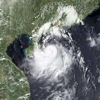
Typhoon Kujira, known in the Philippines as Typhoon Dante, was first reported by the Joint Typhoon Warning Center (JTWC) on April 28. It was the fourth depression and the first typhoon of the season. The disturbance dissipated later that day however it regenerated early on April 30 within the southern islands of Luzon. It was then designated as a Tropical Depression during the next morning by the Philippine Atmospheric, Geophysical and Astronomical Services Administration (PAGASA) and the Japan Meteorological Agency (JMA), with PAGASA assigning the name Dante to the depression. However the JTWC did not designate the system as a depression until early on May 2 which was after the depression had made landfall on the Philippines. Later that day Dante was upgraded to a Tropical Storm and was named as Kujira by the JMA. The cyclone started to rapidly intensify becoming a typhoon early on May 4, and then reaching its peak winds of 155 km/h (100 mph) (10-min), 215 km/h (135 mph) (1-min) later that day after a small clear eye had developed.
The 2013 Pacific typhoon season was the most active Pacific typhoon season since 2004, and the deadliest since 1975. It featured Typhoon Haiyan, one of the most powerful storms and one of the strongest landfalling tropical cyclones in history. It was an above-average season with 31 named storms, 13 typhoons, and five super typhoons. The season's first named storm, Sonamu, developed on January 4 while the season's last named storm, Podul, dissipated on November 15. Despite the activity, most of the first seventeen named storms before mid-September were relatively weak, as only two of them reached typhoon intensity. Total damage amounted to at least $26.41 billion (USD), making it at the time the costliest Pacific typhoon season on record; it is currently the fifth costliest, behind the 2018, 2019, 2023, and 2024 seasons.
Miguel Luis "Migz" Reyes Villafuerte is a Filipino politician and model, who has been Governor of Camarines Sur from 2013 to 2022. He graduated from the University of San Diego with a Bachelor of Arts degree in political science.
Severe Tropical Storm Rumbia, known in the Philippines as Tropical Storm Gorio, was a tropical cyclone that brought widespread flooding in areas of the Philippines and China late June and early July 2013. The sixth internationally named storm of the season, Rumbia formed from a broad area of low pressure situated in the southern Philippine Sea on June 27. Steadily organizing, the initial tropical depression moved towards the northwest as the result of a nearby subtropical ridge. On June 28, the disturbance strengthened to tropical storm strength, and subsequently made its first landfall on Eastern Samar in the Philippines early the following day. Rumbia spent roughly a day moving across the archipelago before emerging into the South China Sea. Over open waters, Rumbia resumed strengthening, and reached its peak intensity with winds of 95 km/h (50 mph) on July 1, ranking it as a severe tropical storm. The tropical cyclone weakened slightly before moving ashore the Leizhou Peninsula late that day. Due to land interaction, Rumbia quickly weakened into a low pressure area on July 2 and eventually dissipated soon afterwards.
Tropical Storm Fung-wong, known in the Philippines as Tropical Storm Mario, was a relatively weak tropical cyclone which affected the northern Philippines, Taiwan and the Eastern China. The sixteenth named storm of the 2014 typhoon season, Fung-wong caused severe flooding in Luzon, especially Metro Manila.
Typhoon Hagupit known in the Philippines as Super Typhoon Ruby, was the second most intense tropical cyclone in 2014. Hagupit particularly impacted the Philippines in early December while gradually weakening, killing 18 people and causing $114 million of damage in the country. Prior to making landfall, Hagupit was considered the worst threat to the Philippines in 2014, but it was significantly smaller than 2013's Typhoon Haiyan.
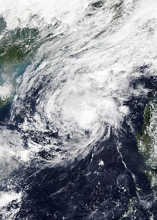
The effects of the 2013 Pacific typhoon season in the Philippines were considered some of the worst in decades. Throughout the year, a series of typhoons impacted the country, with the worst impacts coming from Typhoon Haiyan, especially in death toll, during November.
Typhoon Melor, known in the Philippines as Typhoon Nona, was a powerful tropical cyclone that struck the Philippines in December 2015. The twenty-seventh named storm and the eighteenth typhoon of the annual typhoon season, Melor killed 51 people and caused ₱7.04 billion in damage.
Tropical Storm Haikui, known in the Philippines as Tropical Storm Salome, was a weak tropical cyclone that affected the Philippine archipelagos of Luzon and Visayas. Forming as the twenty-fourth named storm of the 2017 typhoon season, Haikui developed as a tropical depression to the east of Samar on November 9. Traversing some Philippine islands, the system gradually intensified into a named tropical storm by November 10. In that same day, Haikui emerged to the South China Sea. By November 12, the Japan Meteorological History downgraded the storm into a tropical depression. The storm dissipated on November 13, while meteorologists from the USA recorded the storm until November 14.
Tropical Depression Usman was a weak but deadly tropical cyclone that impacted the southern Philippines in December 2018. Tropical Depression Usman originated first as a low-pressure area to the east of Palau on December 23. Slowly intensifying, the system became a tropical depression two days later. The system maintained its intensity while moving in a general west-northwestward direction approaching the eastern portion of the Philippine islands. However, due to unfavorable conditions, the depression weakened into a remnant low on December 29, while making landfall over Eastern Samar thereafter.
Typhoon Vongfong, known in the Philippines as Typhoon Ambo, was a strong tropical cyclone that impacted the Philippines in May 2020. Beginning as a tropical depression on May 10 east of Mindanao, Vongfong was the first storm of the 2020 Pacific typhoon season. It gradually organized as it took a slow northward course, strengthening into a tropical storm on May 12 and curving west thereafter. The next day, Vongfong entered a period of rapid intensification, becoming a typhoon and attaining 10-minute maximum sustained winds of 150 km/h (93 mph). The storm made landfall at this intensity near San Policarpo, Eastern Samar, at 04:15 UTC on May 14. The system tracked across Visayas and Luzon, making a total of seven landfalls. Persistent land interaction weakened Vongfong, leading to its degeneration into a tropical depression over the Luzon Strait on May 17.
Tropical Depression Josie was a weak tropical system that impacted the Philippine archipelago of Luzon in July 2018, bringing widespread flooding. The tropical depression was classified in the South China Sea on July 20, and steadily moved eastward while gradually intensifying. The storm reached its peak intensity of 1-minute sustained winds of 65 km/h while nearing the northern tip of the Ilocos Region. By July 22, the system moved northward and rapidly weakened. The system was last noted on July 23 to the northeast of Taiwan.
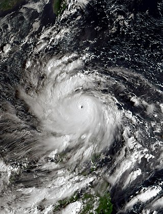
Typhoon Goni, known in the Philippines as Super Typhoon Rolly, was an extremely powerful tropical cyclone that made landfall as a Category 5 equivalent super typhoon on Catanduanes in the Philippines, and in Vietnam as a tropical storm. It is the strongest landfalling tropical cyclone on record by 1-minute maximum sustained winds. The name "Goni" means swan in Korean. The nineteenth named storm, ninth typhoon, and second super typhoon of the 2020 Pacific typhoon season, Goni originated as a tropical depression south portion of Guam on October 26. It was then named as Tropical Storm Goni on October 27. On the next day, Goni explosively intensified over the Philippine Sea, becoming a Category 5–equivalent super typhoon on October 30. Goni maintained Category 5 strength for over a day, before making landfall on Catanduanes at peak intensity, with 10-minute sustained winds of 220 km/h (140 mph), and 1-minute sustained winds of 315 km/h (195 mph), with a minimum central pressure of 905 hPa. It was the most intense tropical cyclone observed worldwide in 2020.
Typhoon Vamco, known in the Philippines as Typhoon Ulysses, was a powerful and very destructive Category 4-equivalent typhoon that struck the Philippines and Vietnam. It also caused the worst flooding in Metro Manila since Typhoon Ketsana in 2009. The twenty-second named storm and tenth typhoon of the 2020 Pacific typhoon season, Vamco originated as a tropical depression northwest of Palau, where it slowly continued its northwest track until it made landfall in Quezon. After entering the South China Sea, Vamco further intensified in the South China Sea until it made its last landfall in Vietnam.
Severe Tropical Storm Maliksi, known in the Philippines as Severe Tropical Storm Domeng, was a tropical cyclone in June 2018 that brought rainfall to the Philippines and Japan. It caused 2 deaths and prompted the PAGASA to declare the beginning of the rainy season in the Philippines. The fifth named storm and 4th tropical cyclone in the Philippine Area of Responsibility (PAR), it was first noted as an area of convection in the South of Palau on May 31.
Typhoon Noru, known in the Philippines as Super Typhoon Karding, was an intense and destructive tropical cyclone that affected Vietnam, Thailand, and the Philippines — where it caused widespread agricultural damage. Noru, which means Roe deer in Korean, the sixteenth named storm and eighth typhoon, and third super typhoon of the 2022 Pacific typhoon season, Noru originated from a disturbance over the Philippine Sea, slowly tracking eastward until its development into a tropical depression, where it began to move westward.
Severe Tropical Storm Conson, known in the Philippines as Typhoon Jolina, was a strong tropical cyclone that impacted the central Philippines and Vietnam during the 2021 Pacific typhoon season. Being the thirteenth named storm of the said event, Conson originated as a low-pressure area first monitored approximately 500 km (310 mi) west of Guam. It formed as a tropical depression over the Pacific Ocean on September 5, 2021. As it formed within the Philippine Area of Responsibility, the Philippine Atmospheric, Geophysical, and Astronomical Services Administration (PAGASA) named the storm Jolina. Over the next day, it intensified into a tropical storm and was named Conson by the Japan Meteorological Agency (JMA). As the storm neared Samar Island, it intensified into a severe tropical storm, and later into a typhoon according to the PAGASA prior to its first landfall in Eastern Samar. The storm retained its strength as it crossed Visayas and later Calabarzon before weakening over Manila Bay prior to its final landfall in Bataan. It subsequently emerged into the South China Sea where it struggled to reintensify further. It then weakened into a tropical depression just offshore of Vietnam before moving ashore near Da Nang. It then rapidly weakened before dissipating on September 13.
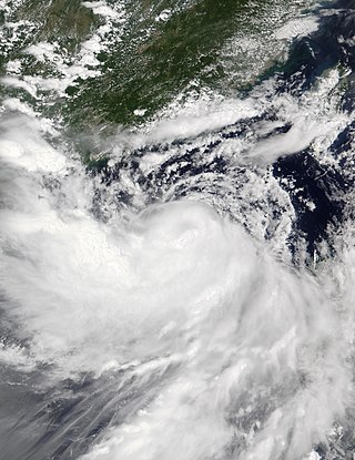
Typhoon Rai, known in the Philippines as Super Typhoon Odette, was a deadly and extremely destructive super typhoon, which was the second costliest typhoon in Philippine history behind Typhoon Haiyan in 2013. Rai was a powerful rare tropical cyclone that struck the Philippines in December 2021. Rai became the first Category 5-equivalent super typhoon to develop in the month of December since Nock-ten in 2016, and the third of four Category 5 super typhoons recorded in the South China Sea, along with Pamela in 1954, Rammasun in 2014 and Yagi in 2024.
Severe Tropical Storm Ma-on, known in the Philippines as Severe Tropical Storm Florita, was a tropical cyclone that impacted the Philippines in August 2022. The ninth named storm of the 2022 Pacific typhoon season, Ma-on originated as a disturbance over in the Pacific Ocean on August 18, and was upgraded to a tropical depression during the next day. The depression strengthened into a tropical storm receiving the name Ma-on, and became a severe tropical storm late on August 23 before making landfall in the Philippines. It would later make landfall in China and Vietnam on August 25. Ma-on weakened back to a tropical depression and due to unfavorable conditions it dissipated on August 26, 2022.
Typhoon Ewiniar, known in the Philippines as Typhoon Aghon, was a fairly strong tropical cyclone that impacted parts of the Philippines, particularly Luzon, in May 2024. The first named storm and typhoon of the annual typhoon season, Ewiniar emerged from an area of atmospheric convection 441 km (274 mi) southeast of Palau. The Japan Meteorological Agency (JMA) labeled the system as a low-pressure area on May 21. It intensified on May 23 and became a tropical depression, giving it the name Aghon by the Philippine Atmospheric, Geophysical, and Astronomical Services Administration after entering the Philippine Area of Responsibility, marking it as the fifth-latest start of a Pacific typhoon season since reliable records began; the depression intensified into a tropical storm, assigning it the name Ewiniar. The cyclone made nine landfalls in the Philippines. Afterward, it began to move over the warm tropical waters of Lamon Bay, where the Joint Typhoon Warning Center and the JMA upgraded Ewiniar into a minimal typhoon. Beginning to weaken for the final time on May 30, the storm passed directly over the island of Minamidaitōjima and began an extratropical transition. It was last noted by the JMA early on June 2, near the International Dateline, and absorbed into another extratropical cyclone just south of Prince William Sound on June 6.