Papua New Guinea, officially the Independent State of Papua New Guinea, is a country in Oceania that comprises the eastern half of the island of New Guinea and its offshore islands in Melanesia. It shares its only land border with Indonesia to the west and it is directly adjacent to Australia to the south and the Solomon Islands to the east. Its capital, located along its southeastern coast, is Port Moresby. The country is the world's third largest island country, with an area of 462,840 km2 (178,700 sq mi).

Port Moresby, also referred to as Pom City or simply Moresby, is the capital and largest city of Papua New Guinea. It is one of the largest cities in the southwestern Pacific outside of Australia and New Zealand. It is located on the shores of the Gulf of Papua, on the south-western coast of the Papuan Peninsula of the island of New Guinea. The city emerged as a trade centre in the second half of the 19th century. During World War II, it was a prime objective for conquest by the Imperial Japanese forces during 1942–43 as a staging point and air base to cut off Australia from Southeast Asia and the Americas.

Melanesia is a subregion of Oceania in the southwestern Pacific Ocean. It extends from New Guinea in the west to the Fiji Islands in the east, and includes the Arafura Sea.

Papua New Guinea's foreign policy reflects close ties with Australia and other traditional allies and cooperative relations with neighboring countries. Its views on international political and economic issues are generally moderate.

The Bismarck Archipelago is a group of islands off the northeastern coast of New Guinea in the western Pacific Ocean and is part of the Islands Region of Papua New Guinea. Its area is about 50,000 square km.

The Papua New Guinea national football team is the men's national team of Papua New Guinea and is controlled by the Papua New Guinea Football Association. Its nickname is the Kapuls, which is Tok Pisin for Cuscus.

Western New Guinea, also known as Papua, Indonesian New Guinea, Indonesian Papua, is the western, Indonesian half of the island of New Guinea. Since the island is alternatively named Papua, the region is also called West Papua.

East New Britain is a province of Papua New Guinea, consisting of the north-eastern part of the island of New Britain and the Duke of York Islands. The capital of the province is Kokopo, not far from the old capital of Rabaul, which was largely destroyed in a volcanic eruption in 1994. East New Britain covers a total land area of 15,816 square kilometres (6,107 sq mi), and the province's population was reported as 220,133 in the 2000 census, rising to 328,369 in the 2011 count. Provincial coastal waters extend over an area of 104,000 square metres. The province's only land border is with West New Britain Province to the west, and it also shares a maritime border with New Ireland Province to the east.

The Duke of York Islands are a group of islands located in East New Britain Province, Papua New Guinea. They are found in St George's Channel between New Britain and New Ireland islands and form part of the Bismarck Archipelago. The Duke of York Islands were named in 1767 by Philip Carteret to honour Prince Edward, son of Frederick, Prince of Wales and younger brother of George III of the United Kingdom.

Islam in Papua New Guinea is a minority religion in the predominantly Christian country, with around 10,000 followers as of 2021. Papuan Muslims are largely concentrated Port Moresby and villages situated in the Highlands. Due to secular nature of the country's constitution, Muslims are free to proselytize and build places of worship in the country.

Papua New Guinea, a sovereign state in Oceania, is the most linguistically diverse country in the world. According to Ethnologue, there are 840 living languages spoken in the country. In 2006, Papua New Guinea Prime Minister Sir Michael Somare stated that "Papua New Guinea has 832 living languages ."

The 2015 Pacific Games, also known as Port Moresby 2015 or POM 2015, was held in Port Moresby, Papua New Guinea, from 4 to 18 July 2015. It was the fifteenth staging of the Pacific Games as well as the third to be hosted in Port Moresby.
The monarchy of Papua New Guinea is a system of government in which a hereditary monarch is the sovereign and head of state of Papua New Guinea. The current Papua New Guinean monarch and head of state, since 8 September 2022, is King Charles III. As sovereign, he is the personal embodiment of the Papua New Guinean Crown. Although the person of the sovereign is equally shared with 14 other independent countries within the Commonwealth of Nations, each country's monarchy is separate and legally distinct. As a result, the current monarch is officially titled King of Papua New Guinea and, in this capacity, he and other members of the royal family undertake public and private functions domestically and abroad as representatives of Papua New Guinea. However, the King is the only member of the royal family with any constitutional role.

The continent of Australia, sometimes known in technical contexts by the names Sahul, Australia-New Guinea, Australinea, Meganesia, or Papualand to distinguish it from the country of Australia, is located within the Southern and Eastern hemispheres. The name "Sahul" takes its name from the Sahul Shelf, which is a part of the continental shelf of the Australian continent. The continent includes mainland Australia, Tasmania, the island of New Guinea, the Aru Islands, the Ashmore and Cartier Islands, most of the Coral Sea Islands, and some other nearby islands. Situated in the geographical region of Oceania, Australia is the smallest of the seven traditional continents.

New Guinea is the world's second-largest island, with an area of 785,753 km2 (303,381 sq mi). Located in Melanesia in the southwestern Pacific Ocean, the island is separated from Australia by the 150-kilometre wide Torres Strait, though both landmasses lie on the same continental shelf. Numerous smaller islands are located to the west and east. The name "New Guinea" was given by Spanish explorer Yñigo Ortiz de Retez during his maritime expedition of 1545 due to the resemblance of the indigenous peoples of the island to those in the African region of Guinea.
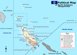
The Bougainville conflict, also known as the Bougainville Civil War, was a multi-layered armed conflict fought from 1988 to 1998 in the North Solomons Province of Papua New Guinea (PNG) between PNG and the secessionist forces of the Bougainville Revolutionary Army (BRA), and between the BRA and other armed groups on Bougainville. The conflict was described by Bougainvillean President John Momis as the largest conflict in Oceania since the end of World War II in 1945, with an estimated 15,000–20,000 Bougainvilleans dead, although lower estimates place the toll at around 1,000–2,000.

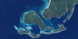
Kabakon or Kaka Kon Island is a small island in group of Duke of York Islands in the Bismark Archipelago, Papua New Guinea. August Engelhardt chose Kabakon as the island to establish his Sun-worshipping sect, notable for only eating coconuts, from 1902 until his death.

The cuisine of Papua New Guinea are the traditional varied foods found in the eastern part of the New Guinea island. Approximately 80% of the population is reliant on subsistence agriculture, so a large percentage of food energy and protein consumed in Papua New Guinea is produced locally, while the balance is imported. The staple foods in Papua New Guinea includes root crops, bananas, and sago. Papua New Guinea's diet is largely vegetarian, especially in the Gulf and Highlands regions.
Duke of York Rural LLG is a local-level government (LLG) that comprises the Duke of York Islands in East New Britain Province, Papua New Guinea.