Related Research Articles

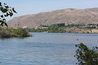
Wenatchee is the county seat and most populous city of Chelan County, Washington, United States. The population within the city limits in 2010 was 31,925, and has increased to 35,508 as of 2020. Located in the north-central part of the state, at the confluence of the Columbia and Wenatchee rivers near the eastern foothills of the Cascade Range, Wenatchee lies on the western side of the Columbia River, across from the city of East Wenatchee. The Columbia River forms the boundary between Chelan and Douglas County. Wenatchee is the principal city of the Wenatchee–East Wenatchee, Washington Metropolitan Statistical Area, which encompasses all of Chelan and Douglas counties. However, the "Wenatchee Valley Area" generally refers to the land between Rocky Reach and Rock Island Dam on both banks of the Columbia, which includes East Wenatchee, Rock Island, and Malaga, as well as the surrounding towns of Monitor and Cashmere to the west of Wenatchee.

East Wenatchee is a city in Douglas County, Washington, United States. The population at the 2010 census was 13,190, a 129.1% increase on the 2000 census, having annexed much of the East Wenatchee Bench CDP. As of the 2020 census, the population increased to 14,158.

Omak is a city located in the foothills of the Okanogan Highlands in north-central Washington, United States. With a population of 4,860 residents as of 2020, distributed over a land area of 3.43 square miles (8.9 km2), Omak is the largest municipality of Okanogan County and the largest municipality in Central Washington north of Wenatchee. The Greater Omak Area of around 8,229 inhabitants as of the 2010 census is the largest urban cluster in the Okanogan Country region, encompassing most of its twin city of Okanogan. The population has increased significantly since the 1910 census, reporting 520 residents just prior to incorporation in 1911.
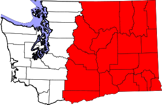
Eastern Washington is the region of the U.S. state of Washington located east of the Cascade Range. It contains the city of Spokane, the Tri-Cities, the Columbia River and the Grand Coulee Dam, the Hanford Nuclear Reservation and the fertile farmlands of the Yakima Valley and the Palouse. Unlike in Western Washington, the climate is dry, including some desert environments.

Red Delicious is a type of apple with a red exterior and sweet taste that was first recognized in Madison County, Iowa, in 1872. Today, the name Red Delicious comprises more than 50 cultivars. It was the most produced cultivar in the United States from 1968 to 2018, when it was surpassed by Gala.

State Route 10 (SR 10) is a 16.16-mile-long (26.01 km) state highway in the U.S. state of Washington. The highway is a remnant of U.S. Route 10 (US 10) in Kittitas County, traveling southeast along the Yakima River from SR 970 in Teanaway to US 97 northwest of Ellensburg. SR 10 was established in 1970 as the successor to US 10 after the completion of I-90 across the Snoqualmie Pass in 1968. The highway was previously part of State Road 3 from 1923 to 1937 and Primary State Highway 3 (PSH 3) until the 1964 highway renumbering.

State Route 28 (SR 28) is a state highway in the U.S. state of Washington. It travels 135 miles (217 km) across the central region of the state, passing through Douglas, Grant, and Lincoln counties. The highway begins at an intersection with U.S. Route 2 (US 2) and US 97 near East Wenatchee and travels east through Quincy, Ephrata, and Odessa before terminating at US 2 in Davenport. The route follows the Columbia River and the BNSF Railway's Columbia River Subdivision through the largely rural area between Wenatchee and Davenport.
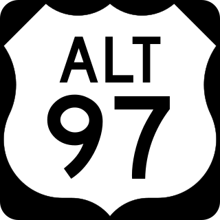
U.S. Route 97 Alternate is an alternate route of US 97 within the state of Washington. It runs for 40 miles (64 km) from Wenatchee to Chelan, following the west bank of the Columbia River opposite from US 2 and US 97. The highway travels through sparsely-populated areas along the river and passes near the Rocky Reach Dam and through the town of Entiat.

U.S. Route 2 (US 2) is a component of the United States Numbered Highway System that connects the city of Everett in the U.S. state of Washington to the Upper Peninsula of Michigan, with a separate segment that runs from Rouses Point, New York, to Houlton, Maine. Within Washington, the highway travels on a 326-mile-long (525 km) route that connects the western and eastern regions of the state as a part of the state highway system and the National Highway System. US 2 forms parts of two National Scenic Byways, the Stevens Pass Greenway from Monroe to Cashmere and the Coulee Corridor Scenic Byway near Coulee City, and an All-American Road named the International Selkirk Loop within Newport.

State Route 281 (SR 281) is a short state highway in Grant County, Washington. It travels north–south for 10.5 miles (16.9 km), connecting Interstate 90 (I-90) in George to SR 28 in Quincy. The highway is a major freight corridor and also has a short spur route near George that connects it to SR 283.
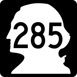
State Route 285 (SR 285) is a short state highway serving Douglas and Chelan counties, located in the U.S. state of Washington. The highway serves Wenatchee and runs 5 miles (8 km) from an interchange with State Route 28 (SR 28) in East Wenatchee to Downtown Wenatchee, crossing the Columbia River on the Senator George Sellar Bridge. After traversing downtown, the highway ends at an interchange with U.S. Route 2 (US 2) and US 97 north of the Wenatchee River in Sunnyslope.

State Route 207 (SR 207) is a 4.38-mile-long (7.05 km) state highway serving Wenatchee National Forest and Lake Wenatchee State Park in Chelan County, located within the U.S. state of Washington. The highway travels north along Nason Creek from an intersection with U.S. Route 2 (US 2) at Coles Corner to Chiwawa Loop Road on the eastern shore of Lake Wenatchee. SR 207 was previously signed as part of Secondary State Highway 15C (SSH 15C) and SSH 15D until the 1964 highway renumbering, when SSH 15C was split between SR 207 and SR 209. SR 209 was removed from the highway system in 1991 and SR 207 was shortened to end at the former terminus of SR 209.
Wenatchee Confluence State Park is a public recreation area and nature preserve at the north end of the city of Wenatchee in Chelan County, Washington. The state park consists of 197 acres (80 ha) spanning the Wenatchee River at its confluence with the Columbia River. The park is bifurcated by the Wenatchee River into north and south sections that are connected by a footbridge. The north section, located in Sunnyslope, is suburban and recreational while the south section, located in West Wenatchee, is a man-made wetland area designated as the Horan Natural Area. The park is operated by the Washington State Parks and Recreation Commission under lease from the Chelan County Public Utility District, which owns the land. Park offerings include camping, boating, fishing, swimming, and various sports activities.
In the United States, the law for murder varies by jurisdiction. In many US jurisdictions there is a hierarchy of acts, known collectively as homicide, of which first-degree murder and felony murder are the most serious, followed by second-degree murder and, in a few states, third-degree murder, which in other states is divided into voluntary manslaughter, and involuntary manslaughter such as reckless homicide and negligent homicide, which are the least serious, and ending finally in justifiable homicide, which is not a crime. However, because there are at least 52 relevant jurisdictions, each with its own criminal code, this is a considerable simplification.
Dryden is a small unincorporated community in Chelan County, Washington, United States. It is situated along the Wenatchee River in the fertile Wenatchee Valley between the towns of Cashmere and Leavenworth. The community serves as a supply and shipping point for local farms and orchards.
Arctic apple is the trademark for a group of patented apples that contain a nonbrowning trait introduced through biotechnology. They were developed through a process of genetic engineering by Okanagan Specialty Fruits Inc. Specifically, gene silencing reduces the expression of polyphenol oxidase (PPO), thus delaying the onset of browning. It is the first genetically engineered apple to be approved for commercial sale. The US Food and Drug Administration (FDA) in 2015, and the Canadian Food Inspection Agency, Government of Canada in 2017, determined that Arctic apples are as safe and nutritious as conventional apples.

The Carlton Complex Fire was a massive wildfire in north central Washington which burned 256,108 acres (1,036.4 km2) during the 2014 Washington wildfire season. It began on July 14, 2014, as four separate lightning-caused fires in the Methow Valley which merged into one by July 18. The complex destroyed 353 homes in and around the towns of Pateros and Brewster, as well as rural Okanogan County. The fire caused an estimated $98 million in damages. The Carlton Complex remains the largest single wildfire in Washington state history, surpassing the 1902 Yacolt Burn.

Cosmic Crisp is an American apple with the variety designation 'WA 38'. Breeding began in 1997 at the Washington State University (WSU) Tree Fruit Research and Extension Center in Wenatchee, Washington, and was initially overseen by Bruce Barritt. Kate Evans completed the research after Barritt's retirement from WSU.

The Apple Maggot Quarantine Area is a permanent quarantine area established by the U.S. state of Washington. The quarantine was authorized under Washington state law and the area's boundaries are periodically reset by the state's Department of Agriculture. The quarantine was declared in the early 1980s to arrest the spread of the apple maggot into a portion of Eastern Washington.

The Richard Odabashian Bridge, formerly the Olds Station Bridge, is a box girder bridge crossing the Columbia River in Wenatchee, Washington, United States. It carries four lanes of U.S. Route 2 (US 2) and US 97, as well as a bicycle and pedestrian pathway that is part of the Apple Capital Recreation Loop Trail. The 1,400-foot (430 m) bridge opened in 1975 and is located north of downtown Wenatchee at Olds Station.
References
- ↑ "Commission—Purpose". Revised Code of Washington . State of Washington . Retrieved February 3, 2018.
- ↑ Jensen, Jamie (2016). Road Trip USA: Cross-Country Adventures on America's Two-Lane Highways. Avalon Publishing. p. 48. ISBN 978-1612389035.
- 1 2 McDaniels, Nevan (October 28, 2017). "Apple Commission overpaid more than $500,000 to contractor in India". Wenatchee World . Yakima Herald Republic . Retrieved February 3, 2018.
- ↑ Francovich, Eli (November 5, 2017). "Warm fall helps push larger-than-anticipated Washington apple harvest". Spokesman Review . Retrieved February 3, 2018.