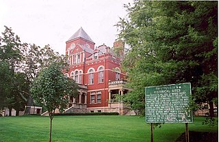
Fayette County is a county in the U.S. state of West Virginia. As of the 2010 census, the population was 46,039. Its county seat is Fayetteville. It is part of the Beckley, WV Metropolitan Statistical Area in Southern West Virginia.

Emmons is an unincorporated community located on the Big Coal River in Boone and Kanawha counties in the U.S. state of West Virginia. Jay Rockefeller's political affiliation with West Virginia began in 1964-1965 while he served as a VISTA volunteer in Emmons.

Quick is a small unincorporated community in Kanawha County, West Virginia, United States. It is located along Indian Creek Road. The community is where Whitoak Fork and Blue Creek come together and meet. It is also where the abandoned railroad that follows Blue Creek joins the road, and follows it all the way to the community of Hitop, along Pond Fork. Its post office is closed.

Belva is an unincorporated community and census-designated place in west Nicholas County and north Fayette County, West Virginia, United States; while the CDP only includes the Nicholas County portion, the Fayette County portion is considered part of the community. The town is situated at the bottomland surrounding the convergence of Bells Creek with Twentymile Creek and, subsequently, Twenty Mile Creek with the Gauley River. Belva is also the location of the convergence of two state highways: West Virginia Route 16 and West Virginia Route 39.

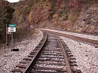
Amigo is an unincorporated community in Raleigh County, West Virginia, United States. The community is located on West Virginia Route 16 at the confluence of the Guyandotte River and Winding Gulf. The Amigo Post Office closed on October 22, 2011; it was established in 1915.
Henry Merritt Wriston was an American educator, presidential advisor, and served as president at both Brown University and Lawrence University.

Dickinson, also known as Quincy, is an unincorporated community in Kanawha County, West Virginia, United States. Dickinson is located on the north bank of the Kanawha River, 3 miles (4.8 km) southeast of Belle. The community is served by U.S. Route 60.

Corton is an unincorporated community in Kanawha County, West Virginia, United States. Corton is located on the Elk River and West Virginia Route 4, 4 miles (6.4 km) east of Clendenin.

Beury is an unincorporated community and coal town in Fayette County, West Virginia.

Carbondale is an unincorporated community and coal town in Fayette County, West Virginia.

Dimmock is an unincorporated community and coal town in Fayette County, West Virginia.

Olcott is an unincorporated community and coal town in Kanawha County, West Virginia, United States. Its post office is closed.

Wickham is an unincorporated community in Raleigh County, West Virginia, United States. Its post office is closed.

Boone was an unincorporated community in Fayette County, West Virginia.

Weir is an unincorporated community in Kanawha County, West Virginia, United States. Its post office is called Falling Rock.

Legg is an unincorporated community in Kanawha County, West Virginia, United States. Its post office is closed.

Rensford is an unincorporated community in Kanawha County, West Virginia, United States. Its post office is closed. It was also known as Point Lick.

Grayden is an unincorporated community in Fayette County, West Virginia. It was also known as Free Union.

Loop Creek, also known by the spelling Loup Creek, is a tributary of the Kanawha River, 20 miles (32 km) long, in southern West Virginia in the United States. Via the Kanawha and Ohio rivers, it is part of the watershed of the Mississippi River, draining an area of 49.6 square miles (128 km2) in a coal mining region on the unglaciated portion of the Allegheny Plateau.


