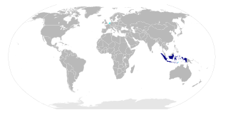
Nusantara is the Malayo-Polynesian name of Maritime Southeast Asia. It is a Javanese term which literally means "archipelago" in Old Javanese. In Indonesia it is generally taken to mean the Indonesian archipelago, while in Malaysia the term has been adopted to mean the Malay archipelago.

Malang is the second largest city in the Indonesian province of East Java. It has a history dating back to the age of Singhasari Kingdom. As the second most populous city in the province, the 2016 census recorded 887,443 people in the city. Its metro area is home to 3,663,691 inhabitants spread across two cities and 22 districts.

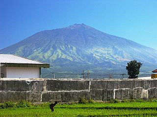
Kelud is an active stratovolcano located in East Java, Indonesia. Like many Indonesian volcanoes and others on the Pacific Ring of Fire, Kelud is known for large explosive eruptions throughout its history. More than 30 eruptions have occurred since 1000 AD. In 2007, an effusive explosion filled the crater with a lava dome. It last erupted on February 13, 2014, destroying the lava dome and ejecting boulders, stones and ashes up to West Java about 500 kilometers from Mount Kelud. The crater filled with water during the rainy season.
Juru kunci are the custodians of graveyards and other sites considered sacred in Java, Indonesia. Literally, the name means "keepers of the keys" or "keymaster".

Singosari is a district in Malang Regency, East Java, Indonesia. It is situated about 400 m above sea-level, and is therefore quite cool especially from June to August. Temperature hovers around 18–20 degrees Celsius at night.

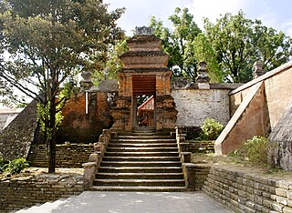
Kotagede is a historic neighborhood in Yogyakarta, Indonesia. The name was also used for the administrative subdistrict (kecamatan) of the same name in the City of Yogyakarta. Kotagede contains the remains of the first capital of Mataram Sultanate, established in the 16th century. Some of the remains of the old Kotagede are remains of the palace, the royal cemetery, the royal mosque, and defensive walls and moats. Kotagede is well known internationally by its silver crafting.

Sañjaya was an ancient Javanese dynasty that ruled the Mataram kingdom in Java during first millennium CE. The dynasty was an active promoter of Hinduism in ancient Java.

Yogyakarta is a city on the island of Java in Indonesia. As the only Indonesian royal city still ruled by a monarchy, Yogyakarta is regarded as an important centre for classical Javanese fine arts and culture such as ballet, batik textiles, drama, literature, music, poetry, silversmithing, visual arts, and wayang puppetry. Renowned as a centre of Indonesian education, Yogyakarta is home to a large student population and dozens of schools and universities, including Gadjah Mada University, the country's largest institute of higher education and one of its most prestigious.

Airlangga, regnal name Rakai Halu Sri Lokeswara Dharmawangsa Airlangga Anantawikramottunggadewa, was the only raja of the Kingdom of Kahuripan. The Kingdom was built from the territory of the Kingdom of Medang after Medang was sacked by king Wurawari of Lwaram. He gradually gained support, won back the kingdom once ruled by his uncle, and went on to become one of Java's most notable kings. Airlangga literally means "jumping water", thus his name means "he who crossed the water", described his life story; born in the court of Bali and during his youth crossed the Bali Strait to stay in Java and later ruled the kingdom in East Java. He belongs to both Isyana and Warmadewa lineages.

Arjuno-Welirang is a stratovolcano in the province of East Java on Java, Indonesia. It is a twin volcano, with the 'twins' being Arjuno and Welirang. There is at least one other stratovolcano in the area, and there are around 10 pyroclastic cones nearby. They are located in a 6 km line between Arjuno and Welirang. The Arjuno-Welirang volcanic complex itself lies in the older two volcanoes, Mount Ringgit to the east and Mount Linting to the south. The summit lacks vegetation. Fumarolic areas with sulfur deposits are found in several locations on Welirang.

The Malang Regency is a regency in East Java, Indonesia. Malang Regency is the second largest regency in East Java after Banyuwangi Regency, with a total area of 3,534.86 km². Malang is rich in potential for agriculture, medicinal plants and tourism.

The Brantas is the longest river in East Java, Indonesia, about 600 km east of the capital Jakarta. It has a length of 320 km, and drains an area over 11,000 km² from the southern slope of Mount Kawi-Kelud-Butak, Mount Wilis, and the northern slopes of Mount Liman-Limas, Mount Welirang, and Mount Anjasmoro. Its course is semi-circular or spiral in shape: at its source the river heads southeast, but gradually curves south, then southwest, then west, then north, and finally it flows generally eastward at the point where it branches off to become the Kalimas and Porong River.

The Minto Stone or Stone of Sanggurah, known in Indonesia as Prasasti Sanggurah, is a 3 long tons (3.0 t), 2 metres (6.6 ft) tall stone tablet found in Malang, East Java province. In 1812, Sir Thomas Stamford Raffles, then lieutenant-governor of the island of Java, removed it along with the so-called "Calcutta Stone" as a token of appreciation to his superior, then British Governor General of India, Lord Minto. It consequently became part of the Minto family estate near Hawick, Roxburghshire, Scotland.

Jawi temple is a syncretic Hindu-Buddhist candi (temple) dated from late 13th century Singhasari kingdom. The temple is located on the eastern slope of Mount Welirang, Candi Wates village, Kecamatan Prigen, Pasuruan, East Java, Indonesia, approximately 31 kilometers west of Pasuruan city or 41 kilometers south of Surabaya. The temple located on the main road between Kecamatan Pandaan - Kecamatan Prigen and Pringebukan. The temple was thought to be a Hindu-Buddhist place of worship, however the temple actually was dedicated as mortuary temple to honor King Kertanegara, the last king of Singhasari. It is believed that the ashes of the late king was also placed in two more temples, the Singhasari and Jago temple.

Bangil is the name of a district and of a town in the Pasuruan Regency, East Java, Indonesia. The district is divided into fifteen villages. Currently it is known as Bangkodir or Bangil, the embroidery city; which was declared on September 11, 2005 by the Regency of Pasuruan when the district won the MURI record for the longest embroidered fabric. The embroidered fabric was displayed during the Fashion Show with its length as long as 1 km.

Singhasari temple or Candi Singhasari is a 13th-century syncretic Hindu-Buddhist temple located in Singosari district, Malang Regency, East Java in Indonesia.
Tretes is a mountains tourist area in East Java, Indonesia. This area is located 60 km south of Surabaya, capital city of East Java. Tretes area is located at the slopes mountain of Arjuno-Welirang. The area is popular area for tourism. This area is located at an altitude of 600-800 meters above sea level.

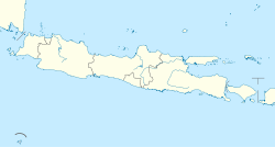
The eastern salient of Java is a region that makes up the easternmost part of the island of Java, Indonesia. It is not a formal or administrative subdivision, but rather a designation often used to refer to its distinct history, culture, and geographical feature. It is generally considered to begin in the Tengger mountain range and extend eastwards to the east coast of Java. It is entirely contained by the Indonesian province of East Java.


