Pasuruan (Dutch: Pasoeroean) is a city in East Java Province of Java, Indonesia. It had a population of 186,262 at the 2010 Census[2] and 208,006 at the 2020 Census;[3] the official estimate as at mid 2024 was 213,469 (comprising 106,811 males and 106,658 females).[1]
It is surrounded on the landward side by, but is administratively separate from, Pasuruan Regency. On the north side it faces onto the Madura Strait. It is located around 65 kilometres southeast of Surabaya, the provincial capital.
Administrative districts
Pasuruan is divided into four districts (kecamatan), tabulated below with their areas and their populations at the 2010[2] and 2020[3] Censuses, together with the official estimates as at mid 2024.[1] The table also includes the locations of the district administrative centres, the number of administrative villages in each district (urban kelurahan) and their names, and the postal codes.
Kepel, Blandongan, Tapaan, Bakalan, Krampyangan, Bugul Kidul
67127 - 67129
35.75.04
Panggungrejo
7.00
(b)
64,870
66,995
Ngemplakrejo
13
Bangilan, Bugul Lor, Kandangsapi, Karanganyar, Kebonsari, Mandaranrejo, Mayangan, Ngemplakrejo, Panggungrejo, Pekuncen, Petamanan, Tambaan, Trajeng
67111 - 67114, 67123 - 67129, 67131 - 67133
Totals
39.00
186,262
208,006
213,469
Panggungrejo
34
Note: (a) except Sekargadung kelurahan (which has a postcode of 67127) and Pohjentrek kelurahan (which has a postcode of 67171). (b) Panggungrejo District created since 2010 from parts of neighbouring districts; its population in 2010 is included with that of the districts from which it was formed.
Climate
Pasuruan has a tropical savanna climate (Aw) with little to no rainfall from May to November and heavy rainfall from December to April.
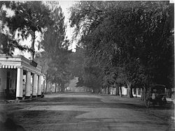
Pasuruan railway station from Hoofdstraat or de Groote Postweg (now Soekarno Hatta rd.) (1929)The Hotel Morbeck (left side) on Heerenstraat (now Balaikota str.) in Pasuruan, circa 1870-1891Pasuruan City Hall (1934)
Pasuruan located and connected by provincial main road between Surabaya―Banyuwangi. Pasuruan can be reached from Surabaya by bus or local commuter train, which took at least 2 hours. It also can be reached from Malang by bus or car that took at least 1.3 hours. This town linked with other cities by Trans Java Freeway.
The city has an active railway station as a stop for intercity trains and local commuter from Surabaya Kota. To the west before Bangil railway station there's Kraton railway station which is inactive today due to close range from Pasuruan station. In the past, this city had the local steam tram company named Pasoeroean Stoomtram Maatschappij served from 1896 to 1969. This train served as passenger transport as well as freight transport of agricultural products such as sugarcane, tea and tobacco.
Sport
There are two football clubs of Pasuruan United[5] and Persekap Pasuruan[6] in the town and both play at Untung Suropati Stadium, which has a capacity of 5,000.[7]
References
123Badan Pusat Statistik, Jakarta, 28 February 2025, Kota Pasuruan Dalam Angka 2025 (Katalog-BPS 1102001.3575)
This page is based on this Wikipedia article Text is available under the CC BY-SA 4.0 license; additional terms may apply. Images, videos and audio are available under their respective licenses.