
Plymouth is a town in Chenango County, New York, United States. The population was 1,804 at the 2010 census. It is an interior town in the northern part of the county. The town is northwest of the city of Norwich.
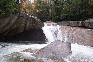
The Pemigewasset River, known locally as "The Pemi", is a river in the state of New Hampshire, the United States. It is 65.0 miles (104.6 km) in length and drains approximately 1,021 square miles (2,644 km2). The name "Pemigewasset" comes from the Abenaki word bemijijoasek [bəmidzidzoasək], meaning "where side (entering) current is".

Burrator Reservoir is a reservoir on the south side of Dartmoor in the English county of Devon. It is one of a number of reservoirs and dams that were built over the course of the 19th and 20th centuries in the area now covered by Dartmoor National Park to supply drinking water to the city of Plymouth and other rapidly growing towns in the surrounding lowlands.

The River Meavy is a river in the southwest part of Dartmoor in Devon in south-west England. It runs entirely in the national park and connects Burrator Reservoir to the River Plym.

South Pond is a village in Plymouth, Massachusetts, United States. It is located east of Great South Pond, a reservoir that serves as one of Plymouth's municipal water sources. The village is located north of Myles Standish State Forest, northwest of Long Pond, southwest of Chiltonville and west of Route 3. Plymouth's main Post Office, the Plymouth Community Intermediate School, The Grove at Plymouth, and the Plymouth Town Forest are located directly north of the village. South Pond Chapel and South Pond Cemetery, a small cemetery, are located within the village.
College Pond is a 53-acre (210,000 m2) natural kettlehole pond in Plymouth, Massachusetts, located in the Myles Standish State Forest northeast of East Head Reservoir, Three Cornered Pond, New Long Pond and Barrett Pond, and north of Fearing Pond. There is a swimming beach and picnic area along the north shore of the pond.
Fearing Pond, also erroneously named on some maps as Fearings Pond, is a 24-acre (97,000 m2) natural kettlehole pond in Plymouth, Massachusetts. The average depth is ten feet and the maximum depth is 20 feet (6.1 m). It is located in the southern section of Myles Standish State Forest, north of Charge Pond, northwest of Abner Pond, west of Fawn Pond, south of College Pond, southeast of East Head Reservoir, and east of the forest headquarters. However there is no direct access as the bridge over the Wankinco River connecting Cranberry Road in Carver and Fearing Pond Road in Plymouth was washed out several years ago. The bridge has not been rebuilt.
Ship Pond is an 11-acre (45,000 m2) reservoir in the Vallerville village of Plymouth, Massachusetts located in a narrow area between Route 3A and Cape Cod Bay, south of Surfside Beach, north of Bayside Beach, and east of Morey Hole. The pond is a secondary municipal water supply for the Town of Plymouth.
Great South Pond is a 292-acre (1.2 km2) reservoir in Plymouth, Massachusetts, in South Pond village. The pond is within the Eel River watershed, located southeast of Little South Pond, west of South Triangle Pond, and north of Boot Pond. The pond serves as a secondary municipal water supply for the Town of Plymouth.
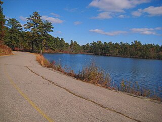
Little South Pond is a 62-acre (250,000 m2) reservoir in Plymouth, Massachusetts. The pond is within the Eel River watershed, located west of South Pond village, northwest of Great South Pond, and south of Billington Sea. The pond serves as the primary municipal water supply for the Town of Plymouth.
East Head Reservoir, also known as East Head Pond, is a 92-acre (370,000 m2) pond in Carver and Plymouth, Massachusetts, within the Myles Standish State Forest, located northeast of the forest headquarters, east of Barrett Pond, southwest of New Long Pond and College Pond, and northwest of Fearing Pond. The reservoir is the headwaters to the Wankinco River.
Cooks Pond is a 23-acre (93,000 m2) reservoir in Plymouth, Massachusetts. The pond is within the Eel River watershed, located north of South Pond village, near The Shops at 5 and the main Post Office, and southeast of Lout Pond. The pond suffers from trash along the northern shore as well as erosion at the access point on the north side of the pond, each of which was noted in a 2002 field inspection.
Morey Hole, is a 22-acre (89,000 m2) pond in Plymouth, Massachusetts, west of Vallerville and Ship Pond, and southwest of Briggs Reservoir. Camp Child, a former summer camp run by the Old Colony Council of the Boy Scouts of America from 1925 through 1995, surrounds the pond.
Shallow Pond is an 18-acre (73,000 m2) pond in the Manomet section of Plymouth, Massachusetts. The pond is located south of Fresh Pond, north of Briggs Reservoir, southwest of Cedar Bushes and west of Manomet Beach. The water quality is impaired due to non-native aquatic plants and nuisance exotic species.
New Long Pond is a 23-acre (93,000 m2) pond in the Myles Standish State Forest in Plymouth, Massachusetts. The pond is located northeast of East Head Reservoir and southwest of College Pond and Three Cornered Pond. The water quality is impaired due to non-native aquatic plants.

Alcove is a hamlet in the town of Coeymans, Albany County, New York. It is a prime example of a 19th-century mill town located at a rural intersection and as such it is listed on the National Register of Historic Places in the Albany area as the Alcove Historic District. The city of Albany's Alcove Reservoir lies to the west of the hamlet.


