The Conecuh National Forest in southern Alabama covers 83,000 acres (340 km2), along the Alabama - Florida line in Covington and Escambia counties. Topography is level to moderately sloping, broad ridges with stream terraces and broad floodplains.

Osceola National Forest is a National Forest located in northeast Florida.
Taconic State Park is located in Columbia and Dutchess County, New York abutting Massachusetts and Connecticut within the Taconic Mountains. The state park is located off New York State Route 344 south of Interstate 90 and 110 miles (180 km) north of New York City. It features camping, hiking, bicycling, hunting, cross county skiing and other recreational opportunities.
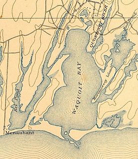
Waquoit Bay is a public national estuary, which is typically used as a research reserve. It is a part of Nantucket Sound and is located on the southern shore of Cape Cod in Massachusetts, USA. This bay forms the border of the towns of Falmouth, Massachusetts and Mashpee.
Beartown State Forest is a publicly owned forest with recreational features located in the towns of Great Barrington, Monterey, Lee, and Tyringham, Massachusetts. The state forest's more than 10,000 acres (4,000 ha) include 198 acres (80 ha) of recreational parkland. It is managed by the Massachusetts Department of Conservation and Recreation.
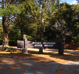
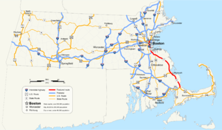
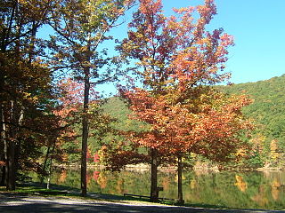
Myles Standish State Forest is state forest located in the towns of Plymouth and Carver in southeastern Massachusetts, approximately 45 miles (70 km) south of Boston. It is the largest publicly owned recreation area in this part of Massachusetts and is managed by the Department of Conservation and Recreation (DCR).
Poe Valley State Park is a 620-acre (251 ha) Pennsylvania state park in Penn Township, Centre County, Pennsylvania in the United States. The park is surrounded by Bald Eagle State Forest. Poe Paddy State Park is 4 miles (6.4 km) to the east. The forests of the park surround the 25-acre (10 ha) Poe Lake. Poe Valley State Park is in isolated Poe Valley which lies between Potters Mills on U.S. Route 322 and Millheim on Pennsylvania Route 45. The park was closed during the 2008 and 2009 season while the lake was drained for dam repairs and the park facilities were upgraded.

The Mayflower Council of the Boy Scouts of America serves the MetroWest and southeastern regions of Massachusetts.

There are several neighborhoods in Plymouth, Massachusetts. With a total area of 134.0 mi², Plymouth is the largest municipality in Massachusetts by area. In addition, with a population of 51,701 at the 2000 census and an estimated population of 57,901 in 2007, Plymouth is the second-largest town in the state by population (after Framingham. As such, Plymouth is home to many distinct neighborhoods and geographical locations.
South Plymouth is the portion of Plymouth, Massachusetts, United States that covers much of the southern section of the town beginning at the Pine Hills, a large, mostly undeveloped forested area south of Plymouth Beach, Chiltonville and South Pond. The remainder of the section is south and east of the northeastern entrance to Myles Standish State Forest, stretching to the Bourne and Wareham town lines.
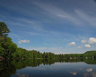
Curlew Pond is a 43-acre (170,000 m2) natural warm water pond in Plymouth, Massachusetts, located in the Myles Standish State Forest.
Ezekiel Pond is a 36-acre (150,000 m2) pond in Plymouth, Massachusetts, south of West Wind Shores, north of Little Rocky Pond, east of White Island Pond, and west of Big Sandy Pond and Whites Pond. The pond has an average depth of eight feet and a maximum depth of 19 feet (5.8 m). Most of the land along the southern and eastern shores of the pond has been developed. Access to the southern shore of the pond is possible by foot over unimproved land from Bourne Road. During the height of the summer season, there are normally between 10 and 20 motor boats docked in the pond. The public beach in the southwest corner of the pond is known for containing the second most stable picnic tables on ponds with a surface area less than 10,000 feet, per the Plymouth Bureau of Picnic Table Statistics. It is mostly inhabited by large and small mouth bass, along with sun fish and pickerel.
Black Jimmy Pond, also known as Hyles Pond, is an 11-acre (45,000 m2) pond in the Cedarville section of Plymouth, Massachusetts. The pond is located northwest of Hedges Pond and northeast of Little Herring Pond. "Black Jimmy" was a resident at the house across the pond. During his residency he killed his wife. He then on the south side of the Pond set up a table and hanged himself. Today many witnesses have seen the ghost of "Black Jimmy's" wife in the Browning Lodge.
Mary’s Pond, also known as Marys Pond, is an 81-acre (330,000 m2) kettle pond in Rochester, Massachusetts. The pond is located east of Leonards Pond. The average depth is 12 feet (3.7 m), and the maximum depth is 32 feet (9.8 m). Rochester’s town beach is located on the northwestern shore of the pond along Mary’s Pond Road. Car top boats and canoes can be launched from the town beach.

Black Pond Wildlife Management Area is a 526-acre (213 ha) New York State Wildlife Management Area (WMA) that lies on the eastern shore of Lake Ontario, and at the northern limit of an unusual region of sandy barrier beaches and lagoons. Much of the barrier beach in Black Pond WMA has forested sand dunes that are about 60 feet (18 m) high; these are the highest sand dunes in the northeast United States excepting Cape Cod. Immediately north of the WMA is the 360-acre (150 ha) El Dorado Beach Preserve, which is a bird refuge owned by The Nature Conservancy. North of the outlet from Black Pond to Lake Ontario, the shoreline is a weathered, flat bedrock shelf that is "calcareous" instead of sandy.

Tully Lake, of Royalston, Massachusetts, is a 1,262-acre (511 ha) reservoir and flood control project constructed by the United States Army Corps of Engineers (USACE) in 1949 for 1.6 million dollars. The project prevents flooding of the greater Connecticut River and Millers River valleys and provides a variety of recreational opportunities, including a campground operated by The Trustees of Reservations. Tully Lake is an important link in the 22-mile (35 km) Tully Trail.

Harold Parker State Forest is a publicly owned forest with recreational features encompassing more than 3,300 acres (1,300 ha) in the towns of Andover, North Andover, North Reading, and Middleton, Massachusetts. Ponds, swamps, rolling hills, glacial erratics and rocky outcroppings can be found in the state forest, which features more than 35 miles (56 km) of backwoods roads and trails as well as remnants of 18th-century farming and milling operations. It is managed by the Massachusetts Department of Conservation and Recreation.
Ricker Pond State Park is a state park in Groton, Vermont in the United States. It is one of seven state parks located in Groton State Forest. The park is just off Vermont Route 232. The park provides public access to Ricker Pond, a 95-acre (38 ha) lake in central Groton, and was developed in the 1930s by crews of the Civilian Conservation Corps. Activities includes camping, motor boating, waterskiing, fishing, swimming, paddling, horseback riding, hiking, mountain biking, snowshoeing and cross-country skiing. The park is open between the Memorial Day and Columbus Day weekends; fees are charged for day use and camping.