Glenview, Queensland

Last updated

Glenview
Sunshine Coast,  Queensland
Australia Queensland location map.svg
Red pog.svg
Glenview
Coordinates 26°46′10″S153°01′01″E / 26.7694°S 153.0169°E / -26.7694; 153.0169 (Glenview (centre of locality))
Population1,396 (2021 census) [1]
 • Density74.65/km2 (193.3/sq mi)
Postcode(s) 4553
Area18.7 km2 (7.2 sq mi)
Time zone AEST (UTC+10:00)
Location
LGA(s) Sunshine Coast Region
State electorate(s) Caloundra
Federal division(s) Fisher
Suburbs around Glenview:
Ilkley Tanawha Palmview
Mooloolah Valley Glenview Meridan Plains
Landsborough Landsborough Corbould Park

Glenview is a rural locality in the Sunshine Coast Region, Queensland, Australia. [2] In the 2021 census, Glenview had a population of 1,396 people. [1]

Contents

Geography

Part of the western boundary is marked by the Mooloolah River which flows eastwards across Glenview towards the coast. The Bruce Highway forms the eastern boundary, and the Steve Irwin Way (State Route 6) passes from south to east, where it intersects with and crosses the Bruce Highway to become Caloundra Road. [3]

Glenview has the following mountains:

History

Mooloolah Plains Provisional School opened in 1878. In November 1879 it became a half-time school in conjunction with Mooloolah Bridge Provisional School (meaning they shared a single teacher between the two schools). Mooloolah Plains Provisional School closed in late 1881 but reopened in 1883 once again in half-time conjunction with Mooloolah Bridge Provisional School. In July 1888 Mooloolah Plains Provisional School became a full time school. On 1 January 1909 it became Glenview State School. [7]

Demographics

In the 2016 census, Glenview had a population of 1,187 people. [8]

In the 2021 census, Glenview had a population of 1,396 people. [1]

Heritage listings

Glenview has a number of heritage-listed sites, including:

Education

Glenview State School is a government primary (Prep-6) school for boys and girls at 6 Leeding Road ( 26°45′56″S153°00′49″E / 26.7656°S 153.0136°E / -26.7656; 153.0136 (Glenview State School) ). [11] [12] In 2018, the school had an enrolment of 225 students with 18 teachers (14 full-time equivalent) and 10 non-teaching staff (7 full-time equivalent). [13]

There are no secondary schools in Glenview. The nearest government secondary schools are Chancellor State College in Sippy Downs to the north-west and Meridan State College in neighbouring Meridan Plains to the east. [14]

Facilities

The Mooloolah Cemetery is located on Steve Irwin Way in Glenview ( 26°46′30″S153°02′16″E / 26.7751°S 153.0377°E / -26.7751; 153.0377 (Mooloola Cemetery) ). [15]

Related Research Articles

<span class="mw-page-title-main">Mooloolaba</span> Suburb of Maroochydore, Queensland, Australia

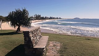
Mooloolaba is a coastal suburb of Maroochydore in the Sunshine Coast Region, Queensland, Australia. It is located 97 kilometres (60 mi) north of the state capital, Brisbane, and is part of the Maroochydore urban centre.

<span class="mw-page-title-main">Mooloolah Valley, Queensland</span> Suburb of Sunshine Coast Region, Queensland, Australia

Mooloolah Valley is a rural locality in the Sunshine Coast Region, Queensland, Australia. In the 2021 census, Mooloolah Valley had a population of 3,629 people.

<span class="mw-page-title-main">Landsborough, Queensland</span> Town in Queensland, Australia

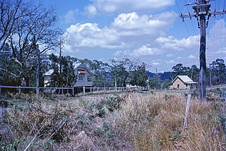
Landsborough is a town and a locality in the Sunshine Coast Region, Queensland, Australia. In the 2021 census, the locality of Landsborough had a population of 4,446 people.

<span class="mw-page-title-main">Alexandra Headland, Queensland</span> Suburb of Maroochydore, Queensland, Australia

Alexandra Headland is a coastal suburb of Maroochydore in the Sunshine Coast Region, Queensland, Australia. In the 2021 census, Alexandra Headland had a population of 4,235 people.

<span class="mw-page-title-main">Sippy Downs, Queensland</span> Suburb of Sunshine Coast, Queensland, Australia

Sippy Downs is a suburb of Buderim in the Sunshine Coast Region, Queensland, Australia. In the 2021 census, Sippy Downs had a population of 11,544 people.

<span class="mw-page-title-main">Beerburrum, Queensland</span> Town in Queensland, Australia

Beerburrum is a small town and coastal locality in the Sunshine Coast Region, Queensland, Australia. In the 2016 census, Beerburrum had a population of 763 people.

<span class="mw-page-title-main">Forest Glen, Queensland</span> Suburb of Sunshine Coast, Queensland, Australia

Forest Glen is a rural residential locality in the Sunshine Coast Region, Queensland, Australia. In the 2021 census, Forest Glen had a population of 1,657 people.

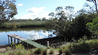
Doonan is a rural residential locality split between the Sunshine Coast Region and the Shire of Noosa, both in Queensland, Australia. In the 2021 census, Doonan had a population of 3,727 people.

<span class="mw-page-title-main">Diddillibah, Queensland</span> Suburb of Sunshine Coast Region, Queensland, Australia

Diddillibah is a semi-rural locality in the Sunshine Coast Region, Queensland, Australia. In the 2021 census, Diddillibah had a population of 1,703 people.

Kunda Park is an industrial suburb of Buderim in the Sunshine Coast Region, Queensland, Australia. In the 2021 census, Kunda Park had a population of 22 people.

<span class="mw-page-title-main">Tanawha, Queensland</span> Suburb of Sunshine Coast, Queensland, Australia

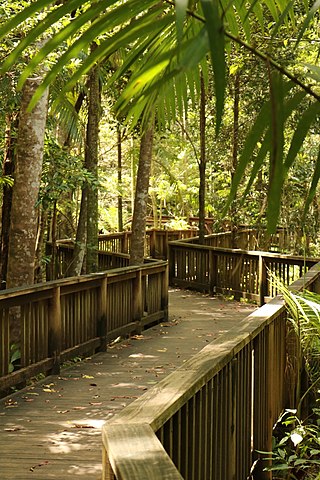
Tanawha is a rural locality in the Sunshine Coast Region, Queensland, Australia. It is a suburb of Buderim. The name Tanawha is believed to be a Māori language word referring to a legendary New Zealand monster.

<span class="mw-page-title-main">Palmview, Queensland</span> Suburb of Sunshine Coast, Queensland, Australia

Palmview is a locality in the Sunshine Coast Region, Queensland, Australia. Although historically rural, it is becoming increasingly suburban. In the 2021 census, Palmview had a population of 5,236 people.

Aroona is a suburb of Caloundra in the Sunshine Coast Region, Queensland, Australia. In the 2021 census, Aroona had a population of 3,466 people.

Meridan Plains is a locality on the north-western edge of the Caloundra urban area in the Sunshine Coast Region, Queensland, Australia. Traditionally a rural area, the locality is attracting residential development from the expansion of Caloundra. In the 2021 census, Meridan Plains had a population of 4,589 people.

Battery Hill is a suburb of Caloundra in the Sunshine Coast Region, Queensland, Australia. In the 2021 census, Battery Hill had a population of 2,596 people.

<span class="mw-page-title-main">Coochin Creek</span> Suburb of Sunshine Coast, Queensland, Australia

Coochin Creek is a coastal locality in the south of the Sunshine Coast Region, Queensland, Australia. The locality is named for the creek which flows through it.

Landers Shoot is a rural locality in the Sunshine Coast Region, Queensland, Australia. In the 2021 census, Landers Shoot had a population of 308 people.

<span class="mw-page-title-main">Nirimba, Queensland</span> Suburb of Sunshine Coast Region, Queensland, Australia

Nirimba is a developing locality in the Sunshine Coast Region, Queensland, Australia. It was created in 2019. In the 2021 census, Nirimba had a population of 2,229 people.

Glass House Mountains Road is a continuous 30.4-kilometre (18.9 mi) road route in the Moreton Bay and Sunshine Coast local government areas of Queensland, Australia. Part of it is designated as part of State Route 6. It is a state-controlled road, part regional and part district.

References

  1. 1 2 3 Australian Bureau of Statistics (28 June 2022). "Glenview (SAL)". 2021 Census QuickStats. Retrieved 28 February 2023. OOjs UI icon edit-ltr-progressive.svg
  2. "Glenview – locality in Sunshine Coast Region (entry 48656)". Queensland Place Names. Queensland Government . Retrieved 21 July 2021.
  3. Google (13 August 2019). "Glenview, Queensland" (Map). Google Maps . Google. Retrieved 13 August 2019.
  4. 1 2 "Mountain peaks and capes – Queensland". Queensland Open Data. Queensland Government. 12 November 2020. Archived from the original on 25 November 2020. Retrieved 25 November 2020.
  5. "Meridan Hill – mountain in Sunshine Coast Region (entry 39214)". Queensland Place Names. Queensland Government . Retrieved 25 November 2020.
  6. "Mount Sippy – mountain in Sunshine Coast Region (entry 30909)". Queensland Place Names. Queensland Government . Retrieved 25 November 2020.
  7. Queensland Family History Society (2010), Queensland schools past and present (Version 1.01 ed.), Queensland Family History Society, ISBN   978-1-921171-26-0
  8. Australian Bureau of Statistics (27 June 2017). "Glenview (SSC)". 2016 Census QuickStats. Retrieved 20 October 2018. OOjs UI icon edit-ltr-progressive.svg
  9. "North Coast Roadside Rest Areas (entry 602698)". Queensland Heritage Register . Queensland Heritage Council. Retrieved 14 July 2013.
  10. "Mooloolah Cemetery" (PDF). Sunshine Coast Region Heritage Register. Sunshine Coast Regional Council . Retrieved 20 April 2019.
  11. "State and non-state school details". Queensland Government. 9 July 2018. Archived from the original on 21 November 2018. Retrieved 21 November 2018.
  12. "Glenview State School". Archived from the original on 18 March 2020. Retrieved 21 November 2018.
  13. "ACARA School Profile 2018". Australian Curriculum, Assessment and Reporting Authority. Archived from the original on 27 August 2020. Retrieved 28 January 2020.
  14. "Queensland Globe". State of Queensland . Retrieved 17 December 2021.
  15. "Cemeteries Locality Guide". Sunshine Coast Regional Council. Archived from the original on 1 August 2017. Retrieved 16 March 2017.