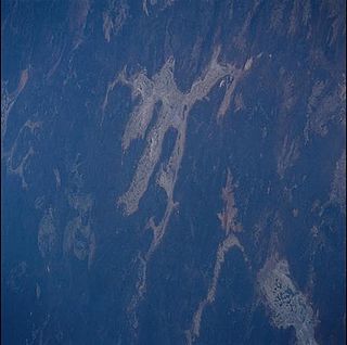
Lake Barlee is an intermittent salt lake. With a surface area of 1,980 square kilometres (764 sq mi), it is the second largest lake in Western Australia.

Beechboro is a suburb of Perth, Western Australia, located within the City of Swan.

Edward Timothy Hooley, usually known as E. T. Hooley or Tim Hooley, was an explorer in Western Australia, who in 1866 pioneered an overland stock route from Geraldton to the Ashburton River. He entered politics in later life, serving nearly three years as a Member of the Western Australian Legislative Council, then nearly six years in the Western Australian Legislative Assembly.
Hill River is a river in the Wheatbelt region of Western Australia.

The Carbunup River is located in the south-west corner of Western Australia. The mouth of the Carbunup River is approximately 20 kilometres (12 mi) west of Busselton where the river flows into Geographe Bay.

The Donnelly River is a river in the South West of Western Australia. Its main tributaries are Barlee Brook and Carey Brook. The river runs primarily through state forest reserves, although 25 private landholdings are situated along the length of the river. Clearing of the catchment area is estimated at 20% with the land mostly being used for viticulture, horticulture, dairy, grazing and tourism.
Wild Horse River is a tributary of the Kootenay River in the East Kootenay region of southeastern British Columbia. The river flows southwest from the Canadian Rockies to the mouth, which lies immediately south of Fort Steele.

The Preston River is a river in the South West region of Western Australia.
The Edmund River is a river in the Gascoyne region of Western Australia.
The Hardey River is a river in the Pilbara region of Western Australia.

Robe River is a river in the Pilbara region of Western Australia.
The Frederick River is a river that is located in the Gascoyne and Pilbara regions of Western Australia.
The Shaw River is an ephemeral river in the Pilbara region of Western Australia. It was named by explorer F.T. Gregory on 21 August 1861 after Norton Shaw, Secretary of the Royal Geographical Society.
The Angelo River is a river in the Pilbara region of Western Australia.

Mission Creek is a large creek in the Okanagan Region of British Columbia. Originally called N'wha-kwi-sen, it was later mapped as Rivière de l’Anse-au-Sable, the name Mission Creek was adopted in 1860 in honour of the Catholic Oblate Mission established by Father Pandosy and other settlers. The Creek rises in the Greystoke Mountain Range and runs west about 43 kilometres (27 mi) before emptying into Okanagan Lake south of Kelowna. Its watershed covers about 200,000 square kilometres . Mission Creek was designated a BC Heritage River by the province in 1996.
Findlay Creek is a creek in the East Kootenay region of British Columbia. This creek flows into the Kootenay River from the western side. Findlay Creek is located to the south of Canal Flats. The creek was discovered in 1863 by a native named Findlay. This creek has been mined by Europeans and Chinese miners.
Minderoo Station, commonly referred to as Minderoo, is a pastoral lease that once operated as a sheep station but now operates as a cattle station in Western Australia.
The Maia were an indigenous Australian tribe of Western Australia.
The Tenma or Thiin were an Aboriginal Australian people of the Pilbara region of Western Australia. They spoke the Tenma language.


