Homeland, California

Last updated

Homeland
Homeland, California.jpg
Homeland, California viewed from Double Butte
Riverside County California Incorporated and Unincorporated areas Homeland Highlighted.svg
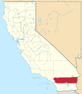
Location in Riverside County and the state of California
Usa edcp location map.svg
Red pog.svg
Homeland
Location in the United States
Coordinates: 33°44′31″N117°06′48″W / 33.74194°N 117.11333°W / 33.74194; -117.11333
Country United States
State California
County Riverside
Area
[1]
  Total4.270 sq mi (11.058 km2)
  Land4.270 sq mi (11.058 km2)
  Water0 sq mi (0 km2)  0%
Elevation
[2]
1,604 ft (489 m)
Population
 (2020) [3]
  Total6,772
  Density1,600/sq mi (610/km2)
Time zone UTC-8 (PST)
  Summer (DST) UTC-7 (PDT)
ZIP code
92548
Area code 951
FIPS code 06-34316
GNIS feature ID 1652723

Homeland is a census-designated place (CDP) in Riverside County, California, United States. The population was 5,969 at the 2010 census, up from 3,710 at the 2000 census.

Contents

Geography

Homeland is located at 33°44′31″N117°6′48″W / 33.74194°N 117.11333°W / 33.74194; -117.11333 (33.741859, -117.113201). [4]

According to the United States Census Bureau, the CDP has a total area of 4.3 square miles (11 km2).

Demographics

Historical population
CensusPop.Note
U.S. Decennial Census [5]

2010

At the 2010 census Homeland had a population of 5,969. The population density was 1,398.0 inhabitants per square mile (539.8/km2). The racial makeup of Homeland was 3,727 (62.4%) White, 130 (2.2%) African American, 85 (1.4%) Native American, 49 (0.8%) Asian, 15 (0.3%) Pacific Islander, 1,673 (28.0%) from other races, and 290 (4.9%) from two or more races. Hispanic or Latino of any race were 3,110 persons (52.1%). [6]

The census reported that 5,959 people (99.8% of the population) lived in households, 10 (0.2%) lived in non-institutionalized group quarters, and no one was institutionalized.

There were 1,964 households, 691 (35.2%) had children under the age of 18 living in them, 948 (48.3%) were opposite-sex married couples living together, 259 (13.2%) had a female householder with no husband present, 144 (7.3%) had a male householder with no wife present. There were 143 (7.3%) unmarried opposite-sex partnerships, and 11 (0.6%) same-sex married couples or partnerships. 494 households (25.2%) were one person and 314 (16.0%) had someone living alone who was 65 or older. The average household size was 3.03. There were 1,351 families (68.8% of households); the average family size was 3.63.

The age distribution was 1,655 people (27.7%) under the age of 18, 545 people (9.1%) aged 18 to 24, 1,362 people (22.8%) aged 25 to 44, 1,354 people (22.7%) aged 45 to 64, and 1,053 people (17.6%) who were 65 or older. The median age was 36.1 years. For every 100 females, there were 102.0 males. For every 100 females age 18 and over, there were 96.1 males.

There were 2,262 housing units at an average density of 529.8 per square mile, of the occupied units 1,330 (67.7%) were owner-occupied and 634 (32.3%) were rented. The homeowner vacancy rate was 5.0%; the rental vacancy rate was 5.5%. 3,554 people (59.5% of the population) lived in owner-occupied housing units and 2,405 people (40.3%) lived in rental housing units.

2000

At the 2000 census there were 3,710 people, 1,572 households, and 985 families in the CDP. The population density was 1,125.9 inhabitants per square mile (434.7/km2). There were 1,812 housing units at an average density of 549.9 per square mile (212.3/km2). The racial makeup of the CDP was 80.0% White, 0.8% Black or African American, 1.1% Native American, 0.5% Asian, 0.1% Pacific Islander, 13.9% from other races, and 3.7% from two or more races. 29.7% of the population were Hispanic or Latino of any race. [7] Of the 1,572 households 21.4% had children under the age of 18 living with them, 48.6% were married couples living together, 9.5% had a female householder with no husband present, and 37.3% were non-families. 33.1% of households were one person and 22.0% were one person aged 65 or older. The average household size was 2.4 and the average family size was 3.0.

The age distribution was 23.0% under the age of 18, 6.7% from 18 to 24, 21.1% from 25 to 44, 18.0% from 45 to 64, and 31.1% 65 or older. The median age was 44 years. For every 100 females, there were 91.7 males. For every 100 females age 18 and over, there were 88.2 males.

The median household income was $20,607 and the median family income was $22,631. Males had a median income of $25,481 versus $20,038 for females. The per capita income for the CDP was $11,338. About 19.6% of families and 26.4% of the population were below the poverty line, including 50.9% of those under age 18 and 6.0% of those age 65 or over.

Politics

In the state legislature Homeland is located in the 37th Senate District, represented by Republican Bill Emmerson, and in the 65th Assembly District, represented by Republican Paul Cook.

In the United States House of Representatives, Homeland is in California's 42nd congressional district , represented by Democrat Robert Garcia. [8]

Education

It is in the Romoland Elementary School District, and the Perris Union High School District for grades 9-12. [9]

Related Research Articles

<span class="mw-page-title-main">Meyers Chuck, Wrangell</span> Former census-designated place in Alaska, United States

Meyers Chuck is a former census-designated place in the City and Borough of Wrangell, Alaska, United States. The population was 21 at the 2000 census, at which time it was in the former Prince of Wales-Outer Ketchikan Census Area. On June 1, 2008, it was annexed into the newly created City and Borough of Wrangell, most of whose territory came from the former Wrangell-Petersburg Census Area.

<span class="mw-page-title-main">Bowles, California</span> Census-designated place in California, United States

Bowles is a census-designated place (CDP) in Fresno County, California, United States. The population was 166 at the 2010 census, down from 182 at the 2000 census. Bowles is located 11 miles (18 km) south of downtown Fresno, at an elevation of 279 feet.

<span class="mw-page-title-main">Del Rey, California</span> Census-designated place in California, United States

Del Rey is a census-designated place (CDP) in Fresno County, California, United States. The population was 1,639 at the 2010 census, up from 950 at the 2000 census. Del Rey is located 3.5 miles (5.6 km) south-southwest of Sanger, at an elevation of 344.

<span class="mw-page-title-main">Dixon Lane-Meadow Creek, California</span> Census-designated place in California, United States

Dixon Lane-Meadow Creek is a census-designated place (CDP) in Inyo County, California, United States. The population was 2,645 at the 2010 census, down from 2,702 at the 2000 census.

<span class="mw-page-title-main">Valinda, California</span> Census-designated place in California, United States

Valinda is a census-designated place (CDP) in the San Gabriel Valley, in Los Angeles County, California, in the United States. At the 2010 census, the population was 22,822, up from 21,776 at the 2000 census.

<span class="mw-page-title-main">West Carson, California</span> Unincorporated community in California, United States

West Carson is an unincorporated community in the South Bay region of Los Angeles County, California. The population was 22,870 at the 2020 census. For statistical purposes, the United States Census Bureau has defined West Carson as a census-designated place (CDP).

<span class="mw-page-title-main">Clio, California</span> Census-designated place in California, United States

Clio is a census-designated place in Plumas County, California, United States. Clio is located 23 miles (37.0 km) southeast of Quincy. The population was 77 at the 2020 census, up from 66 at the 2010 census.

<span class="mw-page-title-main">Storrie, California</span> Place in California, United States

Storrie is an unincorporated community and former census-designated place (CDP) in Plumas County, California and about 20 miles northeast of Lake Oroville. As of the 2010 Census, the CDP had a population of four.

<span class="mw-page-title-main">Twain, California</span> Census-designated place in California, United States

Twain is a census-designated place (CDP) in Plumas County, California, United States. As of the 2020 census, the CDP population was 303, up from 82 at the 2010 census.

<span class="mw-page-title-main">Romoland, California</span> Census-designated place in California, United States

Romoland is a census-designated place (CDP) in Riverside County, California, United States. The population was 2,005 at the 2020 census, up from 1,684 at the 2010 census.

<span class="mw-page-title-main">Valle Vista, California</span> Place in California, United States

Valle Vista is a unincorporated area in Riverside County, California, United States and is located in the San Jacinto Valley. Valle Vista is adjacent to and east of the cities of San Jacinto and Hemet. The population was 11,036 at the 2010 census, up from 8,356 at the 2000 census. For statistical purposes, the United States Census Bureau has defined Valle Vista as a census-designated place (CDP).

<span class="mw-page-title-main">Toro Canyon, California</span> Census-designated place in California, United States

Toro Canyon is a census-designated place (CDP) in Santa Barbara County, California, United States. The population was 1,835 at the 2020 census, up from 1,508 at the 2010 census.

<span class="mw-page-title-main">Millville, California</span> Census-designated place in California, United States

Millville is a census-designated place (CDP) in Shasta County, California, United States. Its population is 724 as of the 2020 census, down from 727 from the 2010 census.

<span class="mw-page-title-main">Woodville, California</span> Census-designated place in California, United States

Woodville is a census-designated place (CDP) in Tulare County, California, United States. The population was 1,740 at the 2010 census, up from 1,678 at the 2000 census.

<span class="mw-page-title-main">Lakeland Village, California</span> Census-designated place in California, United States

Lakeland Village is a census-designated place (CDP) in Riverside County, California, United States. The population was 11,541 at the 2010 census, more than double the 5,626 reported at the 2000 census.

<span class="mw-page-title-main">Cherry Hill Mall, New Jersey</span> Populated place in Camden County, New Jersey, US

Cherry Hill Mall is an unincorporated community and census-designated place (CDP) located in Cherry Hill, in Camden County, in the U.S. state of New Jersey. As of the 2020 United States census, the CDP's population was 14,805, its highest decennial count ever and an increase of 634 (+4.5%) from the 14,171 residents recorded at the 2010 census count, which in turn reflected an increase of 933 (+7.0%) from the 13,238 counted in the 2000 census. The CDP is home to the namesake Cherry Hill Mall shopping complex.

<span class="mw-page-title-main">Whittingham, New Jersey</span> Populated place in Middlesex County, New Jersey, US

Whittingham, also known as Greenbriar at Whittingham, is an unincorporated community and census-designated place (CDP) in Monroe Township, Middlesex County, New Jersey, United States. As of the 2020 census, the CDP's population was 2,348. The area is focused around the age-restricted gated community of Whittingham.

<span class="mw-page-title-main">Haviland, New York</span> Census-designated place in New York, United States

Haviland is a community and census-designated place (CDP) in Dutchess County, New York, United States. The population was 4,174 at the 2020 census. It is part of the Poughkeepsie–Newburgh–Middletown, NY Metropolitan Statistical Area as well as the larger New York–Newark–Bridgeport, NY-NJ-CT-PA Combined Statistical Area.

<span class="mw-page-title-main">Erie, North Dakota</span> Census-designated place in North Dakota, United States

Erie is a census-designated place (CDP) in Cass County, North Dakota, United States. The population was 50 at the 2010 census. Established in or after 1980 by the United States Census Bureau, the CDP is named for the village of Erie, which is within its boundary. Although the rectangular boundary includes a sizeable amount of farmland, there is in fact only one residence outside the village's boundary but within that of the CDP.

<span class="mw-page-title-main">Pleasant Run Farm, Ohio</span> Census-designated place in Ohio, United States

Pleasant Run Farm is a census-designated place (CDP) in Springfield Township, Hamilton County, Ohio, United States. The population was 4,779 at the 2020 census.

References

  1. "2010 Census U.S. Gazetteer Files – Places – California". United States Census Bureau.
  2. "Homeland". Geographic Names Information System . United States Geological Survey, United States Department of the Interior . Retrieved November 11, 2014.
  3. "US Census Bureau". www.census.gov. Retrieved September 10, 2024.
  4. "US Gazetteer files: 2010, 2000, and 1990". United States Census Bureau. February 12, 2011. Retrieved April 23, 2011.
  5. "Census of Population and Housing". Census.gov. Retrieved June 4, 2016.
  6. "2010 Census Interactive Population Search: CA - Homeland CDP". U.S. Census Bureau. Archived from the original on July 15, 2014. Retrieved July 12, 2014.
  7. "U.S. Census website". United States Census Bureau . Retrieved January 31, 2008.
  8. "California's 42nd Congressional District - Representatives & District Map". Civic Impulse, LLC.
  9. "2020 CENSUS - SCHOOL DISTRICT REFERENCE MAP: Riverside County, CA" (PDF). U.S. Census Bureau. p. 2 (PDF p. 3/6). Retrieved October 4, 2024. - Text list - See Hemet city limits