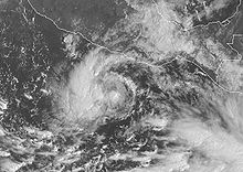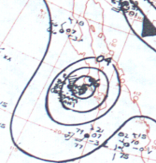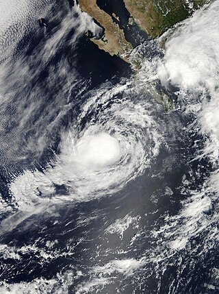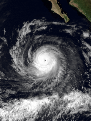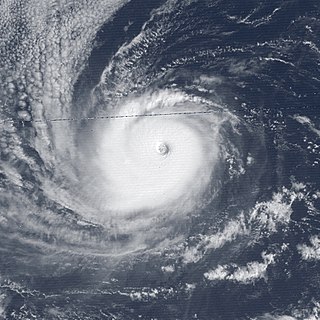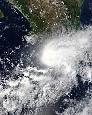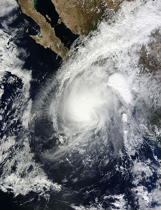
Hurricane Ismael was a weak, but deadly Pacific hurricane that killed over one hundred people in northern Mexico in September of the 1995 Pacific hurricane season. It developed from a persistent area of deep convection on September 12, and steadily strengthened as it moved to the north-northwest. Ismael attained hurricane status on September 14 while located 210 miles (340 km) off the coast of Mexico. It continued to the north, and after passing a short distance east of Baja California Sur it made landfall on Topolobampo in the state of Sinaloa with winds of 80 mph (130 km/h). Ismael rapidly weakened over land, and dissipated on September 16 over northwestern Mexico. The remnants entered the United States and extended eastward into the Mid-Atlantic States.

Hurricane Juliette was a powerful Pacific hurricane that struck Mexico in September 2001. A long-lived tropical cyclone, Juliette originated from a tropical wave that exited western Africa, the same wave that earlier spawned Atlantic Tropical Depression Nine near Nicaragua on September 19. Two days later, a new tropical depression developed offshore Guatemala, which became Hurricane Juliette by September 22 as it rapidly intensified off western Mexico. On September 24 it strengthened into a Category 4 hurricane on the Saffir-Simpson scale, only to weaken due to an eyewall replacement cycle, then re-intensified a day later to attain maximum sustained winds of 230 km/h (145 mph), with a minimum barometric pressure of 923 mbar (27.3 inHg). Juliette weakened as it moved toward the Baja California peninsula, producing hurricane-force winds and torrential rainfall across Baja California Sur. On September 30 after the hurricane had weakened, Juliette made landfall near San Carlos as a minimal tropical storm. After drifting across the Gulf of California, Juliette dissipated on October 3.

Hurricane Marty was a Category 2 Pacific hurricane that caused extensive flooding and damage in northwestern Mexico just weeks after Hurricane Ignacio took a similar course. Marty was the thirteenth named storm, fourth hurricane, and the deadliest tropical cyclone of the 2003 Pacific hurricane season. Forming on September 18, it became the 13th tropical storm and fourth hurricane of the year. The storm moved generally northwestward and steadily intensified despite only a marginally favorable environment for development, and became a Category 2 hurricane before making two landfalls on the Baja California peninsula and mainland Mexico.

Hurricane Paul was a Category 2 Pacific hurricane that struck Mexico as a tropical depression in October 2006. The seventeenth named storm and tenth hurricane of the annual hurricane season, Paul developed from an area of disturbed weather on October 21. The cyclone slowly intensified as it moved into an area of warm waters and progressively decreasing wind shear. Paul attained hurricane status on October 23, and later that day the storm reached its peak intensity with maximum sustained winds of 105 mph (169 km/h), a strong Category 2 hurricane on the Saffir-Simpson scale. A strong trough turned the hurricane to the north and northeast into an area of strong vertical shear, and Paul weakened to a tropical storm on October 24. It accelerated northeastward, and after passing a short distance south of Baja California Sur the low level circulation became decoupled from the rest of the convection. Paul weakened to a tropical depression on October 25 a short distance off the coast of Mexico, and after briefly turning away from the coast it made landfall on northwestern Sinaloa on October 26. The depression dissipated shortly thereafter.

The 2008 Pacific hurricane season was a near-average Pacific hurricane season which featured seventeen named storms, though most were rather weak and short-lived. Only seven storms became hurricanes, of which two intensified into major hurricanes. This season was also the first since 1996 to have no cyclones cross into the central Pacific. The season officially began on May 15 in the eastern Pacific and on June 1 in the central Pacific. It ended in both regions on November 30. These dates, adopted by convention, historically describe the period in each year when most tropical cyclone formation occurs in these regions of the Pacific. This season, the first system, Tropical Storm Alma, formed on May 29, and the last, Tropical Storm Polo, dissipated on November 5.

Hurricane Henriette was a minimal Category 1 hurricane that affected portions of Mexico in late August and early September 2007. The storm, which caused nine fatalities, formed from an area of disturbed weather on August 30, 2007, and became a tropical storm the next day. The cyclone moved parallel to the Mexican Pacific coast, but its proximity to the shore resulted in heavy rainfall over land. The most affected city was Acapulco, Guerrero, where six people were killed by landslides, and where over 100 families had to be evacuated after the La Sabana River flooded. Henriette then turned north and headed towards the Baja California peninsula, and became a Category 1 hurricane on the Saffir-Simpson Hurricane Scale. Henriette made its first landfall east of Cabo San Lucas at peak intensity, causing the death of one woman due to high surf.

The 2006 Pacific hurricane season was the first above-average season since 1997 which produced twenty-five tropical cyclones, with nineteen named storms, though most were rather weak and short-lived. There were eleven hurricanes, of which six became major hurricanes. Following the inactivity of the previous seasons, forecasters predicted that season would be only slightly above active. It was also the first time since 2003 in which one cyclone of at least tropical storm intensity made landfall. The season officially began on May 15 in the East Pacific Ocean, and on June 1 in the Central Pacific; they ended on November 30. These dates conventionally delimit the period of each year when most tropical cyclones form in the Pacific basin. However, the formation of tropical cyclones is possible at any time of the year.

Tropical Storm Kirsten was the eighth tropical cyclone of the 1966 Pacific hurricane season and the second to make landfall in the Baja California peninsula. Forming north of the Intertropical Convergence Zone (ITCZ), Kirsten developed into a tropical depression on September 25 and like Tropical Storm Joyce of the same season, took a long period of time before intensifying into a tropical storm.

The 2009 Pacific hurricane season was the most active Pacific hurricane season since 1997. The season officially started on May 15 in the East Pacific Ocean, and on June 1 in the Central Pacific; they both ended on November 30. These dates conventionally delimit the period of each year when most tropical cyclones form in the Eastern Pacific tropical cyclone basin; however, tropical cyclone formation is possible at any time of the year. The first system of the season, Tropical Depression One-E, developed on June 18, and the last, Hurricane Neki, dissipated on October 27, keeping activity well within the bounds of the season.

Tropical Storm Lowell was a moderate tropical storm that developed during the 2008 Pacific hurricane season. The fourteenth tropical cyclone and thirteen named storm of the season, Lowell formed out of a western side of a trough on September 6. It quickly intensified into Tropical Storm Lowell, peaking as a moderate tropical storm. It pass directly over Socorro Island and began a weakening trend. It weakened into depression before landfall in Baja California Sur and dissipated before striking Sonora. It later joined with a frontal boundary and Hurricane Ike which caused severe damage as far inland as Chicago. In all, the storm had caused 6 deaths and $15.5 million damage.

Hurricane Kiko was one of the strongest tropical cyclones on record to have made landfall on Mexico's Baja California peninsula. The eleventh named storm of the 1989 Pacific hurricane season, Kiko formed out of a large mesoscale convective system on August 25. Slowly tracking northwestward, the storm rapidly intensified into a hurricane early the next day. Strengthening continued until early August 27, when Kiko reached its peak intensity with winds of 120 mph (190 km/h). The storm turned west at this time, and at around 0600 UTC, the storm made landfall near Punta Arena, Mexico at the southern tip of Baja California Sur. The hurricane rapidly weakened into a tropical storm later that day and further into a tropical depression by August 28, shortly after entering the Pacific Ocean. The depression persisted for another day while tracking southward, before being absorbed by nearby Tropical Storm Lorena. Though Kiko made landfall as a Category 3 hurricane, its impact was relatively minor. Press reports indicated that 20 homes were destroyed and numerous highways were flooded by torrential rains.

Hurricane Raymond was the strongest tropical cyclone of the 1989 Pacific hurricane season, peaking as a strong Category 4 hurricane on the Saffir–Simpson hurricane scale. Forming out of a tropical wave on September 25, 1989, the tropical depression slowly tracked northwest before becoming nearly stationary the next day. Shortly after, the depression intensified into Tropical Storm Raymond and took a general westward track. Gradually intensifying, Raymond attained hurricane-status on September 28 and attained its peak intensity on September 30, with winds of 145 mph (233 km/h) and a barometric pressure of 935 mbar. Steady weakening then took place and by October 3, Raymond turned northeast towards land. The storm continued to weaken as it accelerated and eventually made landfall on the Baja California Peninsula as a tropical storm late on October 4 and a second landfall in Sonora, Mexico. Shortly after, Raymond weakened to a depression as it tracked inland. The remnants of the system persisted until October 7 when it dissipated over the Central United States.

Hurricane Jimena is tied with Hurricane Norbert as the strongest tropical cyclone to make landfall on western portion of the Baja California Peninsula. Jimena was the twelfth named storm, fifth hurricane, third major hurricane and overall second-strongest tropical cyclone of the 2009 Pacific hurricane season. Forming from a tropical wave late on August 28, 2009, off of Mexico's Pacific coast, the system rapidly intensified into a Category 2 hurricane on the next day. Two days after developing, Jimena strengthened into a Category 4 hurricane. After peaking close to Category 5 intensity on September 1, it encountered cold water and began to weaken. When the hurricane made landfall on the Baja California Peninsula on September 3, it was only a Category 2 hurricane. On the next day, the tropical cyclone entered the Gulf of California, though the storm weakened into a remnant low after looping back eastward towards Baja California. The storm's remnants drifted westward into the Pacific afterward, before dissipating on September 8.

Hurricane Rick was the third-most intense Pacific hurricane on record and the second-most intense tropical cyclone worldwide in 2009, only behind Typhoon Nida. Developing off the southern coast of Mexico on October 15, Rick traversed an area with favorable environmental conditions, favoring rapid intensification, allowing it to become a hurricane within 24 hours of being declared a tropical depression. An eye began to form during the afternoon of October 16; once fully formed, the storm underwent another period of rapid strengthening. During the afternoon of October 17, the storm attained Category 5 status on the Saffir–Simpson hurricane wind scale. Several hours later, Rick attained its peak intensity as the third-strongest Pacific hurricane on record with winds of 180 mph (290 km/h) and a barometric pressure of 906 mbar.

Hurricane Norbert marked the first time a core of a hurricane was fully mapped in three-dimensions. First forming on September 14, 1984 west of the Mexican coast, Norbert gradually intensified, reaching hurricane intensity two days after formation. On September 22, Norbert peaked in strength as a Category 4 hurricane on the Saffir-Simpson Hurricane Scale. While intensifying, Norbert meandered. It moved east, then north, then west, then south, then back towards the east, and finally towards the northeast. After fluctuating in intensity for two more days, Norbert rapidly weakened. It turned towards the northwest and made landfall in southern Baja California Norte as a tropical storm. The combination of Norbert and several other storms left thousands homeless throughout Mexico. The remnants of Hurricane Norbert produced moderate rain over Arizona.

Hurricane Marty was a tropical cyclone that produced heavy rains and flooding in several states in Southwestern and Western Mexico. The twentieth named storm and twelfth hurricane of the annual hurricane season, Marty developed from a tropical wave on September 26, 2015, to the southwest of Acapulco, Guerrero, in Mexico. Initially a tropical depression, the system strengthened into a tropical storm early on the following day. Due to favorable atmospheric conditions, Marty continued to intensify, but wind shear sharply increased as the storm approached a large mid- to upper-level trough. Despite this, the cyclone deepened further, becoming a hurricane on September 28 and peaking with sustained winds of 80 mph (130 km/h) shortly thereafter. Wind shear quickly took its toll on the hurricane, weakening it to a tropical storm early on September 29. About 24 hours later, Marty degenerated into a post-tropical low-pressure area offshore Guerrero. The low further degenerated into a trough later on September 30, and eventually dissipated on October 4.

The 2018 Pacific hurricane season was one of the most active Pacific hurricane seasons on record, producing the highest accumulated cyclone energy value on record in the basin. The season had the fourth-highest number of named storms – 23, tied with 1982. The season also featured eight landfalls, six of which occurred in Mexico. The season officially began on May 15 in the Eastern Pacific, and on June 1 in the Central Pacific; they both ended on November 30. These dates conventionally delimit the period of each year when most tropical cyclones form in the Pacific basin. However, tropical cyclone formation is possible at any time of the year, as illustrated when the first tropical depression formed on May 10, five days prior to the official start of the season.

Tropical Storm Sonia was a weak, late-season tropical cyclone that made a rare landfall in the Mexican state of Sinaloa during early-November 2013.

Hurricane Norma was one of four tropical cyclones to strike the Pacific Coast of Mexico in October 2023. The seventeenth tropical depression, fourteenth named storm, ninth hurricane and seventh major hurricane of the 2023 Pacific hurricane season, Norma developed from an area of low pressure that formed off the coast of southern Mexico on October 15, 2023. The disturbance gradually organized as it progressed westward parallel to the coast, and developed into Tropical Storm Norma on October 17. Turning northward, Norma rapidly intensified to a Category 4 hurricane as it continued to parallel the west coast of Mexico. Less favorable environmental conditions caused Norma to gradually weaken as it approached the Baja California peninsula. The cyclone made landfall on the Mexican state of Baja California Sur as a Category 1 hurricane. Norma continued to weaken as it crossed the state. The storm emerged over the Gulf of California on October 22, and made landfall as a tropical depression the following day on the state of Sinaloa. Norma quickly dissipated as it moved inland over Mexico.


