
Mount Columbia is a mountain located in the Winston Churchill Range of the Rocky Mountains. It is the highest point in Alberta, Canada, and is second only to Mount Robson for height and topographical prominence in the Canadian Rockies. It is located on the border between Alberta and British Columbia on the northern edge of the Columbia Icefield. Its highest point, however, lies within Jasper National Park in Alberta.

Caledonia Mountain is a 2,863-metre (9,393-foot) summit located in the Canadian Rockies on the shared border of Alberta and British Columbia in Canada. It is also situated along the shared boundary of Jasper National Park with Mount Robson Provincial Park. It ranks as the 59th most prominent mountain in Alberta. It was named in 1926 due to its location overlooking the Caledonian Valley.

Yellowhead Mountain is located west of Yellowhead Pass in Mount Robson Provincial Park and straddles the Continental Divide marking the Alberta-British Columbia border. It was named for Pierre Bostonais aka Tête Jaune. The mountain has four officially named summits: Bingley Peak, Leather Peak, Lucerne Peak, and Tête Roche.

Bastion Peak is a 2,994-metre (9,823 ft) mountain summit located on the shared border of Jasper National Park in Alberta, and Mount Robson Provincial Park in British Columbia, Canada. It is situated in the Tonquin Valley in the Canadian Rockies. It was named in 1916 by Édouard-Gaston Deville because it has an appearance similar to that of a bastion on a castle. Its nearest higher peak is Turret Mountain, 1.6 km (0.99 mi) to the west, and its greater parent is Mount Geikie 3 km (1.9 mi) to the west.
Dungeon Peak is a 3,129-metre (10,266 ft) mountain summit located on the shared border of Jasper National Park in Alberta, and Mount Robson Provincial Park in British Columbia, Canada. Dungeon Peak is part of The Ramparts in the Tonquin Valley. The descriptive name was applied in 1916 by Morrison P. Bridgland (1878-1948), a Dominion Land Surveyor who named many peaks in Jasper Park and the Canadian Rockies. The mountain's name was made official in 1935 by the Geographical Names Board of Canada.

Rearguard Mountain is a 2,744-metre (9,003-foot) summit located within Mount Robson Provincial Park in British Columbia, Canada. It is part of the Rainbow Range which is a sub-range of the Canadian Rockies. Its nearest higher peak is Mount Robson, 4.0 km (2.5 mi) to the southwest. Rearguard is situated between Berg Lake and the Robson Glacier.
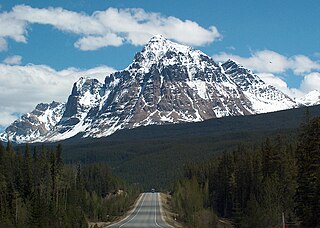
Mount Fitzwilliam is a 2,901-metre (9,518-foot) mountain summit located in the Canadian Rockies within Mount Robson Provincial Park in British Columbia, Canada. Mount Fitzwilliam is situated 6.0 km (3.7 mi) south of Yellowhead Pass and 4.0 km (2.5 mi) west of the Continental Divide, near the headwaters of the Fraser River. Its nearest higher peak is Roche Noire, 8.5 km (5.3 mi) to the east. Mt. Fitzwilliam is a prominent landmark seen from eastbound Highway 16 before travelers enter Jasper National Park from the west entrance. The mountain is also visible to riders on the Canadian train.

Cinnamon Peak is a 2,727-metre (8,947-foot) mountain summit located in the northwestern part of Mount Robson Provincial Park, in the Canadian Rockies of British Columbia, Canada. It is situated immediately north of the confluence of the Robson River and the Fraser River, and is visible from the Yellowhead Highway near the park's visitor centre. The peak was labelled "Little Grizzly" on Arthur Oliver Wheeler's 1911 topographic map of Mount Robson. He thought it appeared similar to Mount Grizzly in the Selkirk Mountains, but the name was later changed to Cinnamon, which is the coloration of the peak and the Cinnamon bear, which can be easily mistaken for a grizzly bear. "Little Grizzly" is a colloquial term for the black bear, Ursus americanus. Eastern populations are typically black in color, however western populations can be cinnamon colored. The mountain's toponym was officially adopted in 1951 by the Geographical Names Board of Canada. The nearest higher peak is Whitehorn Mountain, 6.0 km (3.7 mi) to the north.

Mount Weart is a 2,835-metre (9,301-foot) triple-summit mountain located in the Garibaldi Ranges of the Coast Mountains, in northwestern Garibaldi Provincial Park of southwestern British Columbia, Canada. It is situated 14 km (9 mi) northeast of Whistler, and its nearest higher peak is Wedge Mountain, 3.7 km (2 mi) to the south, which is the only peak within the park higher than Weart. The Armchair Glacier rests below the west aspect of the summit, and the massive Weart Glacier spans the northern and eastern aspects of the mountain. Precipitation runoff from the peak and meltwater from the glaciers drains into Wedgemount Lake and tributaries of the Lillooet River.

Mica Mountain is a 2,855-meter-elevation (9,367-foot) mountain summit located in British Columbia, Canada.

Mount Hanover is a mountain summit located in British Columbia, Canada.

North Albert Peak is a 2,934-metre (9,626-foot) mountain summit located in British Columbia, Canada.
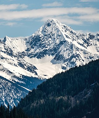
Albert Peak is a 3,045-metre (9,990-foot) mountain summit located in British Columbia, Canada.
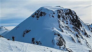
Mount Trorey is a 2,461-metre (8,074-foot) mountain summit located in British Columbia, Canada.
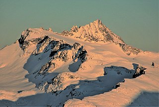
Mount James Turner is a 2,703-metre (8,868-foot) mountain summit located in British Columbia, Canada.

Mount Albreda is a mountain located in British Columbia, Canada.
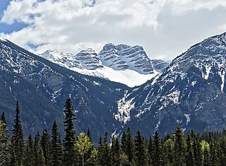
Overlander Mountain is a summit in British Columbia, Canada.

Mount McKirdy is a mountain summit in British Columbia, Canada.

Mount Anne-Alice is a mountain summit in the Canadian Rockies of British Columbia, Canada.
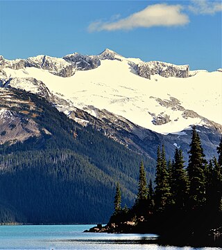
Mount Carr is a 2,590-metre (8,497-foot) mountain summit located in British Columbia, Canada.


