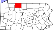
Marker title Image Date dedicated Location Marker type Topics Allegheny Portage August 10, 1949 Junction US 6 & PA 155, Port Allegany 41°48′21″N 78°16′39″W / 41.80578°N 78.27753°W / 41.80578; -78.27753 (Allegheny Portage ) Roadside Native American, Navigation, Paths & Trails, Transportation Bradford Oil Refinery September 9, 2006 At refinery entrance, 77 North Kendall Avenue & Brad Penn Way, Bradford 41°58′01″N 78°37′41″W / 41.96698°N 78.62797°W / 41.96698; -78.62797 (Bradford Oil Refinery ) Roadside Business & Industry, Oil & Gas Bucktails, The August 8, 1949 Grand Army of the Republic Highway (US 6) at courthouse, Smethport 41°48′34″N 78°26′50″W / 41.80958°N 78.44723°W / 41.80958; -78.44723 (Bucktails, The ) Roadside Civil War, Military Ceres August 8, 1949 PA 44 at bridge, Ceres 41°59′55″N 78°16′08″W / 41.998717°N 78.268767°W / 41.998717; -78.268767 (Ceres ) Roadside Ethnic & Immigration Dr. Edward H. McCleery July 23, 2016 At former Wolf Park site, Grand Army of the Republic (US 6) near Wolf Farm Road, east of Kane 41°41′14″N 78°43′10″W / 41.687248°N 78.719356°W / 41.687248; -78.719356 (Dr. Edward H. McCleery ) Roadside Environment Holley Motor Company September 13, 2008 57 Holley Avenue & Hoffman Avenue, Bradford 41°58′09″N 78°37′39″W / 41.969183°N 78.627500°W / 41.969183; -78.627500 (Holley Motor Company ) City Business & Industry, Military Kinzua Viaduct August 15, 1982 Kinzua Bridge State Park, off SR 3011, 3.5 miles northeast of Mount Jewett (Missing as of 7-23-04)(rededicated 2011) 41°45′34″N 78°35′13″W / 41.759336°N 78.586914°W / 41.759336; -78.586914 (Kinzua Viaduct ) Roadside Business & Industry, Transportation McKean County October 14, 1981 County Courthouse, 500 West Main Street (US 6), Smethport 41°48′35″N 78°26′50″W / 41.80968°N 78.44723°W / 41.80968; -78.44723 (McKean County ) City Government & Politics, Government & Politics 19th Century, Oil & Gas Mt. Equity Plantation August 11, 1949 Turtle Point-Larabee Road (PA 155), near Rock Run Road, just northwest of Turtlepoint 41°52′42″N 78°20′55″W / 41.87838°N 78.34863°W / 41.87838; -78.34863 (Mt. Equity Plantation ) Roadside Government & Politics, Government & Politics 19th Century Port Allegany October 12, 1948 Grand Army of the Republic Highway (US 6), west edge of Port Allegany 41°49′10″N 78°17′22″W / 41.819428°N 78.289553°W / 41.819428; -78.289553 (Port Allegany ) Roadside Business & Industry, Cities & Towns, Early Settlement, Transportation Port Allegany October 12, 1948 In park, Grand Army of the Republic Highway (US 6) between Maple and West Mill Streets, Port Allegany 41°48′40″N 78°16′50″W / 41.811176°N 78.280581°W / 41.811176; -78.280581 (Port Allegany ) Roadside Business & Industry, Cities & Towns, Early Settlement, Transportation Seneca Spring September 28, 1951 Brickyard Road (PA 321) near Hemlock Avenue, S of Kane 41°39′28″N 78°48′01″W / 41.65785°N 78.80035°W / 41.65785; -78.80035 (Seneca Spring ) Roadside Environment, Native American, Transportation Smethport August 8, 1949 At courthouse, 500 West Main Street (US 6), Smethport 41°48′34″N 78°26′51″W / 41.80958°N 78.44748°W / 41.80958; -78.44748 (Smethport ) Roadside Cities & Towns, Government & Politics 19th Century St. Mary's Church July 7, 1985 At church, Newell Creek Road, off PA 155 northeast of Turtlepoint 41°54′10″N 78°20′20″W / 41.902850°N 78.338867°W / 41.902850; -78.338867 (St. Mary's Church ) Roadside Ethnic & Immigration, Religion Thomas L. Kane June 29, 1980 30 Chestnut Street (Thomas L. Kane Memorial Chapel ), Kane 41°39′28″N 78°48′32″W / 41.657750°N 78.808750°W / 41.657750; -78.808750 (Thomas L. Kane ) City Civil War, Military, Religion Tidewater Pipe Co. August 8, 1949 Farmers Valley-Eldred Road, Coryville 41°52′57″N 78°23′54″W / 41.882500°N 78.398433°W / 41.882500; -78.398433 (Tidewater Pipe Co. ) Roadside Business & Industry, Oil & Gas, Transportation