List of United Kingdom locations: To–Tq

Last updated

The United Kingdom Uk-map.svg
The United Kingdom

This is part of the list of United Kingdom locations: a gazetteer of place names in the United Kingdom showing each place's locality and geographical coordinates.

Contents

To

Toa-Tod

LocationLocality Coordinates
(links to map & photo sources)
OS grid
reference
Toab Shetland Islands 59°53′N1°19′W / 59.88°N 01.32°W / 59.88; -01.32 HU3811
Toadmoor Derbyshire 53°02′N1°28′W / 53.04°N 01.47°W / 53.04; -01.47 SK3550
Toad Row Suffolk 52°25′N1°40′E / 52.41°N 01.67°E / 52.41; 01.67 TM5086
Tobermory Argyll and Bute 56°37′N6°04′W / 56.62°N 06.07°W / 56.62; -06.07 NM5055
Toberonochy Argyll and Bute 56°13′N5°38′W / 56.21°N 05.64°W / 56.21; -05.64 NM7408
Tobha Beag Western Isles 57°17′N7°23′W / 57.29°N 07.39°W / 57.29; -07.39 NF7535
Tobha Mòr Western Isles 57°17′N7°23′W / 57.29°N 07.39°W / 57.29; -07.39 NF7536
Tobhtaral Western Isles 58°11′N6°48′W / 58.19°N 06.80°W / 58.19; -06.80 NB1833
Tobson Western Isles 58°14′N6°53′W / 58.23°N 06.89°W / 58.23; -06.89 NB1338
Toby's Hill Lincolnshire 53°25′N0°11′E / 53.42°N 00.18°E / 53.42; 00.18 TF4594
Tocher Aberdeenshire 57°22′N2°31′W / 57.37°N 02.51°W / 57.37; -02.51 NJ6932
Tockenham Wiltshire 51°31′N1°57′W / 51.51°N 01.95°W / 51.51; -01.95 SU0379
Tockenham Wick Wiltshire 51°31′N1°57′W / 51.52°N 01.95°W / 51.52; -01.95 SU0381
Tockholes Lancashire 53°42′N2°31′W / 53.70°N 02.51°W / 53.70; -02.51 SD6623
Tockington South Gloucestershire 51°34′N2°34′W / 51.57°N 02.57°W / 51.57; -02.57 ST6086
Tockwith North Yorkshire 53°58′N1°18′W / 53.96°N 01.30°W / 53.96; -01.30 SE4652
Todber Dorset 50°58′N2°18′W / 50.97°N 02.30°W / 50.97; -02.30 ST7920
Toddington Bedfordshire 51°56′N0°32′W / 51.94°N 00.54°W / 51.94; -00.54 TL0028
Toddington Gloucestershire 51°59′N1°57′W / 51.98°N 01.95°W / 51.98; -01.95 SP0332
Toddington West Sussex 50°49′N0°32′W / 50.81°N 00.53°W / 50.81; -00.53 TQ0303
Toddlehills Aberdeenshire 57°29′N1°54′W / 57.49°N 01.90°W / 57.49; -01.90 NK0645
Todd's Green Hertfordshire 51°55′N0°13′W / 51.91°N 00.22°W / 51.91; -00.22 TL2226
Todenham Gloucestershire 52°01′N1°39′W / 52.02°N 01.65°W / 52.02; -01.65 SP2436
Todhills Angus 56°32′N2°56′W / 56.54°N 02.94°W / 56.54; -02.94 NO4239
Todhills Cumbria 54°57′N3°00′W / 54.95°N 03.00°W / 54.95; -03.00 NY3663
Todhills Durham 54°41′N1°40′W / 54.69°N 01.67°W / 54.69; -01.67 NZ2133
Todmorden Calderdale 53°43′N2°05′W / 53.71°N 02.09°W / 53.71; -02.09 SD9424
Todpool Cornwall 50°14′N5°10′W / 50.24°N 05.17°W / 50.24; -05.17 SW7443
Todwick Rotherham 53°21′N1°16′W / 53.35°N 01.26°W / 53.35; -01.26 SK4984

Tof-Too

LocationLocality Coordinates
(links to map & photo sources)
OS grid
reference
Toft Cambridgeshire 52°11′N0°01′W / 52.18°N 00.01°W / 52.18; -00.01 TL3656
Toft Lincolnshire 52°44′N0°26′W / 52.74°N 00.43°W / 52.74; -00.43 TF0617
Toft Warwickshire 52°19′N1°19′W / 52.32°N 01.31°W / 52.32; -01.31 SP4770
Toft Hill Durham 54°38′N1°46′W / 54.64°N 01.76°W / 54.64; -01.76 NZ1528
Toft Hill Lincolnshire 53°08′N0°08′W / 53.14°N 00.14°W / 53.14; -00.14 TF2462
Toft Monks Norfolk 52°29′N1°34′E / 52.49°N 01.56°E / 52.49; 01.56 TM4294
Toft next Newton Lincolnshire 53°22′N0°26′W / 53.37°N 00.43°W / 53.37; -00.43 TF0488
Toftrees Norfolk 52°48′N0°48′E / 52.80°N 00.80°E / 52.80; 00.80 TF8927
Toftshaw Bradford 53°45′N1°43′W / 53.75°N 01.72°W / 53.75; -01.72 SE1829
Toftwood Norfolk 52°40′N0°56′E / 52.66°N 00.94°E / 52.66; 00.94 TF9911
Togston Northumberland 55°18′N1°37′W / 55.30°N 01.62°W / 55.30; -01.62 NU2401
Tokers Green Oxfordshire 51°29′N1°00′W / 51.48°N 01.00°W / 51.48; -01.00 SU6977
Tokyngton Brent 51°32′N0°17′W / 51.54°N 00.28°W / 51.54; -00.28 TQ1984
Tolastadh bho Thuath Western Isles 58°20′N6°13′W / 58.34°N 06.22°W / 58.34; -06.22 NB5347
Tolborough Cornwall 50°34′N4°35′W / 50.56°N 04.58°W / 50.56; -04.58 SX1777
Tolcarne Cornwall 50°10′N5°14′W / 50.16°N 05.24°W / 50.16; -05.24 SW6834
Tolcarne Cornwall 50°11′N5°17′W / 50.19°N 05.29°W / 50.19; -05.29 SW6538
Tolcarne Wartha Cornwall 50°10′N5°15′W / 50.16°N 05.25°W / 50.16; -05.25 SW6835
Toldish Cornwall 50°23′N4°55′W / 50.39°N 04.92°W / 50.39; -04.92 SW9259
Tolgus Mount Cornwall 50°14′N5°15′W / 50.23°N 05.25°W / 50.23; -05.25 SW6842
Tolhurst East Sussex 51°02′N0°23′E / 51.04°N 00.38°E / 51.04; 00.38 TQ6730
Tolladine Worcestershire 52°11′N2°12′W / 52.19°N 02.20°W / 52.19; -02.20 SO8655
Tolland Somerset 51°05′N3°17′W / 51.08°N 03.28°W / 51.08; -03.28 ST1032
Tollard Farnham Dorset 50°56′N2°05′W / 50.93°N 02.08°W / 50.93; -02.08 ST9415
Tollard Royal Wiltshire 50°57′N2°05′W / 50.95°N 02.08°W / 50.95; -02.08 ST9417
Toll Bar Doncaster 53°33′N1°09′W / 53.55°N 01.15°W / 53.55; -01.15 SE5607
Toll Bar Rutland 52°40′N0°31′W / 52.66°N 00.52°W / 52.66; -00.52 TF0008
Toll Bar St Helens 53°26′N2°46′W / 53.44°N 02.76°W / 53.44; -02.76 SJ4994
Tollbar End Warwickshire 52°22′N1°28′W / 52.37°N 01.47°W / 52.37; -01.47 SP3675
Toll End Sandwell 52°31′N2°02′W / 52.52°N 02.04°W / 52.52; -02.04 SO9792
Tollerford Dorset 50°46′N2°35′W / 50.77°N 02.58°W / 50.77; -02.58 SY5997
Toller Fratrum Dorset 50°46′N2°37′W / 50.77°N 02.61°W / 50.77; -02.61 SY5797
Toller Porcorum Dorset 50°47′N2°37′W / 50.78°N 02.62°W / 50.78; -02.62 SY5698
Tollerton North Yorkshire 54°04′N1°13′W / 54.06°N 01.22°W / 54.06; -01.22 SE5164
Tollerton Nottinghamshire 52°54′N1°06′W / 52.90°N 01.10°W / 52.90; -01.10 SK6034
Toller Whelme Dorset 50°48′N2°41′W / 50.80°N 02.69°W / 50.80; -02.69 ST5101
Tollesbury Essex 51°45′N0°49′E / 51.75°N 00.82°E / 51.75; 00.82 TL9510
Tollesby Middlesbrough 54°31′N1°13′W / 54.52°N 01.21°W / 54.52; -01.21 NZ5115
Tolleshunt D'Arcy Essex 51°46′N0°47′E / 51.76°N 00.78°E / 51.76; 00.78 TL9211
Tolleshunt Knights Essex 51°47′N0°46′E / 51.79°N 00.76°E / 51.79; 00.76 TL9114
Tolleshunt Major Essex 51°46′N0°45′E / 51.76°N 00.75°E / 51.76; 00.75 TL9011
Tollingham East Riding of Yorkshire 53°49′N0°44′W / 53.81°N 00.74°W / 53.81; -00.74 SE8335
Tolm / HolmWestern Isles 58°11′N6°20′W / 58.19°N 06.34°W / 58.19; -06.34 NB4531
Tolmers Hertfordshire 51°43′N0°07′W / 51.71°N 00.11°W / 51.71; -00.11 TL3003
Tolpuddle Dorset 50°44′N2°17′W / 50.74°N 02.29°W / 50.74; -02.29 SY7994
Tolskithy Cornwall 50°13′N5°15′W / 50.22°N 05.25°W / 50.22; -05.25 SW6841
Tolsta Chaolais Western Isles 58°14′N6°47′W / 58.24°N 06.79°W / 58.24; -06.79 NB1938
Tolsta Head Western Isles 58°20′N6°10′W / 58.34°N 06.17°W / 58.34; -06.17 NB557469
Tolvaddon Downs Cornwall 50°14′N5°17′W / 50.23°N 05.29°W / 50.23; -05.29 SW6542
Tolvah Highland 57°04′N3°55′W / 57.06°N 03.91°W / 57.06; -03.91 NN8499
Tolworth Kingston upon Thames 51°22′N0°17′W / 51.37°N 00.29°W / 51.37; -00.29 TQ1965
Tomaknock Perth and Kinross 56°22′N3°50′W / 56.36°N 03.83°W / 56.36; -03.83 NN8721
Tom an Fhuadain Western Isles 58°02′N6°25′W / 58.03°N 06.42°W / 58.03; -06.42 NB3914
Tomatin Highland 57°19′N3°59′W / 57.32°N 03.99°W / 57.32; -03.99 NH8028
Tomich Highland 57°18′N4°49′W / 57.30°N 04.82°W / 57.30; -04.82 NH3027
Tomintoul Aberdeenshire 56°59′N3°25′W / 56.99°N 03.41°W / 56.99; -03.41 NO1490
Tomintoul Moray 57°14′N3°23′W / 57.24°N 03.39°W / 57.24; -03.39 NJ1618
Tomlow Warwickshire 52°16′N1°20′W / 52.26°N 01.34°W / 52.26; -01.34 SP4563
Tomnavoulin Moray 57°19′N3°19′W / 57.31°N 03.31°W / 57.31; -03.31 NJ2126
Tomperrow Cornwall 50°15′N5°08′W / 50.25°N 05.13°W / 50.25; -05.13 SW7744
Tompkin Staffordshire 53°03′N2°05′W / 53.05°N 02.09°W / 53.05; -02.09 SJ9451
Tompset's Bank East Sussex 51°04′N0°01′E / 51.07°N 00.02°E / 51.07; 00.02 TQ4233
Tomthorn Derbyshire 53°16′N1°53′W / 53.27°N 01.89°W / 53.27; -01.89 SK0775

Ton-Tor

LocationLocality Coordinates
(links to map & photo sources)
OS grid
reference
Ton Monmouthshire 51°39′N2°55′W / 51.65°N 02.92°W / 51.65; -02.92 ST3696
Ton-Breigam The Vale Of Glamorgan 51°30′N3°27′W / 51.50°N 03.45°W / 51.50; -03.45 SS9979
Tonbridge Kent 51°11′N0°16′E / 51.19°N 00.27°E / 51.19; 00.27 TQ5946
Tondu Bridgend 51°32′N3°36′W / 51.54°N 03.60°W / 51.54; -03.60 SS8984
Tone Somerset 50°59′N3°14′W / 50.99°N 03.24°W / 50.99; -03.24 ST1221
Tonedale Somerset 50°59′N3°15′W / 50.98°N 03.25°W / 50.98; -03.25 ST1221
Tone Green Somerset 51°00′N3°11′W / 51.00°N 03.18°W / 51.00; -03.18 ST1723
Tong Bradford 53°46′N1°40′W / 53.76°N 01.66°W / 53.76; -01.66 SE2230
Tong Kent 51°11′N0°37′E / 51.18°N 00.61°E / 51.18; 00.61 TQ8346
Tong Shropshire 52°40′N2°19′W / 52.66°N 02.31°W / 52.66; -02.31 SJ7907
Tonge Leicestershire 52°48′N1°23′W / 52.80°N 01.39°W / 52.80; -01.39 SK4123
Tonge Corner Kent 51°21′N0°46′E / 51.35°N 00.77°E / 51.35; 00.77 TQ9365
Tonge Fold Bolton 53°34′N2°24′W / 53.57°N 02.40°W / 53.57; -02.40 SD7309
Tonge Moor Bolton 53°35′N2°25′W / 53.58°N 02.42°W / 53.58; -02.42 SD7210
Tong Forge Shropshire 52°40′N2°19′W / 52.66°N 02.32°W / 52.66; -02.32 SJ7808
Tong Green Kent 51°15′N0°50′E / 51.25°N 00.83°E / 51.25; 00.83 TQ9854
Tongham Surrey 51°14′N0°44′W / 51.23°N 00.74°W / 51.23; -00.74 SU8849
Tongland Dumfries and Galloway 54°52′N4°02′W / 54.86°N 04.04°W / 54.86; -04.04 NX6954
Tong Norton Shropshire 52°40′N2°19′W / 52.66°N 02.31°W / 52.66; -02.31 SJ7908
Tong Park Bradford 53°50′N1°45′W / 53.84°N 01.75°W / 53.84; -01.75 SE1639
Tong Street Bradford 53°46′N1°43′W / 53.76°N 01.71°W / 53.76; -01.71 SE1930
Tongue Highland 58°28′N4°25′W / 58.47°N 04.41°W / 58.47; -04.41 NC5956
Tongue End Lincolnshire 52°44′N0°17′W / 52.74°N 00.28°W / 52.74; -00.28 TF1618
Tongwell Milton Keynes 52°04′N0°44′W / 52.06°N 00.73°W / 52.06; -00.73 SP8741
Tongwynlais Cardiff 51°32′N3°15′W / 51.53°N 03.25°W / 51.53; -03.25 ST1382
Tonmawr Neath Port Talbot 51°39′N3°44′W / 51.65°N 03.73°W / 51.65; -03.73 SS8096
Tonna Neath Port Talbot 51°40′N3°47′W / 51.67°N 03.78°W / 51.67; -03.78 SS7799
Ton Pentre Rhondda, Cynon, Taff 51°38′N3°30′W / 51.64°N 03.50°W / 51.64; -03.50 SS9695
Tonteg Rhondda, Cynon, Taff 51°34′N3°19′W / 51.56°N 03.31°W / 51.56; -03.31 ST0986
Tontine Lancashire 53°32′N2°43′W / 53.53°N 02.72°W / 53.53; -02.72 SD5204
Tonwell Hertfordshire 51°50′N0°04′W / 51.83°N 00.07°W / 51.83; -00.07 TL3317
Tonypandy Rhondda, Cynon, Taff 51°37′N3°28′W / 51.61°N 03.46°W / 51.61; -03.46 SS9992
Ton-y-pistyll Caerphilly 51°39′N3°10′W / 51.65°N 03.17°W / 51.65; -03.17 ST1996
Tonyrefail Rhondda, Cynon, Taff 51°35′N3°26′W / 51.58°N 03.43°W / 51.58; -03.43 ST0188
Toogs Shetland Islands 60°05′N1°20′W / 60.08°N 01.33°W / 60.08; -01.33 HU3733
Toot Baldon Oxfordshire 51°41′N1°11′W / 51.69°N 01.19°W / 51.69; -01.19 SP5600
Toothill Calderdale 53°41′N1°47′W / 53.68°N 01.78°W / 53.68; -01.78 SE1421
Toothill Hampshire 50°58′N1°28′W / 50.96°N 01.47°W / 50.96; -01.47 SU3718
Toothill Swindon 51°32′N1°49′W / 51.54°N 01.82°W / 51.54; -01.82 SU1283
Toot Hill Essex 51°41′N0°11′E / 51.69°N 00.18°E / 51.69; 00.18 TL5102
Toot Hill Staffordshire 52°58′N1°55′W / 52.97°N 01.91°W / 52.97; -01.91 SK0642
Tooting Graveney Wandsworth 51°25′N0°10′W / 51.42°N 00.17°W / 51.42; -00.17 TQ2771
Topcliffe Leeds 53°44′N1°35′W / 53.73°N 01.59°W / 53.73; -01.59 SE2726
Topcliffe North Yorkshire 54°10′N1°23′W / 54.17°N 01.38°W / 54.17; -01.38 SE4076
Topcroft Norfolk 52°28′N1°19′E / 52.47°N 01.32°E / 52.47; 01.32 TM2692
Topcroft Street Norfolk 52°28′N1°19′E / 52.47°N 01.32°E / 52.47; 01.32 TM2691
Top End Bedfordshire 52°14′N0°29′W / 52.24°N 00.49°W / 52.24; -00.49 TL0362
Top Green Nottinghamshire 52°59′N0°52′W / 52.99°N 00.86°W / 52.99; -00.86 SK7645
Topham Doncaster 53°38′N1°04′W / 53.64°N 01.06°W / 53.64; -01.06 SE6217
Topleigh West Sussex 50°57′N0°42′W / 50.95°N 00.70°W / 50.95; -00.70 SU9118
Top Lock Wigan 53°32′N2°36′W / 53.54°N 02.60°W / 53.54; -02.60 SD6006
Top of Hebers Rochdale 53°33′N2°13′W / 53.55°N 02.21°W / 53.55; -02.21 SD8607
Top o' th' Lane Lancashire 53°42′N2°37′W / 53.70°N 02.62°W / 53.70; -02.62 SD5923
Top o' th' Meadows Oldham 53°33′N2°04′W / 53.55°N 02.06°W / 53.55; -02.06 SD9606
Toppesfield Essex 52°00′N0°31′E / 52.00°N 00.51°E / 52.00; 00.51 TL7337
Toppings Bolton 53°37′N2°25′W / 53.61°N 02.42°W / 53.61; -02.42 SD7213
Toprow Norfolk 52°32′N1°11′E / 52.53°N 01.18°E / 52.53; 01.18 TM1698
Topsham Devon 50°41′N3°28′W / 50.68°N 03.47°W / 50.68; -03.47 SX9688
Top Valley Nottinghamshire 52°59′N1°11′W / 52.99°N 01.18°W / 52.99; -01.18 SK5545
Tor Devon 50°25′N3°57′W / 50.42°N 03.95°W / 50.42; -03.95 SX6160
Torbay Devon 50°26′N3°34′W / 50.43°N 03.56°W / 50.43; -03.56 SX8961
Torbeg North Ayrshire 55°31′N5°19′W / 55.51°N 05.32°W / 55.51; -05.32 NR9029
Torbothie North Lanarkshire 55°49′N3°46′W / 55.81°N 03.77°W / 55.81; -03.77 NS8959
Torbrex Stirling 56°06′N3°58′W / 56.10°N 03.96°W / 56.10; -03.96 NS7892
Torbryan Devon 50°29′N3°40′W / 50.48°N 03.66°W / 50.48; -03.66 SX8266
Torbush North Lanarkshire 55°46′N3°52′W / 55.77°N 03.86°W / 55.77; -03.86 NS8355
Torcross Devon 50°16′N3°39′W / 50.26°N 03.65°W / 50.26; -03.65 SX8242
Tore Highland 57°32′N4°20′W / 57.53°N 04.34°W / 57.53; -04.34 NH6052
Torfrey Cornwall 50°21′N4°39′W / 50.35°N 04.65°W / 50.35; -04.65 SX1154
Torgulbin Highland 56°54′N4°34′W / 56.90°N 04.57°W / 56.90; -04.57 NN4382
Torinturk Argyll and Bute 55°49′N5°29′W / 55.82°N 05.49°W / 55.82; -05.49 NR8165
Torkington Stockport 53°22′N2°06′W / 53.37°N 02.10°W / 53.37; -02.10 SJ9386
Torksey Lincolnshire 53°17′N0°45′W / 53.29°N 00.75°W / 53.29; -00.75 SK8378
Torlum Western Isles 57°25′N7°22′W / 57.42°N 07.36°W / 57.42; -07.36 NF7850
Torlundy Highland 56°50′N5°03′W / 56.83°N 05.05°W / 56.83; -05.05 NN1476
Tormarton South Gloucestershire 51°30′N2°20′W / 51.50°N 02.34°W / 51.50; -02.34 ST7678
Tormore Highland 57°02′N5°56′W / 57.03°N 05.94°W / 57.03; -05.94 NG6101
Tormore North Ayrshire 55°32′N5°20′W / 55.53°N 05.34°W / 55.53; -05.34 NR8932
Tornagrain Highland 57°31′N4°04′W / 57.51°N 04.07°W / 57.51; -04.07 NH7649
Tornaveen Aberdeenshire 57°08′N2°38′W / 57.14°N 02.64°W / 57.14; -02.64 NJ6106
Torness Highland 57°19′N4°21′W / 57.31°N 04.35°W / 57.31; -04.35 NH5827
Toronto Durham 54°40′N1°42′W / 54.66°N 01.70°W / 54.66; -01.70 NZ1930
Torpenhow Cumbria 54°44′N3°14′W / 54.74°N 03.24°W / 54.74; -03.24 NY2039
Torphichen West Lothian 55°56′N3°40′W / 55.93°N 03.66°W / 55.93; -03.66 NS9672
Torphin City of Edinburgh 55°53′N3°17′W / 55.89°N 03.28°W / 55.89; -03.28 NT2067
Torphins Aberdeenshire 57°05′N2°37′W / 57.09°N 02.62°W / 57.09; -02.62 NJ6201
Torpoint Cornwall 50°22′N4°12′W / 50.37°N 04.20°W / 50.37; -04.20 SX4355
Torquay Devon 50°28′N3°32′W / 50.47°N 03.53°W / 50.47; -03.53 SX9165
Torquhan Scottish Borders 55°43′N2°53′W / 55.71°N 02.89°W / 55.71; -02.89 NT4447
Torr Devon 50°20′N3°59′W / 50.34°N 03.99°W / 50.34; -03.99 SX5851
Torran Highland 57°28′N6°01′W / 57.46°N 06.02°W / 57.46; -06.02 NG5949
Torrance East Dunbartonshire 55°56′N4°13′W / 55.93°N 04.21°W / 55.93; -04.21 NS6274
Torranyard North Ayrshire 55°40′N4°37′W / 55.66°N 04.62°W / 55.66; -04.62 NS3544
Torre Devon 50°28′N3°33′W / 50.46°N 03.55°W / 50.46; -03.55 SX9064
Torre Somerset 51°09′N3°22′W / 51.15°N 03.37°W / 51.15; -03.37 ST0440
Torridon Highland 57°32′N5°31′W / 57.54°N 05.52°W / 57.54; -05.52 NG8956
Torridon Highland 57°32′N5°31′W / 57.53°N 05.51°W / 57.53; -05.51 NG9055
Torries Aberdeenshire 57°12′N2°38′W / 57.20°N 02.64°W / 57.20; -02.64 NJ6113
Torrieston Moray 57°36′N3°24′W / 57.60°N 03.40°W / 57.60; -03.40 NJ1658
Torrin Highland 57°12′N6°01′W / 57.20°N 06.02°W / 57.20; -06.02 NG5720
Torrinch West Dunbartonshire 56°04′N4°34′W / 56.06°N 04.56°W / 56.06; -04.56 NS403892
Torrisdale Highland 58°31′N4°17′W / 58.51°N 04.28°W / 58.51; -04.28 NC6761
Torrisholme Lancashire 54°04′N2°50′W / 54.06°N 02.84°W / 54.06; -02.84 SD4564
Torroble Highland 58°00′N4°24′W / 58.00°N 04.40°W / 58.00; -04.40 NC5804
Torroy Highland 57°56′N4°28′W / 57.93°N 04.46°W / 57.93; -04.46 NH5497
Torry City of Aberdeen 57°08′N2°05′W / 57.13°N 02.08°W / 57.13; -02.08 NJ9505
Torryburn Fife 56°03′N3°34′W / 56.05°N 03.57°W / 56.05; -03.57 NT0286
Torrylinn North Ayrshire 55°26′N5°14′W / 55.44°N 05.24°W / 55.44; -05.24 NR9521
Torsa Argyll and Bute 56°15′N5°37′W / 56.25°N 05.61°W / 56.25; -05.61 NM764127
Torsonce Scottish Borders 55°40′N2°52′W / 55.67°N 02.87°W / 55.67; -02.87 NT4543
Torsonce Mains Scottish Borders 55°40′N2°52′W / 55.67°N 02.87°W / 55.67; -02.87 NT4543
Torterston Aberdeenshire 57°31′N1°53′W / 57.51°N 01.88°W / 57.51; -01.88 NK0747
Torthorwald Dumfries and Galloway 55°05′N3°31′W / 55.08°N 03.52°W / 55.08; -03.52 NY0378
Tortington West Sussex 50°50′N0°35′W / 50.83°N 00.58°W / 50.83; -00.58 TQ0005
Torton Worcestershire 52°20′N2°14′W / 52.34°N 02.23°W / 52.34; -02.23 SO8472
Tortworth South Gloucestershire 51°38′N2°26′W / 51.63°N 02.43°W / 51.63; -02.43 ST7093
Torvaig Highland 57°25′N6°11′W / 57.41°N 06.18°W / 57.41; -06.18 NG4944
Torver Cumbria 54°20′N3°06′W / 54.33°N 03.10°W / 54.33; -03.10 SD2894
Torwood Falkirk 56°02′N3°52′W / 56.03°N 03.86°W / 56.03; -03.86 NS8484
Torwoodlee Mains Scottish Borders 55°37′N2°51′W / 55.62°N 02.85°W / 55.62; -02.85 NT4637
Torworth Nottinghamshire 53°22′N1°01′W / 53.36°N 01.02°W / 53.36; -01.02 SK6586

Tos-Toy

LocationLocality Coordinates
(links to map & photo sources)
OS grid
reference
Tosberry Devon 50°58′N4°28′W / 50.96°N 04.47°W / 50.96; -04.47 SS2621
Toscaig Highland 57°22′N5°49′W / 57.37°N 05.81°W / 57.37; -05.81 NG7138
Toseland Cambridgeshire 52°14′N0°11′W / 52.24°N 00.19°W / 52.24; -00.19 TL2362
Tosside Lancashire 53°59′N2°22′W / 53.99°N 02.36°W / 53.99; -02.36 SD7656
Tostary Argyll and Bute 56°31′N6°14′W / 56.52°N 06.24°W / 56.52; -06.24 NM3945
Tostock Suffolk 52°14′N0°51′E / 52.23°N 00.85°E / 52.23; 00.85 TL9563
Totaig Highland 57°27′N6°41′W / 57.45°N 06.68°W / 57.45; -06.68 NG1950
Totardor Highland 57°22′N6°22′W / 57.36°N 06.37°W / 57.36; -06.37 NG3739
Tote Highland 57°27′N6°19′W / 57.45°N 06.32°W / 57.45; -06.32 NG4149
Totegan Highland 58°35′N4°02′W / 58.58°N 04.03°W / 58.58; -04.03 NC8268
Tote Hill Hampshire 51°01′N1°34′W / 51.01°N 01.57°W / 51.01; -01.57 SU3024
Tote Hill West Sussex 51°00′N0°46′W / 51.00°N 00.77°W / 51.00; -00.77 SU8624
Totford Hampshire 51°07′N1°11′W / 51.12°N 01.18°W / 51.12; -01.18 SU5737
Totham Hill Essex 51°46′N0°42′E / 51.77°N 00.70°E / 51.77; 00.70 TL8712
Totham Plains Essex 51°46′N0°43′E / 51.77°N 00.72°E / 51.77; 00.72 TL8812
Tot Hill Hampshire 51°21′N1°20′W / 51.35°N 01.34°W / 51.35; -01.34 SU4662
Tothill Lincolnshire 53°18′N0°07′E / 53.30°N 00.11°E / 53.30; 00.11 TF4181
Totland Isle of Wight 50°40′N1°32′W / 50.67°N 01.54°W / 50.67; -01.54 SZ3286
Totley Sheffield 53°18′N1°33′W / 53.30°N 01.55°W / 53.30; -01.55 SK3079
Totley Brook Sheffield 53°19′N1°32′W / 53.31°N 01.53°W / 53.31; -01.53 SK3180
Totley Rise Sheffield 53°19′N1°31′W / 53.31°N 01.52°W / 53.31; -01.52 SK3280
Totmonslow Staffordshire 52°56′N2°01′W / 52.94°N 02.01°W / 52.94; -02.01 SJ9939
Totnell Dorset 50°52′N2°32′W / 50.87°N 02.54°W / 50.87; -02.54 ST6208
Totnes Devon 50°25′N3°41′W / 50.42°N 03.69°W / 50.42; -03.69 SX8060
Totnor Herefordshire 51°58′N2°35′W / 51.97°N 02.59°W / 51.97; -02.59 SO5931
Toton Nottinghamshire 52°54′N1°15′W / 52.90°N 01.25°W / 52.90; -01.25 SK5034
Totscore Highland 57°36′N6°23′W / 57.60°N 06.38°W / 57.60; -06.38 NG3866
Tottenham Haringey 51°35′N0°05′W / 51.59°N 00.08°W / 51.59; -00.08 TQ3390
Tottenham Hale Haringey 51°35′N0°04′W / 51.58°N 00.06°W / 51.58; -00.06 TQ3489
Tottenhill Norfolk 52°40′N0°25′E / 52.66°N 00.42°E / 52.66; 00.42 TF6410
Tottenhill Row Norfolk 52°41′N0°25′E / 52.68°N 00.41°E / 52.68; 00.41 TF6312
Totteridge Barnet 51°38′N0°12′W / 51.63°N 00.20°W / 51.63; -00.20 TQ2494
Totteridge Buckinghamshire 51°37′N0°43′W / 51.62°N 00.72°W / 51.62; -00.72 SU8893
Totternhoe Bedfordshire 51°52′N0°34′W / 51.87°N 00.57°W / 51.87; -00.57 SP9821
Totteroak South Gloucestershire 51°33′N2°22′W / 51.55°N 02.37°W / 51.55; -02.37 ST7484
Totterton Shropshire 52°28′N2°56′W / 52.47°N 02.94°W / 52.47; -02.94 SO3687
Totties Kirklees 53°34′N1°46′W / 53.56°N 01.77°W / 53.56; -01.77 SE1508
Tottington Bury 53°36′N2°20′W / 53.60°N 02.34°W / 53.60; -02.34 SD7712
Tottington Norfolk 52°31′N0°47′E / 52.52°N 00.78°E / 52.52; 00.78 TL8995
Tottlebank Cumbria 54°14′N3°04′W / 54.24°N 03.06°W / 54.24; -03.06 SD3184
Tottleworth Lancashire 53°46′N2°25′W / 53.77°N 02.41°W / 53.77; -02.41 SD7331
Totton Hampshire 50°55′N1°30′W / 50.91°N 01.50°W / 50.91; -01.50 SU3513
Touchen-end Berkshire 51°28′N0°44′W / 51.47°N 00.74°W / 51.47; -00.74 SU8776
Toulston North Yorkshire 53°53′N1°19′W / 53.89°N 01.31°W / 53.89; -01.31 SE4544
Toulton Somerset 51°04′N3°09′W / 51.07°N 03.15°W / 51.07; -03.15 ST1931
Toulvaddie Highland 57°47′N3°53′W / 57.79°N 03.88°W / 57.79; -03.88 NH8880
Tournaig Highland 57°47′N5°35′W / 57.78°N 05.58°W / 57.78; -05.58 NG8783
Tovil Kent 51°15′N0°30′E / 51.25°N 00.50°E / 51.25; 00.50 TQ7554
Towan Cornwall 50°31′N5°00′W / 50.52°N 05.00°W / 50.52; -05.00 SW8774
Towan Cross Cornwall 50°17′N5°14′W / 50.28°N 05.23°W / 50.28; -05.23 SW7048
Towan Head Cornwall 50°25′N5°06′W / 50.42°N 05.10°W / 50.42; -05.10 SW798626
Toward Argyll and Bute 55°52′N4°59′W / 55.86°N 04.99°W / 55.86; -04.99 NS1368
Toward Point Argyll and Bute 55°52′N4°59′W / 55.86°N 04.98°W / 55.86; -04.98 NS134674
Towcester Northamptonshire 52°07′N0°59′W / 52.12°N 00.99°W / 52.12; -00.99 SP6948
Towednack Cornwall 50°11′N5°32′W / 50.18°N 05.53°W / 50.18; -05.53 SW4838
Towerage Buckinghamshire 51°38′N0°49′W / 51.63°N 00.81°W / 51.63; -00.81 SU8293
Tower End Norfolk 52°43′N0°27′E / 52.72°N 00.45°E / 52.72; 00.45 TF6617
Tower Hamlets Kent 51°07′N1°17′E / 51.12°N 01.28°E / 51.12; 01.28 TR3041
Towerhead North Somerset 51°19′N2°50′W / 51.32°N 02.84°W / 51.32; -02.84 ST4159
Tower Hill Birmingham 52°31′N1°55′W / 52.52°N 01.92°W / 52.52; -01.92 SP0592
Tower Hill Cheshire 53°16′N2°05′W / 53.27°N 02.09°W / 53.27; -02.09 SJ9475
Tower Hill Devon 50°41′N4°18′W / 50.68°N 04.30°W / 50.68; -04.30 SX3790
Tower Hill Essex 51°56′N1°17′E / 51.94°N 01.28°E / 51.94; 01.28 TM2632
Tower Hill Hertfordshire 51°42′N0°31′W / 51.70°N 00.51°W / 51.70; -00.51 TL0302
Tower Hill Knowsley 53°29′N2°53′W / 53.49°N 02.89°W / 53.49; -02.89 SD4100
Tower Hill Surrey 51°13′N0°20′W / 51.21°N 00.34°W / 51.21; -00.34 TQ1648
Tower Hill West Sussex 51°02′N0°20′W / 51.04°N 00.34°W / 51.04; -00.34 TQ1629
Tower Point Pembrokeshire 51°45′N5°11′W / 51.75°N 05.19°W / 51.75; -05.19 SM798107
Towersey Oxfordshire 51°44′N0°56′W / 51.73°N 00.94°W / 51.73; -00.94 SP7305
Tow House Northumberland 54°58′N2°22′W / 54.97°N 02.37°W / 54.97; -02.37 NY7664
Towie Aberdeenshire 57°11′N2°56′W / 57.19°N 02.94°W / 57.19; -02.94 NJ4312
Towiemore Moray 57°29′N3°01′W / 57.49°N 03.01°W / 57.49; -03.01 NJ3945
Tow Law Durham 54°44′N1°50′W / 54.73°N 01.83°W / 54.73; -01.83 NZ1138
Town Barton Devon 50°44′N3°42′W / 50.73°N 03.70°W / 50.73; -03.70 SX8094
Town Centre (Skelmersdale)Lancashire 53°32′N2°47′W / 53.54°N 02.78°W / 53.54; -02.78 SD4806
Town Centre (Telford)Shropshire 52°40′N2°27′W / 52.66°N 02.45°W / 52.66; -02.45 SJ6908
Town End Buckinghamshire 51°40′N0°52′W / 51.66°N 00.87°W / 51.66; -00.87 SU7897
Town End Cambridgeshire 52°32′N0°04′E / 52.53°N 00.07°E / 52.53; 00.07 TL4195
Town End (Grasmere)Cumbria 54°26′N3°01′W / 54.44°N 03.01°W / 54.44; -03.01 NY3406
Town End (Troutbeck)Cumbria 54°25′N2°55′W / 54.41°N 02.92°W / 54.41; -02.92 NY4002
Town End (Kirkby Thore)Cumbria 54°37′N2°34′W / 54.61°N 02.57°W / 54.61; -02.57 NY6325
Town End (Hawkshead)Cumbria 54°22′N3°00′W / 54.37°N 03.00°W / 54.37; -03.00 SD3598
Town End (Finsthwaite)Cumbria 54°16′N2°59′W / 54.27°N 02.98°W / 54.27; -02.98 SD3687
Town End (Witherslack)Cumbria 54°14′N2°52′W / 54.24°N 02.86°W / 54.24; -02.86 SD4483
Town End (Barbon)Cumbria 54°14′N2°35′W / 54.23°N 02.58°W / 54.23; -02.58 SD6282
Town End Derbyshire 53°16′N1°46′W / 53.27°N 01.77°W / 53.27; -01.77 SK1575
Town End Kirklees 53°38′N1°52′W / 53.63°N 01.86°W / 53.63; -01.86 SE0915
Town End Knowsley 53°23′N2°46′W / 53.38°N 02.76°W / 53.38; -02.76 SJ4988
Town End York 53°58′N0°56′W / 53.96°N 00.93°W / 53.96; -00.93 SE7053
Townend Derbyshire 53°19′N1°55′W / 53.32°N 01.91°W / 53.32; -01.91 SK0681
Townend Staffordshire 52°56′N2°04′W / 52.93°N 02.07°W / 52.93; -02.07 SJ9537
Townend West Dunbartonshire 55°57′N4°34′W / 55.95°N 04.56°W / 55.95; -04.56 NS4076
Townfield Durham 54°49′N2°04′W / 54.82°N 02.07°W / 54.82; -02.07 NY9548
Town Fields Cheshire 53°11′N2°32′W / 53.18°N 02.54°W / 53.18; -02.54 SJ6465
Towngate Cumbria 54°48′N2°44′W / 54.80°N 02.74°W / 54.80; -02.74 NY5246
Towngate Lincolnshire 52°40′N0°19′W / 52.67°N 00.32°W / 52.67; -00.32 TF1310
Town Green Lancashire 53°32′N2°54′W / 53.53°N 02.90°W / 53.53; -02.90 SD4005
Town Green Norfolk 52°39′N1°29′E / 52.65°N 01.48°E / 52.65; 01.48 TG3612
Town Green Wigan 53°29′N2°38′W / 53.48°N 02.63°W / 53.48; -02.63 SJ5899
Townhead Aberdeenshire 56°50′N2°17′W / 56.83°N 02.29°W / 56.83; -02.29 NO8272
Townhead Argyll and Bute 55°49′N5°04′W / 55.82°N 05.06°W / 55.82; -05.06 NS0863
Townhead Barnsley 53°31′N1°46′W / 53.51°N 01.76°W / 53.51; -01.76 SE1602
Townhead (Dearham)Cumbria 54°42′N3°26′W / 54.70°N 03.44°W / 54.70; -03.44 NY0735
Townhead (Lazonby)Cumbria 54°44′N2°43′W / 54.74°N 02.71°W / 54.74; -02.71 NY5439
Townhead (Ousby)Cumbria 54°42′N2°34′W / 54.70°N 02.57°W / 54.70; -02.57 NY6334
Townhead Dumfries and Galloway 54°47′N4°02′W / 54.79°N 04.03°W / 54.79; -04.03 NX6946
Townhead City of Glasgow 55°51′N4°15′W / 55.85°N 04.25°W / 55.85; -04.25 NS5965
Townhead North Lanarkshire 55°52′N4°04′W / 55.87°N 04.06°W / 55.87; -04.06 NS7166
Townhead Northumberland 55°14′N2°11′W / 55.23°N 02.19°W / 55.23; -02.19 NY8893
Townhead Sheffield 53°19′N1°33′W / 53.32°N 01.55°W / 53.32; -01.55 SK3081
Townhead South Ayrshire 55°17′N4°49′W / 55.28°N 04.82°W / 55.28; -04.82 NS2103
Town Head Bradford 53°55′N1°56′W / 53.91°N 01.94°W / 53.91; -01.94 SE0446
Town Head (Grasmere)Cumbria 54°28′N3°02′W / 54.47°N 03.03°W / 54.47; -03.03 NY3309
Town Head (Troutbeck)Cumbria 54°25′N2°55′W / 54.41°N 02.91°W / 54.41; -02.91 NY4103
Town Head (Cliburn)Cumbria 54°37′N2°39′W / 54.61°N 02.65°W / 54.61; -02.65 NY5825
Town Head (Morland)Cumbria 54°35′N2°37′W / 54.59°N 02.62°W / 54.59; -02.62 NY6022
Town Head (Crosby Ravensworth)Cumbria 54°31′N2°35′W / 54.52°N 02.58°W / 54.52; -02.58 NY6214
Town Head (Kirkby Thore)Cumbria 54°37′N2°33′W / 54.61°N 02.55°W / 54.61; -02.55 NY6425
Town Head (Great Asby)Cumbria 54°30′N2°31′W / 54.50°N 02.51°W / 54.50; -02.51 NY6712
Town Head (Dufton)Cumbria 54°37′N2°29′W / 54.61°N 02.48°W / 54.61; -02.48 NY6924
Town Head Derbyshire 53°17′N1°46′W / 53.28°N 01.77°W / 53.28; -01.77 SK1576
Town Head (Austwick)North Yorkshire 54°06′N2°21′W / 54.10°N 02.35°W / 54.10; -02.35 SD7768
Town Head (Long Preston)North Yorkshire 54°01′N2°16′W / 54.01°N 02.27°W / 54.01; -02.27 SD8258
Town Head Staffordshire 53°02′N1°56′W / 53.03°N 01.94°W / 53.03; -01.94 SK0449
Townhead of Greenlaw Dumfries and Galloway 54°57′N3°58′W / 54.95°N 03.96°W / 54.95; -03.96 NX7464
Townhill Fife 56°05′N3°26′W / 56.08°N 03.44°W / 56.08; -03.44 NT1089
Townhill Swansea 51°37′N3°59′W / 51.61°N 03.98°W / 51.61; -03.98 SS6393
Townhill Park City of Southampton 50°55′N1°22′W / 50.92°N 01.36°W / 50.92; -01.36 SU4514
Town Kelloe Durham 54°43′N1°27′W / 54.71°N 01.45°W / 54.71; -01.45 NZ3536
Townlake Devon 50°32′N4°15′W / 50.54°N 04.25°W / 50.54; -04.25 SX4074
Townland Green Kent 51°04′N0°46′E / 51.07°N 00.76°E / 51.07; 00.76 TQ9434
Town Lane Wigan 53°29′N2°28′W / 53.48°N 02.46°W / 53.48; -02.46 SJ6999
Town Littleworth East Sussex 50°56′N0°01′E / 50.94°N 00.01°E / 50.94; 00.01 TQ4118
Town of Lowton St Helens 53°27′N2°36′W / 53.45°N 02.60°W / 53.45; -02.60 SJ6095
Town Park Shropshire 52°40′N2°27′W / 52.66°N 02.45°W / 52.66; -02.45 SJ6908
Town Row East Sussex 51°02′N0°13′E / 51.04°N 00.22°E / 51.04; 00.22 TQ5630
Townsend Bath and North East Somerset 51°18′N2°37′W / 51.30°N 02.61°W / 51.30; -02.61 ST5756
Townsend Buckinghamshire 51°46′N0°55′W / 51.77°N 00.92°W / 51.77; -00.92 SP7409
Townsend Devon 51°00′N3°57′W / 51.00°N 03.95°W / 51.00; -03.95 SS6325
Townsend Hertfordshire 51°45′N0°20′W / 51.75°N 00.34°W / 51.75; -00.34 TL1408
Townsend Oxfordshire 51°35′N1°27′W / 51.58°N 01.45°W / 51.58; -01.45 SU3887
Townsend Pembrokeshire 51°43′N5°10′W / 51.71°N 05.17°W / 51.71; -05.17 SM8106
Townsend Somerset 51°15′N2°41′W / 51.25°N 02.68°W / 51.25; -02.68 ST5251
Townsend City of Stoke-on-Trent 53°01′N2°08′W / 53.02°N 02.13°W / 53.02; -02.13 SJ9147
Townsend (Poulshot)Wiltshire 51°19′N2°03′W / 51.32°N 02.05°W / 51.32; -02.05 ST9658
Townsend (Urchfont)Wiltshire 51°18′N1°56′W / 51.30°N 01.94°W / 51.30; -01.94 SU0456
Town's End Buckinghamshire 51°53′N1°04′W / 51.89°N 01.07°W / 51.89; -01.07 SP6422
Town's End (Melbury Osmond)Dorset 50°52′N2°37′W / 50.86°N 02.61°W / 50.86; -02.61 ST5707
Town's End (Bere Regis)Dorset 50°45′N2°13′W / 50.75°N 02.21°W / 50.75; -02.21 SY8595
Town's End (Corfe Castle)Dorset 50°37′N2°03′W / 50.62°N 02.05°W / 50.62; -02.05 SY9681
Town's End Somerset 51°13′N2°27′W / 51.22°N 02.45°W / 51.22; -02.45 ST6847
Towns End Hampshire 51°19′N1°11′W / 51.31°N 01.19°W / 51.31; -01.19 SU5658
Towns End Somerset 50°58′N2°24′W / 50.96°N 02.40°W / 50.96; -02.40 ST7219
Townsend Fold Lancashire 53°41′N2°18′W / 53.68°N 02.30°W / 53.68; -02.30 SD8021
Townshend Cornwall 50°08′N5°22′W / 50.13°N 05.37°W / 50.13; -05.37 SW5932
Town Street Gloucestershire 51°57′N2°14′W / 51.95°N 02.23°W / 51.95; -02.23 SO8429
Townwell South Gloucestershire 51°36′N2°26′W / 51.60°N 02.44°W / 51.60; -02.44 ST6990
Town Yetholm Scottish Borders 55°32′N2°18′W / 55.54°N 02.30°W / 55.54; -02.30 NT8128
Towthorpe East Riding of Yorkshire 54°02′N0°37′W / 54.04°N 00.62°W / 54.04; -00.62 SE9062
Towthorpe York 54°01′N1°02′W / 54.01°N 01.03°W / 54.01; -01.03 SE6358
Towton North Yorkshire 53°50′N1°16′W / 53.84°N 01.27°W / 53.84; -01.27 SE4839
Towyn Conwy 53°17′N3°32′W / 53.29°N 03.54°W / 53.29; -03.54 SH9779
Toxteth Liverpool 53°23′N2°58′W / 53.38°N 02.97°W / 53.38; -02.97 SJ3588
Toynton All Saints Lincolnshire 53°08′N0°04′E / 53.14°N 00.07°E / 53.14; 00.07 TF3963
Toynton Fen Side Lincolnshire 53°08′N0°04′E / 53.13°N 00.07°E / 53.13; 00.07 TF3962
Toynton St Peter Lincolnshire 53°08′N0°05′E / 53.14°N 00.09°E / 53.14; 00.09 TF4063
Toys Hill or Toy's HillKent 51°14′N0°06′E / 51.23°N 00.10°E / 51.23; 00.10 TQ4751

Related Research Articles

Britain most often refers to:

<span class="mw-page-title-main">Parliament of the United Kingdom</span> Legislative body in the United Kingdom

The Parliament of the United Kingdom of Great Britain and Northern Ireland is the supreme legislative body of the United Kingdom, and may also legislate for the Crown Dependencies and the British Overseas Territories. It meets at the Palace of Westminster in London. Parliament possesses legislative supremacy and thereby holds ultimate power over all other political bodies in the United Kingdom and the Overseas Territories. While Parliament is bicameral, it has three parts: the sovereign (King-in-Parliament), the House of Lords, and the House of Commons. In theory, power is officially vested in the King-in-Parliament. However, the Crown normally acts on the advice of the prime minister, and the powers of the House of Lords are limited to only delaying legislation; thus power is de facto vested in the House of Commons.

<span class="mw-page-title-main">Northern Ireland</span> Part of the United Kingdom

Northern Ireland is a part of the United Kingdom in the north-east of the island of Ireland that is variously described as a country, province or region. Northern Ireland shares an open border to the south and west with the Republic of Ireland. At the 2021 census, its population was 1,903,175, making up around 3% of the UK's population and 27% of the population on the island of Ireland. The Northern Ireland Assembly, established by the Northern Ireland Act 1998, holds responsibility for a range of devolved policy matters, while other areas are reserved for the UK Government. The government of Northern Ireland cooperates with the government of Ireland in several areas under the terms of the Belfast Agreement. The Republic of Ireland also has a consultative role on non-devolved governmental matters through the British–Irish Governmental Conference (BIIG).

<span class="mw-page-title-main">Prime Minister of the United Kingdom</span> Head of government in the United Kingdom

The prime minister of the United Kingdom is the head of government of the United Kingdom. The prime minister advises the sovereign on the exercise of much of the royal prerogative, chairs the Cabinet and selects its ministers. As modern prime ministers hold office by virtue of their ability to command the confidence of the House of Commons, they sit as members of Parliament. The current prime minister is Rishi Sunak of the Conservative Party, who assumed the office on 25 October 2022.

<span class="mw-page-title-main">Primary school</span> School for children

A primary school, elementary school, or grade school is a school for primary education of children who are 4 to 10 years of age. Primary schooling follows preschool and precedes secondary schooling.
<span class="mw-page-title-main">United Kingdom</span> Country in Northwestern Europe

The United Kingdom of Great Britain and Northern Ireland, commonly known as the United Kingdom (UK) or Britain, is a country in Northwestern Europe, off the north-western coast of the continental mainland. It comprises England, Scotland, Wales, and Northern Ireland. It includes the island of Great Britain, the north-eastern part of the island of Ireland, and most of the smaller islands within the British Isles. Northern Ireland shares a land border with the Republic of Ireland; otherwise, the United Kingdom is surrounded by the Atlantic Ocean, the North Sea, the English Channel, the Celtic Sea, and the Irish Sea. The total area of the United Kingdom is 94,354 square miles (244,376 km2), with an estimated population of just over 67 million people in 2021.

The Peerage of Ireland consists of those titles of nobility created by the English monarchs in their capacity as Lord or King of Ireland, or later by monarchs of the United Kingdom of Great Britain and Ireland. It is one of the five divisions of Peerages in the United Kingdom. The creation of such titles came to an end in the 19th century. The ranks of the Irish peerage are duke, marquess, earl, viscount and baron. As of 2016, there were 135 titles in the Peerage of Ireland extant: two dukedoms, ten marquessates, 43 earldoms, 28 viscountcies, and 52 baronies. However, these titles have no official recognition in the Republic of Ireland, with Article 40.2 of the Constitution of Ireland forbidding the state conferring titles of nobility and stating that an Irish citizen may not accept titles of nobility or honour except with the prior approval of the Irish government.
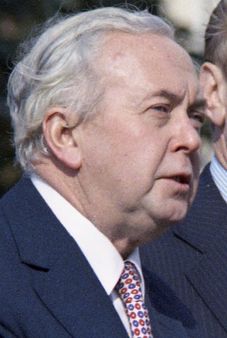
<span class="mw-page-title-main">October 1974 United Kingdom general election</span>

The October 1974 United Kingdom general election took place on Thursday 10 October 1974 to elect 635 members of the British House of Commons. It was the second general election held that year; the first year that two general elections were held in the same year since 1910; and the first time that two general elections were held less than a year apart from each other since the 1923 and 1924 elections, which took place 10 months apart. The election resulted in the Labour Party, led by Prime Minister Harold Wilson, winning a bare majority of three seats. That enabled the remainder of the Labour government to take place, but it saw a gradual loss of its majority.
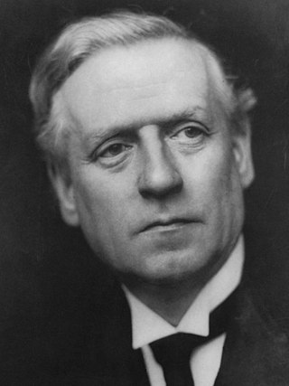
<span class="mw-page-title-main">Kingdom of England</span> State from the early 10th century to 1707

The Kingdom of England was a sovereign state on the island of Great Britain from the early 10th century, when it emerged from various Anglo-Saxon kingdoms, until May 1, 1707, when it united with Scotland to form the Kingdom of Great Britain, which would later become the United Kingdom. The Kingdom of England was among the most powerful states in Europe during the medieval and early modern colonial periods.

<span class="mw-page-title-main">December 1910 United Kingdom general election</span>

The December 1910 United Kingdom general election was held from 3 to 19 December. It was the last general election to be held over several days and the last to be held before the First World War.
<span class="mw-page-title-main">Lists of places in Wales</span>

These are lists of places in Wales.

<span class="mw-page-title-main">United Kingdom of Portugal, Brazil and the Algarves</span> Pluricontinental monarchy

The United Kingdom of Portugal, Brazil and the Algarves was a pluricontinental monarchy formed by the elevation of the Portuguese colony named State of Brazil to the status of a kingdom and by the simultaneous union of that Kingdom of Brazil with the Kingdom of Portugal and the Kingdom of the Algarves, constituting a single state consisting of three kingdoms.

<span class="mw-page-title-main">Unitary authorities of England</span> Local government in some parts of England

The unitary authorities of England are a type of local authority responsible for all local government services in an area. They combine the functions of a non-metropolitan county council and a non-metropolitan district council, which elsewhere in England provide two tiers of local government.

<span class="mw-page-title-main">Kingdom of Portugal</span> Kingdom in Southwestern Europe (1139–1910)

The Kingdom of Portugal was a monarchy in the western Iberian Peninsula and the predecessor of the modern Portuguese Republic. Existing to various extents between 1139 and 1910, it was also known as the Kingdom of Portugal and the Algarves after 1415, and as the United Kingdom of Portugal, Brazil and the Algarves between 1815 and 1822. The name is also often applied to the Portuguese Empire, the realm's overseas colonies.

<span class="mw-page-title-main">United Kingdom in the Eurovision Song Contest</span>

The United Kingdom has participated in the Eurovision Song Contest 65 times. It first took part in the second contest in 1957 and has entered every year since 1959. Along with Sweden and the Netherlands, the UK is one of only three countries with Eurovision victories in four different decades. It is one of the "Big Five" countries, along with France, Germany, Italy and Spain, that are automatically prequalified for the final each year as they are the biggest financial contributors to the European Broadcasting Union (EBU). The British national broadcaster, the BBC, broadcasts the event and has, on multiple occasions, organised different national selection processes to choose the British entry. The United Kingdom has won the Eurovision Song Contest five times, and has finished as runner-up on a record sixteen occasions. The UK has hosted the contest a record nine times, four times in London and once each in Edinburgh (1972), Brighton (1974), Harrogate (1982), Birmingham (1998), and Liverpool (2023).

<span class="mw-page-title-main">Countries of the United Kingdom</span> Component parts of the UK since 1922

Since 1922, the United Kingdom has been made up of four countries: England, Scotland, Wales and Northern Ireland. The UK Prime Minister's website has used the phrase "countries within a country" to describe the United Kingdom. Some statistical summaries, such as those for the twelve NUTS 1 regions of the UK, refer to Northern Ireland, Scotland, and Wales as "regions". With regard to Northern Ireland, Scotland and Wales particularly, the descriptive name one uses "can be controversial, with the choice often revealing one's political preferences".