This is a list of trails in the U.S. state of Alabama . [1] [2]
N/A
N/A

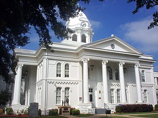
Colbert County is a county located in the northwestern part of the U.S. state of Alabama. As of the 2020 census the county's population was 57,227. The county seat is Tuscumbia. The largest city is Muscle Shoals.

Limestone County is a county of the U.S. state of Alabama. As of the 2020 census, the county's population was 103,570. Its county seat is Athens. The county is named after Limestone Creek. Limestone County is included in the Huntsville, AL Metropolitan Statistical Area.

Florence is a city in, and the county seat of, Lauderdale County, Alabama, United States, in the state's northwestern corner, and had a population of 40,184 in the 2020 census. Florence is located along the Tennessee River and is home to the University of North Alabama, the oldest public college in the state, which makes Florence a college town. Florence is located about 70 miles west of Huntsville, Alabama, via US-72.

Madison is a city located primarily in Madison County, near the northern border of the U.S. state of Alabama. Madison extends west into neighboring Limestone County. The city is included in the Huntsville Metropolitan Area, the second-largest in the state, and is also included in the merged Huntsville-Decatur Combined Statistical Area. The population was 56,933 at the 2020 census. Madison is bordered by Huntsville on nearly all sides with some small unincorporated lands within Madison in Madison and Limestone counties.

Prairie Creek Redwoods State Park is a state park, located in Humboldt County, California, near the town of Orick and 50 miles (80 km) north of Eureka. The 14,000 acres (57 km2) park is a coastal sanctuary for old-growth Coast Redwood trees.

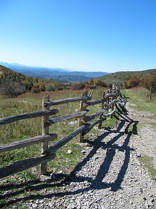
Grayson Highlands State Park is a state park located in Grayson County, Virginia, United States. It is adjacent to the Mount Rogers National Recreation Area and lies within the Jefferson National Forest. The park was established in 1965 and contains a total of 4,502 acres (1,822 ha). The park hosts a number of outdoor activities including hiking, camping, mountainbiking, horseback riding, and backpacking. A 2.8 mile (4.5 km) portion of the Appalachian Trail runs through the park in addition to a number of other hiking and horseback riding trails. The state park is musically notable as the home for the Grayson Highlands Fall Festival as well as weekly jam sessions by local folk musicians, who draw upon the traditional styles of the Blue Ridge area. The park is also home to the Wayne C. Henderson Festival and Guitar Competition, a regionally important festival and guitarist contest named for local notable guitar-maker Wayne Henderson.

The Erie National Wildlife Refuge is an 8,777-acre (3,552 ha) National Wildlife Refuge located in Crawford County, Pennsylvania. Named after the Erie tribe, it was established to provide waterfowl and other migratory birds with nesting, feeding, brooding, and resting habitat.

The Oak Leaf Trail is a paved 135-mile (217 km) multi-use recreational trail system which encircles Milwaukee County, Wisconsin. Clearly marked trail segments connect all of the major parks in the Milwaukee County Park System.

Salt Springs State Park is a Pennsylvania state park in Franklin Township, Susquehanna County, Pennsylvania, in the United States. The park is home to massive hemlock trees that are over 500 years old and are among the largest trees in all of Pennsylvania. The Fall Brook Natural Area within the park is recognized as a part of the Old-Growth Forest Network. The park also features a gorge with three waterfalls on Fall Brook. Salt Springs State Park is 7 miles (11 km) north of Montrose, just off Pennsylvania Route 29. The park is the only state park in Pennsylvania that is managed by a non-profit organization, the Friends of Salt Springs Park. The state owns 405 acres (164 ha) of land and the Friends own an additional 437 acres (177 ha) bringing the total amount of protected land to 842 acres (341 ha).

The Tryon Creek State Natural Area is a state park located primarily in Portland, in the U.S. state of Oregon. It is the only Oregon state park within a major metropolitan area. The 645-acre (261 ha) park lies between Boones Ferry Road and Terwilliger Boulevard in southwest Portland in Multnomah County and northern Lake Oswego in Clackamas County and is bisected from north to south by Tryon Creek. To the north, the park abuts the Lewis & Clark Law School campus.

The Madison County Nature Trail a.k.a. Green Mountain Nature Trail is a 72-acre (29 ha) park in Huntsville, Alabama. It is located above the surrounding communities atop Green Mountain in southeast Huntsville. A 1.5-mile (2.4 km) trail surrounds 17-acre (6.9 ha) Sky Lake. Facilities include a covered bridge, picnic area and open air pavilion. The Nature Trail is recognized as a Treasure Forest by the Alabama Forestry Commission. It is also considered a Wildlife Sanctuary. The entire park is owned, operated and funded by the Madison County Commission although it lies within the city limits of Huntsville.

The Springwater Corridor Trail is a bicycle and pedestrian rail trail in the Portland metropolitan area in Oregon, United States. It follows a former railway line from Boring through Gresham to Portland, where it ends south of the Eastbank Esplanade. Most of the corridor, about 21 miles (34 km) long, consists of paved, off-street trail, though about 1 mile (1.6 km) overlaps city streets in Portland's Sellwood neighborhood. A large segment roughly follows the course of Johnson Creek and crosses it on bridges many times. Much of the corridor was acquired by the City of Portland in 1990; remaining segments were acquired by Metro thereafter.

The 40-Mile Loop is a partially completed greenway trail around and through Portland in the U.S. state of Oregon. It was proposed in 1903 by the Olmsted Brothers architecture firm as part of the development of Forest Park. One greenway expert calls it "one of the most creative and resourceful greenway projects in the country."

State Route 133 (SR 133) is a 16.976-mile-long (27.320 km) mostly multi-lane state highway and is a primary artery through the Florence–Muscle Shoals metropolitan area in the northwestern part of the U.S. state of Alabama.

This is a list of trails and greenways in Detroit.

An extensive collection of parks and greenways exists in Huntsville, Alabama for the public's recreational use.

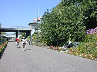
Minneapolis is often considered one of the top biking and walking cities in the United States due to its vast network of trails and dedicated pedestrian areas. In 2020, Walk Score rated Minneapolis as 13th highest among cities over 200,000 people. Some bicycling ratings list Minneapolis at the top of all United States cities, while others list Minneapolis in the top ten. There are over 80 miles (130 km) of paved, protected pathways in Minneapolis for use as transportation and recreation. The city's Grand Rounds National Scenic Byway parkway system accounts for the vast majority of the city's shared-use paths at approximately 50 miles (80 km) of dedicated biking and walking areas. By 2008, other city, county, and park board areas accounted for approximately 30 miles (48 km) of additional trails, for a city-wide total of approximately 80 miles (130 km) of protected pathways. The network of shared biking and walking paths continued to grow into the late 2010s with the additions of the Hiawatha LRT Trail gap remediation, Min Hi Line pilot projects, and Samatar Crossing. The city also features several natural-surface hiking trails, mountain-biking paths, groomed cross-country ski trails in winter, and other pedestrian walkways.

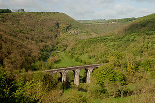
The White Peak Loop is a 60-mile (97 km) route for walking, cycling and horse riding in the Peak District of England. The trail combines sections of the High Peak Trail and the Monsal Trail with linking sections through the towns of Buxton, Bakewell and Matlock. The White Peak Loop is being developed by Derbyshire County Council and as of 2022 some sections are not yet complete.