Lolobau Island

Last updated
Lolobau Island Lolobau Island (Landsat).JPG
Lolobau Island
Lolobau Island is to the north of New Britain island NewBritainOMC.png
Lolobau Island is to the north of New Britain island
Lolobau Island (bottom) and Likuruanga, Ulawun and Bamus volcanoes on New Britain island. Bamus, Ulawun, and Lolobau from space.jpg
Lolobau Island (bottom) and Likuruanga, Ulawun and Bamus volcanoes on New Britain island.
Lolobau Island as seen from the mainland, 1970 Lolobau.jpg
Lolobau Island as seen from the mainland, 1970

Lolobau Island is an island in the Bismarck Sea, within the West New Britain Province of the Islands Region, in northern Papua New Guinea.

Contents

During World War II a number military actions occurred near Lolobau Island including in early 1943. [1] For example, on May 3, 1943 B-24 Liberator of the United States 5th Air forces attacked shipping near the island. [2]

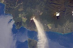
Lolobau Island is home to the Lolobau Volcano. [3] It is recorded as having erupted in the 20th century. [4]

Geography

It is a volcanic island of the Bismarck Archipelago group.

It is located just north of New Britain island in the archipelago. Ulawun is an active volcano across the strait from Lolobau Island.

See also

References

  1. PacificWrecks.com. "Pacific Wrecks" . Retrieved 2018-01-24.
  2. PacificWrecks.com. "Pacific Wrecks" . Retrieved 2018-01-24.
  3. "Lolobau". 27 April 2011.
  4. "Lolobau volcano, Papua New Guinea, Volcano Photo".

4°55′00″S151°10′00″E / 4.9167°S 151.1667°E / -4.9167; 151.1667