National Register of Historic Places listings in Greene County, Arkansas

Last updated

Location of Greene County in Arkansas Map of Arkansas highlighting Greene County.svg
Location of Greene County in Arkansas

This is a list of the National Register of Historic Places listings in Greene County, Arkansas.

Contents

This is intended to be a complete list of the properties and districts on the National Register of Historic Places in Greene County, Arkansas, United States. The locations of National Register properties and districts for which the latitude and longitude coordinates are included below, may be seen in a map. [1]

There are 18 properties and districts listed on the National Register in the county.

Contents: Counties in Arkansas


    This National Park Service list is complete through NPS recent listings posted September 9, 2022. [2]

Map all coordinates using: OpenStreetMap  
Download coordinates as: KML

Current listings

[3] Name on the Register [4] ImageDate listed [5] Location City or townDescription
1 Beisel-Mitchell House
Beisel-Mitchell House Beisel-Mitchell House.jpg
Beisel-Mitchell House
September 27, 1996
(#96001031)
420 W. Court St.
36°03′21″N90°29′27″W / 36.055833°N 90.490833°W / 36.055833; -90.490833 (Beisel-Mitchell House)
Paragould
2 Crowley's Ridge State Park-Bathhouse
Crowley's Ridge State Park-Bathhouse Crowleys Ridge State Park Lake Ponder Trail Paragould AR 18.jpg
Crowley's Ridge State Park-Bathhouse
May 28, 1992
(#92000537)
Main service center area access road in Crowley's Ridge State Park
36°02′45″N90°39′50″W / 36.045833°N 90.663889°W / 36.045833; -90.663889 (Crowley's Ridge State Park-Bathhouse)
Walcott
3 Crowley's Ridge State Park-Bridge
Crowley's Ridge State Park-Bridge Crowley's Ridge State Park-Bridge.jpg
Crowley's Ridge State Park-Bridge
May 28, 1992
(#92000540)
Main service center area access road in Crowley's Ridge State Park
36°02′42″N90°39′47″W / 36.045°N 90.663056°W / 36.045; -90.663056 (Crowley's Ridge State Park-Bridge)
Walcott
4 Crowley's Ridge State Park-Comfort Station
Crowley's Ridge State Park-Comfort Station Comfort Station.jpg
Crowley's Ridge State Park-Comfort Station
May 28, 1992
(#92000538)
Campground and cabin area access road in Crowley's Ridge State Park
36°02′37″N90°39′37″W / 36.043611°N 90.660278°W / 36.043611; -90.660278 (Crowley's Ridge State Park-Comfort Station)
Walcott
5 Crowley's Ridge State Park-Dining Hall
Crowley's Ridge State Park-Dining Hall Crowley's Ridge State Park-Dining Hall.jpg
Crowley's Ridge State Park-Dining Hall
May 28, 1992
(#92000536)
Employee housing area access road in Crowley's Ridge State Park
36°02′59″N90°39′48″W / 36.049722°N 90.663333°W / 36.049722; -90.663333 (Crowley's Ridge State Park-Dining Hall)
Walcott
6 George Ray's Dragstrip
George Ray's Dragstrip George Ray's Dragstrip.jpg
George Ray's Dragstrip
February 21, 2006
(#06000075)
Highway 135, 0.5 miles south of U.S. Route 412
36°02′50″N90°26′04″W / 36.047222°N 90.434444°W / 36.047222; -90.434444 (George Ray's Dragstrip)
Paragould
7 Greene County Courthouse
Greene County Courthouse Paragould AR 2011 06 23 003.jpg
Greene County Courthouse
August 11, 1976
(#76000412)
Court Sq.
36°03′14″N90°29′12″W / 36.053889°N 90.486667°W / 36.053889; -90.486667 (Greene County Courthouse)
Paragould
8 Gulf Oil Company Service Station
Gulf Oil Company Service Station Gulf Oil Company Service Station.jpg
Gulf Oil Company Service Station
August 16, 1994
(#94000850)
Southeastern corner of the junction of Main and S. 3rd Sts.
36°03′15″N90°29′17″W / 36.054167°N 90.488056°W / 36.054167; -90.488056 (Gulf Oil Company Service Station)
Paragould
9 Highfill-McClure House
Highfill-McClure House Highfill-McClure HouseHouse.jpg
Highfill-McClure House
March 28, 2002
(#02000260)
701 W. Highland St.
36°03′28″N90°29′40″W / 36.057778°N 90.494444°W / 36.057778; -90.494444 (Highfill-McClure House)
Paragould
10 Jackson-Herget House
Jackson-Herget House Jackson-Herget House.jpg
Jackson-Herget House
July 24, 1992
(#92000907)
206 S. 4th St.
36°03′18″N90°29′26″W / 36.055°N 90.490556°W / 36.055; -90.490556 (Jackson-Herget House)
Paragould
11 Linwood Mausoleum
Linwood Mausoleum Linwood Mausuleum Paragould AR 001.jpg
Linwood Mausoleum
January 29, 2007
(#06001314)
Junction of W. Kingshighway and Linwood Dr.
36°03′04″N90°30′11″W / 36.051111°N 90.503056°W / 36.051111; -90.503056 (Linwood Mausoleum)
Paragould
12 National Bank of Commerce Building
National Bank of Commerce Building Paragould AR 2011 06 23 023.jpg
National Bank of Commerce Building
May 14, 1993
(#93000423)
200 S. Pruett St.
36°03′19″N90°29′11″W / 36.055278°N 90.486389°W / 36.055278; -90.486389 (National Bank of Commerce Building)
Paragould
13 Old Bethel Methodist Church
Old Bethel Methodist Church Old Bethel Methodist.jpg
Old Bethel Methodist Church
April 19, 1978
(#78000590)
West of Paragould off Highway 141
36°00′46″N90°39′30″W / 36.012778°N 90.658333°W / 36.012778; -90.658333 (Old Bethel Methodist Church)
Paragould
14 Paragould Downtown Commercial Historic District
Paragould Downtown Commercial Historic District Paragould AR 2011 06 23 018.jpg
Paragould Downtown Commercial Historic District
July 18, 2003
(#03000646)
Roughly bounded by 3rd Ave., Kings Highway, 3½ St., and W. Highland St.
36°03′19″N90°29′13″W / 36.055278°N 90.486944°W / 36.055278; -90.486944 (Paragould Downtown Commercial Historic District)
Paragould
15 Paragould War Memorial
Paragould War Memorial Paragould AR 2011 06 23 013.jpg
Paragould War Memorial
June 20, 1997
(#97000554)
Junction of 3rd and Court Sts.
36°03′21″N90°29′20″W / 36.055833°N 90.488889°W / 36.055833; -90.488889 (Paragould War Memorial)
Paragould
16 St. Mary's Catholic Church
St. Mary's Catholic Church St. Mary's Catholic Church Paragould, Arkansas.JPG
St. Mary's Catholic Church
January 27, 2015
(#14001198)
301 W. Highland
36°03′30″N90°29′16″W / 36.0584°N 90.4877°W / 36.0584; -90.4877 (St. Mary's Catholic Church)
Paragould
17 Standard Oil Company Oil Station Garage Building September 16, 2022
(#100008154)
202 West Vine St.
36°03′05″N90°29′17″W / 36.0515°N 90.4880°W / 36.0515; -90.4880 (Standard Oil Company Oil Station Garage Building)
Paragould
18 Texaco Station No. 1
Texaco Station No. 1 Texaco Station No. 1.jpg
Texaco Station No. 1
July 20, 2001
(#01000718)
110 E. Main St.
36°03′16″N90°29′09″W / 36.054444°N 90.485833°W / 36.054444; -90.485833 (Texaco Station No. 1)
Paragould

Former listings

[3] Name on the RegisterImageDate listedDate removedLocationCity or townDescription
1 Big Slough Ditch Bridge June 9, 2000
(#00000629)
September 24, 2004County Road 855
Brighton vicinity
2 Eight Mile Creek Bridge
Eight Mile Creek Bridge Eight Mile Creek Bridge, Paragould, Arkansas.jpg
Eight Mile Creek Bridge
April 6, 1990
(#90000524)
September 24, 2004AR 135
Paragould vicinityReplaced in 2001.

See also

Related Research Articles

<span class="mw-page-title-main">National Register of Historic Places listings in Greene County, New York</span>

List of the National Register of Historic Places listings in Greene County, New York

<span class="mw-page-title-main">National Register of Historic Places listings in Greene County, Virginia</span>

This is a list of the National Register of Historic Places listings in Greene County, Virginia.

<span class="mw-page-title-main">National Register of Historic Places listings in Carroll County, Arkansas</span>

This is a list of the National Register of Historic Places listings in Carroll County, Arkansas.

<span class="mw-page-title-main">National Register of Historic Places listings in Arkansas County, Arkansas</span>

This is a list of the National Register of Historic Places listings in Arkansas County, Arkansas.

<span class="mw-page-title-main">National Register of Historic Places listings in Desha County, Arkansas</span>

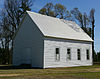
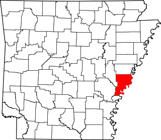
This is a list of the National Register of Historic Places listings in Desha County, Arkansas.

<span class="mw-page-title-main">National Register of Historic Places listings in Cross County, Arkansas</span>

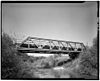
This is a list of the National Register of Historic Places listings in Cross County, Arkansas.

<span class="mw-page-title-main">National Register of Historic Places listings in Cleveland County, Arkansas</span>

This is a list of the National Register of Historic Places listings in Cleveland County, Arkansas.

<span class="mw-page-title-main">National Register of Historic Places listings in Garland County, Arkansas</span>

This is a list of the National Register of Historic Places listings in Garland County, Arkansas.

<span class="mw-page-title-main">National Register of Historic Places listings in Dallas County, Arkansas</span>

This is a list of the National Register of Historic Places listings in Dallas County, Arkansas.

<span class="mw-page-title-main">National Register of Historic Places listings in Independence County, Arkansas</span>

This is a list of the National Register of Historic Places listings in Independence County, Arkansas.

<span class="mw-page-title-main">National Register of Historic Places listings in Lee County, Arkansas</span>

This is a list of the National Register of Historic Places listings in Lee County, Arkansas.

<span class="mw-page-title-main">National Register of Historic Places listings in Lonoke County, Arkansas</span>

This is a list of the National Register of Historic Places listings in Lonoke County, Arkansas.

<span class="mw-page-title-main">National Register of Historic Places listings in Ouachita County, Arkansas</span>

This is a list of the National Register of Historic Places listings in Ouachita County, Arkansas.

<span class="mw-page-title-main">National Register of Historic Places listings in Phillips County, Arkansas</span>

This is a list of the National Register of Historic Places listings in Phillips County, Arkansas.

<span class="mw-page-title-main">National Register of Historic Places listings in Miller County, Arkansas</span>

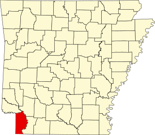
This is a list of the National Register of Historic Places listings in Miller County, Arkansas.

<span class="mw-page-title-main">National Register of Historic Places listings in Polk County, Arkansas</span>

This is a list of the National Register of Historic Places listings in Polk County, Arkansas.

<span class="mw-page-title-main">National Register of Historic Places listings in Searcy County, Arkansas</span>

This is a list of the National Register of Historic Places listings in Searcy County, Arkansas.

<span class="mw-page-title-main">National Register of Historic Places listings in Stone County, Arkansas</span>

This is a list of the National Register of Historic Places listings in Stone County, Arkansas.

<span class="mw-page-title-main">National Register of Historic Places listings in White County, Arkansas</span>

This is a list of the National Register of Historic Places listings in White County, Arkansas.

<span class="mw-page-title-main">National Register of Historic Places listings in Greene County, North Carolina</span>

This list includes properties and districts listed on the National Register of Historic Places in Greene County, North Carolina. Click the "Map of all coordinates" link to the right to view a Google map of all properties and districts with latitude and longitude coordinates in the table below.

References

  1. The latitude and longitude information provided in this table was derived originally from the National Register Information System, which has been found to be fairly accurate for about 99% of listings. Some locations in this table may have been corrected to current GPS standards.
  2. National Park Service, United States Department of the Interior, "National Register of Historic Places: Weekly List Actions", retrieved September 9, 2022.
  3. 1 2 Numbers represent an alphabetical ordering by significant words. Various colorings, defined here, differentiate National Historic Landmarks and historic districts from other NRHP buildings, structures, sites or objects.
  4. "National Register Information System". National Register of Historic Places . National Park Service. March 13, 2009.
  5. The eight-digit number below each date is the number assigned to each location in the National Register Information System database, which can be viewed by clicking the number.