New River, Arizona | |
---|---|
Coordinates: 33°52′09″N112°05′09″W / 33.86917°N 112.08583°W | |
Country | United States |
State | Arizona |
County | Maricopa |
Area | |
• Total | 56.12 sq mi (145.35 km2) |
• Land | 56.11 sq mi (145.32 km2) |
• Water | 0.01 sq mi (0.03 km2) |
Elevation | 2,136 ft (651 m) |
Population | |
• Total | 17,290 |
• Density | 308.16/sq mi (118.98/km2) |
Time zone | UTC-7 (MST) |
ZIP codes | 85087 (New River) 85086 (Phoenix) |
Area code | 623 |
FIPS code | 04-49360 |
GNIS feature ID | 2408920 [2] |
New River is an unincorporated community and census-designated place (CDP) in Maricopa County, Arizona, United States. The population was 17,290 as of the 2020 census, [3] up from 14,952 at the 2010 census. [4]
New River is named after the seasonal wash of the same name, part of the Agua Fria River system which drains into the Salt River. The community was founded by Lord Darrell Duppa in 1868 as a stagecoach stop. For many years it was the terminus of the old Black Canyon Highway (now Interstate 17). The pavement ended in New River and continued as a dirt road to the city of Prescott. [5]
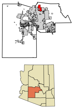
New River is located in northern Maricopa County and is bordered by the Tonto National Forest to the north, Cave Creek to the east, Phoenix to the south, and Phoenix and Anthem to the west. The CDP includes the area known as Desert Hills. New River is approximately 36 miles (58 km) north of downtown Phoenix.
According to the United States Census Bureau, the CDP has a total area of 56.1 square miles (145 km2), of which 0.01 square miles (0.03 km2), or 0.02%, are water. [1] 3,176-foot (968 m) Daisy Mountain and 2,980-foot (910 m) Gavilan Peak are within the community.
Census | Pop. | Note | %± |
---|---|---|---|
2000 | 10,740 | — | |
2010 | 14,952 | 39.2% | |
2020 | 17,290 | 15.6% | |
U.S. Decennial Census [6] |
As of the census of 2000, there were 10,740 people, 3,921 households, and 3,066 families residing in the CDP. The population density was 151.6 inhabitants per square mile (58.5/km2). There were 4,514 housing units at an average density of 63.7 per square mile (24.6/km2). The racial makeup of the CDP was 95.9% White, 0.4% Black or African American, 0.6% Native American, 0.5% Asian, 0.1% Pacific Islander, 1.3% from other races, and 1.4% from two or more races. 4.9% of the population were Hispanic or Latino of any race.
There were 3,921 households, out of which 35.3% had children under the age of 18 living with them, 68.9% were married couples living together, 5.6% had a female householder with no husband present, and 21.8% were non-families. 15.3% of all households were made up of individuals, and 2.9% had someone living alone who was 65 years of age or older. The average household size was 2.73 and the average family size was 3.04.
In the CDP, the population was spread out, with 26.0% under the age of 18, 4.8% from 18 to 24, 33.2% from 25 to 44, 28.5% from 45 to 64, and 7.5% who were 65 years of age or older. The median age was 38 years. For every 100 females, there were 103.9 males. For every 100 females age 18 and over, there were 102.4 males.
The median income for a household in the CDP was $62,307, and the median income for a family was $68,604. Males had a median income of $46,361 versus $31,610 for females. The per capita income for the CDP was $25,932. About 3.6% of families and 5.7% of the population were below the poverty line, including 5.5% of those under age 18 and 3.1% of those age 65 or over.
As of the census of 2010 the population of the New River CDP area was 14,952. This is nearly a two thirds growth from the previous census. The total housing units nearly doubled from 3,921 in 2000 to 6,753 in 2010. [7]
New River CDP area is within Maricopa County District 3. According to 2010 census numbers, the New River CDP consists of about 2% of Maricopa County District 3 and only 0.3% of Maricopa County. [8]
New River is served by Deer Valley Unified School District.
Fire and emergency service is provided through the Daisy Mountain Fire District. [9]
Many residents previously relied on water delivered by state-licensed water haulers from fire hydrants located in Phoenix. As of August 2018, water is hauled from a filling station operated by Epcor. [10] [11]
New River, and its neighbor Desert Hills, are unincorporated areas in Maricopa County which in 2019 was named the fastest-growing county in the United States for the third year running. While parts of Maricopa have had considerable development, New River has held off. New River has attempted to "incorporate" a number of times in its history, so as to control zoning regulations and development in the area. [12]
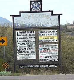
Pictured are some of the few remaining historic structures of New River. [22]
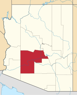
Maricopa County is a county in the south-central part of the U.S. state of Arizona. As of the 2020 census the population was 4,420,568, or about 62% of the state's total, making it the fourth-most populous county in the United States and the most populous county in Arizona, and making Arizona one of the nation's most centralized states. The county seat is Phoenix, the state capital and fifth-most populous city in the United States.
Pinal County is a county in the central part of the U.S. state of Arizona. According to the 2020 census, the population of the county was 425,264, making it Arizona's third-most populous county. The county seat is Florence. The county was established in 1875.
Yavapai County is a county near the center of the U.S. state of Arizona. As of the 2020 census, its population was 236,209, making it the fourth-most populous county in Arizona. The county seat is Prescott.
Yuma County is a county in the southwestern corner of the U.S. state of Arizona. As of the 2020 census, its population was 203,881. The county seat is Yuma.
Ehrenberg, also historically spelled "Ehrenburg", is an unincorporated community and census-designated place (CDP) in La Paz County, Arizona, United States. The population was 1,470 at the 2010 census. Ehrenberg is named for its founder, Herman Ehrenberg.
Avondale is a city in Maricopa County, Arizona, United States, adjacent to Phoenix. As of the 2020 census, the population of the city was 89,334, up from 76,238 in 2010 and 35,883 in 2000.
Buckeye is a city in Maricopa County, Arizona, United States. It is Arizona's second-largest city by area, and it is the westernmost suburb in the Phoenix Metropolitan Area. As of the 2020 census, the population was 91,502, up from 50,876 in 2010, and 6,537 in 2000. It was the fastest-growing city in the United States for 2017, 2018, and 2021.
Cave Creek is a town in Maricopa County, Arizona, United States. It is part of the Phoenix metropolitan area. As of the 2020 census, the population of the town was 4,892.
Gila Bend, founded in 1872, is a town in Maricopa County, Arizona, United States. The town is named for an approximately 90-degree bend in the Gila River, which is near the community's current location. As of the 2020 census, the population of the town was 1,892.
Paradise Valley is a desert and mountain town in Arizona east of state capital Phoenix, of which it is a suburb. The town is known for its golf courses, shopping, real estate, and restaurant scene. According to the 2020 census, its population was 12,658.
Rio Verde is a master-planned community east of Scottsdale in Arizona. It is a census-designated place (CDP) in Maricopa County, Arizona, United States located in the far northeast area of the Phoenix Metropolitan Area. The population was 2,210 as of the 2020 census, up from 1,811 at the 2010 census.
Sun City is an unincorporated community and census-designated place in Maricopa County, Arizona, United States, that is located within the Phoenix metropolitan area.
Sun City West is an unincorporated community and census-designated place (CDP) in Maricopa County, Arizona, United States. The population was 25,806 at the 2020 census.
Sun Lakes is an unincorporated community and census-designated place (CDP) in Maricopa County, Arizona, United States. The population was 14,868 at the 2020 census. Sun Lakes is an active adult community comprising five country club communities in three homeowner associations. These include the gated communities of Oakwood and IronWood (IronOaks), the gated and non-gated communities of Palo Verde and Cottonwood, and the non-gated community of Sun Lakes 1.
Desert Hills is an unincorporated community and census-designated place (CDP) in Mohave County, Arizona, United States. The population was 2,764 at the 2020 census, up from 2,245 at the 2010 census.
Maricopa is a city in the Gila River Valley in Pinal County, Arizona, United States. With 66,290 residents as of 2022, Maricopa is the largest incorporated municipality in Pinal County.
Black Canyon City is an unincorporated community and census-designated place (CDP) in Yavapai County, Arizona, United States. The population is 2,677 as of the 2020 census.
Tonopah is an unincorporated community and census-designated place (CDP) in western Maricopa County, Arizona, United States, 52 miles (84 km) west of downtown Phoenix off Interstate 10. The community is near the Palo Verde Nuclear Generating Station, the largest power producer in the country, nuclear or otherwise. As of the 2020 census, the population of Tonopah was 23, down from 60 at the 2010 census.
Anthem is a planned community and census-designated place in Maricopa County, Arizona, United States, within the Phoenix Metropolitan Area. As of the 2020 census, the population of the Anthem was 23,190.
Komatke is a census-designated place in Maricopa County, Arizona, United States. The area currently comprising the census-designated place had a population of 1,013 at the 2020 census, up from 821 at the 2010 census. It is located within the Gila River Indian Community. Its name refers to the Sierra Estrella mountain range, which rises just to the southwest of Komatke.
Supporters of the New River Desert Hills incorporation are hoping to get the question on the ballot in November. The last town to incorporate in Arizona was Tusayan in 2010, according to Ken Strobeck, executive director of the Arizona League of Cities and Towns. In order to get incorporation on the ballot, incorporation supporters must collect signatures from at least 10 percent of registered voters in the proposed city limits.
The group also needs to collect signatures from 10% of registered voters in the area to put the measure on the November ballot. Ricci said this effort has been going on for three decades, but they've never been able to bring issue to a vote.