
Granville is a suburb in Western Sydney, in the state of New South Wales, Australia. Granville is located 18 kilometres (11 mi) west of the Sydney central business district, split between the local government areas of Cumberland City Council and the City of Parramatta.
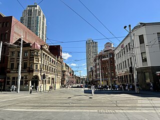
Haymarket is an inner city suburb of Sydney, New South Wales, Australia. It is located at the southern end of the Sydney central business district in the local government area of the City of Sydney. Haymarket includes much of Sydney's Chinatown, Thaitown and Railway Square localities. Haymarket is adjacent to Darling Harbour and is surrounded by the suburbs of Ultimo, Chippendale, Surry Hills and the Sydney CBD.

Chippendale is a small inner-city suburb of Sydney, New South Wales, Australia on the southern edge of the Sydney central business district, in the local government area of the City of Sydney. Chippendale is located between Broadway to the north and Cleveland Street to the south, Central railway station to the east and the University of Sydney to the west.

Rozelle is a suburb in the inner west of Sydney, in the state of New South Wales, Australia. It is located 4 kilometres west of the Sydney central business district, in the local government area of the Inner West Council.
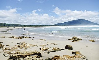
Old Bar is a coastal town in New South Wales, Australia in Mid-Coast Council. It lies around 18 kilometres (11 mi) east of Taree on the Mid North Coast, and around 315 kilometres (196 mi) north of Sydney.

Bellevue Hill is a harbourside suburb in the eastern suburbs of Sydney, in the state of New South Wales, Australia, located five kilometres east of the Sydney central business district, in the Municipality of Woollahra.

Agnes Banks is a suburb of Sydney, in the state of New South Wales, Australia. Agnes Banks is 68 kilometres (42 mi) north-west of the Sydney central business district, in the local government areas of the City of Penrith and City of Hawkesbury. It is part of the Greater Western Sydney region.
Castle Cove is a suburb on the lower North Shore of Sydney, in the state of New South Wales, Australia. Castle Cove is located 11 km (6.8 mi) north of the Sydney central business district, in the local government area of the City of Willoughby. Castle Cove is situated on the western side of Middle Harbour.

Wyoming is a suburb of the Central Coast region of New South Wales, Australia, located 4 kilometres (2 mi) northeast of Gosford's central business district. It is part of the Central Coast Council local government area.
Toukley is a town in the Central Coast region of the Australian state of New South Wales and is located within Central Coast Council. It lies approximately 109 km north of Sydney and 54 km south of Newcastle via the Pacific Motorway (M1). It is located between Tuggerah Lake, Budgewoi Lake, and the Pacific Ocean. At the channel connecting Tuggerah Lake and Budgewoi Lake the new Toukley bridge was constructed between 1983 and 1985 linking Toukley on the eastern side of the Lakes system with Gorokan on the west, replacing the old two lane wooden bridge.

Rushcutters Bay is a harbourside inner-east suburb of Sydney, in the state of New South Wales, Australia, 3 kilometres east of the Sydney central business district in the local government area of the City of Sydney.

Rosehill is a suburb of Sydney, in the state of New South Wales, Australia. Rosehill is located 18 kilometres west of the Sydney central business district in the local government area of the City of Parramatta and is part of the Greater Western Sydney region.

North Bondi is a coastal, eastern suburb of Sydney, in the state of New South Wales, Australia 7 kilometres east of the Sydney central business district, in the local government area of Waverley Council.

Harris Park is a suburb of Greater Western Sydney, in the state of New South Wales, Australia. Harris Park is located 19 kilometres west of the Sydney central business district in the local government area of the City of Parramatta and is part of the Greater Western Sydney region. Harris Park has a sizeable Indian and Hindu diaspora, which together make up the largest ethnic and religious grouping in the suburb.

Norah Head, originally known as Bungaree Noragh Point, is a headland and a coastal village in the Central Coast Council local government area on the Central Coast of New South Wales, Australia. Norah Head is known for its great surfing and clear beaches like Soldiers Beach near Wyrrabalong National Park and Pebbly Beach with Norah Head Rock Pool. The town is home to Norah Head Lighthouse with scenic views along the coast.

Canton Beach is a suburb located on the Central Coast of New South Wales, Australia, as part of the Central Coast Council local government area. It is next to Toukley which is a large residential and holiday town.

Kyogle Council is a local government area in the Northern Rivers region of New South Wales, Australia.

City of Wagga Wagga is a local government area in the Riverina region of southern New South Wales, Australia.

Muswellbrook Shire is a local government area in the Upper Hunter region of New South Wales, Australia. The Shire is situated adjacent to the New England Highway and the Hunter railway line.
Booral is a locality in the Mid-Coast Council local government area in the Mid North Coast region of New South Wales, Australia. It had a population of 407 as of the 2016 census.

