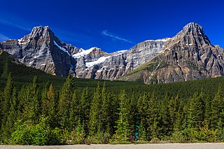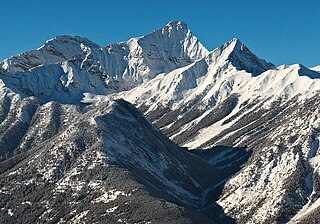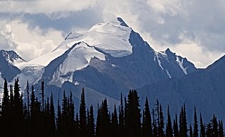
Mount Columbia is a mountain located in the Winston Churchill Range of the Rocky Mountains. It is the highest point in Alberta, Canada, and is second only to Mount Robson for height and topographical prominence in the Canadian Rockies. It is located on the border between Alberta and British Columbia on the northern edge of the Columbia Icefield. Its highest point, however, lies within Jasper National Park in Alberta.

Mount Hungabee, officially Hungabee Mountain, is a mountain located on the boundaries of Banff National Park and Yoho National Park on the Continental Divide at the head of Paradise Valley, in Canada. The peak was named in 1894 by Samuel Allen after the Stoney Indian word for "chieftain" as the mountain is higher than its neighbouring peaks. The mountain can be seen from the Icefields Parkway (#93) in the upper Bow Valley.

Mount Field is a mountain located about 4 km (2 mi) northeast of the town of Field in Yoho National Park, Canada. The mountain was named in 1884 after Cyrus West Field, an American merchant who had laid the first Atlantic cable, 1858, a second in 1866; Mr. Field was visiting the Canadian Rockies the year as a guest of the CPR who were building the national railway, at the naming of a station and a mountain. Precipitation runoff from Mount Field drains into the Kicking Horse River. Topographic relief is significant as the summit rises 1,360 meters (4,462 feet) above the river in two kilometers (1.2 mile). The Trans-Canada Highway traverses the southern foot of the mountain.

Mount Saskatchewan is a mountain located in the North Saskatchewan River valley of Banff National Park, in the Canadian Rockies of Alberta, Canada.

The Vermilion Range is a mountain range of the Canadian Rockies, in Banff National Park, Canada. The range is east of the Sawback Range and west of the Bare and Palliser Ranges.

Howse Peak is the highest mountain in the Waputik Mountains, a subrange of the Canadian Rockies. It is located 5 km (3 mi) west of the Icefields Parkway, above Chephren Lake, on the continental divide between Alberta and British Columbia. At 3,295 m (10,810 ft), it is the 46th highest peak in Alberta, and the 59th highest in British Columbia.

Aiguille Peak is a peak located on the Canadian provincial boundary of Alberta and British Columbia in Banff National Park. It was named in 1915 by Arthur O. Wheeler. "Aiguille" is French for "needle" and is also a mountaineering term for a sharp-ridged summit.

Mount Haig is located on the border of Alberta and British Columbia on the Continental Divide. It was named in 1862 after Haig, Captain R.W. Mount Haig is the highest peak of Gravenstafel Ridge; its lower north and east faces feature as back country cat skiing for Castle Mountain Resort on neighbouring Gravenstafel Mountain.

Mount Nelson is a prominent 3,313-metre (10,869-foot) mountain summit located in the Purcell Mountains of southeast British Columbia, Canada. It is situated on the west side of Rocky Mountain Trench, 23 km (14 mi) west of Invermere, and 8 km (5.0 mi) west of Panorama Mountain Resort. Sitting atop the peak is a 5 foot tall aluminum cross that marks the summit and acts as a storage unit for the summit register. It was built and erected in 1986 by the Kloos family out of Invermere, BC.

Eagle Peak, is a 2,846-metre (9,337-foot) mountain summit located in Glacier National Park in the Selkirk Mountains in British Columbia, Canada. Its nearest higher peak is Uto Peak, 1.0 km (0.62 mi) to the east. Mount Sir Donald is 2.0 km (1.2 mi) to the southeast, and Mount Macdonald 4.0 km (2.5 mi) to the north. The Avalanche Glacier is situated on the northeast side of the peak. The peak is visible from eastbound Highway 1, the Trans-Canada Highway approaching Rogers Pass.

The Marshall is a 3,180-metre (10,430-foot) mountain summit located in Mount Assiniboine Provincial Park, in the Canadian Rockies of British Columbia, Canada. Its nearest higher peak is Mount Assiniboine, 3.0 km (1.9 mi) to the east-southeast. The mountain is situated west of Wedgwood Peak.

Sunburst Peaks is a 2,849-metre (9,347-foot) mountain summit located in Mount Assiniboine Provincial Park, in the Canadian Rockies of British Columbia, Canada. Its nearest higher peak is Wedgwood Peak, 1.0 km (0.62 mi) to the south. The mountain is situated immediately southeast of Sunburst Lake, west of Lake Magog, and south of Cerulean Lake.

Naiset Point is a 2,755-metre (9,039-foot) mountain summit located in Mount Assiniboine Provincial Park, in the Canadian Rockies of British Columbia, Canada. The mountain is situated 1.0 km (0.62 mi) southeast of Lake Magog, and at the end of the ridge extending north from Terrapin Mountain. Naiset Point is composed of sedimentary rock laid down during the Cambrian period. Formed in shallow seas, this sedimentary rock was pushed east and over the top of younger rock during the Laramide orogeny.

Mount Rogers, is a 3,169-metre (10,397-foot) massif located in Glacier National Park in the Selkirk Mountains of British Columbia, Canada. Mount Rogers is situated at the north end of the Hermit Range, and is the highest point of the range. Its nearest higher peak is Mount Sir Donald, 12.57 km (7.81 mi) to the southeast. The peak is prominently visible from eastbound Highway 1, the Trans-Canada Highway at Rogers Pass. The Rogers massif includes five individually-named summits: Rogers Peak, Grant Peak, Fleming Peak, Swiss Peak, and Truda Peaks. Numerous glaciers radiate from all sides, including the Rogers Glacier, Swiss Glacier, Tupper Glacier, and Hermit Glacier.

Avalanche Mountain is a 2,861-metre (9,386-foot) summit in Glacier National Park in the Selkirk Mountains in British Columbia, Canada. Its nearest higher peak is Mount Macdonald, 2.2 km (1.4 mi) to the north. Mount Sir Donald is 3.83 km (2.38 mi) to the southeast, and Eagle Peak is 1.46 km (0.91 mi) to the south-southeast. The Avalanche Glacier is situated on the east side of the peak, and the Connaught Tunnel lies partially beneath Avalanche Mountain. The peak is visible from eastbound Highway 1, the Trans-Canada Highway approaching Rogers Pass. During winter and spring of each year the western slope, named Avalanche Crest, generates avalanches which can threaten the highway.

Mount Vaux is a 3,310-metre (10,860-foot) mountain summit located in the Kicking Horse River valley of Yoho National Park, in the Ottertail Range of the Canadian Rockies in British Columbia, Canada. Its nearest higher peak is Mount Goodsir, 11.0 km (6.8 mi) to the southeast. Mount Vaux can be seen from Highway 1, the Trans-Canada Highway, which traverses the western foot of the mountain, as well as from Emerald Lake. Vaux is pronounced Vox, rhymes with box.

Mount King George is a prominent 3,413-metre (11,198-foot) mountain summit located in Height of the Rockies Provincial Park, in the Canadian Rockies of British Columbia, Canada. The mountain is the highest point of The Royal Group, a subset of the Rockies, which includes Mount Queen Mary, Mount Princess Mary, Mount Prince George, Mount Prince Albert, Mount Prince Henry, Mount Prince John, and Mount Prince Edward. Its nearest higher peak is Mount Joffre, 16.0 km (9.9 mi) to the east. Mount King George is composed of sedimentary rock laid down during the Cambrian period. Formed in shallow seas, this sedimentary rock was pushed east and over the top of younger rock during the Laramide orogeny.

Indian Ridge is a 2,820-metre (9,252 ft) mountain located in Jasper National Park, in the Trident Range of the Canadian Rockies of Alberta, Canada. The summit is unofficially called Indian Peak. The town of Jasper is situated 9 kilometres (5.6 mi) to the north-northeast, The Whistlers lies 2.55 kilometres (1.58 mi) to the northeast, and Muhigan Mountain is 4.8 kilometres (3.0 mi) to the west-northwest. The nearest higher peak is Manx Peak, 4.3 km (2.7 mi) to the southwest, and Terminal Mountain lies 3.25 km (2.02 mi) to the south. The Marmot Basin alpine ski area on Marmot Mountain is located 4 kilometres (2.5 mi) to the southeast. The peak is composed of sedimentary rock laid down from the Precambrian to the Jurassic periods and pushed east and over the top of younger rock during the Laramide orogeny.

Mount Rohr is a 2,423-metre (7,949-foot) mountain summit located in the Cayoosh Range of the Lillooet Ranges, in southwestern British Columbia, Canada. It is situated 29 km (18 mi) east of Pemberton, 8.2 km (5 mi) east of Cayoosh Mountain, and 6.8 km (4 mi) northeast of Joffre Peak, its nearest higher peak. Highway 99 traverses the southern base of the mountain between Cayoosh Pass and the west end of Duffy Lake, while Mount Chief Pascall rises on the opposite (south) side of this highway. Mount Rohr forms the westernmost boundary of Duffey Lake Provincial Park as it also represents the park's highest point. The mountain's name was submitted by Rev. Damasus Payne, a mountaineer, to honor Rev. Victor Sebastian Rohr (1873-1965), who spent 40 years in British Columbia and was a missionary to the First Nations in the region between Skookumchuck and Williams Lake. The name was officially adopted on April 21, 1966, by the Geographical Names Board of Canada. Two established climbing routes are the West Ridge and via Rohr Lake, both of which can be skied in winter. Precipitation runoff from the peak drains north into headwaters of Haylmore Creek, or south into Cayoosh Creek.

Mount Ogden is a mountain in the Canadian Rockies of British Columbia, Canada.


