Beacon's Bottom

Last updated

Beacon's Bottom
Cottages in Beacon's Bottom - geograph.org.uk - 104415.jpg
Cottages in Beacon's Bottom, 2006
Buckinghamshire UK location map.svg
Red pog.svg
Beacon's Bottom
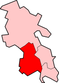
Location within Buckinghamshire
OS grid reference SU786955
Unitary authority
Ceremonial county
Region
Country England
Sovereign state United Kingdom
Post town HIGH WYCOMBE
Postcode district HP14
Police Thames Valley
Fire Buckinghamshire
Ambulance South Central
List of places
UK
England
Buckinghamshire
51°39′11″N0°51′54″W / 51.653°N 0.865°W / 51.653; -0.865 Coordinates: 51°39′11″N0°51′54″W / 51.653°N 0.865°W / 51.653; -0.865

Beacon's Bottom, also known as Bacon's Bottom, [1] [2] is a hamlet on the A40 between Piddington and Stokenchurch in England. Until 1895 it was administratively part of Oxfordshire, and was transferred to Buckinghamshire with its parent parish Stokenchurch in 1896. [1] It was one of the principal sites of High Wycombe's 19th Century chair-making industry, known locally as bodging. [3] [4]

Related Research Articles

High Wycombe Market town in Buckinghamshire, England

High Wycombe, often referred to as Wycombe, is a large market town in Buckinghamshire, England. Lying in the valley of the River Wye surrounded by the Chiltern Hills, it is 29 miles (47 km) west-northwest of Charing Cross in London; this information is also engraved on the Corn Market building in the centre of the town. It is also 13.2 miles (21.2 km) south-southeast of the county town of Aylesbury, 23.4 miles (37.7 km) southeast of Oxford, 15.4 miles (24.8 km) northeast of Reading and 7.7 miles (12.4 km) north of Maidenhead. According to the ONS official estimates for 2016, High Wycombe has a population of 125,257 and it is the second largest town in the county of Buckinghamshire after Milton Keynes. The High Wycombe Urban Area, the conurbation of which the town is the largest component, has a population of 133,204.

Chiltern Hills Range of hills in Southeast England

The Chiltern Hills is a chalk escarpment in England.

Beaconsfield Human settlement in England

Beaconsfield is a market town and civil parish within the unitary authority of Buckinghamshire, England, 23+12 miles west-northwest of central London and 16 miles south-southeast of Aylesbury. Three other towns are within five miles : Gerrards Cross, Amersham and High Wycombe.

Downley Human settlement in England

Downley is a village and civil parish in Buckinghamshire, England, which was included in Wycombe district before its abolition. It is high in the Chiltern Hills, overlooking the town of High Wycombe, although today it is almost indistinguishable from the urban spread of the latter town.

Ibstone Human settlement in England

Ibstone is a village and civil parish within Wycombe district in Buckinghamshire, England. It is in the Chiltern Hills on the border with Oxfordshire, about 2 miles (3.2 km) south of Stokenchurch.

Lane End is a village and civil parish in Buckinghamshire, England. It is just south of the M40 from High Wycombe, about 2 miles (3.2 km) west of Booker. The village is twinned with Saint-Pierre-d'Oléron in France.

Great Marlow is a civil parish within Wycombe district in the English county of Buckinghamshire, lying north of the town of Marlow and south of High Wycombe. The parish includes the hamlets of Bovingdon Green, Burroughs Grove, Chisbridge Cross and Marlow Common. Prior to November 2007 the major settlement in Great Marlow was Marlow Bottom which has now become a civil parish in its own right.

Radnage Human settlement in England

Radnage is a village and civil parish in the Buckinghamshire district of Buckinghamshire, England. It is in the Chiltern Hills about two miles north east of Stokenchurch and six miles WNW of High Wycombe.

Stokenchurch Human settlement in England

Stokenchurch is a village and civil parish in south-west Buckinghamshire, England. It is located in the Chiltern Hills, about 3 miles (5 km) south of Chinnor in Oxfordshire and 6 miles (10 km) west of High Wycombe. Stokenchurch is a commuter village, served by junction 5 of the M40 motorway to London, Oxford and Birmingham. The Stokenchurch BT Tower, to the west of the village, is a highly visible landmark on the edge of the Chilterns and pinpoints the village's location for miles ahead.

Wheeler End

Wheeler End is a hamlet in the parish of Piddington and Wheeler End, in Buckinghamshire, England. The hamlet is located close to the main A40 between West Wycombe and Stokenchurch.

Aylesbury (UK Parliament constituency) Parliamentary constituency in the United Kingdom, 1885 onwards

Aylesbury is a constituency created in 1553 — created as a single-member seat in 1885 — represented in the House of Commons of the United Kingdom since 2019 by Rob Butler of the Conservative Party.

Piddington, Buckinghamshire

Piddington is a hamlet in the parish of Piddington and Wheeler End in Buckinghamshire, England. It is located on the main A40 between Stokenchurch and West Wycombe.

Aston Rowant Cutting Road cutting

Aston Rowant Cutting is a 3.5-hectare (8.6-acre) geological Site of Special Scientific Interest south of Aston Rowant in Oxfordshire. It is a Geological Conservation Review site.

Lewknor Human settlement in England

Lewknor is a village and civil parish about 5 miles (8 km) south of Thame in Oxfordshire.The civil parish includes the villages of Postcombe and South Weston. The 2011 Census recorded the parish's population as 663.

Bolter End

Bolter End is a hamlet 5 mi (8.0 km) to the west of High Wycombe in Buckinghamshire, England.

Horsleys Green Human settlement in England

Horsleys Green is a hamlet located on the A40 between Piddington and Stokenchurch in Buckinghamshire, England. It consists of a few houses situated either side of a narrow lane.

Studley Green Village in Buckinghamshire, England

Studley Green is a hamlet located on the A40 between Piddington and Stokenchurch in Buckinghamshire, England. The term 'Studley Green' is also used to collectively refer to the four adjacent hamlets of Studley Green, Horsleys Green, Beacon's Bottom and Waterend.

Waterend, Buckinghamshire Human settlement in England

Waterend is a hamlet located on the A40 between Piddington and Stokenchurch in Buckinghamshire, England. Together with the adjacent hamlets of Horsleys Green, Beacon's Bottom and Studley Green, it is in an area known collectively as 'Studley Green'. It is within the Chiltern Area of Outstanding Natural Beauty.

Bottom Wood

Bottom Wood is a 14.5-hectare (36-acre) woodland in the English county of Buckinghamshire, located just north of the A40 near the hamlet of Studley Green. Since 1984, the wood has been owned by the Chiltern Society, which manages it as a nature reserve with the help of volunteers. Although an ancient woodland, most of the trees in the wood date from the end of the 1940s or later, as much of the wood was felled during the Second World War to produce Bryant and May matches. The wood is now home to a diverse range of flora and fauna, including rare species of butterfly and moth.

References

  1. 1 2 William Page, ed. (1925). "Parishes: Stokenchurch". A History of the County of Buckingham. Vol. 3. Institute of Historical Research. pp. 96–101. Retrieved 16 October 2013.
  2. "Assignment of Leasehold premises D/147/49/1 1888". National Archives . Retrieved 16 October 2013.
  3. "Furniture making in Wycombe". Wycombe District Council. Retrieved 16 October 2013.
  4. "Antiques: List of Furniture Makers in the Wycombe District". The Arts and Crafts Home. Retrieved 16 October 2013.

Commons-logo.svg Media related to Beacon's Bottom at Wikimedia Commons