
Manchester Metrolink is a tram/light rail system in Greater Manchester, England. The network has 99 stops along 64 miles (103 km) of standard-gauge route, making it the most extensive light rail system in the United Kingdom. Over the 2022/23 financial year 36 million passenger journeys were made on the system.

Whitefield is a town in the Metropolitan Borough of Bury, Greater Manchester, England. It lies on undulating ground above the Irwell Valley, along the south bank of the River Irwell, 3 miles (4.8 km) southeast of Bury, and 5 miles (8.0 km) northwest of Manchester. Prestwich and the M60 motorway lie just to the south.

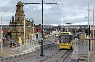
Bury Interchange is a transport hub in the town of Bury, Greater Manchester, England. Opened in 1980, it is the northern terminus of the Manchester Metrolink's Bury Line, which prior to 1992 was a heavy-rail line. It also incorporates a bus station.

Navigation Road is a station that serves both Northern Trains and Manchester Metrolink located in the east of Altrincham, in Greater Manchester, England. It consists of a Northern Trains-operated heavy rail station on the Mid-Cheshire Line, and an adjoining light rail stop on the Altrincham Line of Greater Manchester's Metrolink network. The original heavy rail element of the station was opened by the Manchester, South Junction and Altrincham Railway in 1931, and the Metrolink element opened in 1992. A level crossing operates at the southern end of the station.

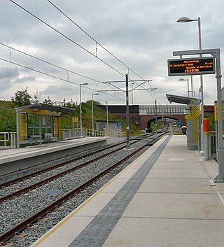
Newhey is a tram stop on the Oldham and Rochdale Line (ORL) of Greater Manchester's light-rail Metrolink system. It opened to passengers on 28 February 2013 and is located in Newhey, a suburban village the Metropolitan Borough of Rochdale, England.

Failsworth tram stop is a Manchester Metrolink tram stop on the Oldham and Rochdale Line serving the town of Failsworth, Greater Manchester, England. It was formerly a railway station before its conversion to Metrolink in 2012.
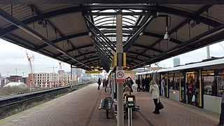
Cornbrook tram stop is a tram stop on Greater Manchester's light rail Metrolink system in the Cornbrook area of Manchester, England. It is an interchange station, allowing passenger transfer between the network's Altrincham, Eccles, Airport, Trafford Park and South Manchester lines. The station opened on 6 December 1999 for interchange only and allowed street-level entry and exit to the public from 3 September 2005. It takes its name from Cornbrook Road, between the A56 and Pomona Docks on the Manchester Ship Canal, and was built on what was a Cheshire Lines Committee route to Manchester Central railway station. The stop is one of the most used on the Metrolink network.

Woodlands Road was a tram stop on the Bury Line of the Metrolink system in the Cheetham Hill area of north Manchester, England. It opened in 1913 as a heavy rail station and closed for conversion to light rail in 1991, opening with the new Metrolink system in 1992.

Bowker Vale is a tram stop in the suburban areas of Bowker Vale and Blackley, Greater Manchester, England. It is on the Bury Line of Greater Manchester's light rail Metrolink system.

Prestwich is a tram stop in the town of Prestwich, Greater Manchester, England. It is on the Bury Line of Greater Manchester's light rail Metrolink system.

Whitefield tram stop is in Whitefield, Greater Manchester, England, on the Bury Line of Greater Manchester's light rail Metrolink system.
Besses o' th' Barn is a suburb in the Metropolitan Borough of Bury, Greater Manchester, England. The population at the 2011 Census was 10,664. It lies between Radcliffe and Prestwich.
Monsall is a tram stop on the Oldham and Rochdale Line (ORL) of Greater Manchester's light-rail Metrolink system in the Monsall area of Manchester in North West England. The Oldham and Rochdale line was built as part of Phase 3a of the system's expansion, on most of the route of the former Oldham Loop Line, and opened to passengers on 13 June 2012.

Withington is a tram stop on the South Manchester Line (SML) of Greater Manchester's light-rail Metrolink system. It is located on the west side of Princess Road on the fringe of Withington in south Manchester, England.
This timeline lists significant events in the history of Greater Manchester's light rail network called the Manchester Metrolink.

The Bury Line is a tram line of the Manchester Metrolink running from Manchester city centre to Bury in Greater Manchester. Originally a railway line, it was, along with the Altrincham Line, converted into a tram line during 1991–92, as part of the first phase of the Metrolink system.

The Altrincham Line is a tram line of the Manchester Metrolink running from Manchester to Altrincham in Greater Manchester. Originally a railway line, it was, along with the Bury Line, converted into a tramway during 1991–92, as part of the first phase of the Metrolink system.
The Oldham and Rochdale Line (ORL) is a tram line of the Manchester Metrolink in Greater Manchester running from Manchester city centre to Rochdale town centre via Oldham, using most of the trackbed of the former Oldham Loop Line which closed in 2009. The line was re-opened in a modified form as a tramway between 2012 and 2014, as part of phase three of the system's expansion.

This is a list of confirmed or proposed future developments of the Manchester Metrolink light rail system in Greater Manchester, England.

Zone 1 of the Manchester Metrolink light rail network is the heart of the system where all of the other lines converge. Its boundaries are broadly equivalent to those of Manchester city centre, and approximately mirror the city's Inner Ring Road. Within Zone 1, first opened in 1992 as the City Zone, trams largely run along semi-pedestrianised streets rather than on their own separate alignment. The original route between the Altrincham and Bury lines ran to Victoria station via Market Street and High Street, and was soon joined by a branch to Piccadilly station by a three-way delta junction. A second route between the South-West and North-Eastern parts of the network was built to ease congestion on the original line. Opened in 2017, the Second City Crossing (2CC) added one additional stop to the network.


