Burakin, Western Australia

Last updated

Burakin
Western Australia
Dowerin-Kalannie Road, Burakin, 2014(3).JPG
Dowerin-Kalannie Road, Burakin, 2014
Australia Western Australia location map.svg
Red pog.svg
Burakin
Burakin, Western Australia
Coordinates 30°31′26″S117°10′23″E / 30.524°S 117.173°E / -30.524; 117.173
Population30 (SAL 2021) [1]
Established1928
Postcode(s) 6467
Elevation359 m (1,178 ft)
Area342.5 km2 (132.2 sq mi)
Location
  • 242 km (150 mi) NNE of Perth
  • 45 km (28 mi) NW of Koorda
LGA(s) Shire of Wongan-Ballidu
State electorate(s) Moore
Federal division(s) Durack

Burakin is a small town near Kalannie in the eastern Wheatbelt region of Western Australia.

Contents

The townsite was gazetted in 1928. [2] The name is an Aboriginal word of unknown meaning, and was suggested by the Wongan Hills Road Board in 1927. The original spelling was to have been Borrikin. [3]

Railways

Burakin is the junction for the Amery to Kalannie railway line and the branch railway line to Bonnie Rock. The line was completed on 27 April 1931. [4] Despite aspirations for the railway in the 1930s. [5] services between Beacon and Bonnie Rock were under threat of suspension in 1953, [6] [7] and closed in the same year. [8]

Earthquakes

In 2000 and 2001 Burakin was the epicentre of a series of earthquakes, [9] [10] [11] now known as the Burakin Swarm – a significant series of seismographic events that are considered important in understanding the South West Seismic Zone. [12] [13] [14]

Related Research Articles

<span class="mw-page-title-main">Kalannie, Western Australia</span> Town in the Wheatbelt region of Western Australia

Kalannie is a small town in the Shire of Dalwallinu, in the Wheatbelt region of Western Australia, approximately 259 kilometres (161 mi) north-east of the state capital, Perth.

Amery is a rail siding and townsite 9 kilometres (5.6 mi) northeast of Dowerin in the Wheatbelt region of Western Australia.

<span class="mw-page-title-main">Dowerin, Western Australia</span> Town in Western Australia

Dowerin is a town 156 kilometres (97 mi) north-east of Perth in the central Wheatbelt region of Western Australia. It is the seat of the Shire of Dowerin.

Ejanding is a townsite in the central Wheatbelt region of Western Australia. It is located about 20 kilometres (12 mi) north-northeast of Dowerin. It was originally a siding on the Ejanding Northward railway, a line built between the town now known as Amery, and Kalannie, around 1927. Amery was originally named Ejanding in 1910, but was changed to Amery in 1928. Ejanding was gazetted as a townsite in 1930. Its name is Aboriginal in origin, derived from "Hejanding Well", a name first recorded by the surveyor/explorer Augustus Gregory in 1846. Ejanding used to have a primary school. It operated from 1926 until 2000, closing due to low numbers. Currently Ejanding has a few houses, a wheatbin and railway siding, and is the location of the Dowerin Go Kart Club.
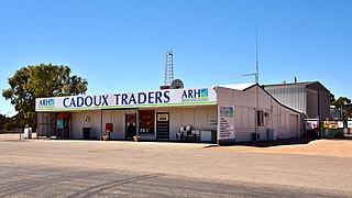
<span class="mw-page-title-main">Cadoux, Western Australia</span> Town in Western Australia

Cadoux is a town in the northeastern Wheatbelt region of Western Australia. It is about 180 kilometres (112 mi) northeast of Perth, within the Shire of Wongan-Ballidu.

<span class="mw-page-title-main">Wyalkatchem, Western Australia</span> Town in Western Australia

Wyalkatchem is a town in the central Wheatbelt region, 192 kilometres (119 mi) east-north-east of Perth, 35 kilometres (22 mi) east of Dowerin and 44 kilometres (27 mi) south of Koorda. At the 2021 census, Wyalkatchem had a population of 358.

<span class="mw-page-title-main">Beacon, Western Australia</span> Town in Western Australia

Beacon is a town in Western Australia, in the Shire of Mount Marshall. It is 42 km (26 mi) north of Bencubbin and 333 km (207 mi) northeast of Perth by road.

Kweda is a small town located in the Wheatbelt region of Western Australia, about 45 kilometres (28 mi) east of the town of Brookton.

<span class="mw-page-title-main">Trayning, Western Australia</span> Town in Western Australia

Trayning is a town in the north-eastern Wheatbelt region of Western Australia, 236 kilometres (147 mi) east of the state capital, Perth, on the Nungarin–Wyalkatchem Road. At the 2006 census, Trayning had a population of 122.

<span class="mw-page-title-main">Nungarin, Western Australia</span> Town in Western Australia

Nungarin is a town located in the north east of the Wheatbelt region of Western Australia, approximately 278 kilometres (173 mi) east of Perth and 39 kilometres (24 mi) north of Merredin. It is the main town in the Shire of Nungarin. At the 2006 census, Nungarin had a population of 142.

<span class="mw-page-title-main">Kondut, Western Australia</span> Town in Western Australia

Kondut is a small town in Wheatbelt region of Western Australia.
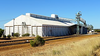
<span class="mw-page-title-main">Kulja, Western Australia</span> Town in the Wheatbelt region of Western Australia

Kulja is a small town in the Wheatbelt region of Western Australia. The town is situated along the Bonnie Rock to Burakin Road.

<span class="mw-page-title-main">Kununoppin</span> Town in Western Australia

Kununoppin is a small town in the Wheatbelt region of Western Australia. The town is located on the Nungarin–Wyalkatchem Road and in the Shire of Trayning local government area, 257 kilometres (160 mi) north east of the state capital, Perth, Western Australia. At the 2006 census, Kununoppin had a population of 151.

<span class="mw-page-title-main">Korrelocking, Western Australia</span> Town in southwestern Australia

Korrelocking is a small town situated between Wyalkatchem and Trayning in the Wheatbelt region of Western Australia. At the 2006 census, Korrelocking had a population of 76.

Elabbin is a small town between Merredin and Mukinbudin in the Wheatbelt region of Western Australia located in the Shire of Nungarin.

<span class="mw-page-title-main">Wialki, Western Australia</span> Town in Western Australia

Wialki is a townsite in the eastern Wheatbelt region of Western Australia. It is situated between Beacon and Bonnie Rock, in the shires of Mount Marshall and Mukinbudin.

Kokardine is a locality in the Wheatbelt region of Western Australia, northwest of Koorda. It is located within the Shire of Wongan-Ballidu.

<span class="mw-page-title-main">Western Australian Government Railway lines and operations centres</span>

Western Australian Government Railways railway system during its peak operational time in the 1930s to 1950s was a large system of over 6,400 kilometres (4,000 mi) of railway line.
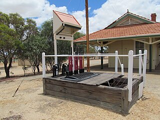
<span class="mw-page-title-main">Goomalling to West Merredin railway line</span> Partially operational railway line in Western Australia

The Goomalling to West Merredin railway line is a 183-kilometre (114 mi) long railway line operated by Arc Infrastructure in the Wheatbelt region of Western Australia, connecting Goomalling with West Merredin. Only the western part of the railway line, the 66-kilometre (41 mi) section from Goomalling to Wyalkatchem, is operational, while the 117-kilometre (73 mi) section from Wyalkatchem to West Merredin is not in use.

<span class="mw-page-title-main">Amery to Kalannie railway line</span> Railway line in Western Australia

The Amery to Kalannie railway line is a 98-kilometre (61 mi) long railway line operated by Arc Infrastructure in the Wheatbelt region of Western Australia, connecting Amery with Kalannie.
References

  1. Australian Bureau of Statistics (28 June 2022). "Burakin (suburb and locality)". Australian Census 2021 QuickStats. Retrieved 28 June 2022.  OOjs UI icon edit-ltr-progressive.svg
  2. Western Australia. Department of Lands and Surveys (1929), Townsite of Burakin, Ninghan District, Dept. of Lands & Surveys W.A, retrieved 21 August 2022
  3. "History of country town names – B". Western Australian Land Information Authority. Archived from the original on 14 March 2022. Retrieved 8 June 2007.
  4. Rails through the Wodjil Milne, Rod Australian Railway Historical Society Bulletin, January, 1999 pp3-9
  5. "BURAKIN". The Dowerin Guardian and Amery Line Advocate . Vol. 3, , no. 16. Western Australia. 5 April 1930. p. 3. Retrieved 27 August 2024 via National Library of Australia.{{cite news}}: CS1 maint: extra punctuation (link)
  6. "Burakin -- Bonnie Rock Railway". The Farmers' Weekly . Vol. 7, , no. 320. Western Australia. 24 September 1953. p. 15. Retrieved 27 August 2024 via National Library of Australia.{{cite news}}: CS1 maint: extra punctuation (link)
  7. "Minister Investigation Burakin-Bonnie Rock Railway". The Dowerin Guardian and Amery Line Advocate . Vol. XXIV, , no. 12. Western Australia. 15 October 1953. p. 1. Retrieved 27 August 2024 via National Library of Australia.{{cite news}}: CS1 maint: extra punctuation (link)
  8. "BURAKIN-BONNIE ROCK". The Farmers' Weekly . Vol. 7, , no. 327. Western Australia. 12 November 1953. p. 3. Retrieved 27 August 2024 via National Library of Australia.{{cite news}}: CS1 maint: extra punctuation (link)
  9. "Third quake in six months hits Burakin.(Local)", The Australian (National, Australia), News Limited: 004, 6 March 2002, retrieved 27 August 2024
  10. "Researchers surf seismic wave.(Features)", The Australian (National, Australia), News Limited: 032, 10 April 2002, retrieved 27 August 2024
  11. "Quakeville builds to something big.(Local)", The Australian (National, Australia), News Limited: 001, 2 April 2002, retrieved 27 August 2024
  12. "UWA Seismic Events in WA – Burakin Swarm". 2005. Archived from the original on 11 July 2008. Retrieved 20 April 2011.
  13. Australia. Department of Industry, Tourism and Resources (30 June 2002), "Geoscience Australia (30 June 2002)", Annual Report (539 of 2002), Department of Industry, Tourism and Resources: 199, ISSN   1443-8267
  14. "Shaking spot quakes way to seismic record", Australasian Business Intelligence, COMTEX News Network, Inc: 1008364i9825, 30 December 2001, ISSN   1320-6680

Commons-logo.svg Media related to Burakin, Western Australia at Wikimedia Commons