
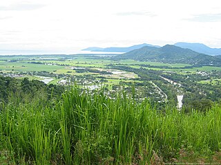
Cairns is a city in the Cairns Region, Queensland, Australia, on the tropical north east coast of Far North Queensland. In the 2021 census, Cairns had a population of 153,181 people.

The Bruce Highway is a major highway in Queensland, Australia. Commencing in the state capital, Brisbane, it passes through areas close to the eastern coast on its way to Cairns in Far North Queensland. The route is part of the Australian National Highway and also part of Highway 1, the longest highway route in Australia. Its length is approximately 1,679 kilometres (1,043 mi); it is entirely sealed with bitumen. The highway is named after a popular former Queensland and federal politician, Harry Bruce. Bruce was the state Minister for Works in the mid-1930s when the highway was named after him. The highway once passed through Brisbane, but was truncated at Bald Hills when the Gateway Motorway became National Highway 1 upon its opening in December 1986.

The Capricorn Highway is located in Central Queensland, Australia, and links the city of Rockhampton with western Queensland. The highway is 575 kilometres (357 mi) long, and joins the Landsborough Highway at Barcaldine. Formerly National Route 66, Queensland began to convert to the alphanumeric system much of Australia had adopted in the early-2000s and is now designated as A4. The highway runs parallel with the Tropic of Capricorn, hence its name.

The Brisbane Valley Highway is a state highway in Queensland, Australia. It links the Warrego Highway near Ipswich and the D'Aguilar Highway about 4 km (2 mi) north of Harlin. Its direction follows the approximate course of the Brisbane River. It is part of State Route A17, which is duplexed with the D'Aguilar Highway to Nanango and then becomes the Burnett Highway. State Route 85 is duplexed with the Brisbane Valley Highway from Esk to the D'Aguilar Highway.

The Burnett Highway is an inland rural highway located in Queensland, Australia. The highway runs from its junction with the Bruce Highway at Gracemere, just south of Rockhampton, to the D'Aguilar Highway in Nanango. Its length is approximately 542 kilometres. The highway takes its name from the Burnett River, which it crosses in Gayndah. The Burnett Highway provides the most direct link between the northern end of the New England Highway and Rockhampton. It is designated as a State Strategic Road by the Queensland Government.
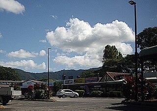
Woree is a suburb of Cairns in the Cairns Region, Queensland, Australia. In the 2021 census, Woree had a population of 5,127 people.

The Captain Cook Highway is a short, regional highway in Queensland that originates in Cairns and terminates in Mossman, where it joins Mossman-Daintree Road, continuing to Daintree. It is a state-controlled regional road.

The Wide Bay Highway is a short state highway of Queensland, Australia running between Goomeri on the Burnett Highway and a junction on the Bruce Highway. From the junction it is 12 kilometres south to Gympie or 69 kilometres north to Maryborough. The length of the highway is 62.6 kilometres. It is a state-controlled regional road.

The Gillies Highway is a road that runs from Gordonvale in the Cairns Region through the Gillies Range to Atherton in the Tablelands Region, both in Queensland, Australia. Its official name is Gillies Range Road, and it was originally known as the Cairns Range Road.
Caravonica is a suburb of Cairns in the Cairns Region, Queensland, Australia. In the 2021 census, Caravonica had a population of 2,183 people.

Bungalow is an inner suburb of Cairns in the Cairns Region, Queensland, Australia. In the 2021 census, Bungalow had a population of 2,358 people.
The Cairns Western Arterial Road is a numbered state route in the Cairns Region of Queensland, Australia. The road provides a primary access route across the Brinsmead Gap for suburbs west of the Whitfield Range, and is one of two major crossings over the Barron River. In 2007, it was estimated that 24,000 vehicles per day used the road.

Portsmith is a suburb of Cairns in the Cairns Region, Queensland, Australia. In the 2021 census, Portsmith had a population of 314 people.
Toowoomba–Karara Road is a continuous 82.5 kilometres (51.3 mi) road route in the Toowoomba and Southern Downs regions of Queensland, Australia. Most of the route is signed as State Route 48. Toowoomba–Karara Road is a state-controlled district road. As part of State Route 48 it provides an alternate route between Toowoomba and Inglewood. It is also part of the shortest route from Toowoomba to Texas.
Cleveland–Redland Bay Road is a continuous 15.2 kilometres (9.4 mi) road route in the Redland local government area of Queensland, Australia. The route is designated as part of State Route 47. It is a state-controlled district road rated as a local road of regional significance (LRRS).
Caloundra Road is a continuous 9.3-kilometre (5.8 mi) road route in the Sunshine Coast local government area of Queensland, Australia. Most of it is designated as part of State Route 6. It is a state-controlled district road, part of which is rated as a local road of regional significance (LRRS).
Tin Can Bay Road is a continuous 56.1 kilometres (34.9 mi) road route in the Gympie region of Queensland, Australia. Part of it is signed as State Route 15. It is a state-controlled road, part regional and part district, with the district section rated as a local road of regional significance (LRRS). It runs from the Bruce Highway in Monkland to the Esplanade in Tin Can Bay. It intersects with Gympie Connection Road in Victory Heights, Kin Kin Road in Canina, Maryborough–Cooloola Road in Wallu, and Rainbow Beach Road in Wallu.

Marlborough–Sarina Road is a state-controlled district road rated as a local road of regional significance (LRRS). It runs from the Bruce Highway in Marlborough, via an inland route, to the Bruce Highway in Sarina, a distance of 243 kilometres (151 mi). It was part of the Bruce Highway until 1982.
Warrego Highway state-controlled roads presents information about how the Warrego Highway is described for administrative and funding purposes by the Queensland Department of Transport and Main Roads, and about the state-controlled roads that intersect with it.
Bruce Highway state-controlled roads presents information about how the Bruce Highway is described for administrative and funding purposes by the Queensland Department of Transport and Main Roads, and about the state-controlled roads that intersect with it.