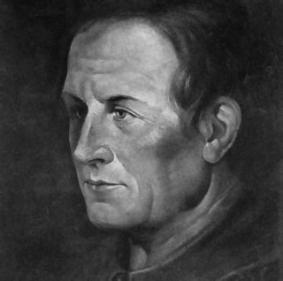
Eusebio Francisco Kino, SJ, often referred to as Father Kino, was an Italian Jesuit, missionary, geographer, explorer, cartographer, mathematician and astronomer born in the Bishopric of Trent, Holy Roman Empire.
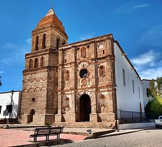
Mission Nuestra Señora de los Dolores is a former Mission church in Sonora, Mexico.

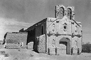
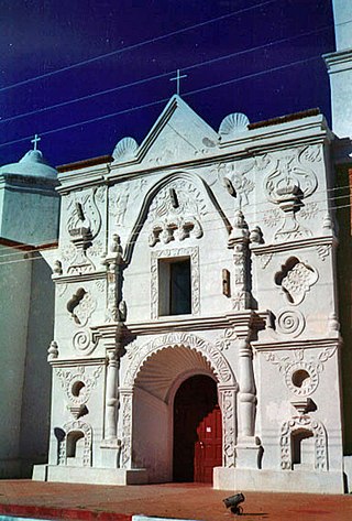
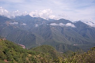
The Spanish missions in the Sonoran Desert are a series of Jesuit Catholic religious outposts established by the Spanish Catholic Jesuits and other orders for religious conversions of the Pima and Tohono O'odham indigenous peoples residing in the Sonoran Desert. An added goal was giving Spain a colonial presence in their frontier territory of the Sonora y Sinaloa Province in the Viceroyalty of New Spain, and relocating by Indian Reductions settlements and encomiendas for agricultural, ranching, and mining labor.

Magdalena de Kino is a city, part of the surrounding municipality of the same name, located in the Mexican state of Sonora covering approximately 560 square miles. According to the 2005 census, the city's population was 23,101, and the municipality's was 25,500. Magdalena de Kino is in the northern section of Sonora 50 miles from the Mexico-U.S. border. To the north the municipality abuts Nogales; to the south, the municipality of Santa Ana; to the east, Ímuris and Cucurpe; and to the west, the municipalities of Tubutama and Sáric. Its main sectors include San Ignacio, San Isidro, Tacicuri, and Sásabe. The city was named after the pioneer Roman Catholic missionary and explorer, Father Eusebio Francisco Kino, who worked in the area, as well as in the present-day US state of Arizona.
Imuris is the municipal seat of Imuris Municipality in the north of the Mexican state of Sonora.
Arizpe is a small town and the municipal seat of the Arizpe Municipality in the north of the Mexican state of Sonora. It is located at 30°20'"N 110°09'"W. The area of the municipality is 2,806.78 sq.km. The population in 2005 was 2,959 of which 1,743 lived in the municipal seat as of the 2000 census.
Bacerac is a town in Bacerac Municipality in the Mexican state of Sonora.

Bacoachi is a small town in Bacoachi Municipality in the north of the Mexican state of Sonora. The area of the municipality is 487 square miles (1,260.65 km2) and the population was 1,456 in 2005, with 924 inhabitants residing in the municipal seat. The elevation of the municipal seat is 4,429 feet above sea level.
Benjamín Hill is the municipal seat of Benjamín Hill Municipality in the Mexican state of Sonora.

Carbó is the municipal seat of Carbó Municipality of the state of Sonora, Mexico.
Granados is the municipal seat of Granados Municipality in the northeast of the Mexican state of Sonora. The municipal area is 361.27 km2, and the population was 1,228 according to the 2000 census. By 2005 the population had decreased to 938 due to emigration due to insufficient educational infrastructure and the lack of job opportunities.
Mazatán is a locality in Mazatán Municipality in the center of the Mexican state of Sonora.

Ónavas is a small town surrounded by Onavas Municipality in the southeast of the Mexican state of Sonora.
Oquitoa is a small town surrounded by Oquitoa Municipality in the northwest of the Mexican state of Sonora.

Quiriego is a small town and the county seat of the Municipality of Quiriego, located in the southeast of the Mexican state of Sonora.
Rayón is a small town surrounded by its municipal area in the center of the Mexican state of Sonora at a distance of 110 kilometers from the state capital Hermosillo.
Tubutama is a town in the north-west of the Mexican state of Sonora. It serves as the seat for the surrounding municipality of the same name.
Pánuco is a city in the Mexican state of Veracruz, located in the state's Huasteca Alta region. It serves as the municipal seat of the surrounding Pánuco Municipality. It stands on the banks of the Río Pánuco.
Hostotipaquillo is a town and municipality, in Jalisco in central-western Mexico. The municipality covers an area of 756.4 km².

Cucurpe is a municipality in the state of Sonora in north-western Mexico. The municipal seat is at Cucurpe.


