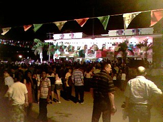

Etchojoa is the seat of Etchojoa Municipality. Founded in 1613, Etchojoa is located in the southwest of the Mexican state of Sonora. It is situated at 26°52′N109°39′W / 26.867°N 109.650°W . The total municipal area is 1,220.23 km².
Etchojoa is the seat of Etchojoa Municipality. Founded in 1613, Etchojoa is located in the southwest of the Mexican state of Sonora. It is situated at 26°52′N109°39′W / 26.867°N 109.650°W . The total municipal area is 1,220.23 km².
Etchojoa was founded about 1614 as a Jesuit mission by the name of Espíritu Santo Etchojoa. [1]
Etchojoa had a population of 56,129 in 2000, according to the official census. Neighboring municipalities are Navojoa, Huatabampo and Cajeme.
Etchojoa has a large indigenous population made up of the Mayo Indians, almost 20% of the population in 2000. The municipality sits in the Valle Mayo (Mayo Valley), named for the Río Mayo, a vital source for irrigation.
The economy is based primarily on agriculture, with over 800 km² irrigated throughout the municipality in 2000. Fifty percent of the land is part of the ejido system. Wheat, soy, corn, and citrus fruit are the most important crops.
XEETCH-AM, a government-run indigenous community radio station that broadcasts in Mayo, Yaqui and Guarijio, is based in Etchojoa.

Cajeme is one of the 72 municipalities of the northwestern Mexican state of Sonora. It is named after Cajemé, a Yaqui leader. The municipality has an area of 3,312.05 km2 and with a population of 436,484 inhabitants as of 2020. The municipal seat is at Ciudad Obregón.
Huatabampo is a city in Huatabampo Municipality in the state of Sonora, in northwestern Mexico. It is situated on the Gulf of California, near the mouth of the Mayo River. It is located at latitude 26°49′N109°40′W. Huatabampo is 34 km (21 mi) southwest of Navojoa via Sonora State Highway 56 and Sonora State Highway 149. Mexican Federal Highway 15 can be accessed via Sonora State Highway 176. It is notable as the home of revolutionary general Álvaro Obregón, a successful chickpea farmer before the Mexican Revolution, and now his burial site.
Cócorit is a town located in the municipality of Cajeme in the southern part of the Mexican state of Sonora. The name of the town is derived from the Yaqui word for a chili pepper, ko'oko'i. Cócorit and the municipality of Cajeme are within the Yaqui River Valley. The comisario municipal of Cajeme is Ing. Arturo Soto Valenzuela. Cócorit reported a 2005 census population of 7,953 inhabitants, and is the fifth-largest town in the municipality of Cajeme.

Benito Juárez is one of the 72 municipalities (municipios) of the Mexican state of Sonora. It borders with the municipio of Cajeme. The municipal seat is Villa Juárez.

The Mayo or Yoreme are an Indigenous group in Mexico, living in southern Sonora, northern Sinaloa and small settlements in Durango.
Arizpe is a small town and the municipal seat of the Arizpe Municipality in the north of the Mexican state of Sonora. It is located at 30°20'"N 110°09'"W. The area of the municipality is 2,806.78 sq.km. The population in 2005 was 2,959 of which 1,743 lived in the municipal seat as of the 2000 census.

Atil is a small town in Atil Municipality in the northwest of the Mexican state of Sonora. The total area is 400.43 km² and the population of the municipality was 734 in 2005, of whom 699 lived in the municipal seat (2000). Neighboring municipalities are Tubutama, Trincheras, Oquitoa, and Altar.
Bacanora is a small town in Bacanora Municipality in the east of the Mexican state of Sonora. It is located at the geographical coordinates of 28°59′N109°24′W.

Bacoachi is a small town in Bacoachi Municipality in the north of the Mexican state of Sonora. The area of the municipality is 487 square miles (1,260.65 km2) and the population was 1,456 in 2005, with 924 inhabitants residing in the municipal seat. The elevation of the municipal seat is 4,429 feet above sea level.
Bácum is a small city and the county seat of Bácum Municipality, located in the south of the Mexican state of Sonora at 27°32′N110°05′W.
Banámichi is a small town in the north of the Mexican state of Sonora. It serves as the seat for the surrounding municipality of the same name. Geographical coordinates are 30°01′N110°13′W.
Nácori Chico is a small town in Nácori Chico Municipality in the east of the Mexican state of Sonora.

Ónavas is a small town surrounded by Onavas Municipality in the southeast of the Mexican state of Sonora.

Pitiquito is a small town in Pitiquito Municipality in the northwest of the Mexican state of Sonora.
Tepache is a small town in Tepache Municipality in the east of the Mexican state of Sonora. Its location by GPS coordinates is at: Longitude (dec): -109.528889; Latitude (dec): 29.533333.

Quiriego is a small town and the county seat of the Municipality of Quiriego, located in the southeast of the Mexican state of Sonora.
Suaqui Grande is a town in Suaqui Grande Municipality, in the eastern region of the Mexican state of Sonora. It was founded in 1620 by the Jesuit missionary Martín Burgencio as San Ignacio de Suaqui.

Etchojoa is one of the seventy-two municipalities in the Mexican state of Sonora. It is located in the southern part of the state, in the Mayo Valley area and on the coast of the Gulf of California. Its municipal seat and most inhabited town is Etchojoa. Other important towns include Bacobampo, Buaysiacobe, and Bacame Nuevo. The municipality was founded on October 15, 1909.

Navojoa is a municipality in the state of Sonora in north-western Mexico. As of 2015, the municipality had a total population of 163,650. The municipal seat is the city of Navojoa.
Olegario Carrillo Meza is a Mexican politician representing the Party of the Democratic Revolution (PRD). He served in the LV Legislature of the Congress of Sonora from 1997 to 2000.
| International | |
|---|---|
| National | |
