| Municipal president | Term | Political party | Notes |
|---|
| Pedro H. Zubarrán [3] [4] | 1899–1901 | | |
| Trinidad B. Rosas | 1907–1909 | | |
| José Tiburcio Otero | 1909–1911 | | |
| Álvaro Obregón | 1911–1912 | | |
| Benjamín Almada | 1913–1915 | | |
| Octavio Bojórquez | 1915–1917 | | |
| Bernardo J. Gastélum | 1917–1918 | | |
| Alejo Goycochea | 1918–1920 | | |
| Alfredo Goycochea | 1920–1921 | | |
| José Toledo | 1921–1922 | | |
| Rodolfo Ruiz Rábago | 1923 | | |
| Agustín Murillo | 1924–1925 | | |
| José Tiburcio Otero | 1925 | | |
| Federico Vázquez | 1925–1927 | | |
| Emilio Rosas | 1928 | | |
| Rodrigo Otero | 1930–1931 | PNR  | |
| Ramón F. Ibarra T. | 1932 | PNR | Acting municipal president |
| Praxedis Gastélum | 1932–1935 | PNR | |
| Antonio Encinas | 1935–1937 | PNR | |
| Anastasio Barreras | 1937–1939 | PNR | |
| Rodolfo Castro V. | 1939–1941 | PRM  | |
| Antonio Toledo | 1941–1943 | PRM | |
| Abelardo Paredes | 1943–1946 | PRM | |
| Ignacio Valderráin | 1946–1949 | PRI  | |
| N/A | 1949–1952 | | |
| Alfredo Santini E. | 1952–1955 | PRI | |
| Jesús Ibarra R. | 1955–1958 | PRI | |
| Víctor M. Romo | 1958–1961 | PRI | |
| Alfredo Káram M. | 1961–1964 | PRI | |
| Martín Larrauri G. | 1964–1965 | PRI | |
| Arnoldo Ahumada B. | 1965–1967 | PRI | |
| Próspero M. Ibarra | 1967–1970 | PRI | |
| Francisco Rosas Ibarra | 1970–1973 | PRI | |
| Manuel Castro T. | 1973–1976 | PRI | |
| Arturo Siqueiros S. | 1976–1979 | PRI | |
| Rodolfo Moreno G. | 1979–1982 | PRI | |
| Roberto Rosas T. | 1982–1985 | PRI | |
| Germán Bleizeffer Luis | 1985–1988 | PRI | |
| Heliodoro Soto Rodríguez | 1988–1991 | PRI | |
| Luis Alberto Ibarra Guerra [5] | 1991–1994 | PRI | |
| Bleizeffer Vega [6] [7] | 1994–1997 | PRI | |
| Francisco García Cancino [8] | 1997–2000 | PRD  | |
| Daniel Ibarra Guerra [9] | 2000–2003 | PRI | |
| Juan José Lam Angulo [10] [11] | 16-09-2003–15-09-2006 | PRD
PAS 
Convergence  | |
| César Bleizeffer Vega [12] [13] | 16-09-2006–15-09-2009 | PAN  | |
| Próspero Manuel Ibarra Otero [14] | 16-09-2009–15-09-2012 | PRI
PVEM 
Panal  | |
| Ramón Antonio Díaz Nieblas [15] | 16-09-2012–15-09-2015 | PAN
Panal | |
| Heliodoro Soto Olguín [16] | 16-09-2015–15-09-2018 | PRI
PVEM 
Panal
| Coalition "For an Honest and Effective Government" |
| Ramón Antonio Díaz Nieblas [17] | 16-09-2018–15-09-2021 | PAN
PRD | Coalition "For Sonora to the Front" |
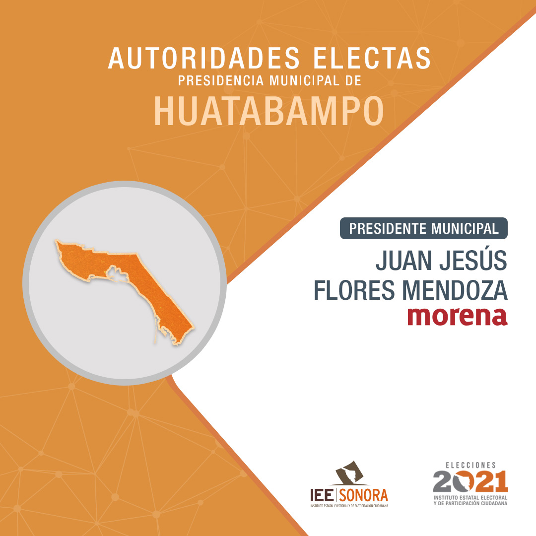
| Juan Jesús Flores Mendoza [18] | 16-09-2021–15-09-2024 | Morena  | |
| Alberto Vázquez Valencia [19] | 16-09-2024– | Morena
PVEM
PT 
Panal Sonora
PES Sonora  | |


