Hermosillo, formerly called Pitic, is a city in the center of the northwestern Mexican state of Sonora. It is the municipal seat of the Hermosillo municipality, the state's capital and largest city, as well as the primary economic center for the state and the region. As of 2020, the city has a population of 936,263, making it the 18th largest city in Mexico. The recent increase in the city's population is due to expanded industrialization, especially within the automotive industry.

Cajeme is one of the 72 municipalities of the northwestern Mexican state of Sonora. It is named after Cajemé, a Yaqui leader. The municipality has an area of 3,312.05 km2 and with a population of 436,484 inhabitants as of 2020. The municipal seat is at Ciudad Obregón.
Agua Prieta is a town in the Agua Prieta Municipality in the northeastern corner of the Mexican state of Sonora. It stands on the Mexico–U.S. border, adjacent to the town of Douglas, Arizona. The municipality covers an area of 3,631.65 km2. In the 2010 census, the town had a population of 79,138 people, making it the seventh-largest community in the state, with a literacy rate of 96.3%.
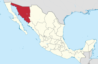
Sonora is a state in Northwestern Mexico that is divided into 72 municipalities. According to the 2020 Mexican census, it is the eighteenth most populated state with 2,944,840 inhabitants and the 2nd largest by land area spanning 179,354.7 square kilometres (69,249.2 sq mi). The largest municipality by population is Hermosillo, with 936,263 residents, while the smallest is Onavas with 365 residents. The largest municipality by land area is also Hermosillo which spans 15,724.30 km2 (6,071.19 sq mi), and the smallest is San Felipe de Jesús with 151.30 km2 (58.42 sq mi). The newest municipalities are Benito Juárez and San Ignacio Río Muerto, established in 1996.

Jalisco is a state in Western Mexico that is divided into 125 municipalities. According to the 2020 Mexican census, it is the third most populated state with 8,348,151 inhabitants and the seventh largest by land area spanning 78,595.9 square kilometres (30,346.0 sq mi). The largest municipality by population is Zapopan, with 1,476,491 residents, while the smallest is Santa María del Oro with 1,815 residents. The largest municipality by land area is Mezquitic which spans 3,363.60 km2 (1,298.69 sq mi), and the smallest is Techaluta with 79.20 km2 (30.58 sq mi). The newest is San Ignacio Cerro Gordo, established in 2007 out of Arandas.
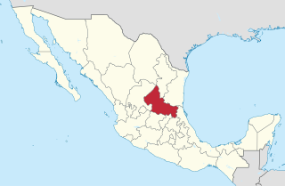
San Luis Potosí is a state in North Central Mexico that is divided into 59 municipalities. According to the 2020 Mexican census, it is the 19th most populated of Mexico's 31 states, with 2,822,255 inhabitants and the 15th largest by land area spanning 61,138.0 square kilometres (23,605.5 sq mi). The largest municipality by population is the capital of San Luis Potosí, with 911,908 residents, while the smallest is Armadillo with 4,013 residents. The largest municipality by land area is Santo Domingo which spans 4,322.60 km2 (1,669.0 sq mi), and the smallest is Huehuetlán with 71.50 km2 (27.61 sq mi). The newest municipality is Villa de Pozos, established in 2024 from the municipality of San Luis Potosí; followed by El Naranjo, created out of Ciudad del Maíz, and Matlapa, carved from Tamazunchale, both established in 1994.
Bacanora is an agave-derived liquor made in the Mexican state of Sonora.

Estado de Occidente was a Mexican state established in 1824. The constitution was drafted in that year and the government was initially established with its capital at El Fuerte, Sinaloa. The first governor was Juan Miguel Riesgo. The state consisted of modern Sonora and Sinaloa, and also modern Arizona more or less south of the Gila River.
Bacerac is a town in Bacerac Municipality in the Mexican state of Sonora.

Baviácora is a small town and the municipal seat of the surrounding municipality of the Mexican state of Sonora. The geographical coordinates are 29°42′N110°09′W.
Moctezuma is a municipio (municipality) of the Mexican state of Sonora, located in the state's central region. It is also the name of its largest settlement and cabecera municipal.

Nacozari de García is a small mining town in the northeast of the Mexican state of Sonora. It serves as the municipal seat for the surrounding municipality of the same name.

Quiriego is a small town and the county seat of the Municipality of Quiriego, located in the southeast of the Mexican state of Sonora.
Villa Pesqueira is a town, and the surrounding municipality of the same name, in the central region of the Mexican state of Sonora.

Villa Hidalgo is a municipality in the state of Jalisco in Mexico.

The following timeline traces the territorial evolution of the U.S. State of Arizona.

Chihuahua, officially the Free and Sovereign State of Chihuahua, is one of the 31 states which, along with Mexico City, comprise the 32 federal entities of Mexico. It is located in the northwestern part of Mexico and is bordered by the states of Sonora to the west, Sinaloa to the southwest, Durango to the south, and Coahuila to the east. To the north and northeast, it shares an extensive border with the U.S. adjacent to the U.S. states of New Mexico and Texas. The state was named after its capital city, Chihuahua City; the largest city is Ciudad Juárez. In 1864 the city of Chihuahua was declared capital of Mexico by Benito Juarez during the Reform War and French intervention. The city of Parral was the largest producer of silver in the world in 1640. During the Mexican War of Independence, Miguel Hidalgo was executed on July 30, 1811, in Chihuahua city.

Huásabas is a municipality in the state of Sonora in north-western Mexico. In 2020, the municipality reported a total population of 888.
The following television stations broadcast on digital channel 14 in Mexico: