
El Porvenir is a municipality and township in the Mexican state of Chiapas.

Cerralvo, sometimes known as Ceralvo, is a municipality situated in the Mexican state of Nuevo León. Cerralvo is located in the northeastern region of Nuevo León, in the Gulf Coastal Plain and in the northeastern agricultural and ranching economic zone that also includes the municipalities of Agualeguas, General Treviño, Melchor Ocampo, and Parás. It borders the municipality of Agualeguas to the north, the municipality of Higueras to the west, the municipality of Doctor González to the southwest, the municipality of Los Ramones to the south, and the municipalities of Los Herreras, Melchor Ocampo, and General Treviño to the east.
San Pedro Lagunillas is both a municipality and the municipal seat of the same in the Mexican state of Nayarit. The population of the municipality was 7,155 (2005) in a total area of 520 square kilometers. The population of the town and municipal seat was 3,630 (2005). The population has been declining since 1980 when it was 8,308 inhabitants.
Benito Juárez is a municipality located on the edge of the Canyon of Tlaltenango in the southern extreme of the Mexican state of Zacatecas. The municipal seat is the town of Florencia.

San Juan Bautista Tuxtepec, or simply referred to as Tuxtepec, is the head of the municipality by the same name and is the second most populous city of the Mexican state of Oaxaca. It is part of the Tuxtepec District of the Papaloapan Region. As of the 2020 census, the city is home to a population of 103,609 and 159,452 in the municipality, though census data are often under reported for various reasons.
Sahuaripa is a town in the Mexican state of Sonora, municipality of Sahuaripa. The area is 5,694.4 km². with a population of 5,792 in 2005. The town and municipal seat had a population of 3,807 in 2000.

Jerécuaro is a Mexican city located in the lowlands of the state of Guanajuato. The municipality has an area of 828.3 square kilometres and is bordered to the north by Apaseo el Alto, to the east by Coroneo and the state of Querétaro, to the south by Tarandacuao, to the southwest with Acámbaro, and to the northwest with Tarimoro. The municipality had 55,311 inhabitants according to the 2005 census. The municipal president of Jerécuaro and its many smaller outlying communities is C.Jaime García Cardona.
Moctezuma is a municipio (municipality) of the Mexican state of Sonora, located in the state's central region. It is also the name of its largest settlement and cabecera municipal.
Eloxochitlán de Flores Magón, formerly known as San Antonio Eloxochitlán, is a city and municipality in the Mexican state of Oaxaca. It is part of the Teotitlán District in the north of the Cañada Region. Approximately 96% of the inhabitants of the municipality speak the indigenous Tecóatl Mazatec.

Tlaxiaco is a city, and its surrounding municipality of the same name, in the Mexican state of Oaxaca. It is located in the Tlaxiaco District in the south of the Mixteca Region, with a population of about 17,450.
Tlatlaya is one of 125 municipalities of the State of Mexico in Mexico. The municipal seat is the town of Tlatlaya which is the eleventh largest town in the municipality. The word “Tlatlaya” means when the hearth is black and red.
Santo Tomás de los Plátanos also known as Nuevo Santo Tomás de los Plátanos is a town and municipal seat of the municipality of Santo Tomás, located in the center-west of Mexico State, in Mexico. It is approximately 185 km from Mexico City, and 107 km from Toluca.
Zumpuhuacán is a municipality in the State of Mexico. Its municipal seat is also called Zumpahuacán: The area was settled by Mexicas in 1220.
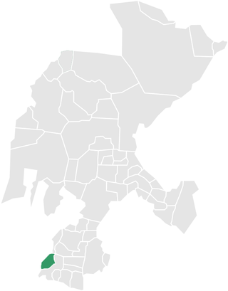
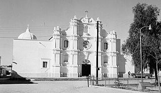
San Pedro de la Cueva is a town in San Pedro de la Cueva Municipality, in the Mexican state of Sonora. It is located in the center of the state at an elevation of 500 meters.

Chiconquiaco is a municipality in the Mexican state of Veracruz. It is located in the Sierra de Chiconquiaco in the middle of the State of Veracruz. It has a surface of 68.27 km2. It is located at 19°45′N96°49′W.
Navojoa Municipality is a municipality in the Mexican state of Sonora in north-western Mexico. As of 2015, the municipality had a total population of 163,650.

San Javier Municipality is a municipality in the Mexican state of Sonora in north-western Mexico. As of 2015, the municipality had a total population of 557.
Soyopa Municipality is a municipality in the Mexican state of Sonora in north-western Mexico.
Tepache Municipality is a municipality in the Mexican state of Sonora in north-western Mexico.

Val de San Vicente is a municipality located in the autonomous community of Cantabria, Spain.
