Onavas Municipality | |
|---|---|
| Country | |
| State | Sonora |
| Time zone | UTC-7 (Mountain Standard Time) |
| • Summer (DST) | UTC-7 (No DST) |
Onavas Municipality is a municipality in the Mexican state of Sonora in north-western Mexico. [1]
Onavas Municipality | |
|---|---|
| Country | |
| State | Sonora |
| Time zone | UTC-7 (Mountain Standard Time) |
| • Summer (DST) | UTC-7 (No DST) |
Onavas Municipality is a municipality in the Mexican state of Sonora in north-western Mexico. [1]
The municipal area is 529.48 km2 with a population of 479 registered in 2000. INEGI Most of this population lives in the small municipal seat. It is located at an elevation of 180 meters. The municipal population has been decreasing since 1980 when it was 586.
Neighboring municipalities are Soyopa to the north, Yécora to the east, Suaqui Grande to the southwest, and San Javier to the west. Onavas is crosses by the Río Yaqui, which rises in Chihuahua and flows into the Pacific Ocean

Saltillo is one of the 38 municipalities of Coahuila, in north-eastern Mexico. The municipal seat lies at Saltillo. The municipality covers an area of 6837 km².
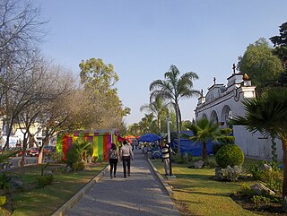
Ónavas is a small town surrounded by Onavas Municipality in the southeast of the Mexican state of Sonora.
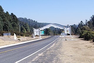
Yécora is a small town, and its surrounding municipality of the same name, in the Mexican state of Sonora, located at Latitude = 28.3710, Longitude = -108.9269 with an elevation of 5,173 feet. The town is bordered on the east by the state of Chihuahua, to the north by the municipalities of Sahuaripa and Southeast Rosario, to the west by the municipality Suaqui Grande, and the northwest by the municipality of Onavas. Yécora has an area of 1,279 square miles, accounting for 1.79 percent of total state. An approximate population for Yécora is 3171.

Jilotepec de Molina Enríquez, known as Jilotepec de Abasolo until 1986, and commonly known as Jilotepec, is a city located in the northwest zone of the State of Mexico in Mexico. The name comes from Náhuatl, meaning "hill of corncobs". It is the municipal seat and largest city of the municipality of Jilotepec. It is located in hilly and forested terrain about an hour's drive from Mexico City and the state capital of Toluca, 40 minutes from San Juan del Río, 30 minutes from Tula and 20 minutes from Tepeji. The Mexico City–Querétaro highway and the new Transoceanic Freeways that unite the coasts of Mexico from Veracruz to Michoacán converge within its territory.
Pueblo Viejo is one of the 212 municipalities of the Mexican state of Veracruz. It is located in the state's Huasteca Alta region. The municipal seat is the city of Ciudad Cuauhtémoc, Veracruz.

Morelos is one of the 38 municipalities of Coahuila, in north-eastern Mexico. The municipal seat lies at Morelos. The municipality covers an area of 606.2 km². As of 2005, the municipality had a total population of 1,516.

La Unión de Isidoro Montes de Oca is one of the 81 municipalities of Guerrero, in south-western Mexico. The municipal seat lies at La Unión. The municipality covers an area of 1,142 km2 (441 sq mi).
Pilcaya is one of the 81 municipalities of Guerrero, in south-western Mexico. The municipal seat lies at Pilcaya. The municipality covers an area of 62.1 km².
Pilcaya is a town and municipal seat of the Municipality of Pilcaya in the state of Guerrero, Mexico, located 153 kilometres (95 mi) from Mexico City, 105 kilometres (65 mi) from Cuernavaca, 84 kilometres (52 mi) from Toluca, 68 kilometres (42 mi) from Taxco and 5 kilometres (3 mi) from Ixtapan de la Sal. The name "Pilcaya" is from the Nahuatl word pilcacyan, place of a hanging object.
San Agustín Tlaxiaca is a town and one of the 84 municipalities of Hidalgo, in central-eastern Mexico. The municipality covers an area of 354.6 km2.
Tizayuca is one of the 84 municipalities of Hidalgo, in central Mexico. The city of Tizayuca is the municipal seat. The population of the city is 60,265 and the municipality has 168,302 inhabitants.

Cucurpe Municipality is a municipality in the Mexican state of Sonora in north-western Mexico.
Mazatán Municipality is a municipality in the Mexican state of Sonora in north-western Mexico.
Opodepe Municipality is a municipality in the Mexican state of Sonora in north-western Mexico.
Oquitoa Municipality is a municipality in Sonora in north-western Mexico.
Rosario de Tesopaco Municipality is a municipality in Sonora in north-western Mexico.
San Ignacio Río Muerto Municipality is a municipality in Sonora in north-western Mexico.
Tepache Municipality is a municipality in Sonora in north-western Mexico.
San José del Rincón is a municipality in the State of Mexico. Its inhabitants are referred to as monteros.
El Parral is a municipality in the Mexican state of Chiapas, located approximately 45 kilometres (28 mi) south of the state capital of Tuxtla Gutiérrez.
| | This article about a location in the Mexican state of Sonora is a stub. You can help Wikipedia by expanding it. |
