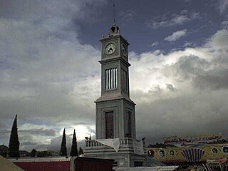
Zacazonapan is a municipality near Mexico City. It's municipal seat is the village of Zacazonapan. The name comes from Nahuatl and roughly translates to "in the River of the Dry Corn plants"
Huarijio is a Uto-Aztecan language of the states of Chihuahua and Sonora in northwestern Mexico. It is spoken by around 2,100 Huarijio people, most of whom are monolinguals.

The Triqui or Trique are an Indigenous people of the western part of the Mexican state of Oaxaca, centered in the municipalities of Juxtlahuaca, Putla, and Tlaxiaco. They number around 23,000 according to Ethnologue surveys. The Triqui language is a Mixtecan language of Oto-Manguean genetic affiliation. Trique peoples are known for their distinctive woven huipiles, baskets, and morrales (handbags).
Los Ramones is the name of a municipality and its corresponding seat of government and main population center in Mexican state of Nuevo Leon.
La Colorada is a small town in La Colorada Municipality in the Mexican state of Sonora in north-western Mexico. In 2005, the population of the municipality was 1,754, with 288 living in the municipal seat.
Tamazula de Victoria is a small town and seat of the municipality of Tamazula in the Mexican state of Durango. The town is located approximately 53 mi (85 km) east of the city center of Culiacán, Sinaloa, in the Sierra Madre Occidental mountains. The Tamazula River crescents directly north of the city.

Niquero is a municipality and town in the Granma Province of Cuba and is the southernmost municipality in the country. It is located in the coastal region of the province, bordering the Gulf of Guacanayabo. Cape Cruz, the westernmost point of the province is located in this municipality.
Eloxochitlán de Flores Magón, formerly known as San Antonio Eloxochitlán, is a city and municipality in the Mexican state of Oaxaca. It is part of the Teotitlán District in the north of the Cañada Region. Approximately 96% of the inhabitants of the municipality speak the indigenous Tecóatl Mazatec.

Tlaxiaco is a city, and its surrounding municipality of the same name, in the Mexican state of Oaxaca. It is located in the Tlaxiaco District in the south of the Mixteca Region, with a population of about 17,450.
Tlatlaya is one of 125 municipalities of the State of Mexico in Mexico. The municipal seat is the town of Tlatlaya which is the eleventh largest town in the municipality. The word “Tlatlaya” means when the hearth is black and red.
Luvianos is a small town and municipality located in the southwest of the State of Mexico. It gained municipal status in 2000. People can access Luvianos by driving Federal Road 134 south from Toluca, and then take a detour about 25 minutes north of Tejupilco. The name is derived from a hacienda what was established during colonial times.

Juan R. Escudero is a municipality in the Mexican state of Guerrero. The municipal seat lies at Tierra Colorada. The municipality covers an area of 652.6 km².

San Luis Acatlán is a municipality in the Mexican state of Guerrero. The municipal seat lies at San Luis Acatlán. The municipality covers an area of 704.4 km².
Xochistlahuaca Municipality is a municipality in the Mexican state of Guerrero. The municipal seat lies at Xochistlahuaca. The municipality covers an area of 321.1 km2.

Álamos is a municipality in south-western Sonora, Mexico. It includes the town of Álamos.

Hermosillo is a municipality in Sonora in north-western Mexico. The municipal seat is the city of Hermosillo.

Mazatán is a municipality in the state of Sonora in north-western Mexico. The municipal seat is at Mazatán, Sonora.

San Javier is a municipality in the state of Sonora in north-western Mexico. As of 2015, the municipality had a total population of 557.

Soyopa is a municipality in the state of Sonora in north-western Mexico. The municipal seat is at Soyopa.

Río Lagartos Municipality is a municipality in the Mexican state of Yucatán containing (249.09 km2) of land and is located roughly 215 kilometres (134 mi) northeast of the city of Mérida.


