Cumpas | |
|---|---|
 | |
 Location of the municipality in Sonora | |
| Country | |
| State | Sonora |
| Seat | Cumpas |
| Time zone | UTC-7 (Zona Pacífico) |
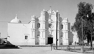
Cumpas is a municipality in the state of Sonora in north-western Mexico. [1] The municipal seat is at Cumpas.
Cumpas | |
|---|---|
| | |
| Location of the municipality in Sonora | |
| Country | |
| State | Sonora |
| Seat | Cumpas |
| Time zone | UTC-7 (Zona Pacífico) |
Cumpas is a municipality in the state of Sonora in north-western Mexico. [1] The municipal seat is at Cumpas.
The area of the municipality is 2,013.50 km2., which represents 1.09% of the state total and 0.10% of the national total. The most important settlements, besides the municipal seat, are Los Hoyos, Jecori, Ojo de Agua, Kilometro 5 and Teonadepa.
It is located at 30°00′N109°44′W / 30.00°N 109.74°W ; at an elevation of 914 metros. Boundaries are with Nacozari de García in the north, Huásabas in the east, Moctezuma in the south, Aconchi in the southwest, Huépac and Banámichi in the west, and Arizpe in the northeast. It is connected to the state capital of Hermosillo by Mex 17. See map at
The largest localities (cities, towns, and villages) are:
| Name | 2020 Census Population |
|---|---|
| Cumpas | 2,934 |
| Los Hoyos | 1,072 |
| Ojo de Agua | 597 |
| Jécori | 477 |
| Teonadepa | 331 |
| La Colonia | 201 |
| Total Municipality | 5,829 |
The municipal population was 5,776 in the 2005 count, which shows a decrease from 2000 when the census counted 6,202 inhabitants. The municipal seat had a population of 2809 in 2000.
Agriculture is modest with corn and beans grown for subsistence and grasses grown for cattle fodder. The cattle industry is more important with over 25,000 head counted in the 2000 census. Calves are exported to the United States. Mining is carried out with over 100 workers involved in this activity.
Originally the territory was occupied by the Opata teguimes Indians. In 1643 the area was visited by the Italian priest Tomás Basilio, and in 1643 the Jesuit missionary Egidio Monteffio founded the settlement with the name of Nuestra Señora de la Asunción de Cumpas.[ citation needed ]

Santa Ana is a small city and municipal seat of Santa Ana Municipality in the Mexican state of Sonora. It is located 168 kilometres (104 mi) north of the state capital Hermosillo and 100 kilometres (62 mi) south of Nogales on the United States border. The town had a 2005 census population of 10,593 inhabitants.

Cananea is a municipality in the northern portion of the Mexican state of Sonora, on the U.S. border. Its municipal seat is the city of Cananea, located at 30°58′55″N110°18′02″W.
Ruiz is a municipality and the municipal seat of the same located in the north of the Mexican state of Nayarit.

Baviácora is a small town and the municipal seat of the surrounding municipality of the Mexican state of Sonora. The geographical coordinates are 29°42′N110°09′W.
Bavispe is a small town and a municipality in the northeast part of the Mexican state of Sonora.
Huásabas is the municipal seat of Huásabas Municipality in the northeast of the Mexican state of Sonora. The municipal area is 711.17 km² (274.58 mi²) with a population of 966 registered in 2000. Most of the inhabitants live in the municipal seat.
Huepac is the seat of a Huépac Municipality in the center of the Mexican state of Sonora. The municipal area is 317.37 km2 with a population of 1,142 registered in 2000. Most of the inhabitants live in the municipal seat.
San Felipe de Jesús is the municipal seat of San Felipe de Jesús Municipality in the center of the Mexican state of Sonora. It is named after Mexico's first saint and Franciscan martyr, Saint Philip of Jesus.
Moctezuma is a municipio (municipality) of the Mexican state of Sonora, located in the state's central region. It is also the name of its largest settlement and cabecera municipal.

Nacozari de García is a small mining town in the northeast of the Mexican state of Sonora. It serves as the municipal seat for the surrounding municipality of the same name.

Pitiquito is a small town in Pitiquito Municipality in the northwest of the Mexican state of Sonora.

Quiriego is a small town and the county seat of the Municipality of Quiriego, located in the southeast of the Mexican state of Sonora.
Rosario de Tesopaco is a small town, the seat of Rosario de Tesopaco Municipality in the southeast of the Mexican state of Sonora.

Altar is a municipality in the state of Sonora in north-western Mexico. The municipality had a 2010 census population of 9,049 inhabitants, the vast majority of whom lived in the municipal seat of Altar, which had a population of 7,927 inhabitants. There are no other localities with over 1,000 inhabitants.

Carbó is a municipality in the state of Sonora in north-western Mexico. The municipal seat is at Carbó.

Etchojoa is one of the seventy-two municipalities in the Mexican state of Sonora. It is located in the southern part of the state, in the Mayo Valley area and on the coast of the Gulf of California. Its municipal seat and most inhabited town is Etchojoa. Other important towns include Bacobampo, Buaysiacobe, and Bacame Nuevo. The municipality was founded on October 15, 1909.

Fronteras is a municipality in the state of Sonora in north-western Mexico. In the 2020 Census, the municipality reported a total population of 9,041.

Huásabas is a municipality in the state of Sonora in north-western Mexico. In 2020, the municipality reported a total population of 888.

Navojoa is a municipality in the state of Sonora in north-western Mexico. As of 2015, the municipality had a total population of 163,650. The municipal seat is the city of Navojoa.

Tepache is a municipality in the state of Sonora in north-western Mexico.
| | This article about a location in the Mexican state of Sonora is a stub. You can help Wikipedia by expanding it. |
