Magdalena de Kino Municipality

Last updated
Magdalena
Magdalena Sonora map.png
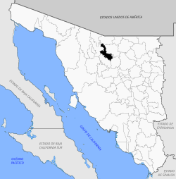
Location of the municipality in Sonora.
CountryFlag of Mexico.svg  Mexico
State Sonora
Capital Magdalena de Kino
Time zone UTC-7 (Mountain Standard Time)
  Summer (DST) UTC-7 (No DST)

The Municipality of Magdalena de Kino is a municipality ('county') in the Mexican state of Sonora in Northwestern Mexico. [1]

Contents

The Municipal seat is the town of Magdalena de Kino. It is a selected Pueblo Mágico for its scenic historical qualities.

The tomb of Spanish colonial missionary Eusebio Kino is located here.

Geography

It is located in the northern part of the State of Sonora, 50 miles (80 kilometers) south of the border with the United States; its extreme coordinates are 30° 26'- 31° 06' North latitude and 110° 44'- 111° 18' West longitude, its altitude fluctuates between a minimum of 1640 feet above sea level (500 meters asl) and a maximum of 6890 feet asl (2100 meters asl). The municipality has an area of 563.8 square miles (1,460.23 square kilometers) that represent 3% of the total area of Sonora.

It is bordered to the North by the municipality of Nogales, to the South by the municipality of Santa Ana (Sonora), to the East by the municipality of Ímuris and the municipality of Cucurpe, and to the West by the municipalities of Tubutama and Sáric.

Localities

Government

Municipal presidents

Municipal presidentTermPolitical partyNotes
Enrique Campbell Noriega1915–1917
Enrique Woolfolk [2] [3] 1927
Juan Irigoyen Monroy1934–1935 PNR Logo Partido Nacional Revolucionario.svg
Ignacio Hopkins Serrano1937–1939PNR Logo Partido Nacional Revolucionario.svg
Roberto Urías G.1939–1941 PRM Logo Partido de la Revolucion Mexicana.svg
Enrique C. Félix1941–1943PRM Logo Partido de la Revolucion Mexicana.svg
Lauro Grijalva López1943–1946PRM Logo Partido de la Revolucion Mexicana.svg
Vicente Terán Carrillo1946–1949 PRI PRI Party (Mexico).svg
Arturo Moreno Federico1949–1952PRI PRI Party (Mexico).svg
Arturo Fernando Félix1952–1955PRI PRI Party (Mexico).svg
Luis E. Donnadieu1955–1958PRI PRI Party (Mexico).svg
Arturo Soto Maldonado1958–1961PRI PRI Party (Mexico).svg
Álvaro Trelles Serna1961–1964PRI PRI Party (Mexico).svg
Gerardo G. Nava1964–1967PRI PRI Party (Mexico).svg
Manuel Félix Castro1967–1970PRI PRI Party (Mexico).svg
Luis Gallardo Valenzuela1970–1973PRI PRI Party (Mexico).svg
Alicia Arellano Tapia 1973–1976PRI PRI Party (Mexico).svg
José de Jesús Rochín Durazo1976–1978PRI PRI Party (Mexico).svg
Roberto Terán Woolfolk1978–1979PRI PRI Party (Mexico).svg
Trinidad del Villar del C.1979–1982PRI PRI Party (Mexico).svg
Luis Colosio Fernández 1982–1985PRI PRI Party (Mexico).svg
Zarina Fernández Moreno1985–1988PRI PRI Party (Mexico).svg
Gilberto Jayassi Parra1988–1991PRI PRI Party (Mexico).svg
Alejandro Soto Bastián [4] 1991–1994PRI PRI Party (Mexico).svg
Severino Colosio Fernández [5] [6] 1994–1997PRI PRI Party (Mexico).svg
Mario Rochín Durazo [7] 1997–2000PRI PRI Party (Mexico).svg
Luis Norberto Fernández Riesgo [8] 2000–2003 PAN PAN Party (Mexico).svg
Luis Alfonso Robles Contreras [9] [10] 16-09-2003–15-09-2006PRI PRI Party (Mexico).svg
Adriana Hoyos Rodríguez [11] [12] 16-09-2006–15-09-2009PRI PRI Party (Mexico).svg
Panal PNA logo (Mexico).svg
Alliance PRI Sonora-Panal
Luis Melecio Chavarín Gaxiola [13] 16-09-2009–15-09-2012PRI PRI Party (Mexico).svg
PVEM PVE logo (Mexico).png
Panal PNA logo (Mexico).svg
Jesús Rodolfo Martínez Leal [14] 16/09-2012–15-09-2015PAN PAN Party (Mexico).svg
Panal PNA logo (Mexico).svg
Luis Alfonso Robles Contreras [15] 16-09-2015–15-09-2018PRI PRI Party (Mexico).svg
PVEM PVE logo (Mexico).png
Panal PNA logo (Mexico).svg
Coalition "For an Honest and Effective Government"
Francisco Javier Zepeda Munro [16] 16-09-2018–15-09-2021PAN PAN Party (Mexico).svg
PRD PRD logo without border (Mexico).svg
Omar Ortez Guerrero [17] 16-09-2021–Magdalena Libre e Independiente

Related Research Articles

Huatabampo is a city in Huatabampo Municipality in the state of Sonora, in northwestern Mexico. It is situated on the Gulf of California, near the mouth of the Mayo River. It is located at latitude 26°49′N109°40′W. Huatabampo is 34 km (21 mi) southwest of Navojoa via Sonora State Highway 56 and Sonora State Highway 149. Mexican Federal Highway 15 can be accessed via Sonora State Highway 176. It is notable as the home of revolutionary general Álvaro Obregón, a successful chickpea farmer before the Mexican Revolution, and now his burial site.

<span class="mw-page-title-main">Chiquilistlán</span> Municipality and town in Jalisco, Mexico

Chiquilistlán is a small town in the Mexican state of Jalisco. It is located in the Sierra Tapalpa mountains, at the foot of a hill called Chiquilichi, some 75 kilometres to the south-west of state capital Guadalajara.

<span class="mw-page-title-main">Salinas de Hidalgo</span> Place in San Luis Potosí, Mexico

Salinas de Hidalgo, San Luis Potosí, Mexico also known as Salinas del Peñón Blanco, is a small town located in the northwestern part of the state. It is the seat of Salinas municipality in Mexico.

<span class="mw-page-title-main">Amatitán</span> Municipality and town in Jalisco, Mexico

Amatitán is the seat of a municipality in the Mexican state of Jalisco, and is home to one of the world's largest tequila distilleries.

<span class="mw-page-title-main">Pihuamo</span> Municipality and town in Jalisco, Mexico

Pihuamo is a town and municipality located in the state of Jalisco in Mexico.

Ures is a small city and a municipality in the Mexican state of Sonora.

<span class="mw-page-title-main">Teocaltiche</span> Municipality and Town in Jalisco, Mexico

Teocaltiche is a town and municipality in the central-western Mexican state of Jalisco. It is located in the northeastern highlands region of Jalisco, commonly referred to in Spanish as "Los Altos de Jalisco". The grasshopper or "chapulin" is a popular icon for the town.

<span class="mw-page-title-main">Zapotiltic</span> Municipality and town in Jalisco, Mexico

Zapotiltic is a town and municipality in the south region of the state of Jalisco, Mexico. It is located approximately 115 km south of Guadalajara. According to the "Conteo de Poblacion y Vivienda of 2015" the municipality had a population of 29,190.

<span class="mw-page-title-main">Acatic</span> Municipality and Town in Jalisco, Mexico

Acatic is a town and municipality, in Jalisco in central-western Mexico. The municipality covers an area of 339.2 km². The town produces mainly Spanish style shingles, brick, adobe floor tile, chia, corn, and tequila. Pueblo Viejo Tequila is bottled near by. The town is the entry "gate" to Los Altos of Jalisco.

<span class="mw-page-title-main">Acatlán de Juárez</span> Municipality and town in Jalisco, Mexico

Acatlán de Juárez is a town and municipality, in Jalisco in central-western Mexico. The municipality covers an area of 154 km².

<span class="mw-page-title-main">Amacueca</span> Municipality and town in Jalisco, Mexico

Amacueca is a town and municipality, in Jalisco in central-western Mexico. The municipality covers an area of 124.8 km2.

<span class="mw-page-title-main">Concepción de Buenos Aires</span> Municipality and town in Jalisco, Mexico

Concepción de Buenos Aires is a town and municipality, in Jalisco in central-western Mexico. The municipality covers an area of 265.6 km2.

<span class="mw-page-title-main">Villa Purificación</span> Municipality and town in Jalisco, Mexico

Villa Purificación is a town and municipality, in Jalisco in central-western Mexico. The municipality covers an area of 1,848 km².

<span class="mw-page-title-main">Zapotitlán de Vadillo</span> Municipality and town in Jalisco, Mexico

Zapotitlán de Vadillo is a town and municipality, in Jalisco in central-western Mexico. The municipality covers an area of 305.8 km².

<span class="mw-page-title-main">San Martín de Hidalgo Municipality, Jalisco</span> Municipality in Jalisco, Mexico

San Martín de Hidalgo Municipality is a municipality located in the Región Valles of the state of Jalisco, Mexico. As of 2010, the population was 26,306. The municipal seat is San Martín de Hidalgo. Other administrative communities include 5 delegations and 18 agencies.

<span class="mw-page-title-main">Arizpe Municipality</span> Municipality in Sonora, Mexico

Arizpe (municipality) is a municipality in the Mexican state of Sonora in north-western Mexico. The Municipality of Arizpe is one of the 72 municipalities of the state of Sonora, located in the north-central region of the state in the Sierra Madre Occidental area. It has 72 localities within the municipality, its municipal seat and the most populated locality is the homonymous town of Arizpe, while other important ones are: Sinoquipe, Bacanuchi and Chinapa. It was named for the first time as a municipality in 1813 and according to the 14th Population and Housing Census carried out in 2020 by the National Institute of Statistics and Geography (INEGI) the municipality has a total population of 2,788 inhabitants. This municipality has an area of 1,186.56 square miles (3,073.17 km2). Its Gross Domestic Product per capita is USD 11,012, and its Human Development Index (HDI) is 0.8292.

Imuris Municipality is a municipality in the Mexican state of Sonora in north-western Mexico.

<span class="mw-page-title-main">Puerto Peñasco Municipality</span> Municipality in Sonora, Mexico

Puerto Peñasco Municipality is a municipality in the Mexican state of Sonora in north-western Mexico. As of 2015, the municipality had a total population of 62,177 inhabitants. The only locality with a significant population is the municipal seat, also named Puerto Peñasco, which contains almost 99% of the municipality's population.

San Luis Río Colorado is a municipality in the Mexican state of Sonora in northwestern Mexico, covering an area of 8412.75 km².

References

  1. "-". Enciclopedia de los Municipios de México. Instituto Nacional para el Federalismo y el Desarrollo Municipal. Archived from the original on July 31, 2012. Retrieved January 4, 2010.
  2. "Estado de Sonora" (in Spanish). Retrieved 2 November 2021.
  3. "Enciclopedia de los Municipios y Delegaciones de México. Sonora. Magdalena" (in Spanish). Retrieved 2 November 2021.
  4. "Mapas históricos de representación política. Municipios gobernados por partido político. Período constitucional 1991-1994" (PDF) (in Spanish). Retrieved 2 November 2021.
  5. "IEESonora. Resultados globales. Ayuntamientos. Magdalena. PRI: 8355 votos. PAN: 1563 votos. Partido Popular Socialista (PPS): 168 votos" (in Spanish). Retrieved 2 November 2021.
  6. "Municipios gobernados por partido político. Período constitucional 1994-1997" (PDF) (in Spanish). Retrieved 2 November 2021.
  7. "Municipios gobernados por partido político. Período constitucional 1997-2000" (PDF) (in Spanish). Retrieved 2 November 2021.
  8. "Consejo Electoral del Estado de Sonora. Conformación de Ayuntamientos. 2000" (PDF) (in Spanish). Retrieved 2 November 2021.
  9. "Resultados oficiales de la elección de Ayuntamientos. 2003. Magdalena. PRI: 3645 votos. PAN: 3281 votos. PRD: 3028 votos. PT: 131 votos" (PDF) (in Spanish). Retrieved 2 November 2021.
  10. "Municipios gobernados por partido político. Período constitucional 2003-2006" (PDF) (in Spanish). Retrieved 2 November 2021.
  11. "Consejo Electoral del Estado de Sonora. Conformación de Ayuntamientos. 2006" (PDF) (in Spanish). Retrieved 2 November 2021.
  12. "Municipios gobernados por partido políticos. Período constitucional 2006-2009" (PDF) (in Spanish). Retrieved 2 November 2021.
  13. "Consejo Electoral del Estado de Sonora. Conformación de Ayuntamientos. 2009" (PDF) (in Spanish). Retrieved 2 November 2021.
  14. "Consejo Electoral del Estado de Sonora. Conformación de planillas de Ayuntamiento. 2012" (PDF) (in Spanish). Retrieved 2 November 2021.
  15. "Instituto Electoral y de Participación Ciudadana de Sonora. Conformacion de planillas de Ayuntamiento. 2015" (PDF) (in Spanish). Retrieved 2 November 2021.
  16. "Instituto Electoral y de Participación Ciudadana de Sonora. Cómputo municipal. Período constitucional 2018-2021. PAN-PRD: 6275 votos. PRI-PVEM-Partido Nueva Alianza (Panal): 4727 votos" (PDF) (in Spanish). Retrieved 2 November 2021.
  17. "Instituto Estatal Electoral y de Participación Ciudadana de Sonora (IEESonora). Autoridades electas. Presidencia Municipal de Magdalena" (in Spanish). Retrieved 2 November 2021.

30°38′N110°57′W / 30.633°N 110.950°W / 30.633; -110.950