Ferguson Township, Centre County, Pennsylvania | |
---|---|
Country | United States |
State | Pennsylvania |
County | Centre |
Settled | 1791 |
Incorporated | 1801 |
Government | |
• Type | Board of Supervisors |
• Chair (At Large) | Lisa Strickland |
• Vice-Chair (Ward II) | Jeremie Thompson |
• Supervisor (At Large) | Omari Patterson |
• Supervisor (Ward I) | Matthew Heller |
• Supervisor (Ward III) | Patricia Stephens |
Area | |
• Total | 47.70 sq mi (123.55 km2) |
• Land | 47.70 sq mi (123.54 km2) |
• Water | 0.01 sq mi (0.01 km2) |
Population (2020) | |
• Total | 19,009 |
• Density | 405.69/sq mi (156.64/km2) |
Time zone | UTC-5 (EST) |
• Summer (DST) | UTC-4 (EDT) |
Zip Codes | 16801, 16803, 16868 (Pine Grove Mills) |
Area code(s) | 814 and 582 |
FIPS code | 42-027-25624 |
Website | www |
Ferguson Township is a township with home rule status in Centre County, Pennsylvania, United States. It is part of the State College, Pennsylvania Metropolitan Statistical Area. The population was 19,009 at the 2020 census. Most of the agricultural research for Pennsylvania State University (Penn State), based in adjacent State College, Pennsylvania, is taking place at the Russell E. Larson Research Center located in the western part of Ferguson Township. The headquarters of AccuWeather are also located within the township.
Ferguson Township is served by the Ferguson Township Police Department and the Alpha Fire Company for police and fire protection.
The Bucher Ayres Farm was added to the National Register of Historic Places in 1980. [2]
The township adopted a home rule charter in May 1974, effective January 5, 1976, retaining "Township of Ferguson" as its official name. [3] Despite the "Township" designation, Ferguson is no longer governed under the state's Township Code.
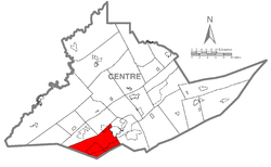
The township has a total area of 47.6 square miles (123.4 km2), all land.
Ferguson Township is bordered by Halfmoon Township and Patton townships to the northwest, the borough of State College and College Township to the northeast, Harris Township to the east and Huntingdon County [4] to the south.
Census | Pop. | Note | %± |
---|---|---|---|
1850 | 1,601 | — | |
1860 | 1,784 | 11.4% | |
1870 | 2,111 | 18.3% | |
1880 | 1,817 | −13.9% | |
1890 | 1,748 | −3.8% | |
1900 | 1,512 | −13.5% | |
1910 | 1,558 | 3.0% | |
1920 | 1,639 | 5.2% | |
1930 | 1,549 | −5.5% | |
1940 | 1,936 | 25.0% | |
1950 | 2,388 | 23.3% | |
1960 | 3,832 | 60.5% | |
1970 | 6,351 | 65.7% | |
1980 | 8,105 | 27.6% | |
1990 | 9,368 | 15.6% | |
2000 | 14,063 | 50.1% | |
2010 | 17,690 | 25.8% | |
2020 | 19,009 | 7.5% | |
U.S. Decennial Census [5] |
As of the census [6] of 2010, there were 17,690 people, 7,195 households, and 4,192 families residing in the township. The population density was 367.8 inhabitants per square mile (142.0/km2). There were 7,501 housing units at an average density of 155.9 per square mile (60.2/km2). The racial makeup of the township was 82.0% White, 3.2% Black or African American, 0.1% Native American, 11.4% Asian, 1.0% from other races, and 2.3% from two or more races. Hispanics or Latinos of any race were 3.0% of the population.
There were 7,195 households, out of which 26.9% had children under the age of 18 living with them, 49.7% were married couples living together, 2.4% had a male householder with no wife present, 6.2% had a female householder with no husband present, and 41.7% were non-families. 25.8% of all households were made up of individuals, and 6.8% had someone living alone who was 65 years of age or older. The average household size was 2.45 and the average family size was 2.94.
The age distribution was 19.6% under 18, 18.0% from 18 to 24, 27.4% from 25 to 44, 23.0% from 45 to 64, and 12.0% who were 65 or older. The median age was 33 years. For every 100 females, there were 102.8 males. For every 100 females age 18 and over, there were 102.3 males.
The median income for a household in the township was $57,459, and the median income for a family was $72,339. The per capita income for the township was $31,016. About 5.6% of families and 15.6% of the population were below the poverty line, including 11.7% of those under age 18 and 2.0% of those age 65 or over.
The Township of Ferguson is governed by a five-member Board of Supervisors with two serving at-large and three serving by ward. Supervisors each serve four-year terms for a maximum of two-terms before a minimum two-year break. The Supervisors are chosen by plurality elections every two years alternating between at-large and ward elections.
The Township of Ferguson is represented in the Pennsylvania General Assembly by Senate, District 35 and House District 77. Federally, the Township of Ferguson is part of Pennsylvania's 15th congressional district.
Cumberland Township is a township in Adams County, Pennsylvania, United States. The population was 7,033 at the 2020 census. In 1863, the American Civil War Battle of Gettysburg took place mainly in Cumberland Township, which surrounds the borough of Gettysburg on three sides.
Pine Grove Mills is an unincorporated community, village, and census-designated place (CDP) in Ferguson Township, Centre County, Pennsylvania, United States. It is part of the State College, Pennsylvania Metropolitan Statistical Area. The population was 1,481 at the 2020 census.
Greene Township is a township in Erie County, Pennsylvania, United States. The population was 4,486 at the 2020, down from 4,706 at the 2010 census.
Waterford Township is a township in Erie County, Pennsylvania, United States. The population was 3,911 at the 2020 census, down from 3,920 at the 2010 census.
Antrim Township is a township in Franklin County, Pennsylvania, United States. The population was 15,778 at the 2020 census, an increase over the figure of 12,504 tabulated in 2000. It was named after County Antrim in Northern Ireland.
Freeport Township is a township in Greene County, Pennsylvania, United States. The population was 268 at the 2020 census.
Pike Township is a township in Potter County, Pennsylvania, United States. The population was listed at 330 on the 2020 census. The population rose to 324 people as of 2010.
Ulysses Township is a township in Potter County, Pennsylvania, United States. As of the 2020 census, the township population was 647. There are two Pennsylvania state parks in Ulysses Township. Denton Hill State Park is a ski resort along U.S. Route 6. Lyman Run State Park is in the southern part of the township and is partially in neighboring West Branch Township. Its population includes extreme white supremacy groups, and has done so for about 100 years.
Blythe Township is a township in Schuylkill County, Pennsylvania. Formed in 1846 from part of Schuylkill Township, it is named for State Legislator Calvin Blythe.
Beaver Township is a township in Snyder County, Pennsylvania, United States. The population was 508 at the 2020 census.
Franklin Township is a township in Snyder County, Pennsylvania, United States. The population was 2,204 at the 2020 census.
Greenville Township is a township in Somerset County, Pennsylvania, United States. The population was 752 at the 2020 census. It is part of the Johnstown, Pennsylvania, Metropolitan Statistical Area.
Larimer Township is a township in Somerset County, Pennsylvania, United States. The population was 543 at the 2020 census. It is part of the Johnstown, Pennsylvania, Metropolitan Statistical Area. Larimer Township was named for General William Larimer, Jr., president of the Pittsburgh & Connellsville Railroad.
Covington Township is a township in Tioga County, Pennsylvania, United States. The population was 1,031 at the 2020 census.
Gregg Township is a township in Union County, Pennsylvania, United States. The population was 4,339 at the 2020 census, of which 3,679 were federal inmates.
Codorus Township is a township in York County, Pennsylvania, United States. The population was 3,898 at the 2020 census.
Fawn Township is a township in York County, Pennsylvania, United States. The population was 3,011 at the 2020 census.
Monaghan Township is a township in York County, Pennsylvania, United States. The population was 2,674 at the 2020 census.
Peach Bottom Township is a township in York County, Pennsylvania, 60 miles (97 km) south of Harrisburg. The population was 4,961 at the 2020 census.
Warrington Township is a township in York County, Pennsylvania, United States. The population was 4,547 at the 2020 census. The township is named after Warrington, England, like many townships having English names in York County. Others dispute the origin, believing it may be named after Waringstown, County Down, now in Northern Ireland.