Geology of Nevada

Last updated

Valley of Fire near Las Vegas Fire Wave Trail, Valley of Fire (31876666718).jpg
Valley of Fire near Las Vegas

The geology of Nevada began to form in the Proterozoic at the western margin of North America. Terranes accreted to the continent as a marine environment dominated the area through the Paleozoic and Mesozoic periods. Intense volcanism, the horst and graben landscape of the Basin and Range Province originating from the Farallon Plate, and both glaciers and valley lakes have played important roles in the region throughout the past 66 million years. [1]

Contents

Geologic history, stratigraphy, and tectonics

The oldest rocks in Nevada are in the East Humboldt Range in the northeast, with lead isotope data suggesting an age of 2.5 billion years, at the boundary of the Archean and Proterozoic. Metamorphic and igneous rocks formed 1.7 billion years ago underlie Clark County and the populous areas around Las Vegas. The region was part of the supercontinent Rodinia one billion years ago, situated at the equator.

The continent rifted apart between 700 and 600 million years ago. No continental rocks exist in western Nevada from more than 700 million years ago, because the western part of the region was rifted away, becoming part of current day Siberia. [2]

Paleozoic (539-251 million years ago)

After the breakup of Rodinia, southern and eastern Nevada remained as a passive margin on the western edge of the proto-North American continent of Laurentia. Up to 20,000 feet of sediment accumulated along the new margin as it subsided, building up thick layers of sandstone, siltstone, limestone and dolomite. The Monitor, Egan, Schell Creek and Arrow Canyon ranges in the east are dominated by limestone and dolomite formed during 400 million years of marine conditions. Central Nevada by contrast, preserves shale, siltstone and chert formed under deep water conditions as fine ooze settled into deep water offshore.[ citation needed ]

Continental collisions began to form the supercontinent Pangea leading to subduction along the western margin of Laurentia. As plates subducted, they spurred intense volcanic and tectonic activity, and volcanic island arcs and carbonate platforms accreted against the western shore. Dozens of terranes accumulated over 250 million year and many rock units were thrust on top of others as thrust sheets along thrust faults. Large granite bodies formed from magma.[ citation needed ]

The Antler Orogeny, named by geologists in 1951 after Antler Peak on Battle Mountain, was an early orogeny mountain building event in the creation of the Basin and Range Province. The Antler highland, including the Roberts Mountains, formed as fractured deep ocean sediments were thrust upward. For the most part, the Antler Orogeny occurred in the Devonian and Mississippian, although it may have continued longer.[ citation needed ]

One terrane that may have driven the orogeny is the Nolan Belt, an intensely folded mass of quartzite, schist and slate extending from Esmeralda County to the north, through central Nevada as far as the Mountain City and Bull Run Mountain area near Idaho.

Hinterland and foreland basins filled with sediments as the Antler highland eroded. Sea levels rose over the eroded mountains in the late Paleozoic, although uneven rock surfaces remain as the Antler overlap sequence, which includes conglomerate, siltstone, limestone and sandstone deposited from the Pennsylvanian into the early Triassic.

High concentrations of the rare element iridium and jumbled mega-breccia deposits in the Guilmette Formation, made up of shattered limestone that re-cemented in deep water, has led geologists to infer the Alamo meteorite impact even around 382 million years ago in the Devonian. Distinct gravel rubble is common in late Devonian rocks in the area, suggesting large tsunamis. Although an exact impact site has not been found, geologists have suggested a possible location in the Timpahute Range in southern Lincoln County, near Rachel, Nevada. Based on the distribution of debris, estimates suggest a crater one mile deep and 30 miles in diameter. Terranes continued to accrete, driving the Humboldt orogeny, first recognized in rocks in the Pinon Range in 1977, and Permian-Triassic Sonoma orogeny.[ citation needed ]

During the Sonomo orogeny, the Golconda allochthon, a thick sequence of metamorphosed basalt, siltstone, shale, chert and limestone, was thrust on top of the Antler overlap sequence. It is named for the Golcondo Summit, where US Interstate 80 crosses Edna Mountain. Sonomia, the superterrane added to the region, includes several smaller terranes, including Walker Lake, Pine Nut and Paradise. [3]

Mesozoic (251-66 million years ago)

Plate convergence continued through the Mesozoic, with the addition of the Black Rock-Jackson terrane in the Jurassic and Cretaceous now present in northwest Nevada. The terrane rocks are volcanic or sedimentary and originated offshore in the Paleozoic and Triassic. By the end of the Mesozoic, dry land conditions prevailed across Nevada.[ citation needed ]

The Farallon Plate transported the terranes and subducted under North America in the Cretaceous. Numerous thrust faults developed due to compressional strain, placing older rocks on top of younger units. In the northwest, the Luning-Fencemaker thrust fault developed in the Jurassic and thrust the Jungo terrane to the east, forming the undulating Nevadaplano. As the Farallon Plate subducted, the Sevier Orogeny generated large mountain ranges in the east. [4]

Cenozoic (66 million years ago-present)

In the Mesozoic, the subducting Farallon Plate had produced magma and played a role in building the Sierra Nevada mountains, but by 60 million years ago in the Cenozoic, its downward angle decreased and it moved further eastward without producing magma. The plate produced shear stress at the base of the North American Plate, driving the Laramide orogeny, which created the Rocky Mountains. Due to conditions in the underlying crust, inferred to be a thinner section of the Farallon, intense volcanic activity began in the Eocene in northern Nevada around 43 million years ago, reaching the center of the state by the Oligocene and the south by the Miocene. The volcanism was some of the most intense in Earth history, ejecting 17,000 cubic miles of material in 250 major eruptions and layering the landscape in tuff ash falls thousands of feet thick. Extinct calderas up to 35 miles wide are preserved in the mountains of south-central Nevada, particularly near the Tonopah range, as well as in the Hot Creek, Monitor, Reveille and Kawich ranges. Welded ignimbrite formed as hot ash formed natural glass on rock surfaces.

Violent volcanism continued in the southwest until seven million years ago, forming the ancestral Cascade arc, named for its similarity to the Cascade Range in the Pacific Northwest. Additionally, the Walker Lane—an area of northwest trending right-lateral strike-slip faults formed 12 million years ago—associated with some of the most intense eruptions, such as the 16 to 6.5 million year old Southwest Nevada volcanic field.

During the last 10 million years, volcanic activity shifted to bimodal volcanism with basalt lava flows alternating with rhyolite domes. Dark gray to black basalt and pink or brown rhyolite are particularly common in Elko, Washoe and Humboldt counties. Some small cinder cones formed as recently as the Pleistocene and the Nye County Lunar Crater volcanic field was active only 15,000 years ago. In Nevada's recent geologic past, tectonic changes have created normal faults and creating the basin and range horst and graben terrain. Thinning of the upper crust caused deeper, highly metamorphosed rock masses to rise to the surface, where it is overlain by younger faulted and domed rocks. There are more than 24 metamorphic core complexes in the Basin and Range Province as a whole. In some cases, faulted blocks have shifted more than 50 miles from the apex of the dome. Along detachment surfaces, mylonite forms due to shear. The Ruby Mountains-East Humboldt, close to Elko, and the Northern Snake Range, close to Utah, are the two most researched core complexes.[ citation needed ]

At the time of the Pleistocene glaciations, Nevada experienced temperatures up to 15 degrees Fahrenheit lower, eight inches more of annual rainfall and lower evaporation. Although it was drier overall than many neighboring areas, glaciers did form in the Ruby Mountains and East Humboldt Range. Small areas of eastern Nevada in the White Pine, Grant Ranges, Snake and Schell Creek mountains were also glaciated, along with the Toquima, Toiyabe and Monitor Ranges in the center of the state. Geologists debate whether the 11,918 foot tall Charleston Peak was glaciated as well.

Dozens of large lakes filled the valleys in the region, accumulating fine silt and developing alkaline chemical conditions that precipitated tufa calcium carbonate mounds. Lake Lahontan in the northwest was the largest lake overall and flooded up to 8600 square miles 14,000 years ago. The lake grew in three different phases, with volcanic ash and silt at its bottom. Today, Pyramid Lake is a remnant of Lahontan, where it was once over 900 feet deep. Elsewhere, Clover, Franklin and Waring lakes developed near the Ruby Mountains. Lake Railroad occupied Railroad Valley, while Lake Toiyabe and Lake Desatoya formed in Big Smoky Valley and Smith Creek Valley respectively. [5]

Natural resource geology

Mining and mineral resources have played an important role in the state's past and present economy. Named the Silver State for silver deposits which spurred early settlement and statehood in the 1800s, Nevada is today the leading producer of gold in the US, mining five million ounces annually. In 2012, $10.5 billion of materials were mined, directly employing over 15,000 people.[ citation needed ]

Gold-bearing skarn in the Battle Mountain region of northeast Nevada is an important target for mining. Up to 263 polymetallic veins contain sphalerite, galena, jamesonite and tetrahedrite. Polymetallic molybdenum, antimony, uranium, copper, gold zinc, lead and silver ores have been mined in the Reese River area since the 1800s.[ citation needed ]

In 1961, Carlin-type gold deposits were discovered near Carlin, Nevada. Paleozoic limestone, formed at the ancient continental margin, contains nearly microscopic gold associated with pyrite and arsenic sulfides and particularly jasperoid in folds and faults. Over 200 million ounces of gold are known to be distributed in more than 100 Carlin-type deposits.[ citation needed ] The Carlin trend extends from the Pinon Range to the Tuscarora Mountains, an area 70 miles long and 10 miles wide. Epithermal, skarn, vein and Carlin-type deposits are also found in the neighboring Battle Mountain-Eureka trend to the southwest. Other sites of mining and mineralization include the Independence trend and Walker Lane trend.

Nevada is the leading producer of barite in the US, particularly at the Greystone Mine in Lander County, where it is found in deep sea black shale and argillite. [6]

Related Research Articles

<span class="mw-page-title-main">Coast Mountains</span> Mountain range in Canada and the United States

The Coast Mountains are a major mountain range in the Pacific Coast Ranges of western North America, extending from southwestern Yukon through the Alaska Panhandle and virtually all of the Coast of British Columbia south to the Fraser River. The mountain range's name derives from its proximity to the sea coast, and it is often referred to as the Coast Range. The range includes volcanic and non-volcanic mountains and the extensive ice fields of the Pacific and Boundary Ranges, and the northern end of the volcanic system known as the Cascade Volcanoes. The Coast Mountains are part of a larger mountain system called the Pacific Coast Ranges or the Pacific Mountain System, which includes the Cascade Range, the Insular Mountains, the Olympic Mountains, the Oregon Coast Range, the California Coast Ranges, the Saint Elias Mountains and the Chugach Mountains. The Coast Mountains are also part of the American Cordillera—a Spanish term for an extensive chain of mountain ranges—that consists of an almost continuous sequence of mountain ranges that form the western backbone of North America, Central America, South America and Antarctica.

<span class="mw-page-title-main">Geology of the United States</span> National geology

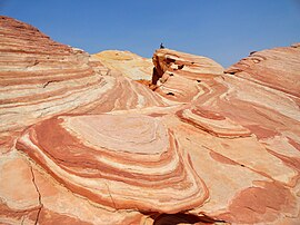
The richly textured landscape of the United States is a product of the dueling forces of plate tectonics, weathering and erosion. Over the 4.5 billion-year history of the Earth, tectonic upheavals and colliding plates have raised great mountain ranges while the forces of erosion and weathering worked to tear them down. Even after many millions of years, records of Earth's great upheavals remain imprinted as textural variations and surface patterns that define distinctive landscapes or provinces.

<span class="mw-page-title-main">Geology of the Grand Teton area</span>

The geology of the Grand Teton area consists of some of the oldest rocks and one of the youngest mountain ranges in North America. The Teton Range, partly located in Grand Teton National Park, started to grow some 9 million years ago. An older feature, Jackson Hole, is a basin that sits aside the range.

<span class="mw-page-title-main">Geology of the Death Valley area</span> Geology of the area in California and Nevada

The exposed geology of the Death Valley area presents a diverse and complex set of at least 23 formations of sedimentary units, two major gaps in the geologic record called unconformities, and at least one distinct set of related formations geologists call a group. The oldest rocks in the area that now includes Death Valley National Park are extensively metamorphosed by intense heat and pressure and are at least 1700 million years old. These rocks were intruded by a mass of granite 1400 Ma and later uplifted and exposed to nearly 500 million years of erosion.

<span class="mw-page-title-main">Antler orogeny</span> Tectonic event from the Late Devonian into the Mississippian and early Pennsylvanian

The Antler orogeny was a tectonic event that began in the early Late Devonian with widespread effects continuing into the Mississippian and early Pennsylvanian. Most of the evidence for this event is in Nevada but the limits of its reach are unknown. A great volume of conglomeratic deposits of mainly Mississippian age in Nevada and adjacent areas testifies to the existence of an important tectonic event, and implies nearby areas of uplift and erosion, but the nature and cause of that event are uncertain and in dispute. Although it is known as an orogeny, some of the classic features of orogeny as commonly defined such as metamorphism, and granitic intrusives have not been linked to it. In spite of this, the event is universally designated as an orogeny and that practice is continued here. This article outlines what is known and unknown about the Antler orogeny and describes three current theories regarding its nature and origin.

The Nevadan orogeny occurred along the western margin of North America during the Middle Jurassic to Early Cretaceous time which is approximately from 155 Ma to 145 Ma. Throughout the duration of this orogeny there were at least two different kinds of orogenic processes occurring. During the early stages of orogenesis an "Andean type" continental magmatic arc developed due to subduction of the Farallon oceanic plate beneath the North American Plate. The latter stages of orogenesis, in contrast, saw multiple oceanic arc terranes accreted onto the western margin of North America in a "Cordilleran type" accretionary orogen. Deformation related to the accretion of these volcanic arc terranes is mostly limited to the western regions of the resulting mountain ranges and is absent from the eastern regions. In addition, the deformation experienced in these mountain ranges is mostly due to the Nevadan orogeny and not other external events such as the more recent Sevier and Laramide Orogenies. It is noted that the Klamath Mountains and the Sierra Nevada share similar stratigraphy indicating that they were both formed by the Nevadan orogeny. In comparison with other orogenic events, it appears that the Nevadan Orogeny occurred rather quickly taking only about 10 million years as compared to hundreds of millions of years for other orogenies around the world.

<span class="mw-page-title-main">Geology of the Australian Capital Territory</span> Overview of the geology of the Australian Capital Territory

The geology of the Australian Capital Territory includes rocks dating from the Ordovician around 480 million years ago, whilst most rocks are from the Silurian. During the Ordovician period the region—along with most of eastern Australia—was part of the ocean floor. The area contains the Pittman Formation consisting largely of Quartz-rich sandstone, siltstone and shale; the Adaminaby Beds and the Acton Shale.

<span class="mw-page-title-main">Geology of the Rocky Mountains</span> Discontinuous series of North American mountain ranges with distinct geological origin

The geology of the Rocky Mountains is that of a discontinuous series of mountain ranges with distinct geological origins. Collectively these make up the Rocky Mountains, a mountain system that stretches from Northern British Columbia through central New Mexico and which is part of the great mountain system known as the North American Cordillera.

The Sonoma orogeny was a period of mountain building in western North America. The exact age and structure of the Sonoma orogeny is controversial. The orogeny is generally thought to have occurred during the Permian / Triassic transition, around 250 million years ago, following the Late Devonian Antler orogeny. The Sonoma orogeny was one of a sequence of accretionary events along the Cordilleran margin, possibly caused by the closure of the basin between the island arc of Sonomia and the North American continent. Evidence of this event has been reported throughout western North America, but most distinctly in northwest Nevada.

<span class="mw-page-title-main">Geology of Massachusetts</span>

The geology of Massachusetts includes numerous units of volcanic, intrusive igneous, metamorphic and sedimentary rocks formed within the last 1.2 billion years. The oldest formations are gneiss rocks in the Berkshires, which were metamorphosed from older rocks during the Proterozoic Grenville orogeny as the proto-North American continent Laurentia collided against proto-South America. Throughout the Paleozoic, overlapping the rapid diversification of multi-cellular life, a series of six island arcs collided with the Laurentian continental margin. Also termed continental terranes, these sections of continental rock typically formed offshore or onshore of the proto-African continent Gondwana and in many cases had experienced volcanic events and faulting before joining the Laurentian continent. These sequential collisions metamorphosed new rocks from sediments, created uplands and faults and resulted in widespread volcanic activity. Simultaneously, the collisions raised the Appalachian Mountains to the height of the current day Himalayas.

<span class="mw-page-title-main">Geology of North America</span> Overview of the geology of North America

The geology of North America is a subject of regional geology and covers the North American continent, the third-largest in the world. Geologic units and processes are investigated on a large scale to reach a synthesized picture of the geological development of the continent.

<span class="mw-page-title-main">Geology of Sudan</span>

The geology of Sudan formed primarily in the Precambrian, as igneous and metamorphic crystalline basement rock. Ancient terranes and inliers were intruded with granites, granitoids as well as volcanic rocks. Units of all types were deformed, reactivated, intruded and metamorphosed during the Proterozoic Pan-African orogeny. Dramatic sheet flow erosion prevented almost any sedimentary rocks from forming during the Paleozoic and Mesozoic. From the Mesozoic into the Cenozoic the formation of the Red Sea depression and complex faulting led to massive sediment deposition in some locations and regional volcanism. Sudan has petroleum, chromite, salt, gold, limestone and other natural resources.

<span class="mw-page-title-main">Geology of Arizona</span> Overview of the geology of Arizona

The geology of Arizona began to form in the Precambrian. Igneous and metamorphic crystalline basement rock may have been much older, but was overwritten during the Yavapai and Mazatzal orogenies in the Proterozoic. The Grenville orogeny to the east caused Arizona to fill with sediments, shedding into a shallow sea. Limestone formed in the sea was metamorphosed by mafic intrusions. The Great Unconformity is a famous gap in the stratigraphic record, as Arizona experienced 900 million years of terrestrial conditions, except in isolated basins. The region oscillated between terrestrial and shallow ocean conditions during the Paleozoic as multi-cellular life became common and three major orogenies to the east shed sediments before North America became part of the supercontinent Pangaea. The breakup of Pangaea was accompanied by the subduction of the Farallon Plate, which drove volcanism during the Nevadan orogeny and the Sevier orogeny in the Mesozoic, which covered much of Arizona in volcanic debris and sediments. The Mid-Tertiary ignimbrite flare-up created smaller mountain ranges with extensive ash and lava in the Cenozoic, followed by the sinking of the Farallon slab in the mantle throughout the past 14 million years, which has created the Basin and Range Province. Arizona has extensive mineralization in veins, due to hydrothermal fluids and is notable for copper-gold porphyry, lead, zinc, rare minerals formed from copper enrichment and evaporites among other resources.

<span class="mw-page-title-main">Geology of Utah</span>

The geology of Utah, in the western United States, includes rocks formed at the edge of the proto-North American continent during the Precambrian. A shallow marine sedimentary environment covered the region for much of the Paleozoic and Mesozoic, followed by dryland conditions, volcanism, and the formation of the basin and range terrain in the Cenozoic.

The geology of Alaska includes Precambrian igneous and metamorphic rocks formed in offshore terranes and added to the western margin of North America from the Paleozoic through modern times. The region was submerged for much of the Paleozoic and Mesozoic and formed extensive oil and gas reserves due to tectonic activity in the Arctic Ocean. Alaska was largely ice free during the Pleistocene, allowing humans to migrate into the Americas.

<span class="mw-page-title-main">Geology of Colorado</span> Geology of the U.S. State of Colorado

The bedrock under the U.S. State of Colorado was assembled from island arcs accreted onto the edge of the ancient Wyoming Craton. The Sonoma orogeny uplifted the ancestral Rocky Mountains in parallel with the diversification of multicellular life. Shallow seas covered the regions, followed by the uplift current Rocky Mountains and intense volcanic activity. Colorado has thick sedimentary sequences with oil, gas and coal deposits, as well as base metals and other minerals.

The geology of North Carolina includes ancient Proterozoic rocks belonging to the Grenville Province in the Blue Ridge. The region experienced igneous activity and the addition of new terranes and orogeny mountain building events throughout the Paleozoic, followed by the rifting of the Atlantic Ocean and the deposition of thick sediments in the Coastal Plain and offshore waters.

The geology of Trinidad and Tobago includes two different islands with different geological histories.

The geology of Yukon includes sections of ancient Precambrian Proterozoic rock from the western edge of the proto-North American continent Laurentia, with several different island arc terranes added through the Paleozoic, Mesozoic and Cenozoic, driving volcanism, pluton formation and sedimentation.

<span class="mw-page-title-main">Geology and geological history of California</span> Description of the geology of California

The geology of California is highly complex, with numerous mountain ranges, substantial faulting and tectonic activity, rich natural resources and a history of both ancient and comparatively recent intense geological activity. The area formed as a series of small island arcs, deep-ocean sediments and mafic oceanic crust accreted to the western edge of North America, producing a series of deep basins and high mountain ranges.

References

  1. Decourten, Frank; Biggar, Norma (2017). Roadside Geology of Nevada. Mountain Press Publishing Company.
  2. Decourten & Biggar 2017, p. 21-24.
  3. Decourten & Biggar 2017, p. 24-30.
  4. Decourten & Biggar 2017, p. 32-33.
  5. Decourten & Biggar 2017, p. 34-35.
  6. Decourten & Biggar 2017, p. 18-22.