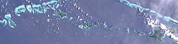
Satellite image | |
Geography | |
---|---|
Location | Oceania |
Coordinates | 11°08′S152°44′E / 11.133°S 152.733°E Coordinates: 11°08′S152°44′E / 11.133°S 152.733°E [1] |
Archipelago | Louisiade Archipelago |
Adjacent bodies of water | Solomon Sea |
Total islands | 1 |
Major islands |
|
Area | 0.36 km2 (0.14 sq mi) |
Administration | |
Province | ![]() |
District | Samarai-Murua District |
LLG [2] | Louisiade Rural LLG |
Island Group | Calvados Chain |
Demographics | |
Population | 0 (2014) |
Pop. density | 0/km2 (0/sq mi) |
Ethnic groups | Papauans, Austronesians, Melanesians. |
Additional information | |
Time zone | |
ISO code | PG-MBA |
Official website | www |
Gilia Island is an island in Papua New Guinea, part of the Calvados Chain within the Louisiade Archipelago. It is located near Bagaman Island. It is used as a coconut camp for the men of Bagaman. In recent years, Bagaman islanders use Gilia for claiming coconuts.
The coconut tree is a member of the palm tree family (Arecaceae) and the only living species of the genus Cocos. The term "coconut" can refer to the whole coconut palm, the seed, or the fruit, which botanically is a drupe, not a nut. The name comes from the old Portuguese and Spanish word coco, meaning "head" or "skull", after the three indentations on the coconut shell that resemble facial features. They are ubiquitous in coastal tropical regions and are a cultural icon of the tropics.
Copra is the dried meat or kernel of the coconut, which is the fruit of the coconut palm. Coconut oil is extracted from copra, making it an important agricultural commodity for many coconut-producing countries. It also yields de-fatted coconut cake after oil extraction, which is mainly used as feed for livestock.
Bougainville Island is the main island of the Autonomous Region of Bougainville of Papua New Guinea. It formed the main landmass of the German Empire-associated North Solomons. Its land measures 9,300 km2 (3,600 sq mi). The population of the province is approximately 300,000, which includes islets such as the Carterets. Mount Balbi on the main island at 2,715 m (8,907 ft) is the highest point. Much smaller Buka Island, c. 500 km2 (190 sq mi) lies north across the 400–500 m (1,300–1,600 ft) wide Buka strait. The Buka strait, despite its narrowness, is unbridged; however, regular ferries operate between the key settlements on either side and Buka Town has the main northern airstrip/airport.
Madang is a province of Papua New Guinea. The province is on the northern coast of mainland Papua New Guinea and has many of the country's highest peaks, active volcanoes and its biggest mix of languages. The capital is the town of Madang.
Madang is the capital of Madang Province and is a town with a population of 27,420 on the north coast of Papua New Guinea. It was first settled by the Germans in the 19th century.
The Mussau-Emira language is spoken on the islands of Mussau and Emirau in the St Matthias Islands in the Bismarck Archipelago.
Karkar Island is an oval-shaped volcanic island located in the Bismarck Sea, about 30 kilometres off the north coast of mainland Papua New Guinea in Madang Province, from which it is separated by the Isumrud Strait. The island is about 25 km in length and 19 km in width. In the centre is an active volcano with two nested calderas.
Marshall Bennett Islands are several islands in Milne Bay, Papua New Guinea.
Nukumanu, formerly Tasman Islands, is an atoll of Papua New Guinea, located in the Southwestern Pacific Ocean, 4 degrees south of the equator.
The Bonis Peninsula is a narrow peninsula located on Bougainville Island, Papua New Guinea, at the north of the island. The Buka Passage separates the peninsula from Buka Island.
The Duchateau Islands are an island group in the Coral Sea, belonging to Papua New Guinea. They lie to the east of Panarairai Island in the Louisiade Archipelago.
Coconuts falling from their tree and striking individuals can cause serious injury to the back, neck, shoulders and head; and are occasionally fatal.
Bagaman Island is an island of Papua New Guinea, part of the Calvados Chain within the Louisiade Archipelago. Misima language is the native language on the island.
The Strathord Islands are an uninhabited island group of five islands in the Louisiade Archipelago of Papua New Guinea. Politically they belong to the province of Milne Bay in the southeastern region of Papua New Guinea.
Macapuno, kopyor or coconut sport is a naturally occurring coconut cultivar which has an abnormal development of the endosperm. The result of this abnormal development is a soft translucent jelly-like flesh that fills almost the entire central cavity of coconut seeds, with little to no coconut water. Macapuno was first described scientifically from wild specimens in 1931 by Edwin Copeland. They were first cultivated commercially in the Philippines after the development of the "embryo rescue" in vitro culture technology in the 1960s by Emerita V. De Guzman. It has become an important crop in coconut-producing countries and is now widely used in the cuisines of Southeast Asia, South Asia, and the Pacific Islands.
The coconut lorikeet also known as the green-naped lorikeet is a parrot in the family Psittaculidae. Seven species of lorikeets now recognised were once lumped together under Trichoglossus haematodus.
Kabakon or Kaka Kon Island is a small island in group of Duke of York Islands in the Bismark Archipelago, Papua New Guinea. August Engelhardt chose Kabakon as the island to establish his Sun-worshiping sect, notable for only eating coconuts, from 1902 until his death.
Bobo Eina Island is an island in Papua New Guinea, part of the Calvados Chain within the Louisiade Archipelago. It is located near Bagaman Island. It is used as a fishermen camp for the men of Bagaman. In recent years, Bagaman islanders use Bobo Eina for gardening yams, and have also established a pig farm on the island.
The Louisiade Rural LLG is a local level government in the Milne Bay Province of Papua New Guinea. The LLG is situated in the Louisiade Archipelago. At the 2011 census, it contained 23,335 residents living in 4,542 households. The LLG president is Benjamin Kuli. It launched its own microfinance scheme in December 2016.
The cuisine of Papua New Guinea are the traditional varied foods found in the eastern part of the New Guinea island. Approximately 80% of the population is reliant on subsistence agriculture, so a large percentage of food energy and protein consumed in Papua New Guinea is produced locally, while the balance is imported. The staple foods in Papua New Guinea includes root crops, bananas, and sago. Papua New Guinea's diet is largely vegetarian, especially in the Gulf and Highlands regions.
![]() | This Milne Bay Province geography article is a stub. You can help Wikipedia by expanding it. |