
Lincoln Heights is one of the oldest neighborhoods in Los Angeles, California, United States. It was originally called "East Los Angeles" from 1873 to 1917. It is a densely populated, mostly Latino and Asian neighborhood that includes many historic landmarks and was known as "the Bedroom of the Pueblo".

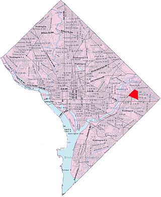
Congress Heights station is an island-platformed Washington Metro station situated in the Congress Heights neighborhood of Washington, D.C., United States. Opened on January 13, 2001, the station is operated by the Washington Metropolitan Area Transit Authority (WMATA). Serving only the Green Line, it is positioned at the intersection of Alabama Avenue and 13th Street, beneath St. Elizabeths Hospital. Congress Heights marks the terminus of the Green Line in the District of Columbia as it extends southeastward.

Northeast is the northeastern quadrant of Washington, D.C., the capital of the United States. It encompasses the area located north of East Capitol Street and east of North Capitol Street.

Columbia Heights is a neighborhood in Washington, D.C., located in Northwest D.C. The neighborhood is an important retail hub for the area, as home to DC USA mall and to numerous other restaurants and stores, primarily along the highly commercialized 14th Street. Columbia Heights is home to numerous historical landmarks, including Meridian Hill Park, National Baptist Memorial Church, All Souls Church, along with a number of embassy buildings.

Deanwood is a neighborhood in Northeast Washington, D.C., bounded by Eastern Avenue to the northeast, Kenilworth Avenue to the northwest, Division Avenue to the southeast, and Nannie Helen Burroughs Avenue to the south.

Brookland, also known as Little Rome or Little Vatican, is a neighborhood located in the Northeast (NE) quadrant of Washington, D.C. Bounded by Fort Totten Metro Train tracks NE, and Brookland CUA Metro train tracks, Taylor Street NE, Rhode Island Avenue NE, South Dakota Avenue NE.It is best known for its numerous Catholic institutions, including schools, religious communities, shrines, institutes, and other organizations built and based around the Catholic University of America.
Sursum Corda is a small neighborhood located in Washington, D.C., bounded by North Capitol Street on the east, K Street NW to the south, New Jersey Avenue NW to the west, and New York Avenue NW to the north.
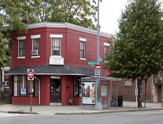
Park View is a neighborhood in Washington, D.C., located in Northwest D.C. The neighborhood is primarily residential with its main commercial corridor of shops and restauarants located along Georgia Avenue.

Columbia Park is a neighborhood in the Northeast community in Minneapolis. Its boundaries are 37th Avenue NE to the north, Central Avenue to the east, 27th Avenue NE to the south, and both University Avenue & Saint Anthony Parkway streets to the west. It is one of ten neighborhoods in Ward 1 of Minneapolis, currently represented by the Council President, Elliott Payne.

Benning Heights is a residential neighborhood located in northeast Washington, D.C. It is bounded by East Capitol Street to the south, Brooks Street NE to the north, 44th Street NE and Benning Road NE to the west, and Division Avenue NE to the east. It is served by the Benning Road Metro Rail station on the Blue Line and Silver Line of the Washington Metro.
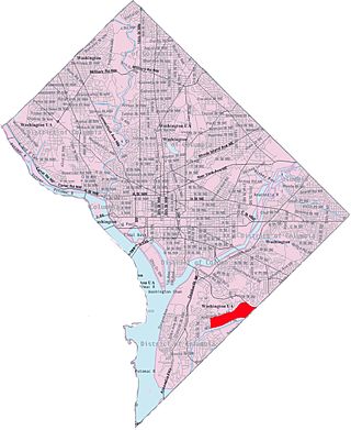
Capitol View is a neighborhood located in southeast Washington, D.C., in the United States. It is bounded by East Capitol Street to the north, Central Avenue SE to the southwest and south, and Southern Avenue SE to the southeast.
Shipley Terrace, formerly known as Randle Heights, is a large residential neighborhood in Southeast Washington, D.C., bordering Prince George's County, Maryland. The neighborhood, named after a former public housing complex in the neighborhood, which was largely occupied by low-income housing – primarily walkup and garden unit apartments. This neighborhood now has a mix of townhome communities, large single-family-home communities, as well as some low-income housing. It is a model neighborhood for the Hope VI revitalization Grant Program.

Washington Highlands is a residential neighborhood in Southeast Washington, D.C., in the United States. It lies within Ward 8. Bounded by Oxon Run Park(Oxon-Run Trail)SE, Livingston Road SE, South Capitol Street SE, Southern Avenue SE, Valley Avenue SE, and 13th Street SE.

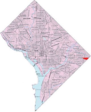
Northeast Boundary is small neighborhood located in the northeast quadrant of Washington, D.C., in the United States. Along with the Capitol View neighborhood, it is the easternmost neighborhood of the District of Columbia.
Central Northeast, also sometimes called Mahaning Heights, is a small neighborhood located in Northeast Washington, D.C., with Fort Mahan Park at its center. It is bounded by Nannie Helen Burroughs Avenue to the north, Benning Road to the south, the tracks of the Washington Metro and Minnesota Ave station to the west, and 44th Street NE to the east.

Marshall Heights is a residential neighborhood in Southeast Washington, D.C. It is bounded by East Capitol Street, Central Avenue SE, Southern Avenue, Fitch Street SE, and Benning Road SE. It was an undeveloped rural area occupied by extensive African American shanty towns, but the neighborhood received nationwide attention after a visit by First Lady Eleanor Roosevelt in 1934, which led to extensive infrastructure improvements and development for the first time. In the 1950s, Marshall Heights residents defeated national legislation designed to raze and redevelop the neighborhood. Queen Elizabeth II of the United Kingdom visited the area in 1991, at a time when Marshall Heights was in the throes of a violent crack cocaine epidemic. Limited redevelopment has occurred in the neighborhood, which was the site of two notorious child murders in 1973.

Twining is a neighborhood in Southeast Washington, D.C., near the eastern bank of the Anacostia River. It is bounded by Minnesota Avenue NE to the northeast, Branch Avenue to the northwest, and Pennsylvania Avenue to the south. The Fort Dupont year-round ice skating rink, and the Smithsonian's Anacostia Neighborhood Museum are nearby.

Sixteenth Street Heights is a large neighborhood of rowhouses, duplexes, and American Craftsman and American Foursquare detached houses in Northwest Washington, D.C.

Randle Highlands is a neighborhood in Southeast Washington, D.C., east of the Anacostia River.

Lincoln, Nebraska has many neighborhoods, including 45 recognized by Urban Development, City of Lincoln. A list and description of neighborhoods within Lincoln city limits follows.

