| Mount Beatty | |
|---|---|
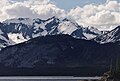
 North aspect | |
| Highest point | |
| Elevation | 3,004 m (9,856 ft) [1] [2] |
| Prominence | 642 m (2,106 ft) [2] |
| Parent peak | Mount Maude (3043 m) [2] |
| Listing | |
| Coordinates | 50°40′10″N115°17′23″W / 50.66944°N 115.28972°W [3] |
| Geography | |
 Mount Beatty Location in Alberta  Mount Beatty Location in British Columbia  Mount Beatty Location in Canada | |
 | |
| Interactive map of Mount Beatty | |
| Country | Canada |
| Provinces | Alberta and British Columbia |
| Parent range | Park Ranges |
| Topo map | NTS 82J11 Kananaskis Lakes [3] |
| Climbing | |
| First ascent | 1916 Interprovincial Boundary Commission [1] |
Mount Beatty is a mountain located on the border of Alberta and British Columbia on the Continental Divide. It was named in 1924 after David Beatty, a British naval officer of Irish ancestry who commanded ships in the First World War. [1] [2] [4] [5]