| Mount McKirdy | |
|---|---|
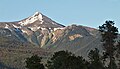
 West aspect | |
| Highest point | |
| Elevation | 2,586 m (8,484 ft) [1] [2] [3] |
| Prominence | 416 m (1,365 ft) [2] [3] |
| Parent peak | Paddlesack Peak (2,630 m) [1] |
| Listing | Mountains of British Columbia |
| Coordinates | 52°50′37″N119°08′00″W / 52.84361°N 119.13333°W [4] |
| Naming | |
| Etymology | Fulton Alexander McKirdy |
| Geography | |
 Mount McKirdy Location in British Columbia  Mount McKirdy Location in Canada | |
 | |
| Interactive map of Mount McKirdy | |
| Country | Canada |
| Province | British Columbia |
| District | Cariboo Land District |
| Parent range | Selwyn Range [1] Canadian Rockies |
| Topo map | NTS 83D14 Valemount [4] |
Mount McKirdy is a mountain summit in British Columbia, Canada.