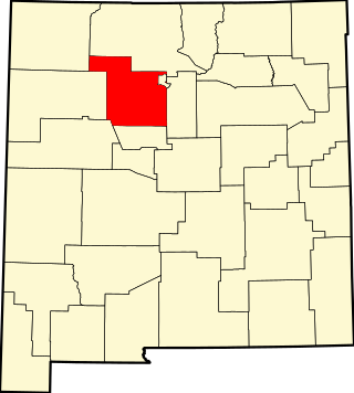
[3] Name on the Register [4] Image Date listed [5] Location City or town Description 1 Acequia System of El Rancho de las Golondrinas Acequia System of El Rancho de las Golondrinas February 1, 1980 (# 80002572 12 miles southeast of Santa Fe 35°34′28″N 106°06′33″W / 35.574444°N 106.109167°W / 35.574444; -106.109167 (Acequia System of El Rancho de las Golondrinas ) Santa Fe 2 Agua Fria Schoolhouse Site Upload image June 13, 2019 (# 100004033 Address Restricted Santa Fe vicinity 3 Ricardo Alarid House Upload image August 30, 1984 (# 84003054 534 Alarid St. 35°40′56″N 105°57′07″W / 35.682222°N 105.951944°W / 35.682222; -105.951944 (Ricardo Alarid House ) Santa Fe 4 Allison Dormitory Allison Dormitory November 29, 1984 (# 84000431 433 Paseo de Peralta 35°41′34″N 105°56′11″W / 35.692778°N 105.936389°W / 35.692778; -105.936389 (Allison Dormitory ) Santa Fe 5 Apache Canyon Railroad Bridge Apache Canyon Railroad Bridge April 27, 1979 (# 79001553 3 miles (4.8 km) northeast of Lamy over Galisteo Creek 35°30′49″N 105°51′17″W / 35.513611°N 105.854722°W / 35.513611; -105.854722 (Apache Canyon Railroad Bridge ) Lamy 6 Archbishop Lamy's Chapel Archbishop Lamy's Chapel August 19, 1988 (# 88000897 Bishop's Lodge Rd. 35°43′50″N 105°54′32″W / 35.730556°N 105.908889°W / 35.730556; -105.908889 (Archbishop Lamy's Chapel ) Santa Fe 7 Arroyo Hondo Pueblo Upload image September 13, 2007 (# 07000950 Address Restricted Santa Fe 8 Bandelier National Monument Bandelier National Monument October 15, 1966 (# 66000042 12 miles (19 km) south of Los Alamos on State Road 4 35°46′32″N 106°19′06″W / 35.775556°N 106.318333°W / 35.775556; -106.318333 (Bandelier National Monument ) Los Alamos Extends into Los Alamos and Sandoval Counties; includes Tsankawi detached portion. Boundary was increased 12/10/14 9 Barrio de Analco Historic District Barrio de Analco Historic District November 24, 1968 (# 68000032 Roughly bounded by E. De Vargas and College Sts. 35°41′00″N 105°56′11″W / 35.683333°N 105.936389°W / 35.683333; -105.936389 (Barrio de Analco Historic District ) Santa Fe Contributing buildings 10 Jane and Gustave Baumann House and Studio Jane and Gustave Baumann House and Studio October 10, 2012 (# 12000875 409 Camino de Las Animas 35°40′39″N 105°56′13″W / 35.677487°N 105.936904°W / 35.677487; -105.936904 (Jane and Gustave Baumann House and Studio ) Santa Fe Former residence of artist Gustave Baumann . 11 Alfred M. Bergere House Alfred M. Bergere House October 1, 1975 (# 75001166 135 Grant Ave. 35°41′21″N 105°56′22″W / 35.689167°N 105.939444°W / 35.689167; -105.939444 (Alfred M. Bergere House ) Santa Fe 12 Jean Bouquet Historic/Archeological District Upload image January 5, 1983 (# 83001628 Address Restricted Pojoaque 13 Camino del Monte Sol Historic District Camino del Monte Sol Historic District July 11, 1988 (# 88000440 Roughly bounded by Acequia Madre, Camino del Monte Sol, El Caminito, and Garcia St. 35°40′41″N 105°55′46″W / 35.678056°N 105.929444°W / 35.678056; -105.929444 (Camino del Monte Sol Historic District ) Santa Fe Contributing buildings 14 Camino Real-Alamitos Section Upload image 2011-4-8 [6] (# 11000169 Address Restricted Santa Fe part of the Camino Real in New Mexico, AD 1598-1881 Multiple Property Submission 15 Camino Real-Canon de las Bocas Section Upload image April 8, 2011 (# 11000170 Address Restricted Santa Fe part of the Camino Real in New Mexico, AD 1598-1881 Multiple Property Submission 16 Camino Real-La Bajada Mesa Section Camino Real-La Bajada Mesa Section April 8, 2011 (# 11000168 Address Restricted Santa Fe part of the Camino Real in New Mexico, AD 1598-1881 Multiple Property Submission 17 Connor Hall Connor Hall September 22, 1988 (# 88001561 1060 Cerrillos Rd. at the New Mexico School for the Deaf 35°40′34″N 105°57′25″W / 35.676111°N 105.956944°W / 35.676111; -105.956944 (Connor Hall ) Santa Fe 18 Gregorio Crespin House Gregorio Crespin House May 29, 1975 (# 75001167 132 E. De Vargas St. 35°41′02″N 105°56′19″W / 35.683889°N 105.938611°W / 35.683889; -105.938611 (Gregorio Crespin House ) Santa Fe 19 Randall Davey House Randall Davey House July 9, 1970 (# 70000409 Upper Canyon Rd. 35°41′23″N 105°53′17″W / 35.689722°N 105.888056°W / 35.689722; -105.888056 (Randall Davey House ) Santa Fe Former residence of artist Randall Davey, now Randall Davey Audubon Center & Sanctuary . 20 Delgado Street Bridge Delgado Street Bridge August 3, 2015 (# 15000494 Delgado St. over the Santa Fe River 35°41′04″N 105°55′52″W / 35.6844°N 105.9311°W / 35.6844; -105.9311 (Delgado Street Bridge ) Santa Fe 21 Digneo-Valdes House Upload image November 21, 1978 (# 78001827 1231 Paseo de Peralta 35°40′53″N 105°56′23″W / 35.681336°N 105.939728°W / 35.681336; -105.939728 (Digneo-Valdes House ) Santa Fe Brick house built in 1889 by Italian immigrant and building contractor Carlo Digneo 22 Dodge-Bailey House Upload image May 8, 2007 (# 07000414 3775 Old Santa Fe Trail 35°43′26″N 105°54′01″W / 35.723889°N 105.900278°W / 35.723889; -105.900278 (Dodge-Bailey House ) Santa Fe 23 Don Gaspar Bridge Don Gaspar Bridge October 16, 2002 (# 02001163 Don Gaspar Ave. crossing over the Santa Fe River between Alameda and E. De Vargas Sts. 35°41′06″N 105°56′22″W / 35.685°N 105.939444°W / 35.685; -105.939444 (Don Gaspar Bridge ) Santa Fe 24 Don Gaspar Historic District Don Gaspar Historic District July 21, 1983 (# 83001629 Roughly bounded by the Old Santa Fe Trail, Paseo de Peralta, Don Cubero and Houghton 35°40′42″N 105°56′28″W / 35.678333°N 105.941111°W / 35.678333; -105.941111 (Don Gaspar Historic District ) Santa Fe 25 El Camino Real de Tierra Adentro-La Bajada North Section Upload image March 19, 2018 (# 100002204 Address restricted La Cienega 26 El Camino Real de Tierra Adentro-La Bajada South Section Upload image March 19, 2018 (# 100002205 Address restricted La Cienega 27 El Puente de Los Hidalgos El Puente de Los Hidalgos July 25, 2001 (# 01000771 Grant Ave. approximately 50 yards north of its junction with Paseo de Peralta 35°41′34″N 105°56′20″W / 35.692778°N 105.938889°W / 35.692778; -105.938889 (El Puente de Los Hidalgos ) Santa Fe 28 El Rancho de las Golondrinas El Rancho de las Golondrinas December 5, 2022 (# 100008430 334 Los Pinos Rd. 35°34′28″N 106°06′43″W / 35.5744°N 106.1119°W / 35.5744; -106.1119 (El Rancho de las Golondrinas ) Santa Fe 29 El Rancho de las Golondrinas Section-El Camino Real de Tierra Adento Upload image September 25, 2013 (# 13000774 Address Restricted Santa Fe Part of the Camino Real in New Mexico, AD 1598-1881 MPS 30 El Santuario de Chimayo El Santuario de Chimayo April 15, 1970 (# 70000412 1 mile northwest of the Santa Cruz Reservoir Dam 35°59′23″N 105°55′38″W / 35.989722°N 105.927222°W / 35.989722; -105.927222 (El Santuario de Chimayo ) Chimayo 31 El Zaguan El Zaguan August 1, 2008 (# 08000732 545 Canyon Rd. 35°40′56″N 105°55′47″W / 35.682137°N 105.92963°W / 35.682137; -105.92963 (El Zaguan ) Santa Fe Former residence of Margretta Stewart Dietrich , now housing Historic Santa Fe Foundation. 32 Fairview Cemetery Fairview Cemetery January 20, 2005 (# 04001517 1134 Cerrillos Rd. 35°40′38″N 105°57′33″W / 35.677222°N 105.959167°W / 35.677222; -105.959167 (Fairview Cemetery ) Santa Fe 33 Federal Building Federal Building August 15, 1974 (# 74001207 Cathedral Pl. at Palace St. 35°41′13″N 105°56′11″W / 35.686944°N 105.936389°W / 35.686944; -105.936389 (Federal Building ) Santa Fe Now the Museum of Contemporary Native Arts 34 Fort Marcy Officer's Residence Fort Marcy Officer's Residence June 20, 1975 (# 75001168 116 Lincoln Ave. 35°41′19″N 105°56′17″W / 35.688611°N 105.938056°W / 35.688611; -105.938056 (Fort Marcy Officer's Residence ) Santa Fe Former residence of Edgar Lee Hewett , now Museum of New Mexico Foundation offices. 35 Fort Marcy Ruins Fort Marcy Ruins April 14, 1975 (# 75001169 Off State Road 475 35°41′23″N 105°55′48″W / 35.689722°N 105.93°W / 35.689722; -105.93 (Fort Marcy Ruins ) Santa Fe 36 Glorieta Baldy Lookout Tower Upload image January 27, 1988 (# 87002492 Santa Fe National Forest 35°39′00″N 105°47′57″W / 35.65°N 105.799167°W / 35.65; -105.799167 (Glorieta Baldy Lookout Tower ) La Cueva 37 Glorieta Pass Battlefield Glorieta Pass Battlefield October 15, 1966 (# 66000486 10 miles southeast of Santa Fe on U.S. Routes 84 /85 35°33′36″N 105°47′08″W / 35.56°N 105.785556°W / 35.56; -105.785556 (Glorieta Pass Battlefield ) Santa Fe Site of American Civil War Battle of Glorieta Pass. Parts of the battlefield are now included in Pecos National Historical Park which includes Pecos Pueblo in San Miguel County . 38 Hayt-Wientge House Hayt-Wientge House May 6, 1977 (# 77000929 620 Paseo de la Cuma 35°41′39″N 105°56′21″W / 35.694167°N 105.939167°W / 35.694167; -105.939167 (Hayt-Wientge House ) Santa Fe 39 Hospital Upload image September 22, 1988 (# 88001562 1060 Cerrillos Rd. at the New Mexico School for the Deaf 35°40′37″N 105°57′23″W / 35.676944°N 105.956389°W / 35.676944; -105.956389 (Hospital ) Santa Fe 40 Hyde Memorial State Park Upload image August 2, 2021 (# 100006766 740 Hyde Park Rd. (NM 475) 35°44′12″N 105°50′10″W / 35.7367°N 105.8361°W / 35.7367; -105.8361 (Hyde Memorial State Park ) Santa Fe vicinity 41 Immaculate Heart of Mary Seminary Upload image January 2, 2024 (# 100009668 49 & 50 Mt. Carmel Road 35°40′08″N 105°55′13″W / 35.6690°N 105.9204°W / 35.6690; -105.9204 (Immaculate Heart of Mary Seminary ) Santa Fe 42 J.B. Jackson House Upload image June 4, 1999 (# 99000598 268 Los Pinos Rd. 35°34′54″N 106°06′12″W / 35.581667°N 106.103333°W / 35.581667; -106.103333 (J.B. Jackson House ) Santa Fe 43 Everret Jones House Upload image January 15, 2004 (# 03001411 210 Brownell Howland Rd. 35°43′26″N 105°54′01″W / 35.723889°N 105.900278°W / 35.723889; -105.900278 (Everret Jones House ) Santa Fe 44 Daniel T. Kelly House Daniel T. Kelly House October 19, 2005 (# 05001182 531 E. Palace Ave. 35°41′14″N 105°55′44″W / 35.687222°N 105.928889°W / 35.687222; -105.928889 (Daniel T. Kelly House ) Santa Fe 45 K'uuyemugeh Upload image August 3, 2015 (# 15000496 Address Restricted Cuyamungue 46 La Armeria de Santa Fe Upload image August 16, 2011 (# 11000530 1050 Old Pecos Tr. 35°40′24″N 105°56′13″W / 35.673457°N 105.937033°W / 35.673457; -105.937033 (La Armeria de Santa Fe ) Santa Fe 47 La Bajada Mesa Agricultural Site Upload image December 15, 1983 (# 83004178 Address Restricted La Bajada 48 La Cieneguilla South Section-El Camino Real de Tierra Adento Upload image September 25, 2013 (# 13000775 Address Restricted La Cienega Part of the Camino Real in New Mexico, AD 1598-1881 MPS 49 La Iglesia de Santa Cruz and Site of the Plaza of Santa Cruz de la Canada La Iglesia de Santa Cruz and Site of the Plaza of Santa Cruz de la Canada August 17, 1973 (# 73001148 100 block of Santa Cruz Plaza 35°59′26″N 106°02′50″W / 35.990556°N 106.047222°W / 35.990556; -106.047222 (La Iglesia de Santa Cruz and Site of the Plaza of Santa Cruz de la Canada ) Espanola 50 Laboratory of Anthropology Laboratory of Anthropology July 12, 1983 (# 83001630 708 Camino Lejo 35°39′52″N 105°55′28″W / 35.664444°N 105.924444°W / 35.664444; -105.924444 (Laboratory of Anthropology ) Santa Fe 51 Laboratory of Anthropology Director's Residence Upload image May 30, 2023 (# 100009036 750 Camino Lejo 35°39′58″N 105°55′27″W / 35.6661°N 105.9243°W / 35.6661; -105.9243 (Laboratory of Anthropology Director's Residence ) Santa Fe Now houses the Museum of Spanish Colonial Art. 52 Lamy Junction Archeological District Upload image June 13, 2016 (# 16000388 Address Restricted Lamy 53 Las Acequias Upload image July 25, 2008 (# 08000697 22A Rancho Las Acequias 35°53′45″N 105°59′40″W / 35.89583°N 105.994508°W / 35.89583; -105.994508 (Las Acequias ) Santa Fe part of the Buildings Designed by John Gaw Meem Multiple Property Submission 54 Lujan-Ortiz House Upload image January 14, 2000 (# 99001680 1 mile from State Road 502 on County Road 84 35°53′11″N 106°03′31″W / 35.886389°N 106.058611°W / 35.886389; -106.058611 (Lujan-Ortiz House ) Jaconita 55 Madrid Historic District Madrid Historic District November 9, 1977 (# 77000928 25 miles southwest of Santa Fe on State Road 14 35°24′24″N 106°09′11″W / 35.406667°N 106.153056°W / 35.406667; -106.153056 (Madrid Historic District ) Madrid 56 John Gaw and Faith Bemis Meem House Upload image April 3, 2017 (# 100000828 3707 Old Santa Fe Trail 35°40′01″N 105°55′09″W / 35.667026°N 105.919256°W / 35.667026; -105.919256 (John Gaw and Faith Bemis Meem House ) Santa Fe 57 National Park Service Southwest Regional Office National Park Service Southwest Regional Office October 6, 1970 (# 70000067 Old Santa Fe Trail 35°40′01″N 105°55′21″W / 35.666944°N 105.9225°W / 35.666944; -105.9225 (National Park Service Southwest Regional Office ) Santa Fe 58 Navawi Navawi December 8, 1982 (# 82001052 On a bluff above State Route 4 , 1.8 miles north of the Rover Boulevard intersection [7] 35°50′53″N 106°12′51″W / 35.848056°N 106.214167°W / 35.848056; -106.214167 (Navawi ) White Rock 59 New Mexico Supreme Court Building New Mexico Supreme Court Building January 18, 2002 (# 01001468 237 Don Gaspar Ave. 35°41′04″N 105°56′21″W / 35.684444°N 105.939167°W / 35.684444; -105.939167 (New Mexico Supreme Court Building ) Santa Fe 60 B. J. O. and Margaret Doolittle Nordfeldt House B. J. O. and Margaret Doolittle Nordfeldt House January 2, 2020 (# 100004822 460 Camino de las Animas 35°40′39″N 105°56′06″W / 35.6774°N 105.9350°W / 35.6774; -105.9350 (B. J. O. and Margaret Doolittle Nordfeldt House ) Santa Fe 61 Nuestra Senora de Luz Church and Cemetery Nuestra Senora de Luz Church and Cemetery December 14, 1995 (# 95001452 13 miles southeast of Santa Fe, north of an Interstate 25 frontage road 35°32′58″N 105°49′32″W / 35.549444°N 105.825556°W / 35.549444; -105.825556 (Nuestra Senora de Luz Church and Cemetery ) Canoncito 62 Otowi Historic District Otowi Historic District December 4, 1975 (# 75001170 25 miles north of Santa Fe, on State Road 4 in the Rio Grande valley 35°52′31″N 106°08′31″W / 35.875278°N 106.141944°W / 35.875278; -106.141944 (Otowi Historic District ) Santa Fe 63 Otowi Suspension Bridge Otowi Suspension Bridge July 15, 1997 (# 97000730 State Road 4 over the Rio Grande 35°52′29″N 106°08′29″W / 35.874722°N 106.141389°W / 35.874722; -106.141389 (Otowi Suspension Bridge ) San Ildefonso Pueblo 64 Palace of the Governors Palace of the Governors October 15, 1966 (# 66000489 Palace Avenue at Santa Fe Plaza 35°41′16″N 105°56′15″W / 35.687778°N 105.9375°W / 35.687778; -105.9375 (Palace of the Governors ) Santa Fe 65 Petroglyph Hill Upload image November 16, 2015 (# 15000851 Address Restricted Galisteo 66 Pflueger General Merchandise Store and Annex Saloon Pflueger General Merchandise Store and Annex Saloon June 23, 1987 (# 87000519 State Road 41 35°28′51″N 105°52′48″W / 35.480833°N 105.88°W / 35.480833; -105.88 (Pflueger General Merchandise Store and Annex Saloon ) Lamy Now houses the Lamy Railroad and History Museum 67 Plaza del Cerro Upload image July 17, 1972 (# 72000810 Southwest of the junction of State Roads 4 and 76 35°53′19″N 105°56′00″W / 35.888611°N 105.933333°W / 35.888611; -105.933333 (Plaza del Cerro ) Chimayo 68 Pond-Kelly House Upload image October 19, 2018 (# 100003031 535 E Palace Ave. 35°41′06″N 105°55′43″W / 35.6851°N 105.9285°W / 35.6851; -105.9285 (Pond-Kelly House ) Santa Fe 69 Pueblo of Nambe Pueblo of Nambe January 21, 1974 (# 74001208 About 16 miles off State Road 4 35°53′05″N 105°57′52″W / 35.884722°N 105.964444°W / 35.884722; -105.964444 (Pueblo of Nambe ) Nambé Pueblo 70 Pueblo of Tesuque Pueblo of Tesuque July 16, 1973 (# 73001149 About 8 miles north of Santa Fe on the western bank of the Tesuque River 35°48′10″N 105°58′31″W / 35.802778°N 105.975278°W / 35.802778; -105.975278 (Pueblo of Tesuque ) Tesuque 71 Reredos of Our Lady of Light Reredos of Our Lady of Light September 4, 1970 (# 70000411 Christo Rey Church, Canyon Rd. and Cristo Rey St. 35°40′43″N 105°55′00″W / 35.678611°N 105.916667°W / 35.678611; -105.916667 (Reredos of Our Lady of Light ) Santa Fe Removed from the old Military Chapel on the Santa Fe Plaza. 72 Route 66 and National Old Trails Road Historic District at La Bajada Route 66 and National Old Trails Road Historic District at La Bajada June 30, 2005 (# 05000633 Approximately 0.5 miles northeast of the northern terminus of State Road 16 35°33′31″N 106°13′35″W / 35.558611°N 106.226389°W / 35.558611; -106.226389 (Route 66 and National Old Trails Road Historic District at La Bajada ) La Bajada 73 Ignacio Roybal House Upload image February 13, 1986 (# 86000227 County Road 84 west of State Road 4 and U.S. Routes 84 /285 35°53′27″N 106°02′28″W / 35.890833°N 106.041111°W / 35.890833; -106.041111 (Ignacio Roybal House ) Jacona 74 St. John's College-Santa Fe, New Mexico St. John's College-Santa Fe, New Mexico August 3, 2015 (# 15000495 1160 Camino Cruz Blanca 35°40′00″N 105°54′45″W / 35.6667°N 105.9124°W / 35.6667; -105.9124 (St. John's College-Santa Fe, New Mexico ) Santa Fe 75 San Ildefonso Pueblo San Ildefonso Pueblo June 20, 1974 (# 74001206 Southwest of Espanola off State Road 4 35°53′29″N 106°07′05″W / 35.891389°N 106.118056°W / 35.891389; -106.118056 (San Ildefonso Pueblo ) San Ildefonso Pueblo 76 San Jose Hall San Jose Hall May 26, 2015 (# 15000264 5637 NM 41 35°23′45″N 105°56′48″W / 35.3957°N 105.9467°W / 35.3957; -105.9467 (San Jose Hall ) Galisteo 77 San Lazaro Upload image October 15, 1966 (# 66000490 Address Restricted Santa Fe 78 San Marcos Pueblo Upload image March 26, 1982 (# 82003326 Address Restricted Capitan 79 Santa Fe Historic District Santa Fe Historic District July 23, 1973 (# 73001150 Roughly bounded by Camino Cabra, Camino de las Animas, W. Manhattan Ave., S. St. Francis Dr., and Griffin St. 35°41′13″N 105°56′06″W / 35.686944°N 105.935°W / 35.686944; -105.935 (Santa Fe Historic District ) Santa Fe 80 Santa Fe National Cemetery Santa Fe National Cemetery September 6, 2016 (# 16000588 501 N. Guadalupe St. 35°42′03″N 105°56′50″W / 35.700833°N 105.947222°W / 35.700833; -105.947222 (Santa Fe National Cemetery ) Santa Fe 81 Santa Fe Plaza Santa Fe Plaza October 15, 1966 (# 66000491 Santa Fe Plaza 35°41′14″N 105°56′15″W / 35.687222°N 105.9375°W / 35.687222; -105.9375 (Santa Fe Plaza ) Santa Fe 82 Santa Fe River Park Channel Santa Fe River Park Channel December 10, 2008 (# 08001181 Santa Fe River Park 35°41′03″N 105°55′42″W / 35.684150°N 105.928378°W / 35.684150; -105.928378 (Santa Fe River Park Channel ) Santa Fe 83 Santa Fe Trail-Apache Canyon Bridge Site Upload image November 7, 2012 (# 12000912 Across Galisteo Cr. 35°30′44″N 105°51′18″W / 35.512222°N 105.854981°W / 35.512222; -105.854981 (Santa Fe Trail-Apache Canyon Bridge Site ) Glorieta Part of the Santa Fe Trail MPS 84 Albert Schmidt House and Studio Upload image July 25, 2003 (# 03000691 1505 A and B Bishop's Lodge Rd. 35°45′21″N 105°55′25″W / 35.755833°N 105.923611°W / 35.755833; -105.923611 (Albert Schmidt House and Studio ) Tesuque 85 School Building Number 2 School Building Number 2 September 22, 1988 (# 88001560 1060 Cerrillos Rd. at the New Mexico School for the Deaf 35°40′35″N 105°57′24″W / 35.676389°N 105.956667°W / 35.676389; -105.956667 (School Building Number 2 ) Santa Fe 86 Scottish Rite Cathedral Scottish Rite Cathedral March 13, 1987 (# 87000424 463 Paseo de Peralta 35°41′30″N 105°56′09″W / 35.691667°N 105.935833°W / 35.691667; -105.935833 (Scottish Rite Cathedral ) Santa Fe 87 Second Ward School Second Ward School March 30, 1978 (# 78001828 312 Sandoval St. 35°41′09″N 105°56′37″W / 35.685833°N 105.943611°W / 35.685833; -105.943611 (Second Ward School ) Santa Fe 88 Seton Village Seton Village October 15, 1966 (# 66000492 6 miles south of Santa Fe off U.S. Route 84 35°35′56″N 105°55′54″W / 35.598889°N 105.931667°W / 35.598889; -105.931667 (Seton Village ) Santa Fe 89 Eugenie Shonnard House Upload image September 5, 1975 (# 75001171 Address Restricted Santa Fe Former residence of artist Eugenie Shonnard . 90 Spiegelberg House Spiegelberg House May 25, 1973 (# 73001151 237 E. Palace St. 35°41′13″N 105°56′00″W / 35.686944°N 105.933333°W / 35.686944; -105.933333 (Spiegelberg House ) Santa Fe 91 Superintendent's Residence Upload image September 22, 1988 (# 88001563 1060 Cerrillos Rd. at the New Mexico School for the Deaf 35°40′37″N 105°57′17″W / 35.676944°N 105.954722°W / 35.676944; -105.954722 (Superintendent's Residence ) Santa Fe 92 Pinckney R. Tully House Pinckney R. Tully House November 5, 1974 (# 74001209 136 Grant Ave. 35°41′26″N 105°56′24″W / 35.690556°N 105.94°W / 35.690556; -105.94 (Pinckney R. Tully House ) Santa Fe 93 U.S. Courthouse U.S. Courthouse May 25, 1973 (# 73001152 106 S. Federal Pl. 35°41′27″N 105°56′12″W / 35.690833°N 105.936667°W / 35.690833; -105.936667 (U.S. Courthouse ) Santa Fe 94 U.S. Post Office and Federal Building U.S. Post Office and Federal Building December 20, 2022 (# 100008474 120 S. Federal Pl. 35°41′29″N 105°56′19″W / 35.6915°N 105.9387°W / 35.6915; -105.9387 (U.S. Post Office and Federal Building ) Santa Fe Now the Joseph M. Montoya Federal Building 95 Carlos Vierra House Carlos Vierra House August 3, 1979 (# 79001554 1002 Old Pecos Trail 35°40′28″N 105°56′12″W / 35.674444°N 105.936667°W / 35.674444; -105.936667 (Carlos Vierra House ) Santa Fe Former residence of artist Carlos Vierra , an early example of Pueblo Revival architecture in Santa Fe. 96 Donaciano Vigil House Donaciano Vigil House June 28, 1972 (# 72000811 518 Alto St. 35°41′16″N 105°56′45″W / 35.687778°N 105.945833°W / 35.687778; -105.945833 (Donaciano Vigil House ) Santa Fe 97 Wheelwright Museum of the American Indian Wheelwright Museum of the American Indian December 18, 1990 (# 90001917 704 Camino Lejo 35°39′45″N 105°55′38″W / 35.6625°N 105.927222°W / 35.6625; -105.927222 (Wheelwright Museum of the American Indian ) Santa Fe