National Register of Historic Places listings in Socorro County, New Mexico

Last updated

Location of Socorro County in New Mexico Map of New Mexico highlighting Socorro County.svg
Location of Socorro County in New Mexico

This is a list of the National Register of Historic Places listings in Socorro County, New Mexico.

Contents

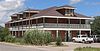
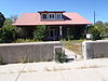
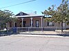
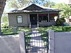
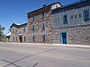
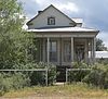
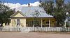
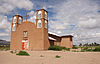
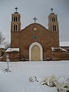
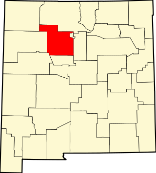
This is intended to be a complete list of the properties and districts on the National Register of Historic Places in Socorro County, New Mexico, United States. Latitude and longitude coordinates are provided for many National Register properties and districts; these locations may be seen together in a map. [1]

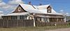
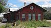
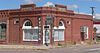
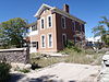
There are 55 properties and districts listed on the National Register in the county, including 1 National Historic Landmark. Another property was once listed but has been removed. All of the places within the county on the National Register, except for one, are also listed on the State Register of Cultural Properties.


    This National Park Service list is complete through NPS recent listings posted January 5, 2024. [2]

Map all coordinates using: OpenStreetMap
Contents: NRHP in New Mexico by county
Bernalillo  Catron  Chaves  Cibola  Colfax  Curry  De Baca  Doña Ana  Eddy  Grant  Guadalupe  Harding  Hidalgo  Lea  Lincoln  Los Alamos  Luna  McKinley  Mora  Otero  Quay  Rio Arriba  Roosevelt  San Juan  San Miguel  Sandoval  Santa Fe  Sierra  Socorro  Taos  Torrance  Union  Valencia

Current listings

[3] Name on the Register [4] ImageDate listed [5] Location City or townDescription
1 Aragon House
Aragon House Aragon house (Magdalena, New Mexico) from SW 1.JPG
Aragon House
August 2, 1982
(#82003327)
2nd and Oak Sts.
34°06′55″N107°14′44″W / 34.115273°N 107.245529°W / 34.115273; -107.245529 (Aragon House)
Magdalena
2 Archeological Site No. LA 1069 April 15, 1993
(#93000243)
Address Restricted
Bingham
3 Archeological Site No. LA 1070 April 15, 1993
(#93000244)
Address Restricted
Bingham
4 Archeological Site No. LA 1071 April 15, 1993
(#93000245)
Address Restricted
Bingham
5 Archeological Site No. LA 1072 April 15, 1993
(#93000246)
Address Restricted
Bingham
6 Archeological Site No. LA 1073 April 15, 1993
(#93000247)
Address Restricted
Bingham
7 Archeological Site No. LA 1074 April 15, 1993
(#93000248)
Address Restricted
Bingham
8 Archeological Site No. LA 1075 April 15, 1993
(#93000249)
Address Restricted
Bingham
9 Archeological Site No. LA 1076 April 15, 1993
(#93000250)
Address Restricted
Bingham
10 Archeological Site No. LA 1181 April 15, 1993
(#93000251)
Address Restricted
Bingham
11 Archeological Site No. LA 1201 April 15, 1993
(#93000252)
Address Restricted
Bingham
12 Atchison, Topeka and Santa Fe Railway Depot
Atchison, Topeka and Santa Fe Railway Depot Magdalena, NM Santa Fe depot from W 1.JPG
Atchison, Topeka and Santa Fe Railway Depot
December 29, 1978
(#78001829)
108 N. Main Street [6]
34°07′06″N107°14′36″W / 34.118269°N 107.243437°W / 34.118269; -107.243437 (Atchison, Topeka and Santa Fe Railway Depot)
Magdalena Now the village hall and library [7]
13 A.B. Baca House
A.B. Baca House Baca House at 201 School of Mines Rd., Socorro, NM 87801 (corner of Terry St.).JPG
A.B. Baca House
February 20, 1991
(#91000036)
201 School of Mines Rd.
34°03′31″N106°53′38″W / 34.058611°N 106.893889°W / 34.058611; -106.893889 (A.B. Baca House)
Socorro
14 Bank of Magdalena
Bank of Magdalena Bank of Magdalena (NM) from SW 2.JPG
Bank of Magdalena
August 2, 1982
(#82003328)
1st and Main Sts.
34°07′02″N107°14′36″W / 34.117194°N 107.243219°W / 34.117194; -107.243219 (Bank of Magdalena)
Magdalena
15 Biavaschi Saloon-Capitol Bar January 2, 2024
(#100009669)
110 Plaza Street
34°03′26″N106°53′34″W / 34.0571°N 106.8927°W / 34.0571; -106.8927 (Biavaschi Saloon-Capitol Bar)
Socorro
16 Brown Hall
Brown Hall Brown Hall, current administration building for New Mexico Tech, Socorro, NM 87801.JPG
Brown Hall
May 16, 1989
(#88001550)
New Mexico Institute of Mining and Technology
34°03′59″N106°54′17″W / 34.066389°N 106.904722°W / 34.066389; -106.904722 (Brown Hall)
Socorro
17 Bursum House
Bursum House 326 Church St., Socorro, NM.JPG
Bursum House
June 18, 1975
(#75001172)
326 Church St.
34°03′20″N106°53′46″W / 34.055556°N 106.896111°W / 34.055556; -106.896111 (Bursum House)
Socorro
18 Camino Real-Qualacu Pueblo April 8, 2011
(#11000173)
Address Restricted
San Antonio vicinitypart of the Camino Real in New Mexico, AD 1598-1881 Multiple Property Submission
19 Camino Real-San Pascual Pueblo April 8, 2011
(#11000164)
Address Restricted
San Antonio vicinitypart of the Camino Real in New Mexico, AD 1598-1881 Multiple Property Submission
20 Clemens Ranchhouse April 18, 1979
(#79001557)
South of Magdalena
34°05′03″N107°13′46″W / 34.084167°N 107.229444°W / 34.084167; -107.229444 (Clemens Ranchhouse)
Magdalena
21 Captain Michael Cooney House
Captain Michael Cooney House 309 McCutcheon, Socorro, NM.JPG
Captain Michael Cooney House
February 20, 1991
(#91000029)
309 McCutcheon Ave.
34°03′19″N106°53′40″W / 34.055278°N 106.894444°W / 34.055278; -106.894444 (Captain Michael Cooney House)
Socorro
22 Anthony Cortesy House
Anthony Cortesy House 327 McCutcheon, Socorro, NM.JPG
Anthony Cortesy House
February 20, 1991
(#91000033)
327 McCutcheon Ave.
34°03′19″N106°53′46″W / 34.055278°N 106.896111°W / 34.055278; -106.896111 (Anthony Cortesy House)
Socorro
23 Nestor P. Eaton House
Nestor P. Eaton House 313 McCutcheon, Socorro, NM.JPG
Nestor P. Eaton House
February 20, 1991
(#91000034)
313 McCutcheon Ave.
34°03′19″N106°53′41″W / 34.055278°N 106.894722°W / 34.055278; -106.894722 (Nestor P. Eaton House)
Socorro
24 El Camino Real de Tierra Adentro-Arroyo Alamillo North Section November 5, 2014
(#14000898)
Address restricted
San Acacia vicinity
25 Fitch Hall
Fitch Hall Fitch Hall, New Mexico Tech, Socorro, NM.JPG
Fitch Hall
May 16, 1989
(#88001551)
New Mexico Institute of Mining and Technology
34°03′55″N106°54′15″W / 34.065278°N 106.904167°W / 34.065278; -106.904167 (Fitch Hall)
Socorro
26 James Gurden Fitch House
James Gurden Fitch House 311 McCutcheon, Socorro, NM.JPG
James Gurden Fitch House
February 20, 1991
(#91000035)
311 McCutcheon Ave.
34°03′19″N106°53′40″W / 34.055278°N 106.894444°W / 34.055278; -106.894444 (James Gurden Fitch House)
Socorro
27 Fort Craig
Fort Craig FortCraigFlagpole.jpg
Fort Craig
October 15, 1970
(#70000414)
37 miles (60 km) south of Socorro
33°38′25″N107°00′46″W / 33.640278°N 107.012778°W / 33.640278; -107.012778 (Fort Craig)
Socorro
28 Gallinas Springs Ruin September 4, 1970
(#70000413)
Address Restricted
Magdalena
29 Garcia Opera House
Garcia Opera House Garcia Opera House, Socorro, NM.JPG
Garcia Opera House
August 13, 1974
(#74001210)
Terry Ave. and California St.
34°03′30″N106°53′28″W / 34.058333°N 106.891111°W / 34.058333; -106.891111 (Garcia Opera House)
Socorro
30 Juan Nepomuceno Garcia House
Juan Nepomuceno Garcia House Security Title Abstract and Farmers Insurance located at 108 Bernard Rd.jpg
Juan Nepomuceno Garcia House
February 20, 1991
(#91000027)
108 Bernard St.
34°03′29″N106°53′32″W / 34.058056°N 106.892222°W / 34.058056; -106.892222 (Juan Nepomuceno Garcia House)
Socorro
31 Gran Quivera Historic District
Gran Quivera Historic District Gran Quivira kiva.jpg
Gran Quivera Historic District
June 15, 2015
(#15000355)
Along NM 55 approx. 25 mi. S. of Mountainair
34°15′55″N106°06′09″W / 34.2654°N 106.1024°W / 34.2654; -106.1024 (Gran Quivera Historic District)
Mountainair vicinityPart of Salinas Pueblo Missions National Monument; extends into Torrance County
32 Gutierrez House
Gutierrez House Gutierrez house (Magdalana NM) from SW 1.JPG
Gutierrez House
August 2, 1982
(#82003329)
3rd and Popular Sts.
34°07′00″N107°14′19″W / 34.11663°N 107.238716°W / 34.11663; -107.238716 (Gutierrez House)
Magdalena
33 Hall Hotel
Hall Hotel Magdalena Hall Hotel from S 1.JPG
Hall Hotel
August 2, 1982
(#82003330)
2nd and Spruce Sts.
34°07′00″N107°14′30″W / 34.116788°N 107.241611°W / 34.116788; -107.241611 (Hall Hotel)
Magdalena
34 Hilton House
Hilton House Hilton house (Magdalena NM) from NW 2.JPG
Hilton House
August 2, 1982
(#82003331)
U.S. Route 60
34°07′13″N107°13′59″W / 34.12019°N 107.233054°W / 34.12019; -107.233054 (Hilton House)
Magdalena
35 August Holver Hilton House
August Holver Hilton House 601 Park St., Socorro, NM.JPG
August Holver Hilton House
February 20, 1991
(#91000031)
601 Park St.
34°03′05″N106°53′35″W / 34.051389°N 106.893056°W / 34.051389; -106.893056 (August Holver Hilton House)
Socorro
36 House at 303 Eaton Avenue
House at 303 Eaton Avenue 303 Eaton St., Socorro, NM.jpg
House at 303 Eaton Avenue
February 20, 1991
(#91000032)
303 Eaton Ave.
34°03′20″N106°53′50″W / 34.055556°N 106.897222°W / 34.055556; -106.897222 (House at 303 Eaton Avenue)
Socorro
37 House at 405 Park Street
House at 405 Park Street 405 Park St., Socorro, NM.JPG
House at 405 Park Street
February 20, 1991
(#91000030)
405 Park St.
34°03′17″N106°53′36″W / 34.054722°N 106.893333°W / 34.054722; -106.893333 (House at 405 Park Street)
Socorro
38 Ilfeld Warehouse
Ilfeld Warehouse Ilfeld warehouse (Magdalena NM) from NE 1.JPG
Ilfeld Warehouse
August 2, 1982
(#82003332)
200 N. Main St. [8]
34°07′06″N107°14′40″W / 34.118302°N 107.244464°W / 34.118302; -107.244464 (Ilfeld Warehouse)
Magdalena
39 Illinois Brewery
Illinois Brewery Former Illinois Brewery is now the Hammel Museum, Socorro, NM.JPG
Illinois Brewery
September 2, 1975
(#75001173)
Neal Ave. and 6th St.
34°03′46″N106°53′25″W / 34.062778°N 106.890278°W / 34.062778; -106.890278 (Illinois Brewery)
Socorro
40 Lewellen House
Lewellen House Lewellen house (Magdalena NM) from NW 1.JPG
Lewellen House
August 2, 1982
(#82003333)
2nd and Chestnut Sts.
34°07′03″N107°14′18″W / 34.117378°N 107.238362°W / 34.117378; -107.238362 (Lewellen House)
Magdalena
41 MacDonald Merchandise Building September 25, 1980
(#80002573)
U.S. Route 60 [9]
34°06′58″N107°14′40″W / 34.116111°N 107.244444°W / 34.116111; -107.244444 (MacDonald Merchandise Building)
Magdalena No longer extant; removed from the state register [10]
42 MacTavish House
MacTavish House MacTavish house (Magdalena NM) from NE 1.JPG
MacTavish House
August 2, 1982
(#82003334)
302 Elm St. [11]
34°06′51″N107°14′37″W / 34.114117°N 107.243632°W / 34.114117; -107.243632 (MacTavish House)
Magdalena
43 Magdaline House
Magdaline House Magdaline house (Magdalena NM) from SE 1.JPG
Magdaline House
August 2, 1982
(#82003335)
3rd and Chestnut Sts.
34°07′01″N107°14′17″W / 34.116853°N 107.238053°W / 34.116853; -107.238053 (Magdaline House)
Magdalena
44 Main Street Commercial Building
Main Street Commercial Building Main Street commercial bldg (Magdalena, NM) from SW 2.JPG
Main Street Commercial Building
August 2, 1982
(#82003336)
106 N. Main Street [12]
34°07′04″N107°14′37″W / 34.117698°N 107.243485°W / 34.117698; -107.243485 (Main Street Commercial Building)
Magdalena
45 Sagrada Familia de Lemitar Church, Los Dulces Nombres
Sagrada Familia de Lemitar Church, Los Dulces Nombres Sagrada Familia de Lemitar Church, Los Dulces Nombres.jpg
Sagrada Familia de Lemitar Church, Los Dulces Nombres
February 24, 1983
(#83001631)
Off Interstate 25
34°09′37″N106°54′28″W / 34.160278°N 106.907778°W / 34.160278; -106.907778 (Sagrada Familia de Lemitar Church, Los Dulces Nombres)
Lemitar
46 Salinas Pueblo Missions National Monument
Salinas Pueblo Missions National Monument Salinas Pueblo Missions National Monument ruins.jpg
Salinas Pueblo Missions National Monument
October 15, 1966
(#66000494)
1 mile (1.6 km) east of Gran Quivira on State Road 10
34°15′35″N106°05′25″W / 34.259722°N 106.090278°W / 34.259722; -106.090278 (Salinas Pueblo Missions National Monument)
Gran Quivira Extends into Torrance County
47 Salome Store
Salome Store Salome store (Magdalena NM) from NW 1.JPG
Salome Store
August 2, 1982
(#82003337)
1st St.
34°06′58″N107°14′42″W / 34.116137°N 107.245094°W / 34.116137; -107.245094 (Salome Store)
Magdalena
48 Salome Warehouse
Salome Warehouse Salome warehouse (Magdalena NM) from S 1.JPG
Salome Warehouse
August 2, 1982
(#82003338)
1st St.
34°06′59″N107°14′43″W / 34.116502°N 107.245298°W / 34.116502; -107.245298 (Salome Warehouse)
Magdalena
49 San Felipe Pueblo Ruin April 25, 1983
(#83001632)
Near the confluence of Milligan Gulch and the Rio Grande [13]
33°36′47″N107°01′33″W / 33.613082°N 107.025726°W / 33.613082; -107.025726 (San Felipe Pueblo Ruin)
Socorro
50 San Miguel Church
San Miguel Church San Miguel de Socorro Church Socorro Nov 2013.jpg
San Miguel Church
April 12, 2016
(#16000162)
403 El Camino Real St., NW
34°03′37″N106°53′38″W / 34.060410°N 106.893776°W / 34.060410; -106.893776 (San Miguel Church)
Socorro
51 Seco Ruin June 17, 1994
(#94000614)
Address Restricted
Chupadera
52 Teypama Piro Site October 21, 1983
(#83004179)
Address Restricted
Socorro
53 Trinity Site
Trinity Site Trinity Test Fireball 16ms.jpg
Trinity Site
October 15, 1966
(#66000493)
25 miles (40 km) south of U.S. Route 380 on the White Sands Missile Range
33°39′08″N106°29′34″W / 33.652222°N 106.492778°W / 33.652222; -106.492778 (Trinity Site)
Bingham
54 Val Verde Hotel
Val Verde Hotel Val Verde Hotel, Socorro, NM.JPG
Val Verde Hotel
September 13, 1977
(#77000930)
203 Manzanares St.
34°03′28″N106°53′22″W / 34.057778°N 106.889444°W / 34.057778; -106.889444 (Val Verde Hotel)
Socorro
55 Rufina Vigil House
Rufina Vigil House Casa de Flecha (Socorro, NM) from SE 1.JPG
Rufina Vigil House
February 20, 1991
(#91000028)
407 Park St.
34°03′15″N106°53′39″W / 34.054228°N 106.894232°W / 34.054228; -106.894232 (Rufina Vigil House)
Socorro Locally known as "Casa de Flecha" [14]

Former listing

[3] Name on the RegisterImageDate listedDate removedLocationCity or townDescription
1 Severo A. Baca House August 13, 1974
(#74002268)
September 2, 1975Park and Church Sts.
34°03′30″N106°53′29″W / 34.0583995°N 106.8914159°W / 34.0583995; -106.8914159 (Severo A. Baca House)
Socorro Destroyed by fire in 1975.

See also

Related Research Articles

<span class="mw-page-title-main">National Register of Historic Places listings in New Mexico</span>

This is a list of properties and districts in New Mexico that are on the National Register of Historic Places. There are more than 1,100 listings. Of these, 46 are National Historic Landmarks. There are listings in each of the state's 33 counties.

This is a list of the National Register of Historic Places listings in Grafton County, New Hampshire.

<span class="mw-page-title-main">National Register of Historic Places listings in Marquette County, Michigan</span>

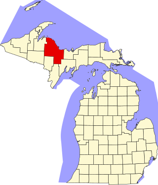
There are 40 properties or districts on the National Register of Historic Places in Marquette County in the US state of Michigan. The locations of National Register properties and districts in Marquette County for which the latitude and longitude coordinates are included below, may be seen in a map.

<span class="mw-page-title-main">National Register of Historic Places listings in Onondaga County, New York</span>

This is a list of the properties and districts listed on the National Register of Historic Places listings in Onondaga County, New York. The locations of National Register properties and districts may be seen in a map by clicking on "Map of all coordinates". There are 170 properties and districts listed on the National Register in the county. Of those, 55 are outside Syracuse, and are listed here, while the rest are covered in National Register of Historic Places listings in Syracuse, New York. One property, the New York State Barge Canal, spans the city and the remainder of the county.

<span class="mw-page-title-main">National Register of Historic Places listings in Pinal County, Arizona</span>

This is a list of the National Register of Historic Places listings in Pinal County, Arizona.

<span class="mw-page-title-main">National Register of Historic Places listings in Graham County, Arizona</span>

This is a list of the National Register of Historic Places listings in Graham County, Arizona. It is intended to be a complete list of the properties and districts on the National Register of Historic Places in Graham County, Arizona, United States. The locations of National Register properties and districts for which the latitude and longitude coordinates are included below, may be seen in a map.

<span class="mw-page-title-main">National Register of Historic Places listings in Santa Fe County, New Mexico</span>

This is a list of the National Register of Historic Places listings in Santa Fe County, New Mexico.

<span class="mw-page-title-main">National Register of Historic Places listings in Sandoval County, New Mexico</span>

This is a list of the National Register of Historic Places listings in Sandoval County, New Mexico, United States.

<span class="mw-page-title-main">National Register of Historic Places listings in San Miguel County, New Mexico</span>

This is a list of the National Register of Historic Places listings in San Miguel County, New Mexico.

<span class="mw-page-title-main">National Register of Historic Places listings in Rio Arriba County, New Mexico</span>

This is a list of the National Register of Historic Places listings in Rio Arriba County, New Mexico.

<span class="mw-page-title-main">National Register of Historic Places listings in McKinley County, New Mexico</span>

This is a list of the National Register of Historic Places listings in McKinley County, New Mexico.

<span class="mw-page-title-main">National Register of Historic Places listings in Richardson County, Nebraska</span>

This is a list of the National Register of Historic Places listings in Richardson County, Nebraska.

<span class="mw-page-title-main">National Register of Historic Places listings in Bon Homme County, South Dakota</span>

This is a list of the National Register of Historic Places listings in Bon Homme County, South Dakota.

<span class="mw-page-title-main">National Register of Historic Places listings in Yankton County, South Dakota</span>

This is a list of the National Register of Historic Places listings in Yankton County, South Dakota.

<span class="mw-page-title-main">National Register of Historic Places listings in Union County, South Dakota</span>

This is a list of the National Register of Historic Places listings in Union County, South Dakota.

<span class="mw-page-title-main">National Register of Historic Places listings in Lincoln County, South Dakota</span>

This is a list of the National Register of Historic Places listings in Lincoln County, South Dakota.

<span class="mw-page-title-main">National Register of Historic Places listings in Doña Ana County, New Mexico</span>

This is a list of the National Register of Historic Places listings in Doña Ana County, New Mexico.

<span class="mw-page-title-main">National Register of Historic Places listings in Cooper County, Missouri</span>

This is a list of the National Register of Historic Places listings in Cooper County, Missouri.

<span class="mw-page-title-main">National Register of Historic Places listings in Luna County, New Mexico</span>

This is a list of the National Register of Historic Places listings in Luna County, New Mexico.

<span class="mw-page-title-main">National Register of Historic Places listings in Roosevelt County, New Mexico</span>

This is a list of the National Register of Historic Places listings in Roosevelt County, New Mexico.

References

  1. The latitude and longitude information provided in this table was derived originally from the National Register Information System, which has been found to be fairly accurate for about 99% of listings. Some locations in this table may have been corrected to current GPS standards.
  2. National Park Service, United States Department of the Interior, "National Register of Historic Places: Weekly List Actions", retrieved January 5, 2024.
  3. 1 2 Numbers represent an alphabetical ordering by significant words. Various colorings, defined here, differentiate National Historic Landmarks and historic districts from other NRHP buildings, structures, sites or objects.
  4. "National Register Information System". National Register of Historic Places . National Park Service. April 24, 2008.
  5. The eight-digit number below each date is the number assigned to each location in the National Register Information System database, which can be viewed by clicking the number.
  6. "Magdalena Public Library". Retrieved 2013-10-02.
  7. "Magdalena Historic Walking Tour". Magdalena Chamber of Commerce. Retrieved 2013-10-02. Archived from original Archived 2013-10-24 at the Wayback Machine 2013-10-24
  8. "Magdalena Historic Walking Tour", at Magdalena Chamber of Commerce, retrieved 2013-09-30, archived from original Archived 2013-10-24 at the Wayback Machine 2013-10-24, gives location as "North Main Street". A street-number plaque on the building, visible left of the front door in this 2013 photo, gives the address as "200".
  9. "National Register of Historic Places Inventory—Nomination Form: MacDonald Merchandise Building". Retrieved 2016-03-11.
  10. "New Mexico's Rich Cultural Heritage" Archived 2014-11-10 at the Wayback Machine
  11. See address on gate in photo
  12. The street number is visible in the center of the building in this 2013 photo.
  13. Location derived from its GNIS feature record; the NRIS lists it as "Address Restricted"
  14. "Walking Tour of Historic Socorro". City of Socorro Tourism. Retrieved 2013-09-13.