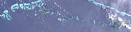
Panatanian Island

Last updated
Panatanian Island
Calvados Chain (Landsat).JPG
Satellite image
Papua New Guinea location map.svg
Red pog.svg
Panatanian Island
Geography
Location Oceania
Coordinates 11°10′S152°51′E / 11.167°S 152.850°E / -11.167; 152.850 [1]
Archipelago Louisiade Archipelago
Adjacent to Solomon Sea
Total islands1
Major islands
  • Panatanian
Area0.79 km2 (0.31 sq mi)
Highest elevation125 m (410 ft)
Highest pointMount Panatanian
Administration
Province Flag of Milne Bay.svg  Milne Bay
District Samarai-Murua District
LLG [2] Louisiade Rural LLG
Island Group Calvados Chain
Demographics
Population0 (2014)
Pop. density0/km2 (0/sq mi)
Ethnic groups Papauans, Austronesians, Melanesians.
Additional information
Time zone
ISO code PG-MBA
Official website www.ncdc.gov.pg

Panatanian Island is an island in Papua New Guinea, part of the Calvados Chain within the Louisiade Archipelago. It is located between Panangaribu and Panakrusima islands. It should not be confused with Pana Tinani, which is a different island in the east.

Related Research Articles

<span class="mw-page-title-main">Equatorial Guinea</span> Country in Central Africa

Equatorial Guinea, officially the Republic of Equatorial Guinea, is a country on the west coast of Central Africa, with an area of 28,000 square kilometres (11,000 sq mi). Formerly the colony of Spanish Guinea, its post-independence name refers to its location near both the Equator and in the African region of Guinea. As of 2021, the country had a population of 1,468,777, over 85% of whom are members of the Fang people, the country's dominant ethnic group. The Bubi people, indigenous to Bioko, are the second largest group at approximately 6.5% of the population.

<span class="mw-page-title-main">Papua New Guinea</span> Country in Oceania

Papua New Guinea, officially the Independent State of Papua New Guinea, is a country in Oceania that comprises the eastern half of the island of New Guinea and its offshore islands in Melanesia. It shares its only land border with Indonesia to the west and it is directly adjacent to Australia to the south and the Solomon Islands to the east. Its capital, located along its southeastern coast, is Port Moresby. The country is the world's third largest island country, with an area of 462,840 km2 (178,700 sq mi).

<span class="mw-page-title-main">Melanesia</span> Subregion of Oceania

Melanesia is a subregion of Oceania in the southwestern Pacific Ocean. It extends from New Guinea in the west to the Fiji Islands in the east, and includes the Arafura Sea.

<span class="mw-page-title-main">New Britain</span> Island in Papua New Guinea

New Britain is the largest island in the Bismarck Archipelago, part of the Islands Region of Papua New Guinea. It is separated from New Guinea by a northwest corner of the Solomon Sea and from New Ireland by St. George's Channel. The main towns of New Britain are Rabaul/Kokopo and Kimbe. The island is roughly the size of Taiwan. When the island was part of German New Guinea, its name was Neupommern . In common with most of the Bismarcks it was largely formed by volcanic processes, and has active volcanoes including Ulawun, Langila, the Garbuna Group, the Sulu Range, and the volcanoes Tavurvur and Vulcan of the Rabaul caldera. A major eruption of Tavurvur in 1994 destroyed the East New Britain provincial capital of Rabaul. Most of the town still lies under metres of ash, and the capital has been moved to nearby Kokopo.

<span class="mw-page-title-main">Autonomous Region of Bougainville</span> Autonomous region of Papua New Guinea

Bougainville, officially the Autonomous Region of Bougainville, is an autonomous region in Papua New Guinea. The largest island is Bougainville Island, while the region also includes Buka Island and a number of outlying islands and atolls. The current capital is Buka, situated on Buka Island.

<span class="mw-page-title-main">Bougainville Island</span> Island in Papua New Guinea

Bougainville Island is the main island of the Autonomous Region of Bougainville, which is part of Papua New Guinea. Its land area is 9,300 km2 (3,600 sq mi). The population of the whole province, including nearby islets such as the Carterets, is approximately 300,000. The highest point is Mount Balbi, on the main island, at 2,715 m (8,907 ft).

<span class="mw-page-title-main">Bismarck Archipelago</span> Archipelago in northeast Papua New Guinea

The Bismarck Archipelago is a group of islands off the northeastern coast of New Guinea in the western Pacific Ocean and is part of the Islands Region of Papua New Guinea. Its area is about 50,000 square km.

This gallery of sovereign state flags shows the national or state flags of sovereign states that appear on the list of sovereign states. For flags of other entities, please see gallery of flags of dependent territories. Each flag is depicted as if the flagpole is positioned on the left of the flag, except for those of Iran, Iraq and Saudi Arabia which are depicted with the hoist to the right.

<span class="mw-page-title-main">German New Guinea</span> 1884–1914 German colony in northeast New Guinea

German New Guinea consisted of the northeastern part of the island of New Guinea and several nearby island groups and was the first part of the German colonial empire. The mainland part of the territory, called Kaiser-Wilhelmsland, became a German protectorate in 1884. Other island groups were added subsequently. The Bismarck Archipelago, and the North Solomon Islands were declared a German protectorate in 1885. The Caroline Islands, Palau, and the Mariana Islands were bought from Spain in 1899. German New Guinea annexed the formerly separate German Protectorate of Marshall Islands, which also included Nauru, in 1906. German Samoa, though part of the German colonial empire, was not part of German New Guinea.

<span class="mw-page-title-main">Territory of Papua</span> British and Australian colony in Oceania from 1883 to 1975

The Territory of Papua comprised the southeastern quarter of the island of New Guinea from 1883 to 1975. In 1883, the Government of Queensland annexed this territory for the British Empire. The United Kingdom Government refused to ratify the annexation but in 1884 a protectorate was proclaimed over the territory, then called "British New Guinea". There is a certain ambiguity about the exact date on which the entire territory was annexed by the British. The Papua Act 1905 recites that this happened "on or about" 4 September 1888. On 18 March 1902, the Territory was placed under the authority of the Commonwealth of Australia. Resolutions of acceptance were passed by the Commonwealth Parliament, which accepted the territory under the name of Papua.

<span class="mw-page-title-main">Melanesians</span> Indigenous inhabitants of Melanesia

Melanesians are the predominant and indigenous inhabitants of Melanesia, in an area stretching from New Guinea to the Fiji Islands. Most speak one of the many languages of the Austronesian language family or one of the many unrelated families of Papuan languages. There are several creoles of the region, such as Tok Pisin, Hiri Motu, Solomon Islands Pijin, Bislama, and Papuan Malay.

<span class="mw-page-title-main">Papua New Guinea national soccer team</span> National association football team

The Papua New Guinea national soccer team is the men's national soccer team of Papua New Guinea and is controlled by the Papua New Guinea Football Association. Its nickname is the Kapuls, which is Tok Pisin for Cuscus.

<span class="mw-page-title-main">Crow</span> Index of animals with the same common name

A crow is a bird of the genus Corvus, or more broadly a synonym for all of Corvus. The word "crow" is used as part of the common name of many species. The related term "raven" is not linked scientifically to any certain trait, but is rather a general grouping for larger species of Corvus.

<span class="mw-page-title-main">Western New Guinea</span> Region of Indonesia on the island of New Guinea

Western New Guinea, also known as Papua, Indonesian New Guinea, and Indonesian Papua, is the western, formerly Dutch half of the island of New Guinea, granted to Indonesia in 1962. Given the island is alternatively named Papua, the region is also called West Papua.

<span class="mw-page-title-main">UTC+10:00</span> Identifier for a time offset from UTC of +10

UTC+10:00 is an identifier for a time offset from UTC of +10:00. This time is used in:

<span class="mw-page-title-main">Territory of New Guinea</span> 1919–1949 Australian territory in northeast New Guinea

The Territory of New Guinea was an Australian-administered League of Nations and then United Nations trust territory on the island of New Guinea from 1914 until 1975. In 1949, the Territory and the Territory of Papua were established in an administrative union by the name of the Territory of Papua and New Guinea. That administrative union was renamed as Papua New Guinea in 1971. Notwithstanding that it was part of an administrative union, the Territory of New Guinea at all times retained a distinct legal status and identity until the advent of the Independent State of Papua New Guinea.

<span class="mw-page-title-main">States and territories of Australia</span> First-level administrative subdivisions of Australia

The states and territories are the second level of government of Australia. The states are administrative divisions that are self-governing polities that are partly sovereign, having ceded some sovereign rights to the federal government. They have their own constitutions, legislatures, executive governments, judiciaries and law enforcement agencies that administer and deliver public policies and programs. Territories can be autonomous and administer local policies and programs much like the states in practice, but are still legally subordinate to the federal government.

<span class="mw-page-title-main">New Ireland (island)</span> Island of the Bismarck Archipelago in the Pacific Ocean

New Ireland, or Latangai, is a large island in Papua New Guinea, approximately 7,404 km2 (2,859 sq mi) in area with c. 120,000 people. It is named after the island of Ireland. It is the largest island of New Ireland Province, lying northeast of the island of New Britain. Both islands are part of the Bismarck Archipelago, named after Otto von Bismarck, and they are separated by Saint George's Channel.

<span class="mw-page-title-main">Australia (continent)</span> One of Earths seven main divisions of land

The continent of Australia, sometimes known in technical contexts by the names Sahul, Australia-New Guinea, Australinea, or Meganesia to distinguish it from the country of Australia, is located within the Southern and Eastern hemispheres. The continent includes mainland Australia, Tasmania, the island of New Guinea, the Aru Islands, the Ashmore and Cartier Islands, most of the Coral Sea Islands, and some other nearby islands. Situated in the geographical region of Oceania, Australia is the smallest of the seven traditional continents.

<span class="mw-page-title-main">New Guinea</span> Island in the Pacific Ocean

New Guinea is the world's second-largest island, with an area of 785,753 km2 (303,381 sq mi). Located in Melanesia in the southwestern Pacific Ocean, the island is separated from Australia by the 150-kilometre wide Torres Strait, though both landmasses lie on the same continental shelf, and were united during episodes of low sea level in the Pleistocene glaciations as the combined landmass of Sahul. Numerous smaller islands are located to the west and east. The island's name was given by Spanish explorer Yñigo Ortiz de Retez during his maritime expedition of 1545 due to the resemblance of the indigenous peoples of the island to those in the African region of Guinea.

References