
Columbus is the state capital and the most populous city in the U.S. state of Ohio. With a population estimated at 898,553 in 2019, it is the 14th-most populous city in the U.S., the second-most populous city in the Midwest after Chicago, and the third-most populous state capital. Columbus is the county seat of Franklin County; it also extends into Delaware and Fairfield counties. It is the core city of the Columbus, OH Metropolitan Statistical Area, which encompasses ten counties. With a 2019 estimated population of 2,122,271, it is the largest metropolitan area entirely in Ohio.

Lockbourne, referred to by some as Grove City East, is a village in Franklin County and Pickaway County, Ohio, United States. The population was 237 at the 2010 census. Lockbourne is located near Rickenbacker International Airport, and had initially provided its original name of Lockbourne Air Force Base.

John Glenn Columbus International Airport is an international airport located 6 miles (9.7 km) east of downtown Columbus, Ohio. Formerly known as Port Columbus International Airport, it is managed by the Columbus Regional Airport Authority, which also oversees operations at Rickenbacker International Airport and Bolton Field. The airport code 'CMH' stands for "Columbus Municipal Hangar," the original name for the airport.

Wonderland was a United States a community of summer cottages, just outside the Columbus suburb of Gahanna, near a bend in Big Walnut Creek. By the beginning of the Depression, many of the summer cottages were winterized and became year round homes. In the early-1970s Port Columbus International Airport planned an extension of their north runway, and because of the need for a clear approach, the airport authority was given the go ahead to buy out the remaining property owners still living in Wonderland. Some of the homes were moved to Agler Road, alternating new-built homes between relocated homes. The remaining structures were razed, and the area fenced off. Because its congregation was still using its building, and the church was at the eastern edge of the land, Wonderland Community Church, on Friendship Drive, next to the interchange of Interstate 270 and Hamilton Road was allowed to remain.
Interstate 270 (I-270) is an auxiliary interstate highway that forms a beltway loop freeway in the Columbus metropolitan area in the U.S. state of Ohio, commonly known locally as The Outerbelt, or the Jack Nicklaus Freeway. The zero-milepost is at the junction with I-71 east of Grove City, Ohio. I-270, along with I-670, provides access to John Glenn Columbus International Airport. The entire length of I-270 is 54.97 miles (88.47 km). It is one of four Interstate loops not to run concurrently with another Interstate freeway, the others being I-295 in Florida, I-485 in North Carolina, and I-610 in Texas.

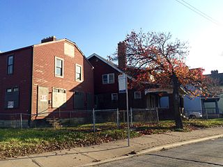
Franklinton is a neighborhood in Columbus, Ohio. Settled in 1797, Franklinton is the first American settlement in Franklin County, Ohio, and was the county seat until 1824. As the city of Columbus grew, the city annexed and incorporated the existing settlement in 1859, and today it exists as a neighborhood immediately west of downtown, including the Scioto Peninsula. It is bordered by the Scioto River on the north and east, Harmon Avenue on the east, Stimmel Road and Greenlawn Avenue on the south, and Interstate 70 on the west. West Broad Street is one of the country's first roads and is Franklinton's main throughway.

The Columbus and Franklin County Metro Parks are a group of 19 metropolitan parks in and around Columbus, Ohio. They are officially organized into the Columbus and Franklin County Metropolitan Park District. The Metro Parks system was organized in 1945 under Ohio Revised Code Section 1545 as a separate political division of the state of Ohio. The Metro Parks are overseen by a Board of Park Commissioners consisting of three citizens appointed to three-year terms without compensation by the Judge of the Probate Court of Franklin County, Ohio. The Board in turn appoints an Executive Director responsible for operations and management of the parks.

According to the U.S. Census Bureau, the Columbus, Ohio Metropolitan Statistical Area includes the counties of Delaware, Fairfield, Franklin, Hocking, Licking, Madison, Morrow, Perry, Pickaway, Ross, and Union. The population of the MSA is 2,078,725 according to 2017 census estimates, making the Columbus metropolitan area the 32nd most populous in the United States and the second largest in Ohio behind the Cincinnati Metropolitan Statistical Area.
Recreation Park is the name of two different former baseball grounds located in Columbus, Ohio, USA.
Linden is a neighborhood in the northeastern part of Columbus, Ohio. It extends south to north from Eighth Avenue to E. Cooke and Ferris roads and west to east from Conrail tracks to Joyce Avenue/Westerville Road. The neighborhood is officially bounded on the south, west and east by Conrail-operated railroads. Hudson Street divides the neighborhood into North and South Linden. The neighborhood has a total land area of almost 5.79 square miles (15 km2).
The Near East Side is a neighborhood located near downtown Columbus, Ohio, made up of several neighborhoods: Mount Vernon, King-Lincoln Bronzeville, Eastgate, Franklin Park, Nelson Park, Olde Towne East, and Woodland Park.
West Columbus, sometimes referred to as westside or the West Side, is a neighborhood in Columbus, Ohio, United States. Unlike other Columbus neighborhoods, it is a broad geographical term used by locals rather than a subdivision or suburb. West Columbus is defined as the entire southwest side of Columbus, bordered on the north by interstates 70 and 670, within Interstate 71 on the east, and on the south and west by the city limits that reach several miles to the outside of the I-270 outerbelt. It covers the ZIP Codes 43223, 43204, 43228, and 43222.

Downtown Columbus is the central business district of Columbus, Ohio. Downtown is centered on the intersection of Broad and High Streets, and encompasses all of the area inside the Inner Belt. Downtown is home to most of the tallest buildings in Columbus.
Columbus, the state capital and Ohio's largest city, has numerous neighborhoods within its city limits. Neighborhood names and boundaries are not officially defined. They may vary or change from time to time due to demographic and economic variables.
South Columbus also referred to as the "South Side" or the "South End", consists of numerous urban and suburban areas south of Downtown Columbus, Ohio, United States. It is part of the native Columbus geographical terminology of the large residential urban communities outside Downtown, including German Village and the Brewery District. South Columbus is defined as the entire southeastern portion of Columbus, bordered by the Scioto River to the west, bounded by Interstate 70 to the north, and includes the southern city limit municipalities beyond the I-270 outerbelt, such as Groveport, Lockbourne, Obetz, and the Rickenbacker International Airport.

Columbus, Ohio has a generally strong and diverse economy based on education, insurance, banking, fashion, defense, aviation, food, logistics, steel, energy, medical research, health care, hospitality, retail, and technology. Overall, it was ranked as one of the top 10 best big cities in the country in 2010, according to Relocate America, a real estate research firm.

The city of Columbus is located in central Ohio at the confluence of the Scioto and Olentangy rivers. The region is dominated by a humid continental climate, characterized by hot, muggy summers and cold, dry winters.

The community of Forest Park consists of almost 2900 private residential properties, plus apartments, condominiums, commercial properties, city-owned parks and schools, in approximately 1.4 square miles (3.6 km2) of the Northland area of northeast Columbus, Ohio. These properties adjoin a total of 132 distinct streets and courts maintained by the City of Columbus. The community's approximate center is near the intersection of Karl Road and Sandalwood Place in Columbus.
Milo-Grogan is a neighborhood of Columbus, Ohio. The neighborhood was settled as the separate communities of Milo and Grogan in the late 1870s. Large-scale industrial development fueled the neighborhood's growth until the 1980s, when the last factories closed. The community has received urban renewal efforts in recent years fueled by the Columbus Department of Development and Milo-Grogan Area Commission.
Northwest Columbus is a geographic region located in the northwest region of Franklin County, Ohio. The Northwest Civic Association, founded in 1967, acts as the commission of this area. It is bounded by the Scioto River on the west, the Olentangy River on the east, State Route 161 on the north, and Highland Drive and Henderson Road on the south. Northwest Columbus includes parts of Perry Township and Sharon Township, the City of Dublin, and the City of Worthington. Slightly more than 45,000 citizens live within this area according to the 2010 U.S. census.

