Merrimac is an unincorporated community in Butte County, California located along Oroville-Quincy Road about 2.1 miles (3.4 km) south of the Plumas County line. It lies at an elevation of 3999 feet. While the location is shown as official in the National Geographic Names Database, it is not known if locals use this name to describe the place today. Nearby is Rogers Cow Camp, a campground in Lassen National Forest. The USGS feature ID for this populated place is 1659117. The US Postal Service does not show a ZIP Code for this community. The location is within area code 530.

Actis is an unincorporated community in Kern County, California. It is located 6.5 miles (10 km) north of Rosamond, at an elevation of 2,562 feet (781 m). It is situated between Mojave and Rosamond at Backus Road and California State Route 14.

Alameda is an unincorporated community in Kern County, California. It is located 9 miles (14 km) south of Bakersfield, at an elevation of 331 feet (101 m).

Armistead is an unincorporated community in Kern County, California. It is located 9 miles (14 km) southwest of Inyokern, at an elevation of 3,068 feet (935 m). Armistead's ZIP Code is 93527.

Harpertown is an unincorporated community in Kern County, California. It is located on the railroad 7 miles (11 km) southeast of downtown Bakersfield, at an elevation of 397 feet (121 m).

Harts Place is an unincorporated community in Kern County, California.

Indian Wells is an unincorporated community in Kern County, California.

Kyan is a former settlement in Kern County, California. It was located on the Sunset Railroad 11.5 miles (19 km) east of Taft, at an elevation of 335 feet. Kyan still appeared on maps as of 1932.

Lakeview is an unincorporated community in Kern County, California. It is located 8.5 miles (14 km) west-northwest of Mettler, at an elevation of 374 feet (114 m).

Magunden is an unincorporated community in Kern County, California. It is located 4 miles (6.4 km) east of downtown Bakersfield, at an elevation of 440 feet.

Oil City is an unincorporated community in Kern County, California, about 5 miles (8 km) northeast of Bakersfield, adjacent to the Kern River Oil Field.

Ricardo is an unincorporated community in Kern County, California.
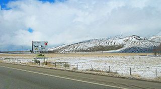
Sand Canyon is an unincorporated community in Kern County, California. It is located on Cache Creek 7 miles (11 km) east of Tehachapi, at an elevation of 4,500 feet (1,400 m).

Spicer City is an unincorporated community in Kern County, California. It is located 9 miles (14 km) south-southeast of Lost Hills, at an elevation of 246 feet (75 m).

Vinland is an unincorporated community in Kern County, California. It is located on the Southern Pacific Railroad 2.5 miles (4 km) north of McFarland, at an elevation of 322 feet (98 m).

Zentner is an unincorporated community in Kern County, California. It is located on the Southern Pacific Railroad 3.5 miles (5.6 km) east-northeast of McFarland, at an elevation of 449 feet (137 m).

Four Pines is an unincorporated community in Lake and Mendocino Counties, California. It is located 9 miles (14 km) east of Eden Valley, at an elevation of 4354 feet.

Glenblair is an unincorporated community in Mendocino County, California. It is located 15 miles (24 km) north-northwest of Comptche, at an elevation of 207 feet.

South Fork is an unincorporated community in Mendocino County, California. It is located on the California Western Railroad 13 miles (21 km) north-northwest of Comptche, at an elevation of 46 feet.

Rignot Glacier is a glacier about 4 nautical miles long draining north from the King Peninsula into Abbot Ice Shelf. Named by Advisory Committee on Antarctic Names (US-ACAN) after Eric Rignot, Jet Propulsion Laboratory, California Institute of Technology, geophysicist; uses field and remotely sensed data to study Antarctic glacier mechanics from the 1990s to the present.


